Scaling Dam Reservoir
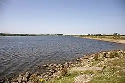
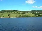
Scaling Dam Reservoir is a freshwater man-made lake on the edge of the A171 road in North Yorkshire, England. The reservoir is near to the hamlet of Scaling Dam from where it derives its name, and was built in 1958.
| Scaling Dam Reservoir | |
|---|---|
| Scaling Reservoir | |
 Scaling Dam Reservoir from the east | |
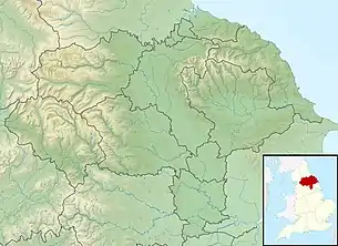
 Scaling Dam Reservoir Location within North Yorkshire | |
| Location | Scaling, North Yorkshire |
| Coordinates | 54.5038°N 0.8508°W |
| Type | Reservoir |
| Primary outflows | Dam Beck Roxby Beck Staithes Beck |
| Catchment area | 1,510 acres (612 hectares) |
| First flooded | 1958 |
| Surface area | 100 acres (41 hectares) |
| Average depth | 12 feet (3.6 m) |
| Water volume | 51,275,600 cubic feet (1,451,962 m3) |
| Shore length1 | 2.5 miles (4 km) |
| Surface elevation | 607 feet (185 m) |
| References | [1] |
| 1 Shore length is not a well-defined measure. | |
The reservoir lies inside the North York Moors National Park and the western half is in the Borough of Redcar and Cleveland, whilst the eastern half is in the Borough of Scarborough.
History
Scaling Dam Reservoir was built between 1952 and 1958 at a cost of £450,000[2][3] and is the largest lake in the North York Moors.[4] The area that the reservoir is built in was named Scaling Dam long before the reservoir was built in 1958; mapping and records show a hamlet of Scaling Dam in the early nineteenth century,[5][6] and the name is mentioned in Camden's 17th century "Britannia".[7] The dam was constructed by the Tees Valley and Cleveland Water Company[8] and despite being in North Yorkshire (though its on the border between Redcar and Cleveland and the Borough of Scarborough), the dam is owned and regulated by Northumbrian Water. However, fresh water from the dam was historically supplied to Yorkshire Water, though this practice stopped in 2012.[9]
Unusually, the dam wall is long, running along the width of the reservoir on the northern side. Dam walls are usually narrow against the water that they hold back.[10] As such the deepest point, near the dam wall, is only 30 feet (9 m).[11]
Water leaving the dam exits as Dam Beck, which on its 3.7-mile (6 km) journey to the North Sea via the fishing village of Staithes, changes to Roxby Beck, Easington Beck and then finally Staithes Beck.[12]
Recreational uses
As the Environment Agency classify the water quality as being good,[13] Scaling Dam Reservoir is a suitable venue for angling, walking and swimming.[14] The dam also is home to the Scaling Dam Sailing Club.[15] There is a visitor centre and shop which sells angling supplies and parts of the reservoir are accessible for disabled anglers.[16]
Wildlife
Besides the fish (which have been introduced for angling), the site is noted for a regular appearance of ospreys during the spring and summer months,[17] and the Nathusius' pipistrelle bat.[18] As Scaling Dam is located close to the North Sea coast, it is an attractive site for migratory birds during the winter months, when human activity on the dam is not allowed.[19]
The western edge of the reservoir is also the site of a nature reserve,[20] and whilst there is no public access, people can walk around the edges of the reserve and the reservoir.[21]
References
- "Scaling Dam Reservoir". eip.ceh.ac.uk. Retrieved 10 August 2019.
- "Water Supplies, Cleveland - Hansard". hansard.parliament.uk. Retrieved 11 August 2019.
- Smith, Jonathan (2 March 2019). "Country walk: Beacon Hill and Scaling Reservoir". York Press. Retrieved 10 August 2019.
- Bagshaw, Mike (2010). Go slow Yorkshire dales & moors : local, characterful guides to Britain's special places. Chalfont St Peter: Bradt Travel Guides. p. 158. ISBN 978-1-84162-323-8.
- "Genuki: Easington, Yorkshire (North Riding)". www.genuki.org.uk. Retrieved 10 August 2019.
- "History of Scaling Dam, in Redcar and Cleveland and North Riding | Map and description". www.visionofbritain.org.uk. Retrieved 10 August 2019.
- "Camden's Britannia eBook version". Retrieved 28 September 2019.
- "No. 43,731". The London Gazette. 6 August 1965. pp. 7, 464.
- "Water Resources Management Plan" (PDF). yorkshirewater.com. August 2014. p. 44. Retrieved 10 August 2019.
- "Yorkshire Moors: Scaling Reservoir". www.yorkshiremoors.co.uk. Retrieved 11 August 2019.
- Parker 2006, p. 12.
- Fisher, Stuart (2019). Coastal Britain : England and Wales : celebrating the history, heritage and wildlife of Britain's shores. London: Bloomsbury. p. 26. ISBN 978-1-4729-5869-3.
- "Scaling Dam Reservoir Overview". environment.data.gov.uk. Retrieved 10 August 2019.
- "Northumbrian Water - Scaling Dam Reservoir". www.nwl.co.uk. Retrieved 10 August 2019.
- Moscariello, Martina (29 May 2019). "Thousands of pounds worth of equipment stolen in Scaling Dam Sailing Club break-in". The Scarborough News. Retrieved 10 August 2019.
- "Fishing". northyorkmoorsnationalpark.org. Retrieved 10 August 2019.
- Teale, Bill (22 August 2011). "Birdwatch: Success story for spectacular ospreys". The Yorkshire Post. Retrieved 10 August 2019.
- Smart, Graeme (November 2012). "Nathusius' Pipistrelle – Natural History Society of Northumbria". nhsn.ncl.ac.uk. Retrieved 10 August 2019.
- Beadle, Brian (18 January 2012). "Cycle ride: Runswick Bay, Staithes and Scaling Dam". Gazette & Herald. Retrieved 11 August 2019.
- Parker 2006, p. 13.
- "Scaling Dam Reservoir Walk" (PDF). nwl.co.uk. Retrieved 11 August 2019.
Sources
- Parker, Ted (Autumn 2006). "Cleveland Birding Sites - Scaling Dam" (PDF). Teesmouth Birding Club (35). Retrieved 11 August 2019.CS1 maint: ref=harv (link)
External links
| Wikimedia Commons has media related to Scaling Dam Reservoir. |
