Tanga Airport
Tanga Airport (IATA: TGT, ICAO: HTTG) is a small domestic airport in northeastern Tanzania serving the city of Tanga and the surrounding Tanga Region.
Tanga Airport Uwanja wa Ndege wa Tanga (Swahili) | |||||||||||||||
|---|---|---|---|---|---|---|---|---|---|---|---|---|---|---|---|
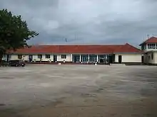
 The Terminal building. | |||||||||||||||
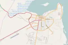
 Location of airport within the city. | |||||||||||||||
| Summary | |||||||||||||||
| Airport type | Public | ||||||||||||||
| Operator | Tanzania Airports Authority | ||||||||||||||
| Serves | Tanga, Tanzania | ||||||||||||||
| Elevation AMSL | 39 m / 128 ft | ||||||||||||||
| Coordinates | 5°5′31.52″S 39°4′18″E | ||||||||||||||
| Website | www | ||||||||||||||
| Map | |||||||||||||||
 TGT Location of airport in Tanzania | |||||||||||||||
| Runways | |||||||||||||||
| |||||||||||||||
| Statistics (2013) | |||||||||||||||
| |||||||||||||||
It is 3 kilometres (1.9 mi) west of the city, off the A14 trunk road. The airport has scheduled flights to Arusha, Dar es Salaam and the Zanzibar Archipelago islands of Unguja and Pemba.
The Tanga non-directional beacon (Ident: TG) is located on the field.[4]
Airlines and destinations
| Airlines | Destinations |
|---|---|
| As Salaam Air | Pemba |
| Auric Air | Pemba, Zanzibar |
| Coastal Aviation | Arusha, Dar es Salaam, Pemba, Zanzibar |
Traffic and statistics
handled |
(tonnes) |
Movements | |
|---|---|---|---|
| 1999 | 918 | – | 314 |
| 2000 | 963 | – | 297 |
| 2001 | 3,407 | – | 782 |
| 2002 | 9,552 | – | 1,336 |
| 2003 | 5,864 | – | 1,084 |
| 2004 | 7,113 | – | 1,324 |
| 2005 | 7,153 | 11.857 | 1,250 |
| 2006 | 8,201 | 32.133 | 1,410 |
| 2007 | 7,705 | 30.310 | 1,289 |
| 2008 | 8,447 | 35.245 | 1,588 |
| 2009 | 9,759 | 45.121 | 1,534 |
| 2010 | 9,277 | 38.919 | 1,552 |
| 2011 | 13,509 | – | 2,286 |
| 2012 | 20,020 | 10.000 | 3,339 |
| 2013 | 21,271 | – | 3,444 |
See also
 Tanzania portal
 Aviation portal
- List of airports in Tanzania
- Transport in Tanzania
References
- "Consolidated Traffic Statistics". Tanzania Airports Authority. Archived from the original (PDF) on September 2014. Retrieved 21 September 2014.
- Airport information for TGT at Great Circle Mapper.
- "Tanga Airport". Google Maps. Google. Retrieved 30 June 2018.
- "SkyVector: Flight Planning / Aeronautical Charts". skyvector.com. Retrieved 2018-08-28.
External links
This article is issued from Wikipedia. The text is licensed under Creative Commons - Attribution - Sharealike. Additional terms may apply for the media files.