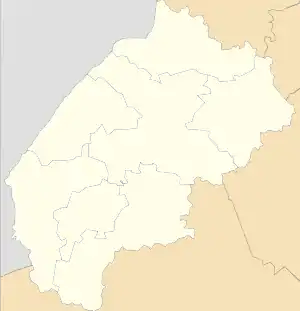
Verkhniachka, Skole Raion
Verkhniachka (Ukrainian: Верхня́чка) – a small village (selo) in the Skole Raion, Lviv Oblast (province) of Western Ukraine (name to year 1954 - Ukrainian: Вижлів).
Population of the village is about 939 people and Local government is administered by Verkhniachkivska village council.[1]
Verkhniachka
Верхня́чка | |
|---|---|
 Verkhniachka | |
| Coordinates: 48°46′31″N 23°14′31″E | |
| Country | |
| Province | |
| District | |
| Established | 1730 |
| Area | |
| • Total | 174 km2 (67 sq mi) |
| Elevation /(average value of) | 830 m (2,720 ft) |
| Population | |
| • Total | 939 |
| • Density | 5.4/km2 (14/sq mi) |
| Time zone | UTC+2 (EET) |
| • Summer (DST) | UTC+3 (EEST) |
| Postal code | 82654 |
| Area code | +380 3251 |
| Website | Верхнячка, райцентр Сколе (Ukrainian) |
Geography
The village is located deep of the Carpathian Mountains of Ukraine[2] within the limits of the Eastern Beskids, on the altitude of 830 metres (2,700 ft) above sea level, which forms here the mountain climate.[3]
It is at a distance 55 kilometres (34 mi) from the Highway M06 (Ukraine) (![]() M06).
Distance from the regional center Lviv is 159 kilometres (99 mi) , 51 kilometres (32 mi) from the district center Skole, and 151 kilometres (94 mi) from the
Uzhhorod.
M06).
Distance from the regional center Lviv is 159 kilometres (99 mi) , 51 kilometres (32 mi) from the district center Skole, and 151 kilometres (94 mi) from the
Uzhhorod.
Stryi River originates on the outskirts of the village.
History and Attractions
The first written record of the village dates from 1730 and its first name - Vyzliv (Ukrainian: Вижлів).
In the village is an architectural monument of local importance of Skole Raion (Skole district). It is a wooden Church of Annunciation Virgin (1832) [4]
References
- Верхнячківська сільська рада (in Ukrainian)
- Internet Encyclopedia of Ukraine\Carpathian Mountains
- Село Верхнячка: карта вулиць (in Ukrainian)
- Церква Благовіщення Пресвятої Богородиці (с.Верхнячка, Львівська обл.): карта (in Ukrainian)
External links
Literature
- Історія міст і сіл УРСР : Львівська область, Сколівський район, Верхня́чка. – К. : ГРУРЕ, 1968 р. Page 715 (in Ukrainian)