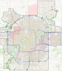
Windermere, Edmonton
Windermere is a neighbourhood in southwest Edmonton, Alberta, Canada, overlooking the North Saskatchewan River valley.[8]
Windermere | |
|---|---|
Neighbourhood | |
 Windermere Location of Windermere in Edmonton | |
| Coordinates: 53.439°N 113.621°W | |
| Country | |
| Province | |
| City | Edmonton |
| Quadrant[1] | NW/SW |
| Ward[1] | 9 |
| Sector[2] | Southwest |
| Area[3][4] | Windermere |
| Government | |
| • Administrative body | Edmonton City Council |
| • Councillor | Tim Cartmell |
| Area | |
| • Total | 4.09 km2 (1.58 sq mi) |
| Elevation | 686 m (2,251 ft) |
| Population (2012)[7] | |
| • Total | 2,136 |
| • Density | 522.2/km2 (1,352/sq mi) |
| • Change (2009–12) | |
| • Dwellings | 1,498 |
It is bounded on the south by the future realignment of Ellerslie Road, on the east by 170 Street SW/Terwillegar Drive, on the northeast by Anthony Henday Drive, and on the west and northwest by the river valley.[9]
According to the 2005 Municipal Census, there were 84 single-family dwellings in the neighbourhood, which was in an early stage of development at that time. The census also indicated that all but three of these homes were owner-occupied.[10]
Windermere currently has three schools - St. John XXII, a separate K-9 Catholic School, Constable Daniel Woodall School and Dr. Maragaret Ann Armour in the Ambleside community, a K-9 school that can accommodate up to 900 students.
Demographics
In the City of Edmonton's 2012 municipal census, Windermere had a population of 2,136 living in 1,498 dwellings,[7] a 563.4% change from its 2009 population of 322.[11] With a land area of 4.09 km2 (1.58 sq mi),[6] it had a population density of 522.2 people/km2 in 2012.[7][6]
Surrounding neighbourhoods
References
- "City of Edmonton Wards & Standard Neighbourhoods" (PDF). City of Edmonton. Retrieved February 13, 2013.
- "Edmonton Developing and Planned Neighbourhoods, 2011" (PDF). City of Edmonton. Retrieved February 13, 2013.
- "The Way We Grow: Municipal Development Plan Bylaw 15100" (PDF). City of Edmonton. 2010-05-26. Retrieved February 13, 2013.
- "City of Edmonton Plans in Effect" (PDF). City of Edmonton. November 2011. Retrieved February 13, 2013.
- "City Councillors". City of Edmonton. Retrieved February 13, 2013.
- "Neighbourhoods (data plus kml file)". City of Edmonton. Retrieved February 13, 2013.
- "Municipal Census Results – Edmonton 2012 Census". City of Edmonton. Retrieved February 22, 2013.
- "Windermere Neighbourhood Structure Plan (Office Consolidation)" (PDF). City of Edmonton. February 2012. Retrieved 2012-04-27.
- "Windermere Area Structure Plan (Office Consolidation)" (PDF). City of Edmonton. October 2008. Retrieved 2011-01-29.
- "2005 Municipal Census Profile – Windermere Estates" (PDF). City of Edmonton. Retrieved 2011-01-29.
- "2009 Municipal Census Results". City of Edmonton. Retrieved February 22, 2013.