Wondai
Wondai /ˈwɒndaɪ/[2] is a rural town and locality in the South Burnett Region, Queensland, Australia.[3][4] In the 2016 census, Wondai had a population of 1,973 people.[1]
| Wondai Queensland | |||||||||||||||
|---|---|---|---|---|---|---|---|---|---|---|---|---|---|---|---|
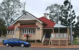
 Post office | |||||||||||||||
 Wondai | |||||||||||||||
| Coordinates | 26.3183°S 151.8736°E | ||||||||||||||
| Population | 1,973 (2016 census)[1] | ||||||||||||||
| • Density | 49.33/km2 (127.75/sq mi) | ||||||||||||||
| Postcode(s) | 4606 | ||||||||||||||
| Area | 40.0 km2 (15.4 sq mi) | ||||||||||||||
| Time zone | AEST (UTC+10:00) | ||||||||||||||
| Location | |||||||||||||||
| LGA(s) | South Burnett Region | ||||||||||||||
| State electorate(s) | Nanango | ||||||||||||||
| Federal Division(s) | Flynn | ||||||||||||||
| |||||||||||||||
Geography
Wondai is located to the south of the Bunya Highway, 241 kilometres (150 mi) north west of the state capital, Brisbane.
History


The name Wondai is believed to be an aboriginal word from the Wakawaka language derived from either watya meaning dingo (a native dog) or wandar meaning nape of the neck.[3][4]
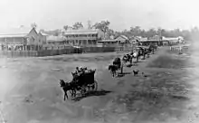
Wondai was first settled in the 1850s and closer settlement took place in the early 1900s.
Wondai Provisional School opened on 2 May 1905. On 1 January 1909 it became Wondai State School. A secondary department was added in 1964.[5]
St Mary's Anglican Church was dedicated on Thursday 21 September 1939 by Archbishop William Wand.[6][7] It replaced an earlier church.[8]
In the 2006 census Wondai had a population of 1,402 people.[9]
In the 2011 census Wondai had a population of 2,127 people.[10]
In the 2016 census Wondai had a population of 1,973 people.[1]
Heritage listings
Wondai has a number of heritage-listed sites, including:
- Mundubbera-Durong Road, Boondooma: Boondooma Homestead[11]
Economy
Important industries include beef, dairy, grains and duboisia, used in the production of the antispasmodic drug butylscopolamine. Growing in importance is the wine industry.
Education
Wondai State School is a government primary and secondary (Prep-9) school for boys and girls at 32 Kent Street (26.3207°S 151.8821°E).[12][13] In 2018, the school had an enrolment of 162 students with 20 teachers (18 full-time equivalent) and 17 non-teaching staff (13 full-time equivalent).[14] It includes a special education program.[12]
For secondary education to Year 12, the nearest schools are Murgon State High School in Murgon to the north-west or Kingaroy State High School in Kingaroy to the south.[15]
Amenities
The South Burnett Regional Council operates a library in Wondai.[16] The Wondai library building opened in 1962 and is located at 78 Mackenzie Street.[17][18]
The Wondai branch of the Queensland Country Women's Association meets at 86 McKenzie Street.[19]
St Mary's Anglican Church is at 32 Baynes Street (26.3198°S 151.8765°E).[20]
Attractions
Attractions in Wondai include Boondooma Dam, an artificial lake formed by the damming of the Boyne River.
Wondai was also home to the legendary pacer Wondai's Mate.[21]
Notable residents
Notable people from Wondai include
- Australian Test cricketers Carl Rackemann and Nathan Hauritz.
- Country music artist/comedian Chad Morgan
References
- Australian Bureau of Statistics (27 June 2017). "Wondai (SSC)". 2016 Census QuickStats. Retrieved 20 October 2018.

- Macquarie Dictionary, Fourth Edition (2005). Melbourne, The Macquarie Library Pty Ltd. ISBN 1-876429-14-3
- "Wondai – town in South Burnett Region (entry 37889)". Queensland Place Names. Queensland Government. Retrieved 16 September 2020.
- "Wondai – locality in South Burnett Region (entry 46282)". Queensland Place Names. Queensland Government. Retrieved 16 September 2020.
- Queensland Family History Society (2010), Queensland schools past and present (Version 1.01 ed.), Queensland Family History Society, ISBN 978-1-921171-26-0
- "NEW ANGLICAN CHURCH AT WONDAI DEDICATED". The Telegraph. Queensland, Australia. 22 September 1939. p. 12 (CITY FINAL LAST MINUTE NEWS). Retrieved 16 September 2020 – via National Library of Australia.
- "Year Book" (PDF). Anglican Archdiocese of Brisbane. 2019. p. 132. Archived (PDF) from the original on 15 September 2020. Retrieved 15 September 2020.
- "NEW ANGLICAN CHURCH AT WONDAI". Maryborough Chronicle, Wide Bay And Burnett Advertiser (21, 180). Queensland, Australia. 28 September 1939. p. 2. Retrieved 16 September 2020 – via National Library of Australia.
- Australian Bureau of Statistics (25 October 2007). "Wondai (Urban Centre/Locality)". 2006 Census QuickStats. Retrieved 28 October 2007.
- Australian Bureau of Statistics (31 October 2012). "Wondai". 2011 Census QuickStats. Retrieved 1 September 2015.

- "Boondooma Homestead (entry 600967)". Queensland Heritage Register. Queensland Heritage Council. Retrieved 12 July 2013.
- "State and non-state school details". Queensland Government. 9 July 2018. Archived from the original on 21 November 2018. Retrieved 21 November 2018.
- "Wondai State School". Retrieved 21 November 2018.
- "ACARA School Profile 2018". Australian Curriculum, Assessment and Reporting Authority. Retrieved 28 January 2020.
- "Queensland Globe". State of Queensland. Retrieved 16 September 2020.
- "Locate a Library - South Burnett Regional Council". South Burnett Regional Council. Retrieved 26 February 2016.
- "Queensland Public Libraries Statistical Bulletin 2016-2017" (PDF). Public Libraries Connect. State Library of Queensland. November 2017. Retrieved 24 January 2018.
- "Wondai Library". Public Libraries Connect. State Library of Queensland. 15 August 2017. Retrieved 24 January 2018.
- "Branch Locations". Queensland Country Women's Association. Retrieved 26 December 2018.
- "St Mary's Anglican Church". Churches Australia. Retrieved 16 September 2020.
- "24 HOURS OF SADNESS HITS THE SOUTH BURNETT". Just Racing. Phil Purser. 2004. Retrieved 1 March 2007.
External links
| Wikimedia Commons has media related to Wondai, Queensland. |
- "Wondai". Queensland Places. Centre for the Government of Queensland, University of Queensland.
- "Town map of Wondai". Queensland Government. 1981.
- SMH Travel article