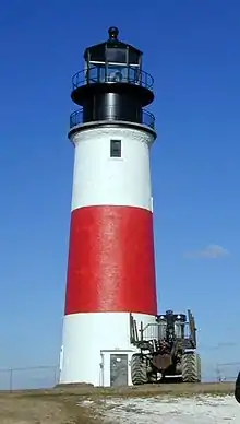
Wood End Light
Wood End Light Lookout Station is a historic lighthouse, located at the southwest end of Long Point in Provincetown, Massachusetts. It is located at Wood End, near the southernmost extent of the Provincetown Spit, and acts as a navigational aid to vessels on their approach to Provincetown Harbor. The Long Point Light Station, further down the peninsula at the tip of Long Point is an identical design and completed in 1875, three years after Wood End Light.
 US Coast Guard photo, not dated. | |
 | |

| |
| Location | Provincetown, Massachusetts |
|---|---|
| Coordinates | 42°1′16.4″N 70°11′36.6″W |
| Year first constructed | 1864 (lookout station) 1872 (lighthouse built) |
| Year first lit | 1872[1] |
| Automated | 1961[1] |
| Foundation | Concrete |
| Construction | Brick |
| Tower shape | Square, pyramidal |
| Markings / pattern | White with black lantern (originally painted brown)[1] |
| Tower height | 39 feet (12 m) |
| Focal height | 45 feet (14 m) above mean sea level |
| Original lens | Fifth-order Fresnel lens[1] |
| Current lens | VRB-25 |
| Range | 13 nautical miles (24 km; 15 mi) |
| Characteristic | Fl Red 10s (Red flash every 10 seconds) |
| Fog signal | Horn:one 3-second blast every 30 seconds[note 1] Previous (1902): 1,000 lb (450 kg) fog bell |
| ARLHS number | USA-904 |
| USCG number | 1-13270[2][3][4] |
| Heritage | place listed on the National Register of Historic Places |
Wood End Light Lookout Station | |
| MPS | Lighthouses of Massachusetts TR |
| NRHP reference No. | 87001504[5] |
| Added to NRHP | June 15, 1987 |
The light was first illuminated on November 20, 1872 and added to the National Register of Historic Places in 1987. In 1981, Wood End Light became the first Massachusetts lighthouse to be converted to use solar energy to power the light and fog signal equipment.[1][6]
In 1896 a wooden keeper's house was built, as well as a storage shed and oil house. With the changing times and no need to man the light station, it was decided in 1961 to raze the buildings leaving just the tower and oil house.

Notes
- Fog signal is radio activated, during times of reduced visibility, turn marine VHF-FM radio to channel 83A/157.175Mhz. Key microphone 5 times consecutively, to activate fog signal for 45 minutes.[2]
References
- "Wood End Light Lookout Station". Maritime History of Massachusetts, a National Register of Historic Places Travel Itinerary. National Park Service. Retrieved 6 November 2014.
- Light List, Volume I, Atlantic Coast, St. Croix River, Maine to Shrewsbury River, New Jersey (PDF). Light List. United States Coast Guard. 2019. p. 119.
- Rowlett, Russ (2010-03-10). "Lighthouses of the United States: Southeast Massachusetts". The Lighthouse Directory. University of North Carolina at Chapel Hill.
- "Historic Light Station Information and Photography: Massachusetts". United States Coast Guard Historian's Office. Archived from the original on 2017-05-01.
- "National Register Information System". National Register of Historic Places. National Park Service. April 15, 2008.
- "Lighthouses of Massachusetts - Thematic Group Nomination (National Register of Historic Places Inventory -- Nomination Form)" (PDF). National Park Service. 4 May 1987. p. Item 7, Page 5. Retrieved 6 November 2014.
