La Chapelle-Saint-Ursin
La Chapelle-Saint-Ursin is a commune in the Cher department in the Centre-Val de Loire region of France.
La Chapelle-Saint-Ursin | |
|---|---|
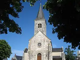 The church in La Chapelle-Saint-Ursin | |
.svg.png.webp) Coat of arms | |
Location of La Chapelle-Saint-Ursin 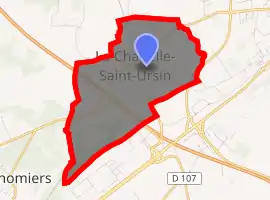
| |
 La Chapelle-Saint-Ursin  La Chapelle-Saint-Ursin | |
| Coordinates: 47°03′47″N 2°19′32″E | |
| Country | France |
| Region | Centre-Val de Loire |
| Department | Cher |
| Arrondissement | Bourges |
| Canton | Saint-Doulchard |
| Intercommunality | CA Bourges Plus |
| Government | |
| • Mayor (2008–2014) | Yvon Beuchon |
| Area 1 | 7.83 km2 (3.02 sq mi) |
| Population (2017-01-01)[1] | 3,542 |
| • Density | 450/km2 (1,200/sq mi) |
| Time zone | UTC+01:00 (CET) |
| • Summer (DST) | UTC+02:00 (CEST) |
| INSEE/Postal code | 18050 /18570 |
| Elevation | 128–159 m (420–522 ft) |
| 1 French Land Register data, which excludes lakes, ponds, glaciers > 1 km2 (0.386 sq mi or 247 acres) and river estuaries. | |
Geography
A small town of farming and light industry situated some 3 miles (4.8 km) southwest of Bourges at the junction of the D16 and the D107 roads. The A71 autoroute cuts across the middle of the commune’s territory.
Population
| Year | Pop. | ±% |
|---|---|---|
| 1962 | 859 | — |
| 1968 | 1,326 | +54.4% |
| 1975 | 1,953 | +47.3% |
| 1982 | 2,430 | +24.4% |
| 1990 | 2,890 | +18.9% |
| 1999 | 3,193 | +10.5% |
| 2008 | 3,209 | +0.5% |
Sights
- The church of St. Ursin, dating from the twelfth century.
See also
References
- "Populations légales 2017". INSEE. Retrieved 6 January 2020.
| Wikimedia Commons has media related to La Chapelle-Saint-Ursin. |
| Authority control |
|
|---|
This article is issued from Wikipedia. The text is licensed under Creative Commons - Attribution - Sharealike. Additional terms may apply for the media files.