Saint-Georges-sur-Moulon
Saint-Georges-sur-Moulon is a commune in the Cher department in the Centre-Val de Loire region of France.
Saint-Georges-sur-Moulon | |
|---|---|
Location of Saint-Georges-sur-Moulon 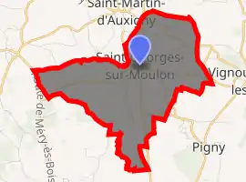
| |
 Saint-Georges-sur-Moulon  Saint-Georges-sur-Moulon | |
| Coordinates: 47°11′28″N 2°25′24″E | |
| Country | France |
| Region | Centre-Val de Loire |
| Department | Cher |
| Arrondissement | Bourges |
| Canton | Saint-Martin-d'Auxigny |
| Intercommunality | CC Terres du Haut Berry |
| Government | |
| • Mayor (2008–2014) | Alain Bardin |
| Area 1 | 9.43 km2 (3.64 sq mi) |
| Population (2017-01-01)[1] | 696 |
| • Density | 74/km2 (190/sq mi) |
| Time zone | UTC+01:00 (CET) |
| • Summer (DST) | UTC+02:00 (CEST) |
| INSEE/Postal code | 18211 /18110 |
| Elevation | 142–212 m (466–696 ft) (avg. 162 m or 531 ft) |
| 1 French Land Register data, which excludes lakes, ponds, glaciers > 1 km2 (0.386 sq mi or 247 acres) and river estuaries. | |
Geography
An area of lakes, streams and farming comprising the village and two hamlets situated on the banks of the river Moulon about 9 miles (14 km) north of Bourges, at the junction of the D940 with the D131 and the D56 roads.
Population
| Year | Pop. | ±% |
|---|---|---|
| 1962 | 315 | — |
| 1968 | 362 | +14.9% |
| 1975 | 414 | +14.4% |
| 1982 | 524 | +26.6% |
| 1990 | 645 | +23.1% |
| 1999 | 667 | +3.4% |
| 2008 | 734 | +10.0% |
Sights
- The chateau des Granges, dating from the nineteenth century.
- A menhir known as the "Pierre à la Femme".
- Traces of a Roman aqueduct.
- A watermill, the Moulin Neuf.
See also
References
- "Populations légales 2017". INSEE. Retrieved 6 January 2020.
| Wikimedia Commons has media related to Saint-Georges-sur-Moulon. |
| Authority control |
|---|
This article is issued from Wikipedia. The text is licensed under Creative Commons - Attribution - Sharealike. Additional terms may apply for the media files.