National Register of Historic Places listings in Warwick, Rhode Island
This is a list of Registered Historic Places in Warwick, Rhode Island, which has been transferred from and is an integral part of National Register of Historic Places listings in Kent County, Rhode Island.
Bristol | Kent | Newport | Providence | Washington |
- This National Park Service list is complete through NPS recent listings posted January 29, 2021.[1]
| [2] | Name on the Register[3] | Image | Date listed[4] | Location | City or town | Description |
|---|---|---|---|---|---|---|
| 1 | Apponaug Historic District | 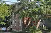 Apponaug Historic District |
February 23, 1984 (#84001833) |
3376, 3384, 3387, 3391, 3397-3399, and 3404 Post Rd. 41°38′18″N 71°27′04″W |
Warwick | |
| 2 | John Waterman Arnold House | 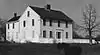 John Waterman Arnold House |
September 10, 1971 (#71000013) |
11 Roger Williams Ave. 41°45′18″N 71°23′56″W |
Warwick | |
| 3 | Budlong Farm | 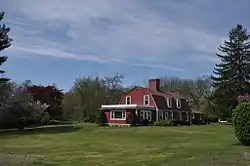 Budlong Farm |
August 18, 1983 (#83000165) |
595 Buttonwoods Ave. 41°41′24″N 71°25′38″W |
Warwick | |
| 4 | Buttonwoods Beach Historic District | 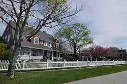 Buttonwoods Beach Historic District |
February 23, 1984 (#84001834) |
Roughly bounded by Brush Neck Cove, Greenwich Bay, Cooper and Promenade Aves. 41°41′09″N 71°24′49″W |
Warwick | |
| 5 | Cedar Hill | 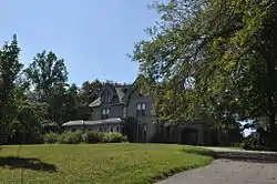 Cedar Hill |
December 22, 2014 (#14001077) |
4157 Post Rd. 41°40′42″N 71°27′10″W |
Warwick | Now the Clouds Hill Victorian Museum. |
| 6 | Conimicut Lighthouse | 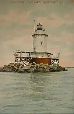 Conimicut Lighthouse |
March 30, 1988 (#88000269) |
East of Conimicut Pt. in the Providence River 41°43′01″N 71°20′45″W |
Warwick | |
| 7 | Cowesett Pound | 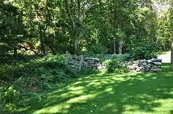 Cowesett Pound |
September 4, 1987 (#87000994) |
Cowesett Rd. 41°41′08″N 71°27′44″W |
Warwick | |
| 8 | District Four School | 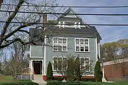 District Four School |
April 14, 1997 (#97000318) |
1515 W. Shore Rd. 41°42′24″N 71°23′03″W |
Warwick | |
| 9 | East Greenwich Historic District |  East Greenwich Historic District |
June 13, 1974 (#74000036) |
Roughly bounded by Kenyon Ave., Division, Peirce, and London Sts., Greenwich Cove and Dark Entry Brook 41°39′43″N 71°27′17″W |
East Greenwich and Warwick | |
| 10 | Elizabeth Spring | 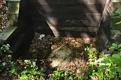 Elizabeth Spring |
August 18, 1983 (#83000166) |
Off Forge Rd. 41°38′51″N 71°27′25″W |
Warwick | |
| 11 | Forge Farm | 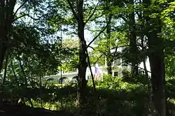 Forge Farm |
January 11, 1974 (#74000037) |
40 Forge Rd. 41°38′19″N 71°27′06″W |
Warwick | |
| 12 | Forge Road Historic District | 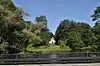 Forge Road Historic District |
February 23, 1984 (#84001861) |
Forge Rd. from Ives Rd. to the Potowomut River 41°38′18″N 71°27′04″W |
Warwick | |
| 13 | Capt. Oliver Gardiner House | 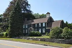 Capt. Oliver Gardiner House |
August 18, 1983 (#83000167) |
4451 Post Rd. 41°40′10″N 71°26′57″W |
Warwick | |
| 14 | Gaspee Point | 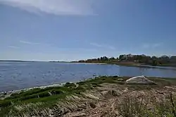 Gaspee Point |
June 8, 1972 (#72000018) |
Off Namquid Dr. 41°44′38″N 71°22′42″W |
Warwick | |
| 15 | Caleb Gorton House | 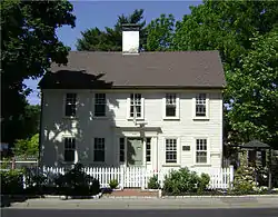 Caleb Gorton House |
August 18, 1983 (#83000168) |
987 Greenwich Ave. 41°42′30″N 71°27′53″W |
Warwick | |
| 16 | Caleb Greene House | 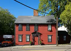 Caleb Greene House |
November 28, 1978 (#78000063) |
15 Centerville Rd. 41°41′55″N 71°27′39″W |
Warwick | |
| 17 | Moses Greene House | 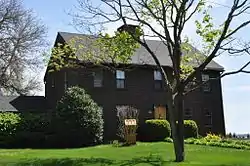 Moses Greene House |
August 18, 1983 (#83000169) |
11 Economy Ave. 41°42′49″N 71°22′16″W |
Warwick | |
| 18 | Peter Greene House | 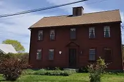 Peter Greene House |
August 18, 1983 (#83000170) |
1124 W. Shore Rd. 41°42′55″N 71°22′34″W |
Warwick | |
| 19 | Richard Wickes Greene House | 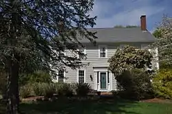 Richard Wickes Greene House |
August 18, 1983 (#83000171) |
27 Homestead Ave. 41°40′51″N 71°22′49″W |
Warwick | |
| 20 | Greene-Bowen House | 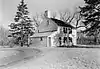 Greene-Bowen House |
May 2, 1974 (#74000038) |
100 Mill Wheel Rd. 41°41′26″N 71°25′19″W |
Warwick | |
| 21 | Greene-Durfee House | 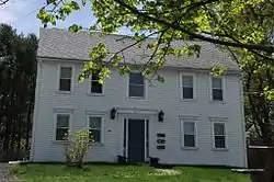 Greene-Durfee House |
August 18, 1983 (#83000172) |
1272 W. Shore Rd. 41°42′46″N 71°22′48″W |
Warwick | |
| 22 | Greenwich Cove Site | January 4, 1980 (#80000077) |
Address Restricted |
Warwick | ||
| 23 | Greenwich Mills | 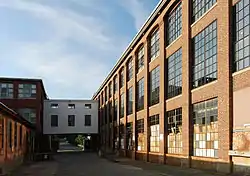 Greenwich Mills |
December 20, 2006 (#06001151) |
42 Ladd St. 41°40′01″N 71°26′52″W |
Warwick | |
| 24 | Hopelands | 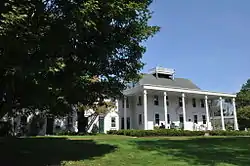 Hopelands |
August 18, 1983 (#83000173) |
Wampanoag Rd. 41°39′27″N 71°25′02″W |
Warwick | Now the campus of the Rocky Hill School. |
| 25 | Indian Oaks | 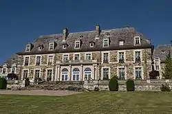 Indian Oaks |
August 18, 1983 (#83000174) |
836 Warwick Neck Ave. 41°40′55″N 71°22′35″W |
Warwick | |
| 26 | Knight Estate | 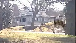 Knight Estate |
February 23, 1984 (#84001864) |
486 East Ave. 41°43′06″N 71°28′54″W |
Warwick | |
| 27 | Lambert Farm Site, RI-269 | November 3, 1983 (#83003798) |
Address Restricted |
Warwick | ||
| 28 | Meadows Archeological District | November 3, 1983 (#83003800) |
Address Restricted |
Warwick | ||
| 29 | Pawtuxet Village Historic District | 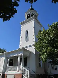 Pawtuxet Village Historic District |
April 24, 1973 (#73000050) |
Bounded roughly by Bayside, S. Atlantic, and Ocean Aves., Pawtuxet and Providence rivers, and Post Rd. 41°45′49″N 71°23′27″W |
Warwick | |
| 30 | Pontiac Mills | 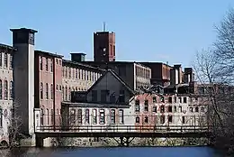 Pontiac Mills |
June 5, 1972 (#72000019) |
Knight St. 41°43′35″N 71°28′13″W |
Warwick | |
| 31 | Rhode Island State Airport Terminal | 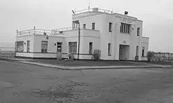 Rhode Island State Airport Terminal |
August 18, 1983 (#83000175) |
572 Occupasstuxet Rd. 41°43′54″N 71°25′44″W |
Warwick | |
| 32 | Christopher Rhodes House | 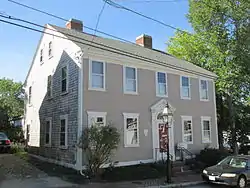 Christopher Rhodes House |
March 31, 1971 (#71000015) |
25 Post Rd. 41°45′49″N 71°23′29″W |
Warwick | |
| 33 | Trafalgar Site, RI-639 | November 3, 1983 (#83003801) |
Address Restricted |
Warwick | ||
| 34 | Warwick Civic Center Historic District |  Warwick Civic Center Historic District |
June 27, 1980 (#80000079) |
Post Rd. 41°41′57″N 71°27′31″W |
Warwick | |
| 35 | Warwick Lighthouse | 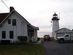 Warwick Lighthouse |
March 30, 1988 (#88000268) |
1350 Warwick Neck Ave. 41°40′01″N 71°22′43″W |
Warwick | |
| 36 | John R. Waterman House | 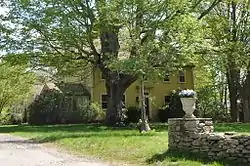 John R. Waterman House |
August 18, 1983 (#83000176) |
100 Old Homestead Rd. 41°43′16″N 71°23′43″W |
Warwick | |
| 37 | Oliver A. Wickes House | 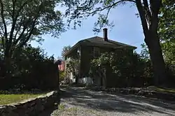 Oliver A. Wickes House |
August 18, 1983 (#83000177) |
794 Major Potter Rd. 41°40′25″N 71°28′30″W |
Warwick |
See also
References
- "National Register of Historic Places: Weekly List Actions". National Park Service, United States Department of the Interior. Retrieved on January 29, 2021.
- Numbers represent an alphabetical ordering by significant words. Various colorings, defined here, differentiate National Historic Landmarks and historic districts from other NRHP buildings, structures, sites or objects.
- "National Register Information System". National Register of Historic Places. National Park Service. March 13, 2009.
- The eight-digit number below each date is the number assigned to each location in the National Register Information System database, which can be viewed by clicking the number.
| Topics | _(extra_close)_(US48).svg.png.webp) | ||||||||||
|---|---|---|---|---|---|---|---|---|---|---|---|
| Lists by county | |||||||||||
| Lists by city |
| ||||||||||
| |||||||||||
This article is issued from Wikipedia. The text is licensed under Creative Commons - Attribution - Sharealike. Additional terms may apply for the media files.