National Register of Historic Places listings in Westerly, Rhode Island
This is a list of Registered Historic Places in Westerly, Rhode Island.
Bristol | Kent | Newport | Providence | Washington |
- This National Park Service list is complete through NPS recent listings posted January 29, 2021.[1]
| [2] | Name on the Register[3] | Image | Date listed[4] | Location | City or town | Description |
|---|---|---|---|---|---|---|
| 1 | Babcock-Smith House | 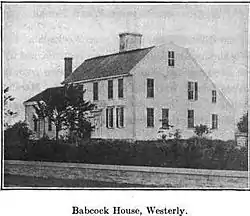 Babcock-Smith House |
July 24, 1972 (#72000008) |
124 Granite St. 41°22′16″N 71°49′13″W |
Westerly | |
| 2 | Bradford Village Historic District | 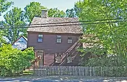 Bradford Village Historic District |
May 30, 1996 (#96000573) |
Roughly Bowling Ln. from the Pawcatuck River to Vars Ln. and Main St. from the Bradford Bridge to Church Ave. 41°24′08″N 71°45′06″W |
Hopkinton and Westerly | |
| 3 | Flying Horse Carousel |  Flying Horse Carousel |
January 11, 1980 (#80000019) |
Bay St. 41°18′32″N 71°51′31″W |
Westerly | One of the earliest carousels still in use, dating to 1876. Horses suspended from chains rather than on poles, hence name. |
| 4 | Former Immaculate Conception Church | 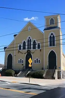 Former Immaculate Conception Church |
April 24, 1973 (#73000007) |
119 High St. 41°22′55″N 71°49′32″W |
Westerly | |
| 5 | Lewis-Card-Perry House | 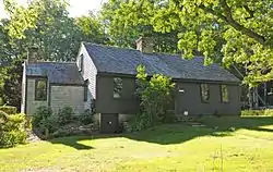 Lewis-Card-Perry House |
October 4, 2005 (#05001152) |
12 Margin St. 41°22′08″N 71°49′57″W |
Westerly | |
| 6 | Main Street Historic District | 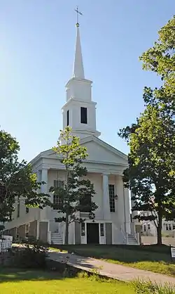 Main Street Historic District |
January 9, 1978 (#78000021) |
113-132 Main St., 8, 7-13 School St., 3-14 Maple St. 41°22′25″N 71°49′51″W |
Westerly | |
| 7 | North End Historic District | 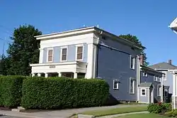 North End Historic District |
April 20, 2006 (#06000298) |
Canal, Dayton, Friendship, High, Pearl, Pierce, Pleasant, Pond, West, Industrial Lila, Geranium, Marriott and Turano 41°23′16″N 71°49′38″W |
Westerly | |
| 8 | Nursery Site, RI-273 | November 1, 1984 (#84000386) |
Address Restricted |
Westerly | ||
| 9 | US Post Office | 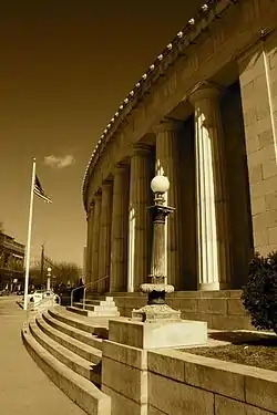 US Post Office |
August 12, 1971 (#71000004) |
High and Broad Sts. 41°22′39″N 71°49′50″W |
Westerly | |
| 10 | Watch Hill Historic District | 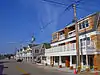 Watch Hill Historic District |
September 5, 1985 (#85001948) |
Roughly bounded by Breen, Watch Hill, and E. Hill Rds., Block Island Sound, Little Narragansett Bay, and the Pawtucket River 41°18′49″N 71°51′23″W |
Westerly | Well-preserved Victorian seaside resort area |
| 11 | Weekapaug Inn | 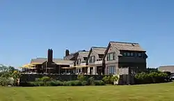 Weekapaug Inn |
January 25, 2007 (#06001305) |
25 Spray Rock Rd. 41°19′49″N 71°45′03″W |
Westerly | |
| 12 | Westerly Armory |  Westerly Armory |
November 7, 1996 (#96001322) |
Railroad Ave., west of downtown Westerly 41°22′55″N 71°49′40″W |
Westerly | |
| 13 | Westerly Downtown Historic District | 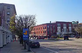 Westerly Downtown Historic District |
July 19, 1984 (#84002055) |
Railroad Ave., High, Canal, Broad, Union, and Main Sts. 41°22′45″N 71°49′49″W |
Westerly | |
| 14 | Wilcox Park Historic District | _-_Westerly%252C_RI.JPG.webp) Wilcox Park Historic District |
May 7, 1973 (#73000011) |
Roughly bounded by Broad, Granite, High Sts. and Grove Ave. and running along Elm St. 41°22′36″N 71°49′43″W |
Westerly |
See also
References
- "National Register of Historic Places: Weekly List Actions". National Park Service, United States Department of the Interior. Retrieved on January 29, 2021.
- Numbers represent an alphabetical ordering by significant words. Various colorings, defined here, differentiate National Historic Landmarks and historic districts from other NRHP buildings, structures, sites or objects.
- "National Register Information System". National Register of Historic Places. National Park Service. March 13, 2009.
- The eight-digit number below each date is the number assigned to each location in the National Register Information System database, which can be viewed by clicking the number.
| Topics | _(extra_close)_(US48).svg.png.webp) | ||||||||||
|---|---|---|---|---|---|---|---|---|---|---|---|
| Lists by county | |||||||||||
| Lists by city |
| ||||||||||
| |||||||||||
|Westerly]]
This article is issued from Wikipedia. The text is licensed under Creative Commons - Attribution - Sharealike. Additional terms may apply for the media files.