Roquefort-la-Bédoule
Roquefort-la-Bédoule (French pronunciation: [ʁɔkfɔʁ la bedul]; Occitan: Ròcafòrt e la Bedola) is a commune in the department of Bouches-du-Rhône in the Provence-Alpes-Côte d'Azur region in southern France. Its inhabitants are called Bédoulens.
Roquefort-la-Bédoule | |
|---|---|
 St. Roseline | |
.svg.png.webp) Coat of arms | |
Location of Roquefort-la-Bédoule 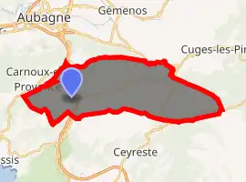
| |
 Roquefort-la-Bédoule  Roquefort-la-Bédoule | |
| Coordinates: 43°14′54″N 5°35′29″E | |
| Country | France |
| Region | Provence-Alpes-Côte d'Azur |
| Department | Bouches-du-Rhône |
| Arrondissement | Marseille |
| Canton | La Ciotat |
| Intercommunality | Aix-Marseille-Provence |
| Government | |
| • Mayor (2020–2026) | Marc Del Grazia |
| Area 1 | 31.15 km2 (12.03 sq mi) |
| Population (2017-01-01)[1] | 5,688 |
| • Density | 180/km2 (470/sq mi) |
| Time zone | UTC+01:00 (CET) |
| • Summer (DST) | UTC+02:00 (CEST) |
| INSEE/Postal code | 13085 /13830 |
| Dialling codes | 0491 |
| Elevation | 158–567 m (518–1,860 ft) (avg. 276 m or 906 ft) |
| 1 French Land Register data, which excludes lakes, ponds, glaciers > 1 km2 (0.386 sq mi or 247 acres) and river estuaries. | |
Geography
It is situated north of Cassis, Ceyreste and La Cadière-d'Azur, but south of Aubagne, Gémenos and Cuges-les-Pins and east of Carnoux-en-Provence and west of Castellet.
History
It was founded during the 7th century.
Population
|
|
References
- "Populations légales 2017". INSEE. Retrieved 6 January 2020.
| Wikimedia Commons has media related to Roquefort-la-Bédoule. |
| Authority control |
|---|
This article is issued from Wikipedia. The text is licensed under Creative Commons - Attribution - Sharealike. Additional terms may apply for the media files.