Rushton, Cheshire
Rushton is a village and civil parish in the unitary authority of Cheshire West and Chester and the ceremonial county of Cheshire, in the north west of England, approximately 6 miles (10 km) west of Winsford and 2 miles (3 km) north east of Tarporley. According to the 2011 census, Rushton has 484 people.[1] Rushton is predominantly countryside,[2] however does includes the village of Eaton. This village contains the Jessie Hughes Village Hall, Eaton Primary School and the church St Thomas.[3]
| Rushton | |
|---|---|
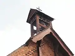
 St Thomas Church, Rushton | |
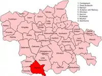
 Rushton Location within Cheshire | |
| Population | 484 |
| OS grid reference | SJ583640 |
| District | |
| Shire county | |
| Region | |
| Country | England |
| Sovereign state | United Kingdom |
| Post town | Tarporley |
| Postcode district | CW6 |
| Dialling code | 01829 |
| Police | Cheshire |
| Fire | Cheshire |
| Ambulance | North West |
| UK Parliament | |

In 1887 Rushton was described as
- "Rushton.-- township, Tarporley par., Cheshire, on NE. side and in town of Tarporley, 1797 ac., pop. 334".[4]
Population
The first recorded population statistic was in the 1881 census. At that time the population was 334. Since then that number has fluctuated, but on the whole has increased. An example of this fluctuation is in 1911 where the population was 305. After that it increased up to 415 in 1951. Today the figure stands at 484.[5]

Industry
In the 1881 census of England and Wales, the industry data showed 100 males and 95 females were eligible for work. Agriculture was comprehensively the main industry in Rushton. 70 males and 9 females were involved in the industry. 2 adult males were without a specified occupation. However, when compared with adult females, 68 were without a specified job. The largest industry for women was domestic cleaning, which consisted of 15 females.[6]
Housing
The earliest census in 1881 recorded 75 houses, since then the number has increased however large fluctuations have occurred. For example, the number of houses increased to 79 in 1901, but the next census after in 1921 saw a fall of 10 houses.[7] In 2011 the census recorded 194 houses.[8] All census data reaching back to 1881 have indicated that the vast majority of Rushton's households have been occupied. Only one 1 house in the 1881 and 1891 census was vacant. However, that number did increase to 4 in 1901. The number of houses occupied has generally increased since the first census in 1881. The largest increase in occupied houses occurred from 1931 to 1951, where 50 more houses were occupied since the previous recorded census.[9]
Health
Figures from the 2011 census showed, 57.9% of residents of Rushton had very good health. When compared to Cheshire west and Chester(48.5), North West (46.5) and England in general(47.2), Rushton had a significant higher rating of very healthy people. This data was collected by local residents who described their health as very good. 30.2% of Rushton's residents described their health as good, this was a slightly lower percentage than the greater region of the North West (33.1) and England's data (34.2).[10] Rushton has a very low disability rate. Only 4.3% had a disability or a long term injury which has lasted/thought to last 12 months. This percentage is half the rate of the average in England[11]
Jessie Hughes Village Hall
The Jessie Hughes hall or the Hall of Eaton was opened on 26 September 1926. The main enforcer in building the hall, was a woman called Mrs Jessie Hughes, who was the wife of the Rector of Tarporley. At the time she was the president of the Women's Institute and played a pivotal role in raising money for the town hall to be built. She opened the hall by laying a corner stone and declared the stone well and truly laid. In 1928 Mrs Hughes died, but today her hard work is still remembered through an inscribed stone which reads "This stone was laid by Jessie L Hughes 1926"[12]
The original village hall fell into disrepair and was rebuilt in 2008. The replacement building retained the name Jessie Hughes Village Hall following a local ballot, and was joint winner of the Cheshire Pride Community Project Award in 2008 – see [13]
References
- "Key figures for 2011 census: Key statistics". Neighbourhood statistics. Office for national statistics. Retrieved 4 February 2013.
- "Walley Drive, Eaton, Rushton, Cheshire". British streets.info. British streets.info. Retrieved 24 April 2013.
- "Rushton Parish including the village of Eaton". Eaton and Rushton Parish Council website. Refined Line Web Development. Retrieved 24 April 2013.
- Bartholomew, John (1887). Gazetteer of the British Isles (1st ed.). Edinburgh: Bartholomew. Retrieved 4 February 2013.
- "Rushton CP/Tn through time Population Statistics". A Vision of Britain through Time. Visionofbritain.org.uk. Retrieved 7 May 2013.
- Woollard, Mathew. "1881 Census of England and Wales, Ages, Table 10, 'Occupations of Males and Females in the Division and its Registration Counties". University of Essex. Retrieved 22 March 2013.
- "Rushton CP/Tn through time Housing Statistics". A Vision of Britain through Time. Visionofbritain.org.uk. Retrieved 7 May 2013.
- "All Households (Households, Mar11)". Key Figures for 2011 Census: Key Statistics. Office for National Statistics. Retrieved 8 April 2013.
- "Rushton CP/Tn through time House Occupancy". A Vision of Britain through Time. visionofbritain.org.uk. Retrieved 7 May 2013.
- "Good Health (Persons, Mar11)". Health and Provision of Unpaid Care, 2011 (KS301EW). Key Figures for 2011 Census: Key Statistics. Retrieved 19 April 2013.
- "Day-to-Day Activities Limited a Lot (Persons, Mar11)1". Health and Provision of Unpaid Care, 2011 (KS301EW). Key Figures for 2011 Census: Key Statistics. Retrieved 19 April 2013.
- "The Village". Eaton and Rushton Parish Council website 2011. Refined Line Web Development. Retrieved 30 April 2013.
- http://www.silvatimber.co.uk/case-study-jessie-hughes-village-hall
External links
![]() Media related to Rushton, Cheshire at Wikimedia Commons
Media related to Rushton, Cheshire at Wikimedia Commons