Bagneux, Indre
Bagneux is a commune in the Indre département in central France.
Bagneux | |
|---|---|
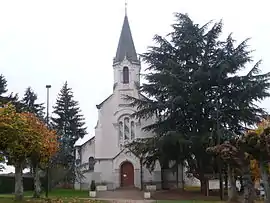 The church in Bagneux | |
Location of Bagneux 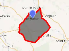
| |
 Bagneux  Bagneux | |
| Coordinates: 47°11′02″N 1°45′14″E | |
| Country | France |
| Region | Centre-Val de Loire |
| Department | Indre |
| Arrondissement | Issoudun |
| Canton | Valençay |
| Intercommunality | Pays de Bazelle |
| Government | |
| • Mayor (2008–2014) | Michel Petit |
| Area 1 | 25.3 km2 (9.8 sq mi) |
| Population (2017-01-01)[1] | 174 |
| • Density | 6.9/km2 (18/sq mi) |
| Time zone | UTC+01:00 (CET) |
| • Summer (DST) | UTC+02:00 (CEST) |
| INSEE/Postal code | 36011 /36210 |
| Elevation | 92–146 m (302–479 ft) (avg. 143 m or 469 ft) |
| 1 French Land Register data, which excludes lakes, ponds, glaciers > 1 km2 (0.386 sq mi or 247 acres) and river estuaries. | |
Population
| Year | Pop. | ±% |
|---|---|---|
| 1793 | 532 | — |
| 1800 | 616 | +15.8% |
| 1806 | 575 | −6.7% |
| 1821 | 572 | −0.5% |
| 1831 | 617 | +7.9% |
| 1836 | 642 | +4.1% |
| 1841 | 667 | +3.9% |
| 1846 | 660 | −1.0% |
| 1851 | 683 | +3.5% |
| 1856 | 686 | +0.4% |
| 1861 | 657 | −4.2% |
| 1866 | 684 | +4.1% |
| 1872 | 624 | −8.8% |
| 1876 | 622 | −0.3% |
| 1881 | 570 | −8.4% |
| 1886 | 565 | −0.9% |
| 1891 | 579 | +2.5% |
| 1896 | 600 | +3.6% |
| 1901 | 598 | −0.3% |
| 1906 | 574 | −4.0% |
| 1911 | 562 | −2.1% |
| 1921 | 488 | −13.2% |
| 1926 | 491 | +0.6% |
| 1931 | 453 | −7.7% |
| 1936 | 425 | −6.2% |
| 1946 | 426 | +0.2% |
| 1954 | 398 | −6.6% |
| 1962 | 324 | −18.6% |
| 1968 | 287 | −11.4% |
| 1975 | 242 | −15.7% |
| 1982 | 193 | −20.2% |
| 1990 | 169 | −12.4% |
| 1999 | 174 | +3.0% |
| 2009 | 192 | +10.3% |
See also
References
- "Populations légales 2017". INSEE. Retrieved 6 January 2020.
| Wikimedia Commons has media related to Bagneux (Indre). |
| Authority control |
|---|
This article is issued from Wikipedia. The text is licensed under Creative Commons - Attribution - Sharealike. Additional terms may apply for the media files.