Brion, Indre
Brion is a commune in the Indre department in central France.
Brion | |
|---|---|
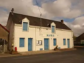 The town hall in Brion | |
Location of Brion 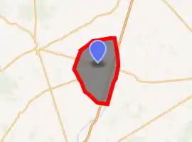
| |
 Brion  Brion | |
| Coordinates: 46°57′28″N 1°43′42″E | |
| Country | France |
| Region | Centre-Val de Loire |
| Department | Indre |
| Arrondissement | Châteauroux |
| Canton | Levroux |
| Government | |
| • Mayor (2008–2014) | Thierry Fourré |
| Area 1 | 44.2 km2 (17.1 sq mi) |
| Population (2017-01-01)[1] | 572 |
| • Density | 13/km2 (34/sq mi) |
| Time zone | UTC+01:00 (CET) |
| • Summer (DST) | UTC+02:00 (CEST) |
| INSEE/Postal code | 36026 /36110 |
| Elevation | 158–222 m (518–728 ft) (avg. 180 m or 590 ft) |
| 1 French Land Register data, which excludes lakes, ponds, glaciers > 1 km2 (0.386 sq mi or 247 acres) and river estuaries. | |
Population
| Year | Pop. | ±% |
|---|---|---|
| 1793 | 550 | — |
| 1800 | 509 | −7.5% |
| 1806 | 586 | +15.1% |
| 1821 | 658 | +12.3% |
| 1831 | 700 | +6.4% |
| 1836 | 761 | +8.7% |
| 1841 | 765 | +0.5% |
| 1846 | 804 | +5.1% |
| 1851 | 785 | −2.4% |
| 1856 | 799 | +1.8% |
| 1861 | 810 | +1.4% |
| 1866 | 841 | +3.8% |
| 1872 | 795 | −5.5% |
| 1876 | 833 | +4.8% |
| 1881 | 835 | +0.2% |
| 1886 | 847 | +1.4% |
| 1891 | 851 | +0.5% |
| 1896 | 805 | −5.4% |
| 1901 | 776 | −3.6% |
| 1906 | 813 | +4.8% |
| 1911 | 828 | +1.8% |
| 1921 | 744 | −10.1% |
| 1926 | 794 | +6.7% |
| 1931 | 772 | −2.8% |
| 1936 | 788 | +2.1% |
| 1946 | 778 | −1.3% |
| 1954 | 753 | −3.2% |
| 1962 | 686 | −8.9% |
| 1968 | 680 | −0.9% |
| 1975 | 585 | −14.0% |
| 1982 | 598 | +2.2% |
| 1990 | 496 | −17.1% |
| 1999 | 440 | −11.3% |
| 2009 | 505 | +14.8% |
See also
References
- "Populations légales 2017". INSEE. Retrieved 6 January 2020.
| Wikimedia Commons has media related to Brion (Indre). |
| Authority control |
|---|
This article is issued from Wikipedia. The text is licensed under Creative Commons - Attribution - Sharealike. Additional terms may apply for the media files.