Orville, Indre
Orville is a commune in the Indre department in central France.
Orville | |
|---|---|
Location of Orville 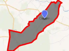
| |
 Orville  Orville | |
| Coordinates: 47°09′11″N 1°47′30″E | |
| Country | France |
| Region | Centre-Val de Loire |
| Department | Indre |
| Arrondissement | Issoudun |
| Canton | Valençay |
| Intercommunality | Pays de Bazelle |
| Government | |
| • Mayor (2008–2014) | Alain Canivet |
| Area 1 | 9.35 km2 (3.61 sq mi) |
| Population (2017-01-01)[1] | 138 |
| • Density | 15/km2 (38/sq mi) |
| Time zone | UTC+01:00 (CET) |
| • Summer (DST) | UTC+02:00 (CEST) |
| INSEE/Postal code | 36147 /36210 |
| Elevation | 97–152 m (318–499 ft) (avg. 125 m or 410 ft) |
| 1 French Land Register data, which excludes lakes, ponds, glaciers > 1 km2 (0.386 sq mi or 247 acres) and river estuaries. | |
Population
| Year | Pop. | ±% |
|---|---|---|
| 1793 | 201 | — |
| 1800 | 398 | +98.0% |
| 1806 | 318 | −20.1% |
| 1821 | 371 | +16.7% |
| 1831 | 357 | −3.8% |
| 1836 | 400 | +12.0% |
| 1841 | 375 | −6.2% |
| 1846 | 396 | +5.6% |
| 1851 | 392 | −1.0% |
| 1856 | 436 | +11.2% |
| 1861 | 426 | −2.3% |
| 1866 | 450 | +5.6% |
| 1872 | 453 | +0.7% |
| 1876 | 427 | −5.7% |
| 1881 | 409 | −4.2% |
| 1886 | 429 | +4.9% |
| 1891 | 415 | −3.3% |
| 1896 | 408 | −1.7% |
| 1901 | 419 | +2.7% |
| 1906 | 399 | −4.8% |
| 1911 | 368 | −7.8% |
| 1921 | 346 | −6.0% |
| 1926 | 327 | −5.5% |
| 1931 | 297 | −9.2% |
| 1936 | 304 | +2.4% |
| 1946 | 267 | −12.2% |
| 1954 | 256 | −4.1% |
| 1962 | 213 | −16.8% |
| 1968 | 198 | −7.0% |
| 1975 | 146 | −26.3% |
| 1982 | 146 | +0.0% |
| 1990 | 144 | −1.4% |
| 1999 | 120 | −16.7% |
| 2009 | 128 | +6.7% |
See also
References
- "Populations légales 2017". INSEE. Retrieved 6 January 2020.
| Wikimedia Commons has media related to Orville (Indre). |
| Authority control |
|---|
This article is issued from Wikipedia. The text is licensed under Creative Commons - Attribution - Sharealike. Additional terms may apply for the media files.