Chabris
Chabris is a commune in the Indre department in central France.
Chabris | |
|---|---|
 The church of Saint-Christophe-et-Saint-Phalier, in Chabris | |
.svg.png.webp) Coat of arms | |
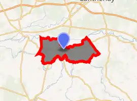
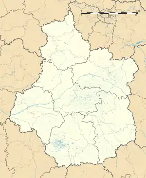
Location of Chabris 
| |
 Chabris  Chabris | |
| Coordinates: 47°15′20″N 1°39′15″E | |
| Country | France |
| Region | Centre-Val de Loire |
| Department | Indre |
| Arrondissement | Issoudun |
| Canton | Valençay |
| Intercommunality | Pays de Bazelle |
| Government | |
| • Mayor (2008–2014) | Serge Pinault |
| Area 1 | 41.22 km2 (15.92 sq mi) |
| Population (2017-01-01)[1] | 2,750 |
| • Density | 67/km2 (170/sq mi) |
| Time zone | UTC+01:00 (CET) |
| • Summer (DST) | UTC+02:00 (CEST) |
| INSEE/Postal code | 36034 /36210 |
| Elevation | 72–134 m (236–440 ft) (avg. 80 m or 260 ft) |
| 1 French Land Register data, which excludes lakes, ponds, glaciers > 1 km2 (0.386 sq mi or 247 acres) and river estuaries. | |
Located at an important river crossing-place on the road from Valençay to Romorantin with a bridge since Roman times, Chabris was once the site of the ancient Bishop of Bourges's feudal fortress. Its church was built over the tomb of the 6th century hermit Saint Phalier. There is a twinning with Lonsee, in Germany.
Population
| Year | Pop. | ±% |
|---|---|---|
| 1793 | 1,937 | — |
| 1800 | 1,923 | −0.7% |
| 1806 | 2,055 | +6.9% |
| 1821 | 2,236 | +8.8% |
| 1831 | 2,511 | +12.3% |
| 1836 | 2,563 | +2.1% |
| 1841 | 2,530 | −1.3% |
| 1846 | 2,781 | +9.9% |
| 1851 | 2,872 | +3.3% |
| 1856 | 2,958 | +3.0% |
| 1861 | 3,030 | +2.4% |
| 1866 | 3,111 | +2.7% |
| 1872 | 3,116 | +0.2% |
| 1876 | 3,044 | −2.3% |
| 1881 | 3,043 | −0.0% |
| 1886 | 3,026 | −0.6% |
| 1891 | 2,927 | −3.3% |
| 1896 | 2,836 | −3.1% |
| 1901 | 2,780 | −2.0% |
| 1906 | 2,792 | +0.4% |
| 1911 | 2,737 | −2.0% |
| 1921 | 2,552 | −6.8% |
| 1926 | 2,441 | −4.3% |
| 1931 | 2,372 | −2.8% |
| 1936 | 2,437 | +2.7% |
| 1946 | 2,385 | −2.1% |
| 1954 | 2,358 | −1.1% |
| 1962 | 2,391 | +1.4% |
| 1968 | 2,493 | +4.3% |
| 1975 | 2,493 | +0.0% |
| 1982 | 2,589 | +3.9% |
| 1990 | 2,672 | +3.2% |
| 1999 | 2,656 | −0.6% |
| 2009 | 2,787 | +4.9% |
Personalities
- Luc Montagnier was born in Chabris on 18 August 1932, French virologist and co-recipient of the 2008 Nobel Prize in Physiology or Medicine for his discovery of HIV.
See also
References
- "Populations légales 2017". INSEE. Retrieved 6 January 2020.
| Wikimedia Commons has media related to Chabris. |
This article is issued from Wikipedia. The text is licensed under Creative Commons - Attribution - Sharealike. Additional terms may apply for the media files.