L'Hôpital-le-Grand
L'Hôpital-le-Grand is a commune in the Loire department in central France.
L'Hôpital-le-Grand | |
|---|---|
Commune | |
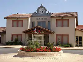 Town hall | |
.svg.png.webp) Coat of arms | |
Location of L'Hôpital-le-Grand 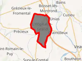
| |
 L'Hôpital-le-Grand  L'Hôpital-le-Grand | |
| Coordinates: 45°35′39″N 4°11′55″E | |
| Country | France |
| Region | Auvergne-Rhône-Alpes |
| Department | Loire |
| Arrondissement | Montbrison |
| Canton | Montbrison |
| Intercommunality | CA Loire Forez |
| Government | |
| • Mayor (2014–2020) | Frédéique Rochette |
| Area 1 | 12.86 km2 (4.97 sq mi) |
| Population (2017-01-01)[1] | 1,054 |
| • Density | 82/km2 (210/sq mi) |
| Time zone | UTC+01:00 (CET) |
| • Summer (DST) | UTC+02:00 (CEST) |
| INSEE/Postal code | 42108 /42210 |
| Elevation | 352–380 m (1,155–1,247 ft) (avg. 375 m or 1,230 ft) |
| 1 French Land Register data, which excludes lakes, ponds, glaciers > 1 km2 (0.386 sq mi or 247 acres) and river estuaries. | |
Geography
L'Hôpital Le Grand is situated near Boisset-lès-Montrond, Craintilleux, Sury-le-Contal, and Montbrison.
Population
| Year | Pop. | ±% |
|---|---|---|
| 1793 | 224 | — |
| 1806 | 212 | −5.4% |
| 1821 | 306 | +44.3% |
| 1831 | 276 | −9.8% |
| 1841 | 324 | +17.4% |
| 1851 | 356 | +9.9% |
| 1861 | 378 | +6.2% |
| 1872 | 381 | +0.8% |
| 1881 | 440 | +15.5% |
| 1891 | 492 | +11.8% |
| 1901 | 447 | −9.1% |
| 1911 | 437 | −2.2% |
| 1921 | 374 | −14.4% |
| 1931 | 378 | +1.1% |
| 1946 | 360 | −4.8% |
| 1954 | 309 | −14.2% |
| 1962 | 303 | −1.9% |
| 1968 | 341 | +12.5% |
| 1975 | 361 | +5.9% |
| 1982 | 407 | +12.7% |
| 1990 | 506 | +24.3% |
| 1999 | 596 | +17.8% |
| 2006 | 862 | +44.6% |
| 2015 | 1,017 | +18.0% |
See also
References
- "Populations légales 2017". INSEE. Retrieved 6 January 2020.
| Wikimedia Commons has media related to L'Hôpital-le-Grand. |
| Authority control |
|---|
This article is issued from Wikipedia. The text is licensed under Creative Commons - Attribution - Sharealike. Additional terms may apply for the media files.