Saint-Polgues
Saint-Polgues is a commune in the Loire department in central France.
Saint-Polgues | |
|---|---|
Commune | |
.svg.png.webp) Coat of arms | |
Location of Saint-Polgues 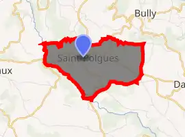
| |
 Saint-Polgues  Saint-Polgues | |
| Coordinates: 45°54′47″N 3°58′33″E | |
| Country | France |
| Region | Auvergne-Rhône-Alpes |
| Department | Loire |
| Arrondissement | Roanne |
| Canton | Boën-sur-Lignon |
| Intercommunality | Vals d'Aix et d'Isable |
| Government | |
| • Mayor (2014–2020) | Domique Fraise |
| Area 1 | 5.77 km2 (2.23 sq mi) |
| Population (2017-01-01)[1] | 259 |
| • Density | 45/km2 (120/sq mi) |
| Time zone | UTC+01:00 (CET) |
| • Summer (DST) | UTC+02:00 (CEST) |
| INSEE/Postal code | 42274 /42260 |
| Elevation | 453–644 m (1,486–2,113 ft) (avg. 600 m or 2,000 ft) |
| 1 French Land Register data, which excludes lakes, ponds, glaciers > 1 km2 (0.386 sq mi or 247 acres) and river estuaries. | |
Population
| Year | Pop. | ±% |
|---|---|---|
| 1793 | 400 | — |
| 1806 | 331 | −17.2% |
| 1821 | 319 | −3.6% |
| 1831 | 369 | +15.7% |
| 1841 | 362 | −1.9% |
| 1851 | 335 | −7.5% |
| 1861 | 362 | +8.1% |
| 1872 | 374 | +3.3% |
| 1881 | 360 | −3.7% |
| 1891 | 407 | +13.1% |
| 1901 | 460 | +13.0% |
| 1911 | 425 | −7.6% |
| 1921 | 374 | −12.0% |
| 1931 | 325 | −13.1% |
| 1946 | 228 | −29.8% |
| 1954 | 218 | −4.4% |
| 1962 | 204 | −6.4% |
| 1968 | 196 | −3.9% |
| 1975 | 191 | −2.6% |
| 1982 | 197 | +3.1% |
| 1990 | 182 | −7.6% |
| 1999 | 194 | +6.6% |
| 2011 | 248 | +27.8% |
| 2017 | 259 | +4.4% |
See also
References
- "Populations légales 2017". INSEE. Retrieved 6 January 2020.
| Wikimedia Commons has media related to Saint-Polgues. |
| Authority control |
|---|
This article is issued from Wikipedia. The text is licensed under Creative Commons - Attribution - Sharealike. Additional terms may apply for the media files.