La Gimond
La Gimond is a commune in the Loire department in central France.
La Gimond | |
|---|---|
Location of La Gimond 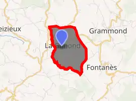
| |
 La Gimond  La Gimond | |
| Coordinates: 45°33′28″N 4°24′38″E | |
| Country | France |
| Region | Auvergne-Rhône-Alpes |
| Department | Loire |
| Arrondissement | Montbrison |
| Canton | Feurs |
| Intercommunality | Saint-Étienne Métropole |
| Government | |
| • Mayor (2014–2020) | Pascal Gonon |
| Area 1 | 3.37 km2 (1.30 sq mi) |
| Population (2017-01-01)[1] | 277 |
| • Density | 82/km2 (210/sq mi) |
| Time zone | UTC+01:00 (CET) |
| • Summer (DST) | UTC+02:00 (CEST) |
| INSEE/Postal code | 42100 /42140 |
| Elevation | 598–773 m (1,962–2,536 ft) (avg. 680 m or 2,230 ft) |
| 1 French Land Register data, which excludes lakes, ponds, glaciers > 1 km2 (0.386 sq mi or 247 acres) and river estuaries. | |
Population
| Year | Pop. | ±% |
|---|---|---|
| 1800 | 167 | — |
| 1821 | 192 | +15.0% |
| 1831 | 186 | −3.1% |
| 1841 | 167 | −10.2% |
| 1851 | 157 | −6.0% |
| 1861 | 196 | +24.8% |
| 1872 | 199 | +1.5% |
| 1881 | 233 | +17.1% |
| 1891 | 236 | +1.3% |
| 1901 | 242 | +2.5% |
| 1911 | 247 | +2.1% |
| 1921 | 214 | −13.4% |
| 1931 | 184 | −14.0% |
| 1946 | 166 | −9.8% |
| 1954 | 178 | +7.2% |
| 1962 | 178 | +0.0% |
| 1968 | 168 | −5.6% |
| 1975 | 174 | +3.6% |
| 1982 | 197 | +13.2% |
| 1990 | 221 | +12.2% |
| 1999 | 217 | −1.8% |
| 2005 | 240 | +10.6% |
| 2015 | 279 | +16.3% |
See also
References
- "Populations légales 2017". INSEE. Retrieved 6 January 2020.
| Wikimedia Commons has media related to La Gimond. |
| Authority control |
|---|
This article is issued from Wikipedia. The text is licensed under Creative Commons - Attribution - Sharealike. Additional terms may apply for the media files.