National Register of Historic Places listings in Hocking County, Ohio
This is a list of the National Register of Historic Places listings in Hocking County, Ohio.
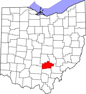
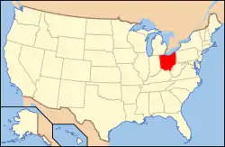
Location of Hocking County in Ohio
This is intended to be a complete list of the properties and districts on the National Register of Historic Places in Hocking County, Ohio, United States. The locations of National Register properties and districts for which the latitude and longitude coordinates are included below, may be seen in a Google map.[1]
There are 13 properties and districts listed on the National Register in the county. Another property was once listed but has been removed.
- This National Park Service list is complete through NPS recent listings posted January 29, 2021.[2]
Current listings
| [3] | Name on the Register[4] | Image | Date listed[5] | Location | City or town | Description |
|---|---|---|---|---|---|---|
| 1 | Davis Works |  Davis Works |
July 15, 1974 (#74001525) |
Southwestern quarter of Section 8, Town 11, Range 19[6] 39°26′36″N 82°43′16″W |
Salt Creek Township | |
| 2 | George Deffenbaugh Mound | July 15, 1974 (#74001526) |
Northeast of Laurelville[7] |
Salt Creek Township | ||
| 3 | Haydenville Historic Town |  Haydenville Historic Town |
March 20, 1973 (#73001480) |
Haydenville 39°28′41″N 82°19′31″W |
Green Township | |
| 4 | Hocking Valley Railway Historic District |  Hocking Valley Railway Historic District |
May 5, 1988 (#88000451) |
Roughly between Bridge #494 in Logan and Bridge #629 in Nelsonville 39°28′46″N 82°19′11″W |
Falls Township, Green Township, Logan, and Starr Township | Extends into Athens County |
| 5 | Inter County Highway 360 |  Inter County Highway 360 |
December 20, 2002 (#02001552) |
Iles Rd., west of Logan 39°33′27″N 82°27′28″W |
Falls Township | |
| 6 | Charles Worth James House | 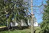 Charles Worth James House |
September 11, 1980 (#80003100) |
75 Hill St. 39°32′33″N 82°24′37″W |
Logan | |
| 7 | Karshner Mound | 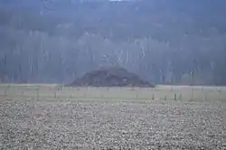 Karshner Mound |
July 15, 1974 (#74001527) |
Second terrace above Salt Creek[8] 39°27′05″N 82°43′12″W |
Salt Creek Township | |
| 8 | Logan City Hall | 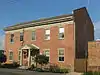 Logan City Hall |
February 11, 1980 (#80003101) |
101 E. Main St. 39°32′23″N 82°24′24″W |
Logan | |
| 9 | Logan Historic District |  Logan Historic District |
April 19, 2010 (#10000192) |
Roughly bounded by 2nd St., Spring St., Hill St., Keynes Dr., and Culver St. 39°32′24″N 82°24′25″W |
Logan | |
| 10 | McCarthy-Blosser-Dillon Building | 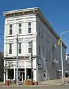 McCarthy-Blosser-Dillon Building |
November 29, 1984 (#84000449) |
4 W. Main St. 39°32′25″N 82°24′32″W |
Logan | |
| 11 | Edith Ross Mound | June 18, 1973 (#73001481) |
Address Restricted |
Salt Creek Township | Near Laurelville | |
| 12 | Saint John the Evangelist Catholic Church Complex | 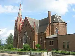 Saint John the Evangelist Catholic Church Complex |
March 13, 1997 (#97000200) |
351 N. Market St. 39°32′35″N 82°24′33″W |
Logan | |
| 13 | William H. Woodruff House | 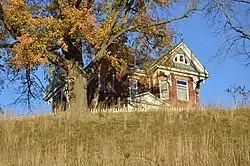 William H. Woodruff House |
July 29, 1982 (#82003598) |
35330 Linton Rd., southeast of Logan 39°31′13″N 82°21′55″W |
Green Township |
Former listing
| [3] | Name on the Register | Image | Date listed | Date removed | Location | City or town | Summary |
|---|---|---|---|---|---|---|---|
| 1 | Ladies Comfort Station | March 9, 1990 (#90000382) | 1999 | S. Mulberry St. |
Logan |
See also
| Wikimedia Commons has media related to National Register of Historic Places in Hocking County, Ohio. |
References
- The latitude and longitude information provided in this table was derived originally from the National Register Information System, which has been found to be fairly accurate for about 99% of listings. Some locations in this table may have been corrected to current GPS standards.
- "National Register of Historic Places: Weekly List Actions". National Park Service, United States Department of the Interior. Retrieved on January 29, 2021.
- Numbers represent an alphabetical ordering by significant words. Various colorings, defined here, differentiate National Historic Landmarks and historic districts from other NRHP buildings, structures, sites or objects.
- "National Register Information System". National Register of Historic Places. National Park Service. March 13, 2009.
- The eight-digit number below each date is the number assigned to each location in the National Register Information System database, which can be viewed by clicking the number.
- Location derived from Thomas, Cyrus. Catalogue of Prehistoric Works East of the Rocky Mountains. Washington: GPO, 1891, 175. The NRIS lists the site as "Address Restricted"
- Location derived from its Federal Register notice; the NRIS lists the site as "Address Restricted"
- Location derived from Owen, Lorrie K., ed. Dictionary of Ohio Historic Places. Vol. 2. St. Clair Shores: Somerset, 1999, 776. The NRIS lists the site as "Address Restricted".
Municipalities and communities of Hocking County, Ohio, United States | ||
|---|---|---|
| City | Map of Ohio highlighting Hocking County | |
| Villages | ||
| Townships | ||
| CDPs | ||
| Unincorporated communities | ||
| Footnotes | ‡This populated place also has portions in an adjacent county or counties | |
| ||
This article is issued from Wikipedia. The text is licensed under Creative Commons - Attribution - Sharealike. Additional terms may apply for the media files.