National Register of Historic Places listings in Monroe County, Ohio
This is a list of the National Register of Historic Places listings in Monroe County, Ohio.
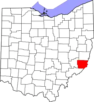
Location of Monroe County in Ohio
This is intended to be a complete list of the properties on the National Register of Historic Places in Monroe County, Ohio, United States. The locations of National Register properties for which the latitude and longitude coordinates are included below, may be seen in a Google map.[1]
There are 10 properties listed on the National Register in the county.
- This National Park Service list is complete through NPS recent listings posted January 29, 2021.[2]
Current listings
| [3] | Name on the Register[4] | Image | Date listed[5] | Location | City or town | Description |
|---|---|---|---|---|---|---|
| 1 | First United Methodist Church | 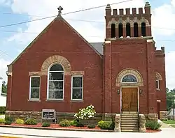 First United Methodist Church |
August 9, 2006 (#06000694) |
136 N. Main St. 39°45′49″N 81°06′54″W |
Woodsfield | |
| 2 | Foraker Bridge | 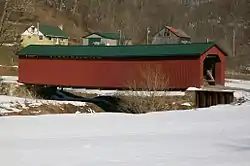 Foraker Bridge |
June 5, 1975 (#75001493) |
3 miles east of Graysville on Plainview Rd. 39°39′20″N 81°07′16″W |
Perry Township | |
| 3 | Hollister-Parry House | 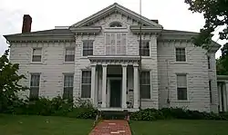 Hollister-Parry House |
April 16, 1980 (#80003166) |
217 Eastern Ave. 39°45′40″N 81°06′44″W |
Woodsfield | |
| 4 | Frederick Kindleberger Stone House and Barn | 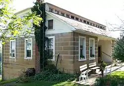 Frederick Kindleberger Stone House and Barn |
February 8, 1980 (#80003163) |
Northwest of Clarington on State Route 25 39°49′50″N 80°54′21″W |
Switzerland Township | |
| 5 | Knowlton Covered Bridge |  Knowlton Covered Bridge |
March 11, 1980 (#80003165) |
North of Rinard Mills 39°36′04″N 81°09′26″W |
Washington Township | |
| 6 | Monroe Bank |  Monroe Bank |
March 11, 1980 (#80003167) |
117 Main St. 39°45′47″N 81°06′57″W |
Woodsfield | |
| 7 | Monroe County Courthouse | 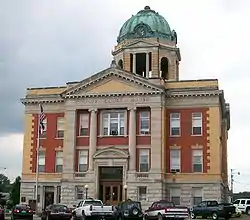 Monroe County Courthouse |
July 21, 1980 (#80003168) |
Main St. 39°45′46″N 81°06′59″W |
Woodsfield | |
| 8 | William C. Mooney House | 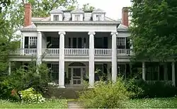 William C. Mooney House |
March 15, 1982 (#82003615) |
122 N. Paul St. 39°45′50″N 81°06′46″W |
Woodsfield | |
| 9 | Walter Ring House and Mill Site |  Walter Ring House and Mill Site |
November 28, 1980 (#80003164) |
Northern side of Township Road 575 at its crossing of the Little Muskingum River[6] 39°36′26″N 81°07′20″W |
Benton Township | |
| 10 | Salem Church | 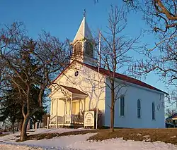 Salem Church |
August 18, 1992 (#92000989) |
48452 State Route 255, north of Sardis 39°39′57″N 80°57′00″W |
Ohio Township |
See also
| Wikimedia Commons has media related to National Register of Historic Places in Monroe County, Ohio. |
References
- The latitude and longitude information provided in this table was derived originally from the National Register Information System, which has been found to be fairly accurate for about 99% of listings. Some locations in this table may have been corrected to current GPS standards.
- "National Register of Historic Places: Weekly List Actions". National Park Service, United States Department of the Interior. Retrieved on January 29, 2021.
- Numbers represent an alphabetical ordering by significant words. Various colorings, defined here, differentiate National Historic Landmarks and historic districts from other NRHP buildings, structures, sites or objects.
- "National Register Information System". National Register of Historic Places. National Park Service. April 24, 2008.
- The eight-digit number below each date is the number assigned to each location in the National Register Information System database, which can be viewed by clicking the number.
- Location derived from its HABS entry; the NRIS lists it as "Address Restricted."
Municipalities and communities of Monroe County, Ohio, United States | ||
|---|---|---|
| Villages | Map of Ohio highlighting Monroe County | |
| Townships | ||
| CDPs | ||
| Unincorporated communities | ||
| Ghost town | ||
| Footnotes | ‡This populated place also has portions in an adjacent county or counties | |
| ||
This article is issued from Wikipedia. The text is licensed under Creative Commons - Attribution - Sharealike. Additional terms may apply for the media files.