National Register of Historic Places listings in Madison County, Alabama
The following properties are listed on the National Register of Historic Places in Madison County, Alabama.
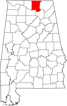
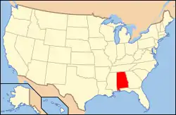
Location of Madison County in Alabama
This is intended to be a complete list of the properties and districts on the National Register of Historic Places in Madison County, Alabama, United States. Latitude and longitude coordinates are provided for many National Register properties and districts; these locations may be seen together in a Google map.[1]
There are 85 properties and districts listed on the National Register in the county, including 6 National Historic Landmarks.
- This National Park Service list is complete through NPS recent listings posted February 5, 2021.[2]
Current listings
| [3] | Name on the Register | Image | Date listed[4] | Location | City or town | Description |
|---|---|---|---|---|---|---|
| 1 | Alabama Agricultural and Mechanical University Historic District | Alabama Agricultural and Mechanical University Historic District |
December 31, 2001 (#01001407) |
Chase Rd. 34°46′43″N 86°34′18″W |
Huntsville | |
| 2 | Beckers Block |  Beckers Block |
September 22, 1980 (#80000703) |
105–111 N. Jefferson St.s 34°43′53″N 86°35′13″W |
Huntsville | |
| 3 | James H. Bibb House |  James H. Bibb House |
April 12, 1984 (#84000651) |
11 Allen St. 34°41′33″N 86°45′13″W |
Madison | |
| 4 | Big Spring |  Big Spring |
September 22, 1980 (#80000704) |
W. Side Sq. 34°43′47″N 86°35′09″W |
Huntsville | |
| 5 | Building at 105 S. Washington Street |  Building at 105 S. Washington Street |
May 23, 1984 (#84000653) |
105 S. Washington St. 34°43′53″N 86°35′07″W |
Huntsville | |
| 6 | Building at 305 Jefferson | 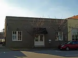 Building at 305 Jefferson |
November 15, 2003 (#03001134) |
305 Jefferson St. 34°44′00″N 86°35′18″W |
Huntsville | |
| 7 | Buildings at 104–128 S. Side Sq. |  Buildings at 104–128 S. Side Sq. |
September 22, 1980 (#80004472) |
104–128 S. Side Sq. 34°43′47″N 86°35′05″W |
Huntsville | |
| 8 | William Burritt Mansion | 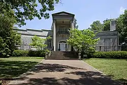 William Burritt Mansion |
May 29, 1992 (#92000627) |
3101 Burritt Dr., SE. 34°42′57″N 86°32′22″W |
Huntsville | |
| 9 | Butlers' Store |  Butlers' Store |
August 31, 1992 (#92001089) |
5498 Main Dr. 34°32′13″N 86°23′40″W |
New Hope | |
| 10 | Church of the Visitation |  Church of the Visitation |
September 22, 1980 (#80000705) |
222 N. Jefferson St. 34°43′58″N 86°35′14″W |
Huntsville | |
| 11 | Clemens House |  Clemens House |
October 16, 1974 (#74000419) |
Pratt Ave. at Meridian St. 34°44′19″N 86°35′03″W |
Huntsville | Moved from its original location (Clinton Ave. at Church St.) in 2004[5] |
| 12 | Dallas Mill |  Dallas Mill |
September 18, 1978 (#78000496) |
701 Dallas Ave. 34°44′50″N 86°34′49″W |
Huntsville | Destroyed by fire in 1991 |
| 13 | Dallas Mill Village Historic District | 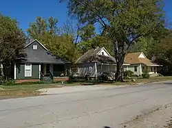 Dallas Mill Village Historic District |
June 27, 2011 (#11000406) |
Bounded by Dickson St. NE. to Russell St. NE., Rison Ave. NE. to Pratt Ave. NE. 34°44′33″N 86°34′44″W |
Huntsville | |
| 14 | Domestic Science Building |  Domestic Science Building |
April 11, 1973 (#73000358) |
Alabama Agricultural and Mechanical University campus 34°47′07″N 86°34′09″W |
Huntsville | |
| 15 | Donegan Block |  Donegan Block |
September 22, 1980 (#80000706) |
105–109 N. Side Sq. 34°43′51″N 86°35′08″W |
Huntsville | |
| 16 | Downtown Chevron Station | Downtown Chevron Station |
September 22, 1980 (#80000707) |
300 E. Clinton Ave. 34°43′56″N 86°35′03″W |
Huntsville | Demolished in 1980s. |
| 17 | Dunnavant's Building |  Dunnavant's Building |
September 22, 1980 (#80000708) |
100 N. Washington St. 34°43′55″N 86°35′08″W |
Huntsville | |
| 18 | Joel Eddins House |  Joel Eddins House |
September 12, 1996 (#96001004) |
3101 Burritt Drive 34°43′01″N 86°32′23″W |
Huntsville | Moved in 2007, originally located near Ardmore in Limestone County[6] |
| 19 | Episcopal Church of the Nativity |  Episcopal Church of the Nativity |
October 9, 1974 (#74000420) |
212 Eustis St. 34°43′48″N 86°35′00″W |
Huntsville | |
| 20 | Everett Building |  Everett Building |
September 22, 1980 (#80000709) |
115–123 N. Washington St. 34°43′56″N 86°35′10″W |
Huntsville | |
| 21 | First National Bank | 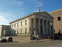 First National Bank |
October 25, 1974 (#74000421) |
West Side Sq. 34°43′47″N 86°35′09″W |
Huntsville | |
| 22 | Five Points Historic District | 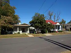 Five Points Historic District |
August 20, 2012 (#12000522) |
Roughly Beirne, Clinton, Eustis, Grayson, McCullough, Pratt, Randolph, Russell, Ward, Wellman, & Wells Aves. 34°44′19″N 86°34′21″W |
Huntsville | |
| 23 | Flint River Place |  Flint River Place |
January 18, 1982 (#82002050) |
1997 Jordan Rd. 34°47′01″N 86°29′37″W |
Huntsville | |
| 24 | Hezekiah Ford House |  Hezekiah Ford House |
June 13, 2014 (#14000318) |
920 Countess Rd. 34°49′13″N 86°32′56″W |
Huntsville | |
| 25 | Fowler's Department Store |  Fowler's Department Store |
May 30, 1996 (#96000597) |
116 Washington and 214 Holmes Sts. 34°43′57″N 86°35′09″W |
Huntsville | Partially deconstructed in 2011–12. The façade was retained and used for the Belk Husdon Lofts.[7] |
| 26 | Gurley Historic District |  Gurley Historic District |
June 2, 2004 (#04000562) |
Section Line St., Railroad St., Maple Boulevard and Church St. between Gurley Pike and Jackson St. 34°42′00″N 86°22′25″W |
Gurley | |
| 27 | Halsey Grocery Warehouse |  Halsey Grocery Warehouse |
September 22, 1980 (#80000710) |
301 N. Jefferson St. 34°43′59″N 86°35′18″W |
Huntsville | |
| 28 | W. L. Halsey Warehouse |  W. L. Halsey Warehouse |
September 22, 1980 (#80000711) |
300 N. Jefferson St. 34°44′00″N 86°35′17″W |
Huntsville | |
| 29 | Henderson National Bank |  Henderson National Bank |
September 22, 1980 (#80000712) |
118 S. Jefferson St. 34°43′50″N 86°35′10″W |
Huntsville | |
| 30 | Hotel Russel Erskine | 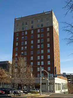 Hotel Russel Erskine |
September 22, 1980 (#80000713) |
123 W. Clinton Ave. 34°43′50″N 86°35′14″W |
Huntsville | |
| 31 | David C. Humphreys House |  David C. Humphreys House |
August 3, 1977 (#77000211) |
109 Gates Ave. 34°43′41″N 86°35′07″W |
Huntsville | Originally located at 510 W. Clinton Ave. W. |
| 32 | Hundley House |  Hundley House |
May 22, 1978 (#78000497) |
401 Madison St. 34°43′43″N 86°35′04″W |
Huntsville | |
| 33 | Hundley Rental Houses | Hundley Rental Houses |
September 22, 1980 (#80000714) |
108 Gates St. and 400 Franklin St. 34°43′44″N 86°35′02″W |
Huntsville | |
| 34 | Terry Hutchens Building |  Terry Hutchens Building |
September 22, 1980 (#80000715) |
102 W. Clinton Ave. 34°43′52″N 86°35′13″W |
Huntsville | |
| 35 | W. T. Hutchens Building |  W. T. Hutchens Building |
December 28, 1983 (#83004374) |
100–104 S. Jefferson St. 34°43′51″N 86°35′12″W |
Huntsville | |
| 36 | George Jude House |  George Jude House |
February 24, 2000 (#00000139) |
2132 Winchester Rd. 34°47′37″N 86°35′12″W |
Huntsville | |
| 37 | Kelly Brothers and Rowe Building | 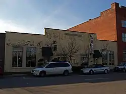 Kelly Brothers and Rowe Building |
September 22, 1980 (#80000716) |
307 N. Jefferson St. 34°44′00″N 86°35′18″W |
Huntsville | |
| 38 | Kildare-McCormick House |  Kildare-McCormick House |
July 15, 1982 (#82002051) |
2005 Kildare St. 34°44′59″N 86°35′06″W |
Huntsville | |
| 39 | Kress Building | 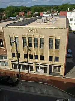 Kress Building |
September 22, 1980 (#80000717) |
107 S. Washington St. 34°43′53″N 86°35′07″W |
Huntsville | |
| 40 | William Lanford House |  William Lanford House |
May 20, 1994 (#94000499) |
7400 Old Madison Pike 34°42′54″N 86°41′44″W |
Huntsville | |
| 41 | Leech-Hauer House | December 8, 1978 (#78000498) |
502 Governors Dr. 34°43′14″N 86°35′13″W |
Huntsville | Demolished, now a medical office building on site | |
| 42 | Lincoln Mill and Mill Village Historic District |  Lincoln Mill and Mill Village Historic District |
April 26, 2010 (#10000200) |
Bounded by Meridian St., Oakwood Ave., Front St., Mountain View Dr., Davidson St., Cottage St, and King Ave. 34°44′52″N 86°34′55″W |
Huntsville | |
| 43 | Lincoln School |  Lincoln School |
December 27, 1982 (#82001608) |
1110 N. Meridian St. 34°44′43″N 86°35′02″W |
Huntsville | |
| 44 | Lombardo Building | 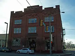 Lombardo Building |
September 22, 1980 (#80000718) |
315 N. Jefferson St. 34°44′01″N 86°35′19″W |
Huntsville | |
| 45 | Lowe Mill and Mill Village Historic District | 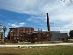 Lowe Mill and Mill Village Historic District |
June 24, 2011 (#11000375) |
Bounded by Triana Blvd. SW., 10th Ave. SW., Summer St. & Governor's Dr. 34°43′02″N 86°36′11″W |
Huntsville | |
| 46 | Lowry House |  Lowry House |
October 29, 2001 (#01001165) |
1205 Kildare Ave. 34°44′49″N 86°35′08″W |
Huntsville | |
| 47 | Madison Station Historic District |  Madison Station Historic District |
March 29, 2006 (#06000185) |
Roughly bounded by the Wall Triana Highway, Mill Rd., Church St., Maple St., Martin St., and Bradley St. 34°41′46″N 86°44′51″W |
Madison | |
| 48 | Maple Hill Cemetery |  Maple Hill Cemetery |
August 22, 2012 (#12000523) |
203 Maple Hill Dr. 34°43′59″N 86°34′24″W |
Huntsville | |
| 49 | Mason Building |  Mason Building |
September 22, 1980 (#80000719) |
115 E. Clinton Ave. 34°43′54″N 86°35′09″W |
Huntsville | |
| 50 | May and Cooney Dry Goods Company |  May and Cooney Dry Goods Company |
September 22, 1980 (#80000720) |
205 E. Side Sq. 34°43′51″N 86°35′04″W |
Huntsville | |
| 51 | McCartney-Bone House |  McCartney-Bone House |
December 16, 1977 (#77000213) |
3 miles northeast of Maysville on Hurricane Rd. 34°47′39″N 86°24′32″W |
Maysville | |
| 52 | McCrary House |  McCrary House |
June 1, 1982 (#82002052) |
Northeast of Huntsville 34°50′43″N 86°29′14″W |
Huntsville | |
| 53 | Merrimack Mill Village Historic District |  Merrimack Mill Village Historic District |
April 16, 2010 (#10000172) |
Alpine St., Triana Blvd., Dunn Dr., Cobb Rd., Drake Ave., & Grote St. 34°42′15″N 86°36′41″W |
Huntsville | |
| 54 | Milligan Block |  Milligan Block |
September 22, 1980 (#80000721) |
201–203 E. Side Sq. 34°43′51″N 86°35′05″W |
Huntsville | |
| 55 | Monte Sano Railroad Workers' House |  Monte Sano Railroad Workers' House |
August 14, 1998 (#98001019) |
4119 Shelby Ave. 34°44′29″N 86°31′26″W |
Huntsville | |
| 56 | Neutral Buoyancy Space Simulator | 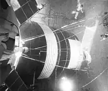 Neutral Buoyancy Space Simulator |
October 3, 1985 (#85002807) |
George C. Marshall Space Flight Center 34°39′11″N 86°40′39″W |
Huntsville | |
| 57 | New Market Historic District |  New Market Historic District |
March 31, 2004 (#04000237) |
Roughly bounded by Mountain Fork, College St., Davis St., Winchester Rd. to Cochran St., and parts of Cochran St. and Cedar St. 34°54′30″N 86°25′43″W |
New Market | |
| 58 | New Market Presbyterian Church | 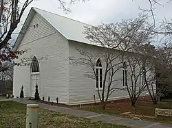 New Market Presbyterian Church |
August 25, 1988 (#88001348) |
1723 New Market Rd. 34°54′37″N 86°25′46″W |
New Market | |
| 59 | New Market United Methodist Church |  New Market United Methodist Church |
June 14, 1990 (#90000919) |
310 Hurricane Rd. 34°54′26″N 86°25′36″W |
New Market | |
| 60 | Old Town Historic District |  Old Town Historic District |
July 18, 1978 (#78000499) |
Roughly bounded by Dement and Lincoln Sts. and Randolph and Walker Aves.; 305, 309, 310 Dallas St. & 115, 118, 120 Walker Ave. 34°44′07″N 86°34′50″W |
Huntsville | Second set of address represent a boundary increase listed March 17, 2015 |
| 61 | William Madison Otey House |  William Madison Otey House |
January 19, 1982 (#82002056) |
South of Meridianville 34°50′10″N 86°34′13″W |
Meridianville | |
| 62 | Phelps-Jones House |  Phelps-Jones House |
February 19, 1982 (#82002053) |
6112 Pulaski Pike 34°48′02″N 86°37′10″W |
Huntsville | |
| 63 | Propulsion and Structural Test Facility |  Propulsion and Structural Test Facility |
October 3, 1985 (#85002804) |
George C. Marshall Space Flight Center 34°37′31″N 86°39′31″W |
Huntsville | |
| 64 | Rand Building | 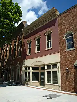 Rand Building |
September 22, 1980 (#80000722) |
113 N. Side Sq. 34°43′51″N 86°35′07″W |
Huntsville | |
| 65 | Randolph Street Church of Christ |  Randolph Street Church of Christ |
September 22, 1980 (#80000723) |
210 Randolph Ave. 34°43′52″N 86°35′03″W |
Huntsville | |
| 66 | Redstone Test Stand |  Redstone Test Stand |
May 13, 1976 (#76000341) |
George C. Marshall Space Flight Center 34°37′58″N 86°40′00″W |
Huntsville | |
| 67 | John Robinson House | 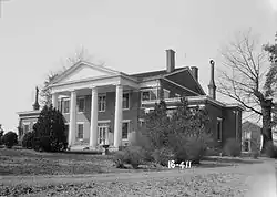 John Robinson House |
October 6, 1977 (#77000212) |
2709 Meridian St., N. 34°45′38″N 86°34′38″W |
Huntsville | |
| 68 | Mrs. William Robinson House |  Mrs. William Robinson House |
February 4, 1982 (#82002054) |
401 Quietdale Dr., NE. 34°45′25″N 86°34′26″W |
Huntsville | |
| 69 | Saturn V Dynamic Test Stand |  Saturn V Dynamic Test Stand |
October 3, 1985 (#85002806) |
George C. Marshall Space Flight Center 34°37′51″N 86°39′40″W |
Huntsville | |
| 70 | Saturn V Space Vehicle |  Saturn V Space Vehicle |
November 22, 1978 (#78000500) |
Tranquility Base 34°42′36″N 86°39′21″W |
Huntsville | |
| 71 | Schiffman Building |  Schiffman Building |
September 22, 1980 (#80000724) |
231 E. Side Sq. 34°43′49″N 86°35′03″W |
Huntsville | |
| 72 | Southern Railway System Depot | 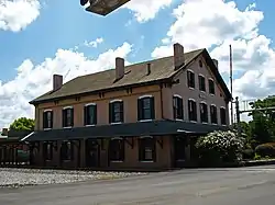 Southern Railway System Depot |
September 10, 1971 (#71000101) |
330 Church St. 34°44′04″N 86°35′27″W |
Huntsville | |
| 73 | Steele-Fowler House | 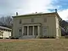 Steele-Fowler House |
June 20, 1974 (#74000422) |
808 Maysville Rd. 34°44′40″N 86°33′52″W |
Huntsville | |
| 74 | Steger House |  Steger House |
June 1, 1982 (#82002055) |
3141 Maysville Rd. 34°46′17″N 86°25′46″W |
Maysville | |
| 75 | Struve-Hay Building |  Struve-Hay Building |
September 22, 1980 (#80000725) |
117–123 N. Jefferson St. 34°43′55″N 86°35′14″W |
Huntsville | |
| 76 | Times Building |  Times Building |
September 22, 1980 (#80000726) |
228 E. Holmes Ave. 34°43′59″N 86°35′07″W |
Huntsville | |
| 77 | Twickenham Historic District |  Twickenham Historic District |
January 4, 1973 (#73000357) |
Roughly bounded by Clinton Ave., California St., Newman Ave. and S. Green St., and Franklin St. 34°43′47″N 86°34′43″W |
Huntsville | Boundary increase May 26, 2015 |
| 78 | U.S. Courthouse and Post Office | 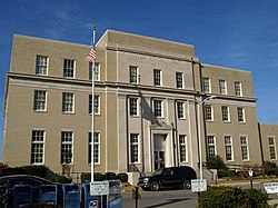 U.S. Courthouse and Post Office |
February 24, 1981 (#81000129) |
101 E. Holmes Ave. 34°43′57″N 86°35′13″W |
Huntsville | |
| 79 | Urquhart House |  Urquhart House |
February 13, 1992 (#92000034) |
8042 Pulaski Pike 34°51′01″N 86°38′12″W |
Huntsville | |
| 80 | Vaught House | 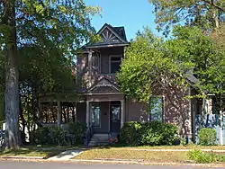 Vaught House |
December 15, 1981 (#81000130) |
701 Ward Ave. 34°44′24″N 86°34′36″W |
Huntsville | |
| 81 | Warden's Residence |  Warden's Residence |
May 17, 2010 (#10000258) |
151 Stone St. 34°34′53″N 86°43′56″W |
Triana | |
| 82 | White-Turner-Sanford House |  White-Turner-Sanford House |
April 12, 1984 (#84000655) |
601 Madison St. 34°43′33″N 86°34′54″W |
Huntsville | |
| 83 | Whitman-Cobb House |  Whitman-Cobb House |
January 18, 1982 (#82002057) |
Winchester Rd. 34°54′13″N 86°25′45″W |
New Market | |
| 84 | Withers-Chapman House |  Withers-Chapman House |
December 8, 1978 (#78000501) |
2409 Dairy Lane, NE. 34°45′24″N 86°33′42″W |
Huntsville | |
| 85 | Yarbrough Hotel |  Yarbrough Hotel |
September 22, 1980 (#80000727) |
127–129 N. Washington St. 34°43′57″N 86°35′11″W |
Huntsville |
See also
| Wikimedia Commons has media related to National Register of Historic Places in Madison County, Alabama. |
References
- The latitude and longitude information provided in this table was derived originally from the National Register Information System, which has been found to be fairly accurate for about 99% of listings. Some locations in this table may have been corrected to current GPS standards.
- "National Register of Historic Places: Weekly List Actions". National Park Service, United States Department of the Interior. Retrieved on February 5, 2021.
- Numbers represent an alphabetical ordering by significant words. Various colorings, defined here, differentiate National Historic Landmarks and historic districts from other NRHP buildings, structures, sites or objects.
- The eight-digit number below each date is the number assigned to each location in the National Register Information System database, which can be viewed by clicking the number.
- "Wins - The Clemens House". Alabama's Preservation Scoreboard. University of West Alabama. Archived from the original on 25 August 2011. Retrieved 19 March 2011.
- "Log house gets new life at Burritt". The Decatur Daily. AP. August 21, 2007. Archived from the original on February 1, 2014. Retrieved January 24, 2014.
- Doyle, Steve (July 12, 2011). "Belk Hudson Lofts moving from drawing board to reality in downtown Huntsville". The Huntsville Times. Archived from the original on November 17, 2012. Retrieved April 7, 2013.
Municipalities and communities of Madison County, Alabama, United States | ||
|---|---|---|
| Cities | Map of Alabama highlighting Madison County | |
| Towns | ||
| CDPs | ||
| Unincorporated communities | ||
| Footnotes | ‡This populated place also has portions in an adjacent county or counties | |
| ||
This article is issued from Wikipedia. The text is licensed under Creative Commons - Attribution - Sharealike. Additional terms may apply for the media files.