Pematangsiantar
Pematangsiantar (sometimes written as Pematang Siantar, acronym PS or P. Siantar, colloquially just Siantar),[2] is an independent city in North Sumatra, Indonesia, surrounded by, but not part of, the Simalungun Regency, making Pematangsiantar an enclave within Simalungun Regency. Pematangsiantar formerly had the status of a second level district (daerah tingkat dua) and was the administrative centre of the surrounding Regency, but it has recently been elevated to Kota (City) and separated from the Regency.
Pematangsiantar
(Kota Pematangsiantar) | |
|---|---|
| Other transcription(s) | |
| • Batak | ᯈᯩᯕᯖᯰᯙᯫᯁᯉ᯳ᯖᯓ᯳ |
| • Chinese | 先達 |
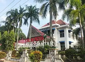 | |
 Coat of arms | |
| Motto(s): ᯃᯬᯖ ᯈᯩᯕᯖᯰᯙᯫᯁᯉ᯳ᯖᯓ᯳ (Sapangambei Manoktok Hitei) | |
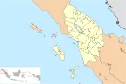 Location within North Sumatra | |
| Coordinates: 2°57′36″N 99°3′36″E | |
| Country | |
| Province | |
| Government | |
| • Mayor | Hefriansyah |
| • Vice Mayor | Togar Sitorus |
| • Speaker of City Council | Timbul Marganda Lingga (PDI-P) |
| • Deputy Speaker of City Council | Mangatas Maruli Tua Silalahi (Golkar) and Ronald Darwin Tampubolon (People's Conscience Party) |
| Area | |
| • Total | 55.7 km2 (21.5 sq mi) |
| Population (mid 2018) | |
| • Total | 253,500 |
| • Density | 4,600/km2 (12,000/sq mi) |
| [1] | |
| Time zone | UTC+7 (Indonesia Western Time) |
| Area code | (+62) 622 |
| Website | www |
Its population was 229,525 in the 2005 Census, 234,698 in the 2010 Census, and 247,219 in the 2015 Intermediate Census, while the latest official estimate (as at mid 2018) is 253,500,[3] making it the second largest city in the province after the provincial capital of Medan.
Administrative divisions
The city is divided administratively into eight districts (kecamatan), tabulated below with their areas and 2010 Census populations:[4]
| Name | Areea in sq.km | Population Census 2010[4] |
|---|---|---|
| Siantar Selatan (South Siantar) | 2.16 | 17,101 |
| Siantar Barat (West Siantar) | 3.35 | 34,984 |
| Siantar Utara (North Siantar) | 4.06 | 46,423 |
| Siantar Timur (East Siantar) | 4.15 | 38,454 |
| Siantar Marihat | 7.70 | 17,872 |
| Siantar Marimbun | 16.36 | 14,642 |
| Siantar Martoba | 16.39 | 38,368 |
| Siantar Sitalasari | 22.72 | 26,854 |
History
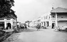
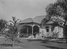
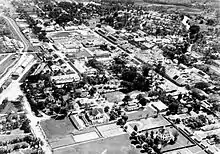
Before 1907, Pematangsiantar was a Kingdom led by the Damanik. Damanik is one of the clans of the Simalungun ethnic group of the Batak people. The last king of the dynasty was Tuan Sangnawaluh Damanik. In 1907, the Dutch took control, turning Pematangsiantar into their colony. The city remained under Dutch control until 1942 when the Japanese invaded and ruled over Indonesia.
After Indonesia proclaimed its freedom in 1945, Pematangsiantar was granted autonomous status. In 1974, Pematangsiantar became a second level district, and was appointed as the capital of Simalungun Regency.[5]
Demographics
Batak Toba and Javanese are the major ethnic groups in Pematangsiantar, with sizeable native Simalungun, Mandailing, Chinese, Minangkabau and Karo.
The majority of Pematangsiantar's inhabitants are Christian (51.25%) and Muslim (43.9%). Around 4.36% percent are Buddhists, and there are smaller numbers of Hindus and followers of Confucianism.
Transport and travel
.JPG.webp)
Pematangsiantar is 50 kilometres from Lake Toba on the Trans-Sumatran Highway. Lake Toba is one of the largest volcanic calderas in the world, and a major tourism destination. It is common to see tourists stopping over in Pt. Siantar. Siantar is famous for Batak culture, 'Batik' and 'Ulos' fabric, and Batak foods. There is a zoo worth visiting that is aptly named Taman Hewan Pematangsiantar - animal garden of Pematangsiantar (Kebun Binatang Pemetangsiantar in Indonesian). It has a good collection of Indonesian native animals, most notably birds, tigers and apes. The zoo itself boasts abundant tropical trees and plants, some of which are quite old. The location is close to the main roads of the city (within walking distance). Ticket price (April 2009) is 7,000 IDR. Another place of interest in the city is Vihara Avalokitesvara - a Buddhist Temple housing the Statue of Kwan Im. At 22.8 meter high, is the tallest statue of its kind in Indonesia. The temple complex is accessible from Jl. Pane. It is part of a new temple complex. Adjacent to the new complex and connected by a bridge across the river of Bah Bolon, the old building of the temple was burned completely in an inferno in May, 2008.
Pematangsiantar can also be reached from Medan by train. There are also large buses which connect Siantar to Medan 130 kilometres away, about a 3-hour trip.
Cuisine
Most of Pematangsiantar's food styles are inherited from Batak and Chinese traditional food. Foods such as saksang (pork cooked in its own blood) and roasted pork, or drinks like tuak (an alcoholic beverage made from sugar palm and sometimes from coconut) prepared by the Batak people are very popular.
Chinese restaurants can also be found across the city. One of the very popular local delicacies inherited from Chinese food is "Mie Pangsit" (Wonton noodles). Minangkabau cuisine is also quite popular, especially Nasi Padang (various dishes with rice) and Sate Padang (spicy satay, usually eaten with rice-cake).
Climate
Pematangsiantar has a tropical rainforest climate (Af) with heavy rainfall year-round. The temperatures are slightly moderated by its elevation.
| Climate data for Pematangsiantar | |||||||||||||
|---|---|---|---|---|---|---|---|---|---|---|---|---|---|
| Month | Jan | Feb | Mar | Apr | May | Jun | Jul | Aug | Sep | Oct | Nov | Dec | Year |
| Average high °C (°F) | 29.2 (84.6) |
29.7 (85.5) |
30.0 (86.0) |
30.0 (86.0) |
30.3 (86.5) |
30.2 (86.4) |
29.9 (85.8) |
29.7 (85.5) |
29.2 (84.6) |
28.9 (84.0) |
28.6 (83.5) |
28.8 (83.8) |
29.5 (85.2) |
| Daily mean °C (°F) | 24.3 (75.7) |
24.5 (76.1) |
24.8 (76.6) |
25.0 (77.0) |
25.3 (77.5) |
25.0 (77.0) |
24.7 (76.5) |
24.6 (76.3) |
24.5 (76.1) |
24.5 (76.1) |
24.2 (75.6) |
24.3 (75.7) |
24.6 (76.4) |
| Average low °C (°F) | 19.4 (66.9) |
19.4 (66.9) |
19.7 (67.5) |
20.1 (68.2) |
20.3 (68.5) |
19.9 (67.8) |
19.6 (67.3) |
19.6 (67.3) |
19.9 (67.8) |
20.1 (68.2) |
19.9 (67.8) |
19.8 (67.6) |
19.8 (67.6) |
| Average rainfall mm (inches) | 210 (8.3) |
181 (7.1) |
210 (8.3) |
241 (9.5) |
261 (10.3) |
192 (7.6) |
176 (6.9) |
233 (9.2) |
318 (12.5) |
350 (13.8) |
263 (10.4) |
259 (10.2) |
2,894 (114.1) |
| Source: Climate-Data.org[7] | |||||||||||||
References
| Wikivoyage has a travel guide for Pematangsiantar. |
| Wikimedia Commons has media related to Pematangsiantar. |
- Badan Pusat Statistik, Jakarta, 2019.
- "Official Website of Pematangsiantar City (In Indonesian)". Archived from the original on 2007-01-25.
- Badan Pusat Statistik, Jakarta, 2019.
- Biro Pusat Statistik, Jakarta, 2011.
- "Pematangsiantar history (in Indonesian)". Archived from the original on 2008-05-22.
- Sensus Penduduk Tahun 2010
- "Climate: Pematangsiantar". Climate-Data.org. Retrieved 6 November 2020.


