National Register of Historic Places listings in Allegan County, Michigan
The following is a list of Registered Historic Places in Allegan County, Michigan.
- This National Park Service list is complete through NPS recent listings posted February 5, 2021.[1]
| [2] | Name on the Register[3] | Image | Date listed[4] | Location | City or town | Description |
|---|---|---|---|---|---|---|
| 1 | All Saints' Episcopal Church† |  All Saints' Episcopal Church† |
December 27, 1984 (#84000511) |
252 Grand St. 42°39′23″N 86°12′03″W |
Saugatuck | |
| 2 | Edward D. Born House |  Edward D. Born House |
March 12, 1987 (#87000237) |
158 Hill St. 42°32′03″N 85°50′40″W |
Allegan | |
| 3 | Engelbert B. Born House |  Engelbert B. Born House |
March 12, 1987 (#87000238) |
128 Hill St. 42°31′59″N 85°50′41″W |
Allegan | |
| 4 | William H. Brown House |  William H. Brown House |
July 8, 1987 (#87000239) |
800 Ely St. 42°31′09″N 85°51′55″W |
Allegan | |
| 5 | Cherry DeLefebvre House | 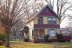 Cherry DeLefebvre House |
November 1, 1991 (#91001548) |
115 W. Chart St. 42°26′30″N 85°38′32″W |
Plainwell | |
| 6 | Douglas Union School† | 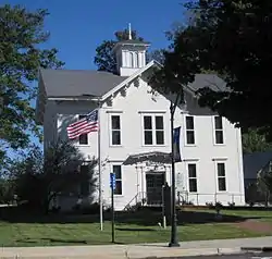 Douglas Union School† |
July 21, 1995 (#95000870) |
130 Center St. 42°38′39″N 86°12′13″W |
Douglas | |
| 7 | Downtown Allegan Historic District | 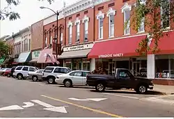 Downtown Allegan Historic District |
March 12, 1987 (#87000251) |
Roughly bounded by Trowbridge, Locust, Hubbard, Brady, and Water Sts. 42°31′39″N 85°50′58″W |
Allegan | |
| 8 | J. F. Eesley Milling Co. Flour Mill–Elevator | 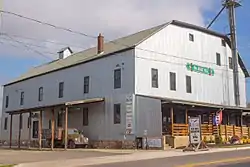 J. F. Eesley Milling Co. Flour Mill–Elevator |
November 1, 1991 (#91001547) |
717 E. Bridge St. 42°26′35″N 85°37′54″W |
Plainwell | |
| 9 | Dorr E. Felt Mansion† | 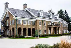 Dorr E. Felt Mansion† |
December 12, 1996 (#96001418) |
6597 138th Ave. 42°41′49″N 86°11′37″W |
Holland | |
| 10 | Fifty-Seventh Street Bridge† |  Fifty-Seventh Street Bridge† |
April 1, 1998 (#98000273) |
57th St. over the Kalamazoo River 42°39′05″N 86°06′25″W |
Manlius Township | |
| 11 | Francis Metallic Surfboat† | 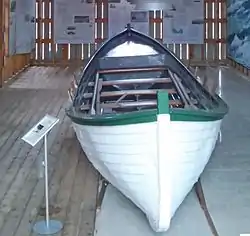 Francis Metallic Surfboat† |
April 21, 2015 (#15000156) |
130 W. Center St. 42°38′39″N 86°12′12″W |
Douglas | |
| 12 | Henry Franks House | 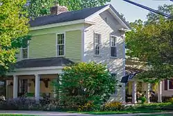 Henry Franks House |
March 12, 1987 (#87000252) |
535 Ely St. 42°31′26″N 85°51′33″W |
Allegan | |
| 13 | Griswold Civic Center Historic District | 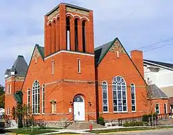 Griswold Civic Center Historic District |
March 12, 1987 (#87000253) |
Roughly bounded by Hubbard, Walnut, and Trowbridge Sts. 42°31′38″N 85°51′10″W |
Allegan | |
| 14 | Hacklander Site† | 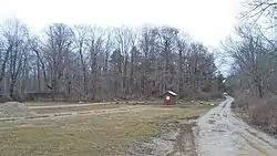 Hacklander Site† |
July 27, 1973 (#73002150) |
South shore of Kalamazoo River, at Hacklander River Access.[5] 42°38′10″N 86°09′45″W |
Douglas | Archaeological site also designated 20AE78. |
| 15 | HENNEPIN Self-unloading Steamship (Shipwreck) | 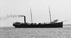 HENNEPIN Self-unloading Steamship (Shipwreck) |
February 1, 2008 (#07001489) |
Lake Michigan[6] 42°27′39″N 86°31′47″W |
South Haven | |
| 16 | Island Historic District | 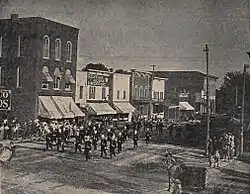 Island Historic District |
November 1, 1991 (#91001546) |
Roughly bounded by Hill St., Anderson St., the mill race, Park St., Bannister St. and the Kalamazoo River 42°26′26″N 85°38′24″W |
Plainwell | |
| 17 | Lake Shore Chapel | 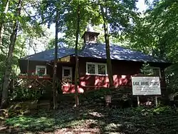 Lake Shore Chapel |
March 28, 1997 (#97000280) |
Shorewood Rd., junction with Campbell Rd. 42°39′02″N 86°13′18″W |
Douglas | |
| 18 | Leiendecker's Inn-Coral Gables | 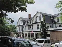 Leiendecker's Inn-Coral Gables |
July 16, 2009 (#09000520) |
220 Water St. 42°39′21″N 86°12′19″W |
Saugatuck | |
| 19 | Augustus Lilly House | 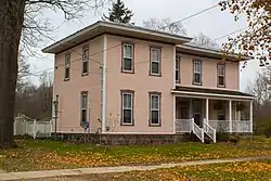 Augustus Lilly House |
March 12, 1987 (#87000254) |
132 Cora St. 42°32′17″N 85°50′41″W |
Allegan | |
| 20 | Marshall Street Historic District | 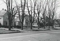 Marshall Street Historic District |
March 12, 1987 (#87000256) |
231-237, 335-705, 232-630 Marshall St. 42°31′16″N 85°50′34″W |
Allegan | |
| 21 | William C. Messenger House | 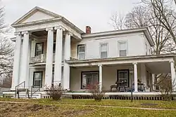 William C. Messenger House |
March 12, 1987 (#87000258) |
310 River St. 42°32′03″N 85°50′54″W |
Allegan | |
| 22 | Michigan Paper Company Mill Historic District† | 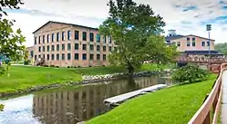 Michigan Paper Company Mill Historic District† |
September 8, 2011 (#11000636) |
200 Allegan St. 42°26′40″N 85°38′40″W |
Plainwell | |
| 23 | Navigation Structures at Saugatuck Harbor | 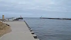 Navigation Structures at Saugatuck Harbor |
November 8, 2001 (#01001216) |
Mouth of the Kalamazoo River 42°40′35″N 86°12′58″W |
Saugatuck | |
| 24 | Oakwood Cemetery Chapel | 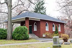 Oakwood Cemetery Chapel |
March 12, 1987 (#87000261) |
Arbor St. 42°31′38″N 85°51′44″W |
Allegan | |
| 25 | Old Wing Mission† | 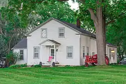 Old Wing Mission† |
August 13, 1986 (#86001551) |
5298 E. 40th Ave. 42°45′42″N 86°04′02″W |
Holland | |
| 26 | Pritchard's Outlook Historic District |  Pritchard's Outlook Historic District |
July 8, 1987 (#87000265) |
Roughly bounded by Park Dr., Walnut, Crescent, and Davis Sts. 42°31′46″N 85°51′20″W |
Allegan | |
| 27 | Saugatuck Pump House† |  Saugatuck Pump House† |
December 29, 2015 (#15000943) |
735 Park St. 42°39′38″N 86°12′26″W |
Saugatuck | Now the Saugatuck Douglas Historical Museum |
| 28 | Second Street Bridge† | .jpg.webp) Second Street Bridge† |
June 11, 1980 (#80001845) |
2nd St. 42°31′52″N 85°50′53″W |
Allegan | |
| 29 | Second Street–Gun River Bridge | December 17, 1999 (#99001573) |
2nd St. over Gun River (Martin Township) 42°30′56″N 85°33′46″W |
Hooper | Bridge Demolished- Replaced with a modern span | |
| 30 | James Noble Sherwood House |  James Noble Sherwood House |
December 27, 1984 (#84000507) |
768 Riverview Dr. 42°25′55″N 85°37′09″W |
Plainwell | |
| 31 | Sarah Lowe Stedman House |  Sarah Lowe Stedman House |
March 12, 1987 (#87000266) |
632 Grand St. 42°31′59″N 85°50′05″W |
Allegan | |
| 32 | Warner P. Sutton House† |  Warner P. Sutton House† |
January 22, 1992 (#91001999) |
736 Pleasant St. 42°39′13″N 86°11′47″W |
Saugatuck | |
| 33 | West Bridge Street Historic District |  West Bridge Street Historic District |
November 1, 1991 (#91001549) |
320, 414-550 and 321-563 W. Bridge St. 42°26′32″N 85°38′57″W |
Plainwell |
See also
| Wikimedia Commons has media related to National Register of Historic Places in Allegan County, Michigan. |
- List of Registered Historic Places in Michigan
- List of Michigan State Historic Sites in Allegan County, Michigan
References
- "National Register of Historic Places: Weekly List Actions". National Park Service, United States Department of the Interior. Retrieved on February 5, 2021.
- Numbers represent an alphabetical ordering by significant words. Various colorings, defined here, differentiate National Historic Landmarks and historic districts from other NRHP buildings, structures, sites or objects.
- "National Register Information System". National Register of Historic Places. National Park Service. April 24, 2008.
- The eight-digit number below each date is the number assigned to each location in the National Register Information System database, which can be viewed by clicking the number.
- The NRIS gives the location of the Hacklander site as "Address Restricted." However, references (i.e., Elizabeth B. Garland; Robert G. Kingsley, Archaeological Survey to Determine Prehistoric Settlement Patterns in Allegan County, Michigan: 1978 Field Season, Michigan History Division Department of State, Lansing, Michigan) make it clear that the site is located at the Hacklander River Access Site. Geo-coordinates are approximate.
- The NPS lists the Hennipin as "Address Restricted." However, the MSRA gives the geo-coordinates.
| Lists by county |
|  |
|---|---|---|
| Other lists |
| |
| Topics | |
|---|---|
| Lists by state |
|
| Lists by insular areas | |
| Lists by associated state | |
| Other areas | |
| Related | |
| |
This article is issued from Wikipedia. The text is licensed under Creative Commons - Attribution - Sharealike. Additional terms may apply for the media files.