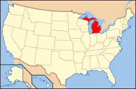
National Register of Historic Places listings in Huron County, Michigan
The following is a list of Registered Historic Places in Huron County, Michigan.
- This National Park Service list is complete through NPS recent listings posted February 5, 2021.[1]
Current listings
| [2] | Name on the Register[3] | Image | Date listed[4] | Location | City or town | Description |
|---|---|---|---|---|---|---|
| 1 | Bay Port Historic Commercial Fishing District | 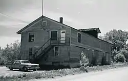 Bay Port Historic Commercial Fishing District |
September 22, 1977 (#77000714) |
Saginaw Bay end of Lakeside Dr. and First St. 43°51′14″N 83°22′25″W |
Bay Port | |
| 2 | First Methodist Episcopal Church | 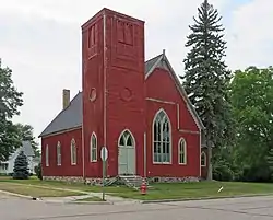 First Methodist Episcopal Church |
November 20, 1987 (#87001963) |
4451 Second St. 43°56′22″N 82°42′59″W |
Port Hope | |
| 3 | James and Jane Grice House | 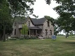 James and Jane Grice House |
November 12, 1982 (#82000534) |
865 N. Huron Ave. 43°51′20″N 82°39′12″W |
Harbor Beach | |
| 4 | Grindstone City Historic District | 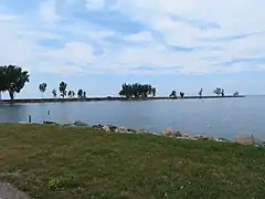 Grindstone City Historic District |
September 3, 1971 (#71000393) |
On M-25 44°03′16″N 82°53′53″W |
Grindstone City | |
| 5 | Harbor Beach Lighthouse |  Harbor Beach Lighthouse |
August 4, 1983 (#83000850) |
Breakwater Entrance 43°50′44″N 82°37′51″W |
Harbor Beach | |
| 6 | Herman House |  Herman House |
November 20, 1987 (#87001974) |
4405 Main St. 43°56′27″N 82°42′46″W |
Port Hope | |
| 7 | Huron City Historic District | 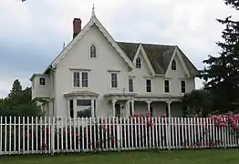 Huron City Historic District |
April 28, 1995 (#95000446) |
Pioneer Dr., Huron and Port Austin Townships 44°01′52″N 82°49′57″W |
Huron City | |
| 8 | Indian Mission | 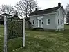 Indian Mission |
September 22, 1972 (#72000620) |
590 E. Bay St. 43°43′33″N 83°26′32″W |
Sebewaing | |
| 9 | Charles G. Learned House |  Charles G. Learned House |
May 31, 1984 (#84001400) |
8544 Lake St. 44°02′32″N 82°59′38″W |
Port Austin | |
| 10 | Isaac Leuty House | 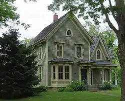 Isaac Leuty House |
November 20, 1987 (#87001975) |
7955 School St. 43°56′26″N 82°42′54″W |
Port Hope | |
| 11 | Masonic Temple | 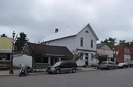 Masonic Temple |
November 20, 1987 (#87001962) |
4425 Main St. 43°56′28″N 82°42′48″W |
Port Hope | |
| 12 | Melligan Store-Agriculture Hall | 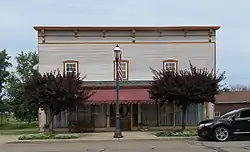 Melligan Store-Agriculture Hall |
January 4, 1988 (#87001965) |
4432 Main St. 43°56′30″N 82°42′46″W |
Port Hope | |
| 13 | Frank Murphy Birthplace | 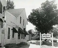 Frank Murphy Birthplace |
September 22, 1971 (#71000394) |
142 S. Huron St. 43°50′33″N 82°39′05″W |
Harbor Beach | |
| 14 | Navigation Structures at Harbor Beach Harbor | 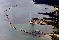 Navigation Structures at Harbor Beach Harbor |
September 11, 1997 (#97000972) |
N. Lakeshore Dr. 43°50′54″N 82°38′15″W |
Harbor Beach | |
| 15 | Ogilvie Building | 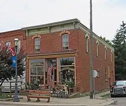 Ogilvie Building |
November 20, 1987 (#87001973) |
4443 Main St. 43°56′29″N 82°42′49″W |
Port Hope | |
| 16 | Pointe Aux Barques Lighthouse | 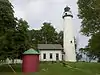 Pointe Aux Barques Lighthouse |
March 20, 1973 (#73000949) |
East of Huron City on Light House Rd. 44°01′25″N 82°45′20″W |
Huron City | |
| 17 | Port Austin Reef Light | 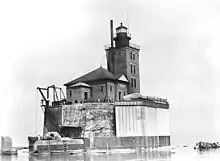 Port Austin Reef Light |
September 15, 2011 (#11000666) |
Port Austin Reef, 2.5 miles north of Port Austin (Port aux Barques Township) 44°04′55″N 82°58′55″W |
Port Austin vicinity | Light Stations of the United States MPS |
| 18 | Albert E. Sleeper House | 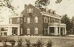 Albert E. Sleeper House |
February 1, 1972 (#72000619) |
228 W. Huron St. (M-53) 43°48′06″N 83°00′16″W |
Bad Axe | |
| 19 | Smith-Culhane House | 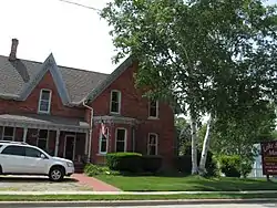 Smith-Culhane House |
September 24, 2001 (#01001015) |
8569 Lake St. 44°02′35″N 82°59′41″W |
Port Austin | |
| 20 | St. John's Lutheran Church | 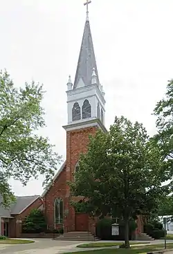 St. John's Lutheran Church |
November 20, 1987 (#87001964) |
4527 Second St. 43°56′26″N 82°43′07″W |
Port Hope | |
| 21 | Stafford House |  Stafford House |
January 25, 1973 (#73000950) |
4467 Main St. 43°56′28″N 82°42′53″W |
Port Hope | |
| 22 | Frederick H. and Elizabeth Stafford House | 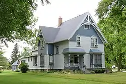 Frederick H. and Elizabeth Stafford House |
November 20, 1987 (#87001976) |
4489 Main St. 43°56′30″N 82°42′53″W |
Port Hope | |
| 23 | W. R. Stafford Flour Mill and Elevator | 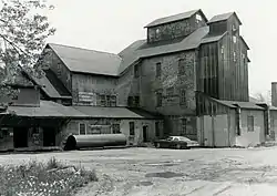 W. R. Stafford Flour Mill and Elevator |
November 20, 1987 (#87001961) |
4310 Huron St. 43°56′31″N 82°42′29″W |
Port Hope | |
| 24 | W. R. Stafford Planing Mill Site | 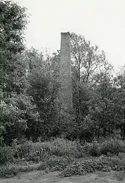 W. R. Stafford Planing Mill Site |
November 20, 1987 (#87001960) |
Huron St. 43°56′29″N 82°42′27″W |
Port Hope | |
| 25 | W. R. Stafford Saw Mill Site | 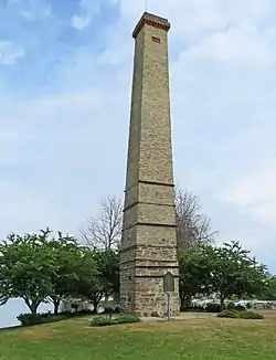 W. R. Stafford Saw Mill Site |
November 20, 1987 (#87001959) |
4451 Huron St. (at Stafford County Park) 43°56′37″N 82°42′32″W |
Port Hope | |
| 26 | W. R. Stafford Worker's House | 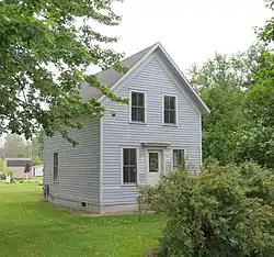 W. R. Stafford Worker's House |
November 20, 1987 (#87001978) |
8022 Cedar St. 43°56′22″N 82°42′40″W |
Port Hope | |
| 27 | Winsor and Snover Bank Building |  Winsor and Snover Bank Building |
March 19, 1987 (#87000482) |
8648 Lake St. 44°02′40″N 82°59′38″W |
Port Austin |
See also
| Wikimedia Commons has media related to National Register of Historic Places in Huron County, Michigan. |
- List of Registered Historic Places in Michigan
- List of Michigan State Historic Sites in Huron County, Michigan
References
- "National Register of Historic Places: Weekly List Actions". National Park Service, United States Department of the Interior. Retrieved on February 5, 2021.
- Numbers represent an alphabetical ordering by significant words. Various colorings, defined here, differentiate National Historic Landmarks and historic districts from other NRHP buildings, structures, sites or objects.
- "National Register Information System". National Register of Historic Places. National Park Service. April 24, 2008.
- The eight-digit number below each date is the number assigned to each location in the National Register Information System database, which can be viewed by clicking the number.
| Lists by county |
|  |
|---|---|---|
| Other lists |
| |
| Topics | |
|---|---|
| Lists by state |
|
| Lists by insular areas | |
| Lists by associated state | |
| Other areas | |
| Related | |
| |
This article is issued from Wikipedia. The text is licensed under Creative Commons - Attribution - Sharealike. Additional terms may apply for the media files.