National Register of Historic Places listings in Ingham County, Michigan
This is a list of the National Register of Historic Places listings in Ingham County, Michigan.
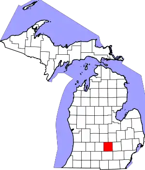
Location of Ingham County in Michigan
This is intended to be a complete list of the properties and districts on the National Register of Historic Places in Ingham County, Michigan, United States. The locations of National Register properties and districts for which the latitude and longitude coordinates are included below, may be seen in an online map.[1]
There are 51 properties and districts listed on the National Register in the county, including 1 National Historic Landmark.
- This National Park Service list is complete through NPS recent listings posted February 5, 2021.[2]
Current listings
| [3] | Name on the Register[4] | Image | Date listed[5] | Location | City or town | Description |
|---|---|---|---|---|---|---|
| 1 | Arbaugh's Department Store Building |  Arbaugh's Department Store Building |
July 20, 2007 (#07000748) |
401 S. Washington 42°43′46″N 84°33′07″W |
Lansing | |
| 2 | Ash Street-Sycamore Creek Bridge |  Ash Street-Sycamore Creek Bridge |
January 14, 2000 (#99001673) |
M-36 over Sycamore Creek 42°34′45″N 84°26′51″W |
Mason | |
| 3 | Brown-Price House | 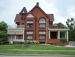 Brown-Price House |
March 22, 1984 (#84001429) |
1003 N. Washington Ave. 42°44′42″N 84°33′09″W |
Lansing | |
| 4 | Capital Bank Tower† | 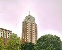 Capital Bank Tower† |
December 6, 2005 (#05001357) |
124 W. Allegan St. 42°43′58″N 84°33′11″W |
Lansing | Now known as Boji Tower |
| 5 | Central Methodist Episcopal Church | 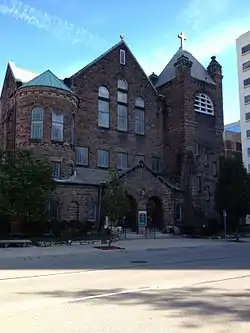 Central Methodist Episcopal Church |
September 17, 1980 (#80001864) |
215 N. Capitol Ave. 42°44′06″N 84°33′16″W |
Lansing | |
| 6 | Central School | 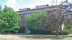 Central School |
April 10, 1986 (#86000709) |
325 W. Grand River Ave. 42°44′11″N 84°29′20″W |
East Lansing | |
| 7 | Courthouse Square Historic District | 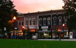 Courthouse Square Historic District |
June 6, 1985 (#85001243) |
Bounded by Park, E. Columbia, Rodgers and South 42°34′43″N 84°26′31″W |
Mason | |
| 8 | Dodge Mansion | 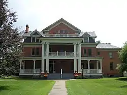 Dodge Mansion |
September 14, 1972 (#72000621) |
106 E. North St. 42°45′03″N 84°33′08″W |
Lansing | |
| 9 | Emery Houses |  Emery Houses |
December 10, 1993 (#93001409) |
320-322 and 326-328 W. Ottawa 42°44′05″N 84°33′25″W |
Lansing | |
| 10 | Eustace Hall† | 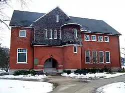 Eustace Hall† |
September 3, 1971 (#71000395) |
470 W. Circle Dr. 42°43′57″N 84°28′47″W |
East Lansing | |
| 11 | Federal Building | 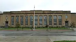 Federal Building |
September 17, 1980 (#80001865) |
315 W. Allegan St. 42°43′55″N 84°33′23″W |
Lansing | |
| 12 | First Baptist Church | 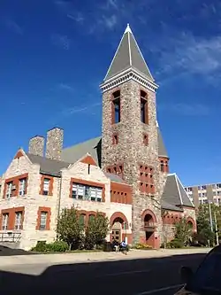 First Baptist Church |
September 17, 1980 (#80001866) |
227 N. Capitol Ave. 42°44′08″N 84°33′16″W |
Lansing | |
| 13 | Franklin Avenue Presbyterian Church |  Franklin Avenue Presbyterian Church |
May 27, 1988 (#88000564) |
108 W. Grand River Ave. 42°44′53″N 84°33′08″W |
Lansing | |
| 14 | Walter H. French Junior High School | 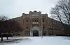 Walter H. French Junior High School |
December 30, 2014 (#14001097) |
1900 S. Cedar St. 42°42′40″N 84°32′54″W |
Lansing | |
| 15 | Genesee Street School |  Genesee Street School |
April 7, 2014 (#14000124) |
835 W. Genesee St. 42°44′19″N 84°33′49″W |
Lansing | |
| 16 | Richard and Deborah (Brough) Glaister House | _Glaister_House.jpg.webp) Richard and Deborah (Brough) Glaister House |
March 21, 2017 (#100000763) |
402 S. Walnut St. 42°43′47″N 84°33′26″W |
Lansing | |
| 17 | Goetsch-Winckler House | 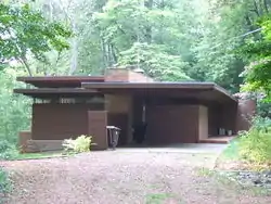 Goetsch-Winckler House |
December 13, 1995 (#95001423) |
2410 Hulett Rd., Meridian Township 42°42′29″N 84°26′21″W |
Okemos | |
| 18 | Grand Trunk Western Rail Station/Lansing Depot | 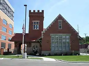 Grand Trunk Western Rail Station/Lansing Depot |
July 3, 1980 (#80004605) |
1203 S. Washington Ave. 42°43′10″N 84°33′05″W |
Lansing | |
| 19 | Ingham County Courthouse | 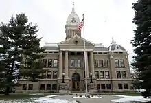 Ingham County Courthouse |
December 13, 1971 (#71000397) |
315 S. Jefferson St. 42°34′47″N 84°26′33″W |
Mason | |
| 20 | J.W. Knapp Company Building | 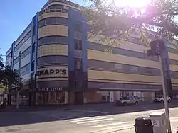 J.W. Knapp Company Building |
May 21, 1983 (#83000851) |
300 S. Washington Ave. 42°43′52″N 84°33′10″W |
Lansing | |
| 21 | Lansing Artillery Michigan National Guard Armory |  Lansing Artillery Michigan National Guard Armory |
December 13, 2010 (#10001025) |
330 Marshall St. 42°44′14″N 84°31′31″W |
Lansing | |
| 22 | Lansing Downtown Historic District | 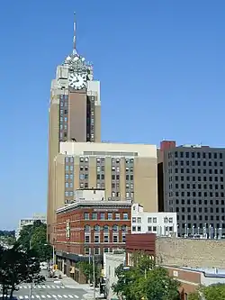 Lansing Downtown Historic District |
July 22, 2009 (#09000551) |
N. and S. Washington, Grand, N. and S. Capitol, Michigan Ave., Allegan, Washtenaw, Kalamazoo, Lenawee, and Townsend 42°43′53″N 84°33′11″W |
Lansing | |
| 23 | Lansing Woman's Club Building |  Lansing Woman's Club Building |
September 17, 1980 (#80001867) |
118 W. Ottawa St. 42°44′05″N 84°33′11″W |
Lansing | |
| 24 | Maple Grove Cemetery | 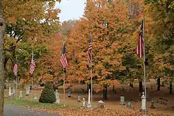 Maple Grove Cemetery |
June 6, 1985 (#85001237) |
W. Columbia St. 42°35′03″N 84°26′44″W |
Mason | |
| 25 | Masonic Temple Building | 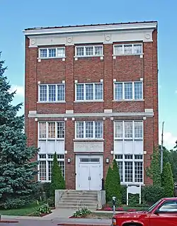 Masonic Temple Building |
March 29, 1999 (#98001083) |
314 M.A.C. Ave. 42°44′10″N 84°28′49″W |
East Lansing | |
| 26 | Masonic Temple Building | 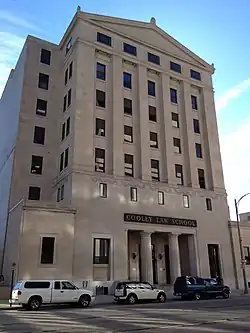 Masonic Temple Building |
September 17, 1980 (#80001868) |
217 S. Capitol Ave. 42°43′55″N 84°33′12″W |
Lansing | |
| 27 | Merrylees-Post House | 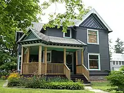 Merrylees-Post House |
June 6, 1985 (#85001238) |
519 W. Ash St. 42°34′44″N 84°27′04″W |
Mason | |
| 28 | Michigan Central Railroad Mason Depot | 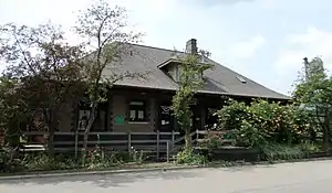 Michigan Central Railroad Mason Depot |
June 6, 1985 (#85001239) |
111 N. Mason St. 42°34′58″N 84°26′55″W |
Mason | |
| 29 | Michigan Millers Mutual Fire Insurance Company Building |  Michigan Millers Mutual Fire Insurance Company Building |
September 17, 1980 (#80001869) |
120-122 W. Ottawa St. 42°44′05″N 84°33′12″W |
Lansing | |
| 30 | Michigan School for the Blind | Michigan School for the Blind |
July 26, 2018 (#100002714) |
715 W. Willow St. 42°44′54″N 84°33′53″W |
Lansing | |
| 31 | Michigan State Capitol | 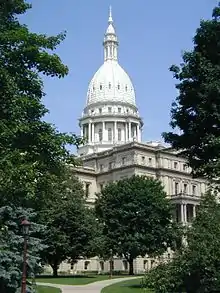 Michigan State Capitol |
January 25, 1971 (#71000396) |
Capitol and Michigan Aves. 42°44′01″N 84°33′20″W |
Lansing | |
| 32 | Michigan State Medical Society Building |  Michigan State Medical Society Building |
November 30, 2011 (#11000864) |
120 W. Saginaw St. 42°44′49″N 84°29′05″W |
East Lansing | |
| 33 | Darius B. Moon House | 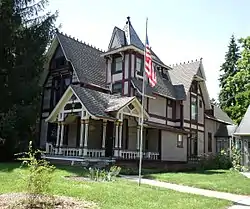 Darius B. Moon House |
November 30, 1982 (#82000535) |
216 Huron St. 42°43′56″N 84°34′18″W |
Lansing | |
| 34 | J.H. Moores Memorial Natatorium | 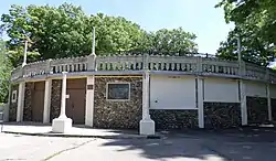 J.H. Moores Memorial Natatorium |
January 14, 1985 (#85000096) |
420 Moores River Dr. 42°43′01″N 84°33′23″W |
Lansing | |
| 35 | Mutual Building | 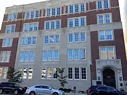 Mutual Building |
September 17, 1980 (#80001870) |
208 N. Capitol Ave. 42°44′07″N 84°33′13″W |
Lansing | |
| 36 | Philip Nice House | 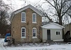 Philip Nice House |
June 6, 1985 (#85001240) |
321 Center St. 42°34′59″N 84°26′52″W |
Mason | |
| 37 | North Lansing Historic Commercial District | .jpg.webp) North Lansing Historic Commercial District |
April 30, 1976 (#76001029) |
E. Grand River Ave. and Turner St. 42°44′52″N 84°33′00″W |
Lansing | |
| 38 | Ottawa Street Power Station | 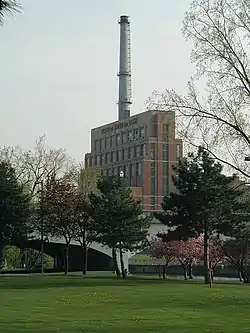 Ottawa Street Power Station |
November 26, 2008 (#08001103) |
217 E. Ottawa St. 42°44′05″N 84°33′02″W |
Lansing | |
| 39 | Prudden Wheel Company Building |  Prudden Wheel Company Building |
May 30, 2007 (#07000478) |
707 Prudden St. 42°44′27″N 84°32′33″W |
Lansing | |
| 40 | Pulver Brothers Filling Station | 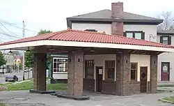 Pulver Brothers Filling Station |
August 4, 2016 (#16000507) |
127 W. Grand River Ave. 42°44′50″N 84°33′12″W |
Lansing | |
| 41 | John Raynor House | 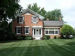 John Raynor House |
June 6, 1985 (#85001241) |
725 E. Ash St. 42°34′42″N 84°25′53″W |
Mason | |
| 42 | Smith-Turner House |  Smith-Turner House |
July 11, 1980 (#80004604) |
326 W. Grand River Ave. 42°44′51″N 84°33′24″W |
Lansing | |
| 43 | Somerville Barn |  Somerville Barn |
March 17, 2005 (#05000152) |
1050 N. College Rd. 42°36′45″N 84°28′59″W |
Alaiedon Township | |
| 44 | St. Katherine's Chapel | .jpg.webp) St. Katherine's Chapel |
July 8, 1970 (#70000272) |
4650 Meridian Rd., 42°43′07″N 84°21′43″W |
Williamstown Township | |
| 45 | St. Mary Cathedral | .jpg.webp) St. Mary Cathedral |
November 2, 1990 (#90001716) |
229 Seymour St. 42°44′08″N 84°33′22″W |
Lansing | |
| 46 | State Office Building |  State Office Building |
May 17, 1984 (#84001432) |
320 S. Walnut St. 42°43′50″N 84°33′28″W |
Lansing | |
| 47 | Stockbridge Town Hall | 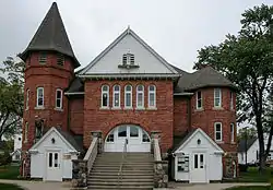 Stockbridge Town Hall |
March 10, 1980 (#80001872) |
101 S. Clinton St. 42°27′02″N 84°10′46″W |
Stockbridge | |
| 48 | Strand Theatre and Arcade | 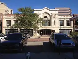 Strand Theatre and Arcade |
September 17, 1980 (#80001871) |
211-219 S. Washington Ave. 42°43′55″N 84°33′05″W |
Lansing | |
| 49 | Union Depot† | 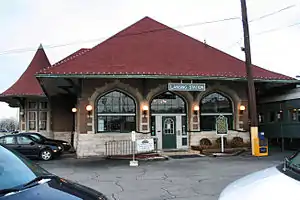 Union Depot† |
July 21, 1995 (#95000869) |
637 E. Michigan Ave. 42°44′04″N 84°32′36″W |
Lansing | |
| 50 | Westside Neighborhood Historic District |  Westside Neighborhood Historic District |
June 6, 1985 (#85001242) |
Roughly bounded by W. Maple, W. Ash, Lansing and McRoberts Sts. 42°34′47″N 84°26′56″W |
Mason | |
| 51 | Williamston Downtown Historic District |  Williamston Downtown Historic District |
December 12, 2012 (#12001029) |
1st blocks of E. & W. Grand River Ave. & S. Putnam St. 42°41′21″N 84°17′00″W |
Williamston |
Former listings
| [3] | Name on the Register | Image | Date listed | Date removed | Location | City or town | Summary |
|---|---|---|---|---|---|---|---|
| 1 | Benjamin Davis House |  Benjamin Davis House |
Unknown (#72001589) | 1972 | 528 S. Washington Ave. 42°43′40″N 84°33′00″W |
Lansing | Demolished in 1972. |
| 2 | Reo Motor Car Company Plant |  Reo Motor Car Company Plant |
June 2, 1978 (#78001500) | July 31, 1985 | 2100 S. Washington St. 42°42′35″N 84°33′20″W |
Lansing | Demolished by January 14, 1980. Formerly a National Historic Landmark.[6] |
See also
| Wikimedia Commons has media related to National Register of Historic Places in Ingham County, Michigan. |
References
- The latitude and longitude information provided in this table was derived originally from the National Register Information System, which has been found to be fairly accurate for about 99% of listings. Some locations in this table may have been corrected to current GPS standards.
- "National Register of Historic Places: Weekly List Actions". National Park Service, United States Department of the Interior. Retrieved on February 5, 2021.
- Numbers represent an alphabetical ordering by significant words. Various colorings, defined here, differentiate National Historic Landmarks and historic districts from other NRHP buildings, structures, sites or objects.
- "National Register Information System". National Register of Historic Places. National Park Service. March 13, 2009.
- The eight-digit number below each date is the number assigned to each location in the National Register Information System database, which can be viewed by clicking the number.
| Lists by county |
|  |
|---|---|---|
| Other lists |
| |
| Topics | |
|---|---|
| Lists by state |
|
| Lists by insular areas | |
| Lists by associated state | |
| Other areas | |
| Related | |
| |
This article is issued from Wikipedia. The text is licensed under Creative Commons - Attribution - Sharealike. Additional terms may apply for the media files.