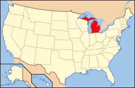
National Register of Historic Places listings in Genesee County, Michigan
The following is a list of Registered Historic Places in Genesee County, Michigan.
- This National Park Service list is complete through NPS recent listings posted February 5, 2021.[1]
| [2] | Name on the Register[3] | Image | Date listed[4] | Location | City or town | Description |
|---|---|---|---|---|---|---|
| 1 | Robert P. Aitken Farm House | 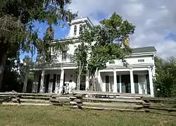 Robert P. Aitken Farm House |
November 26, 1982 (#82000496) |
1110 N. Linden Rd. 43°01′10″N 83°46′21″W |
Flint Township | Italianate/Greek Revival style farmhouse. Built circa 1843 by Michigan State Congressman Robert P. Aitken (1819–1873) and later owned by his son U.S. Congressman David D. Aitken (1853–1930). Still a private residence. |
| 2 | Applewood | 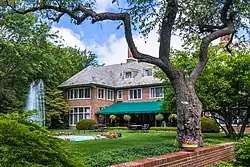 Applewood |
April 16, 1979 (#79001152) |
1400 E. Kearsley St. 43°01′26″N 83°40′24″W |
Flint | Estate of Charles Stewart Mott (1875–1973) |
| 3 | Atlas Grange Hall | 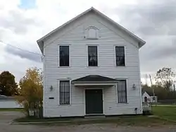 Atlas Grange Hall |
November 26, 1982 (#82000497) |
8530 Perry Rd. 42°56′16″N 83°32′05″W |
Atlas | |
| 4 | Benjamin Bangs House | 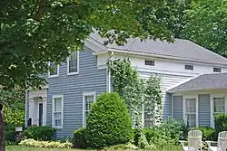 Benjamin Bangs House |
November 26, 1982 (#82000498) |
819 S. Leroy St. 42°47′21″N 83°42′17″W |
Fenton | |
| 5 | Barn at 4277 Irish Road | 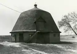 Barn at 4277 Irish Road |
November 26, 1982 (#82000499) |
4277 Irish Rd. 42°58′05″N 83°33′13″W |
Davison | |
| 6 | Beach-Garland Street-Flint River Bridge |  Beach-Garland Street-Flint River Bridge |
December 9, 1999 (#99001513) |
Beach and Garland Sts. over Flint R. 43°01′11″N 83°41′39″W |
Flint | Luten arch bridge. It has been destroyed and replaced. |
| 7 | Berridge Hotel | 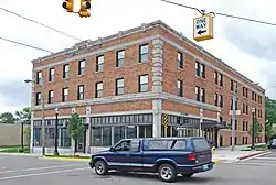 Berridge Hotel |
March 27, 2008 (#08000219) |
421 Garland St. 43°01′10″N 83°41′44″W |
Flint | |
| 8 | Bird/Boyd Farm House |  Bird/Boyd Farm House |
November 26, 1982 (#82000500) |
14215 Bird Rd. 42°49′10″N 83°52′30″W |
Byron | |
| 9 | Frank D. Bloss and Sons Farm House | 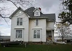 Frank D. Bloss and Sons Farm House |
November 26, 1982 (#82000501) |
8380 Reid Rd. 42°55′39″N 83°50′44″W |
Swartz Creek | |
| 10 | Bridge Street-Broad Street Historic District | 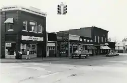 Bridge Street-Broad Street Historic District |
November 26, 1982 (#82000502) |
3 Central blocks of Broad St., 2 blocks Bridge St. 42°48′53″N 83°46′53″W |
Linden | |
| 11 | Jesse H. Buck Farm House | 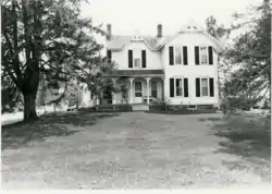 Jesse H. Buck Farm House |
November 26, 1982 (#82000503) |
6095 Baldwin Rd. 42°53′02″N 83°47′33″W |
Swartz Creek | |
| 12 | Capitol Theatre Building | 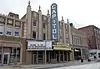 Capitol Theatre Building |
January 31, 1985 (#85000165) |
140 E. 2nd St. 43°00′55″N 83°41′20″W |
Flint | |
| 13 | William Carmer House | 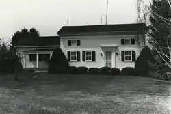 William Carmer House |
November 26, 1982 (#82000504) |
10448 Washburn Rd. 42°52′42″N 83°27′17″W |
Ortonville | |
| 14 | Volney Church-Carlos B. Shotwell House | 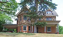 Volney Church-Carlos B. Shotwell House |
November 26, 1982 (#82000505) |
812 S. Adelaide St. 42°47′20″N 83°42′26″W |
Fenton | |
| 15 | City of Flint Municipal Center |  City of Flint Municipal Center |
December 19, 2019 (#100004775) |
1101 Saginaw St., 210 East Fifth St., 310 East Fifth St. 43°00′42″N 83°41′11″W |
Flint | |
| 16 | Civic Park Historic District |  Civic Park Historic District |
September 7, 1979 (#79001153) |
Roughly bounded by Welch and Brownell Blvds., Trumbull Ave., Dupont and Dartmouth Sts. 43°02′15″N 83°43′11″W |
Flint | |
| 17 | Clio Depot | 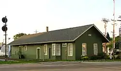 Clio Depot |
June 20, 1983 (#83000842) |
300-308 W. Vienna Rd. 43°10′39″N 83°44′15″W |
Clio | Now a museum |
| 18 | David B. Colwell House | 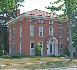 David B. Colwell House |
November 26, 1982 (#82000506) |
901 S. Leroy St. 42°47′16″N 83°42′17″W |
Fenton | |
| 19 | Calvin Coolidge Elementary School | February 1, 2018 (#100002067) |
3701 Van Buren Ave. 43°00′35″N 83°43′58″W |
Flint | ||
| 20 | Dibbleville-Fentonville Historic District | Dibbleville-Fentonville Historic District |
November 26, 1982 (#82000507) |
Roughly bounded by Shiawassee, Riggs, Holly and George Sts. 42°47′31″N 83°42′20″W |
Fenton | |
| 21 | Durant-Dort Carriage Company Office | 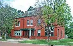 Durant-Dort Carriage Company Office |
September 2, 1975 (#75000943) |
316 W. Water St. 43°01′02″N 83°41′46″W |
Flint | Office building of General Motors founder William C. Durant and his business partner Josiah Dallas Dort. |
| 22 | Elks Lodge Building | 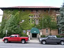 Elks Lodge Building |
October 4, 1978 (#78001497) |
142 W. 2nd St. 43°00′53″N 83°41′28″W |
Flint | |
| 23 | Fenton Railroad Depot | 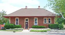 Fenton Railroad Depot |
June 20, 1983 (#83000843) |
207 Silver Lake Rd. 42°47′50″N 83°42′09″W |
Fenton | Now an office building |
| 24 | First Baptist Church of Grand Blanc |  First Baptist Church of Grand Blanc |
June 20, 1983 (#83000844) |
6101 S. Saginaw St. 42°56′32″N 83°38′53″W |
Grand Blanc | |
| 25 | First National Bank and Trust Company Building | 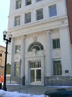 First National Bank and Trust Company Building |
June 27, 2007 (#07000646) |
460 South Saginaw St. 43°00′57″N 83°41′28″W |
Flint | |
| 26 | Flint Journal Building | .jpg.webp) Flint Journal Building |
December 11, 2013 (#13000903) |
200 E. 1st St. 43°00′59″N 83°41′20″W |
Flint | Now used by the Michigan State University College of Human Medicine. |
| 27 | Genesee Avenue – Walker Street Historic District |  Genesee Avenue – Walker Street Historic District |
June 20, 1983 (#83000845) |
Roughly bounded by Washington, Elm, Lord Sts., and railroad Tracks 42°52′21″N 83°54′48″W |
Gaines | |
| 28 | Genesee County Courthouse | 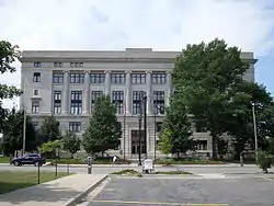 Genesee County Courthouse |
May 24, 1990 (#90000798) |
920 S. Saginaw St. 43°00′42″N 83°41′17″W |
Flint | |
| 29 | Genesee County Savings Bank |  Genesee County Savings Bank |
November 27, 2017 (#100001836) |
352 S. Saginaw St. 43°01′01″N 83°41′32″W |
Flint | |
| 30 | Horace Gilbert/Morgan and Enos Miller House |  Horace Gilbert/Morgan and Enos Miller House |
November 26, 1982 (#82000509) |
5023 Holland Dr. 42°57′23″N 83°49′54″W |
Swartz Creek | |
| 31 | Glenwood Cemetery | 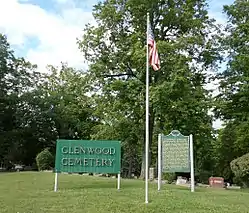 Glenwood Cemetery |
September 22, 2010 (#10000616) |
2500 W Court St. 43°00′25″N 83°43′17″W |
Flint | |
| 32 | Alanson Green Farm House | 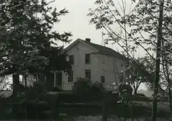 Alanson Green Farm House |
November 26, 1982 (#82000510) |
11226 Green Rd. 42°54′15″N 83°29′07″W |
Goodrich | |
| 33 | Hegel Road Historic District |  Hegel Road Historic District |
November 26, 1982 (#82000511) |
Hegel Rd. between Seneca and the Goodrich Millpond 42°55′00″N 83°30′18″W |
Goodrich | |
| 34 | Col. J. Hinckley House |  Col. J. Hinckley House |
November 26, 1982 (#82000512) |
210 High St. 42°47′16″N 83°42′11″W |
Fenton | |
| 35 | Hotel Durant | .jpg.webp) Hotel Durant |
March 17, 2009 (#09000128) |
607 East 2nd Avenue 43°01′13″N 83°41′39″W |
Flint | Sat vacant for decades, it was recently renovated and is now an apartment building. |
| 36 | House at 10410 Stanley Road |  House at 10410 Stanley Road |
November 26, 1982 (#82000514) |
10410 Stanley Rd. 43°06′13″N 83°53′18″W |
Flushing | |
| 37 | House at 1339 Cummings Road | 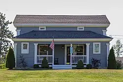 House at 1339 Cummings Road |
November 26, 1982 (#82000515) |
1339 Cummings Rd. 43°01′47″N 83°29′20″W |
Davison | |
| 38 | House at 4305 South Linden Road | 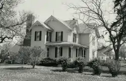 House at 4305 South Linden Road |
November 26, 1982 (#82000516) |
4305 S. Linden Rd. 42°57′52″N 83°46′16″W |
Flint | |
| 39 | House at 4344 Frances Road | 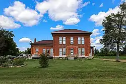 House at 4344 Frances Road |
November 26, 1982 (#82000517) |
4344 W. Frances Rd. 43°08′03″N 83°46′02″W |
Clio | |
| 40 | House at 5556 Flushing Road | 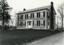 House at 5556 Flushing Road |
November 26, 1982 (#82000518) |
5556 Flushing Rd. 43°02′39″N 83°47′25″W |
Flushing | |
| 41 | House at 6112 Carpenter Road | 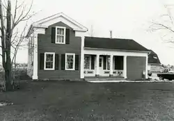 House at 6112 Carpenter Road |
November 26, 1982 (#82000513) |
6112 Carpenter Rd. 43°05′03″N 83°35′34″W |
Flint | |
| 42 | House at 7066 Lobdell Road | 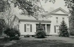 House at 7066 Lobdell Road |
November 26, 1982 (#82000519) |
7066 Lobdell Rd. 42°47′29″N 83°48′28″W |
Linden | |
| 43 | Industrial Savings Bank Building | 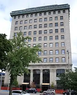 Industrial Savings Bank Building |
April 19, 1984 (#84001393) |
432 N. Saginaw St. 43°01′12″N 83°41′35″W |
Flint | Now the Northbank Center, part of the University of Michigan–Flint |
| 44 | H. N. Jennings House | 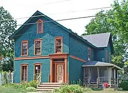 H. N. Jennings House |
November 26, 1982 (#82000520) |
800 S. East St. 42°47′16″N 83°42′07″W |
Fenton | |
| 45 | Abner C. Johnson House | 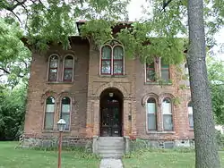 Abner C. Johnson House |
February 19, 1987 (#87000183) |
625 East St. 43°01′02″N 83°40′58″W |
Flint | |
| 46 | Morris A. Knight House | 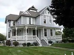 Morris A. Knight House |
July 29, 1982 (#82004680) |
1105 Church St. 43°00′33″N 83°41′17″W |
Flint | |
| 47 | Linden Mill | 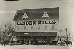 Linden Mill |
August 21, 1972 (#72000615) |
Tickner St. 42°48′55″N 83°46′54″W |
Linden | |
| 48 | Main Street Historic District | 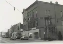 Main Street Historic District |
June 20, 1983 (#83000846) |
Main St. from Maple to 628 Main St. 43°03′47″N 83°51′01″W |
Flushing | |
| 49 | Mauk & Hammer/Houghton Elevator | 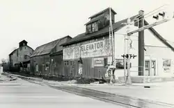 Mauk & Hammer/Houghton Elevator |
November 26, 1982 (#82000521) |
315 W. Vienna St. 43°10′37″N 83°44′16″W |
Clio | |
| 50 | John McAra House | 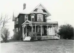 John McAra House |
November 26, 1982 (#82000522) |
2157 Irish Rd. 43°00′03″N 83°33′17″W |
Davison | |
| 51 | William Henry and Lucinda McCaslin Farm House | 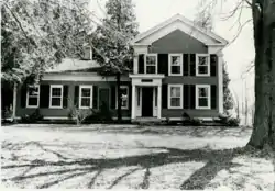 William Henry and Lucinda McCaslin Farm House |
November 26, 1982 (#82000523) |
15237 McCaslin Lake Rd. 42°48′25″N 83°51′18″W |
Linden | |
| 52 | Alexander McClew Farm House | 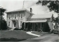 Alexander McClew Farm House |
November 26, 1982 (#82000524) |
7115 Farrand Rd. 43°11′41″N 83°34′35″W |
Millington | |
| 53 | Isaac R. Middlesworth Farm House | 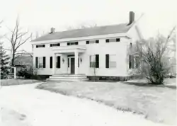 Isaac R. Middlesworth Farm House |
November 26, 1982 (#82000525) |
11355 Rolston Rd. 42°49′29″N 83°53′58″W |
Byron | |
| 54 | James H. Murray House | 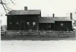 James H. Murray House |
November 26, 1982 (#82000526) |
7232 Silver Lake Rd. 42°48′39″N 83°48′52″W |
Linden | |
| 55 | Daniel O'Sullivan House/Halfway House | 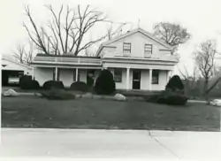 Daniel O'Sullivan House/Halfway House |
November 26, 1982 (#82000527) |
5035 Flushing Rd. 43°02′21″N 83°46′29″W |
Flushing | |
| 56 | Parker and Dunstan Hardware/Dr. E. D. Lewis Building | 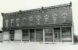 Parker and Dunstan Hardware/Dr. E. D. Lewis Building |
November 26, 1982 (#82000528) |
129–133 W. Main St. 43°09′57″N 83°31′31″W |
Otisville | |
| 57 | William A. Paterson Factory Complex | 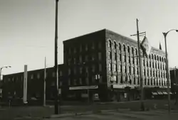 William A. Paterson Factory Complex |
February 16, 1984 (#84001396) |
126 E. 3rd St. 43°00′51″N 83°41′17″W |
Flint | |
| 58 | Superintendent's Cottage |  Superintendent's Cottage |
July 7, 1975 (#75000944) |
Michigan School for the Deaf campus 43°00′20″N 83°42′08″W |
Flint | |
| 59 | Swayze Apartments | 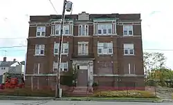 Swayze Apartments |
July 10, 2015 (#15000363) |
313 W. Court St. 43°00′39″N 83°41′27″W |
Flint | |
| 60 | E. S. Swayze Drugstore/Otisville Mason Lodge No. 401 | 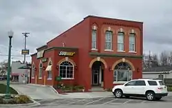 E. S. Swayze Drugstore/Otisville Mason Lodge No. 401 |
November 26, 1982 (#82000529) |
106 E. Main St. 43°10′00″N 83°31′27″W |
Otisville | Now a Subway restaurant |
| 61 | H. Elmer Thayer House | 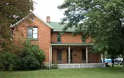 H. Elmer Thayer House |
November 26, 1982 (#82000530) |
G-3202 Court St. 43°00′27″N 83°44′28″W |
Flint | |
| 62 | Harry C. Tinker House |  Harry C. Tinker House |
November 26, 1982 (#82000531) |
12030 N. Lewis Rd. 43°10′46″N 83°40′46″W |
Clio | |
| 63 | Tinlinn Apartments |  Tinlinn Apartments |
March 27, 2008 (#08000220) |
413 Garland St. 43°01′09″N 83°41′43″W |
Flint | |
| 64 | Edwin Trump House |  Edwin Trump House |
November 26, 1982 (#82000532) |
801 S. East St. 42°47′16″N 83°42′04″W |
Fenton | |
| 65 | United States Post Office | United States Post Office |
May 22, 2013 (#13000321) |
600 Church St. 43°00′48″N 83°41′32″W |
Flint | Now a federal courthouse |
| 66 | John Van Buskirk Farm House |  John Van Buskirk Farm House |
June 20, 1983 (#83000847) |
7348 Coldwater Rd. 43°05′29″N 83°33′53″W |
Davison | |
| 67 | Vermont House and Fenton Grain Elevator | 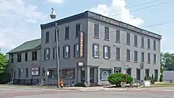 Vermont House and Fenton Grain Elevator |
May 15, 1980 (#80001853) |
302 and 234 N. Leroy St. 42°47′54″N 83°42′17″W |
Fenton | |
| 68 | West Second Street-Swartz Creek Bridge | 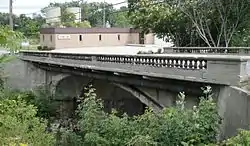 West Second Street-Swartz Creek Bridge |
December 9, 1999 (#99001512) |
West Second St. over Swartz Creek 43°00′38″N 83°41′58″W |
Flint | |
| 69 | West Vienna United Methodist Church | 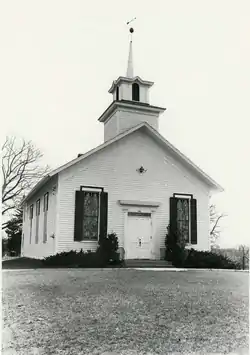 West Vienna United Methodist Church |
June 20, 1983 (#83000848) |
5485 Wilson Rd. 43°09′45″N 83°47′30″W |
Clio | The historic church appears to have been demolished. |
| 70 | Robert J. Whaley House | .jpg.webp) Robert J. Whaley House |
May 15, 1980 (#80001855) |
624 E. Kearsley St. 43°01′12″N 83°41′02″W |
Flint | Now a museum |
Former listings
| [2] | Name on the Register | Image | Date listed | Date removed | Location | City or town | Summary |
|---|---|---|---|---|---|---|---|
| 1 | Fenton Downtown Historic District |  Fenton Downtown Historic District |
1974 (#74002339) | Unknown | Bounded by Silver Lake Rd., Ellen, Walnut and River Sts. 42°47′47″N 83°42′18″W |
Fenton | Demolished.[5] |
| 2 | Fenton Seminary | 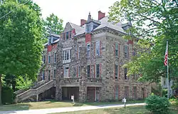 Fenton Seminary |
November 26, 1982 (#82000508) | July 1, 2020[6] | 309 High St. 42°47′16″N 83°42′34″W |
Fenton | This building was demolished in 2015.[7] |
| 3 | Flint Brewing Company | 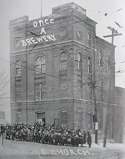 Flint Brewing Company |
April 10, 1980 (#80001854) | July 1, 2020[6] | 2001 S. Saginaw St. 43°00′14″N 83°40′39″W |
Flint | Demolished in 1992. |
| 4 | Industrial Mutual Association Auditorium | 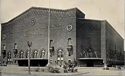 Industrial Mutual Association Auditorium |
July 28, 1983 (#83000849) | November 12, 1997 | 815 E Second Ave. 43°01′12″N 83°41′31″W |
Flint | Demolished |
See also
| Wikimedia Commons has media related to National Register of Historic Places in Genesee County, Michigan. |
References
- "National Register of Historic Places: Weekly List Actions". National Park Service, United States Department of the Interior. Retrieved on February 5, 2021.
- Numbers represent an alphabetical ordering by significant words. Various colorings, defined here, differentiate National Historic Landmarks and historic districts from other NRHP buildings, structures, sites or objects.
- "National Register Information System". National Register of Historic Places. National Park Service. April 24, 2008.
- The eight-digit number below each date is the number assigned to each location in the National Register Information System database, which can be viewed by clicking the number.
- "Weekly List 20200702". National Park Service. Retrieved July 8, 2020.
- Roberto Acosta (September 22, 2015). "Part of Fenton history comes down with demolition of seminary building". MLive.
| Lists by county |
|  |
|---|---|---|
| Other lists |
| |
| Topics | |
|---|---|
| Lists by state |
|
| Lists by insular areas | |
| Lists by associated state | |
| Other areas | |
| Related | |
| |
This article is issued from Wikipedia. The text is licensed under Creative Commons - Attribution - Sharealike. Additional terms may apply for the media files.