Saint-Hostien
Saint-Hostien is a commune in the Haute-Loire department in south-central France.
Saint-Hostien | |
|---|---|
Commune | |
 Town hall | |
Location of Saint-Hostien 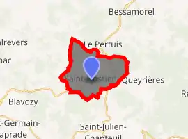
| |
 Saint-Hostien  Saint-Hostien | |
| Coordinates: 45°04′23″N 4°02′54″E | |
| Country | France |
| Region | Auvergne-Rhône-Alpes |
| Department | Haute-Loire |
| Arrondissement | Le Puy-en-Velay |
| Canton | Emblavez-et-Meygal |
| Government | |
| • Mayor (2014–2020) | Isabelle Verdun |
| Area 1 | 13.49 km2 (5.21 sq mi) |
| Population (2017-01-01)[1] | 755 |
| • Density | 56/km2 (140/sq mi) |
| Time zone | UTC+01:00 (CET) |
| • Summer (DST) | UTC+02:00 (CEST) |
| INSEE/Postal code | 43194 /43260 |
| Elevation | 747–1,204 m (2,451–3,950 ft) (avg. 830 m or 2,720 ft) |
| 1 French Land Register data, which excludes lakes, ponds, glaciers > 1 km2 (0.386 sq mi or 247 acres) and river estuaries. | |
Population
| Year | Pop. | ±% |
|---|---|---|
| 1793 | 1,482 | — |
| 1806 | 1,711 | +15.5% |
| 1821 | 1,646 | −3.8% |
| 1831 | 1,738 | +5.6% |
| 1841 | 1,960 | +12.8% |
| 1851 | 1,110 | −43.4% |
| 1861 | 1,153 | +3.9% |
| 1872 | 1,234 | +7.0% |
| 1881 | 1,249 | +1.2% |
| 1891 | 1,310 | +4.9% |
| 1901 | 1,139 | −13.1% |
| 1911 | 1,076 | −5.5% |
| 1921 | 1,007 | −6.4% |
| 1931 | 812 | −19.4% |
| 1946 | 700 | −13.8% |
| 1954 | 681 | −2.7% |
| 1962 | 663 | −2.6% |
| 1968 | 581 | −12.4% |
| 1975 | 514 | −11.5% |
| 1982 | 541 | +5.3% |
| 1990 | 578 | +6.8% |
| 1999 | 578 | +0.0% |
| 2010 | 684 | +18.3% |
| 2017 | 755 | +10.4% |
References
- "Populations légales 2017". INSEE. Retrieved 6 January 2020.
| Wikimedia Commons has media related to Saint-Hostien. |
| Authority control |
|---|
This article is issued from Wikipedia. The text is licensed under Creative Commons - Attribution - Sharealike. Additional terms may apply for the media files.