Saint-Vénérand
Saint-Vénérand is a commune in the Haute-Loire department in south-central France.
Saint-Vénérand | |
|---|---|
Commune | |
.JPG.webp) Town hall | |
Location of Saint-Vénérand 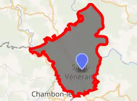
| |
 Saint-Vénérand  Saint-Vénérand | |
| Coordinates: 44°52′04″N 3°40′47″E | |
| Country | France |
| Region | Auvergne-Rhône-Alpes |
| Department | Haute-Loire |
| Arrondissement | Brioude |
| Canton | Gorges de l'Allier-Gévaudan |
| Intercommunality | Pays de Saugues |
| Government | |
| • Mayor (2014–2020) | Élie Fraisse |
| Area 1 | 9.68 km2 (3.74 sq mi) |
| Population (2017-01-01)[1] | 52 |
| • Density | 5.4/km2 (14/sq mi) |
| Time zone | UTC+01:00 (CET) |
| • Summer (DST) | UTC+02:00 (CEST) |
| INSEE/Postal code | 43225 /43580 |
| Elevation | 660–1,099 m (2,165–3,606 ft) (avg. 1,020 m or 3,350 ft) |
| 1 French Land Register data, which excludes lakes, ponds, glaciers > 1 km2 (0.386 sq mi or 247 acres) and river estuaries. | |
Population
| Year | Pop. | ±% |
|---|---|---|
| 1793 | 222 | — |
| 1806 | 227 | +2.3% |
| 1821 | 354 | +55.9% |
| 1831 | 384 | +8.5% |
| 1841 | 326 | −15.1% |
| 1851 | 301 | −7.7% |
| 1861 | 282 | −6.3% |
| 1872 | 313 | +11.0% |
| 1881 | 306 | −2.2% |
| 1891 | 319 | +4.2% |
| 1901 | 318 | −0.3% |
| 1911 | 279 | −12.3% |
| 1921 | 209 | −25.1% |
| 1931 | 171 | −18.2% |
| 1946 | 158 | −7.6% |
| 1954 | 126 | −20.3% |
| 1962 | 119 | −5.6% |
| 1968 | 113 | −5.0% |
| 1975 | 84 | −25.7% |
| 1982 | 69 | −17.9% |
| 1990 | 69 | +0.0% |
| 1999 | 52 | −24.6% |
| 2012 | 51 | −1.9% |
| 2017 | 52 | +2.0% |
References
- "Populations légales 2017". INSEE. Retrieved 6 January 2020.
| Wikimedia Commons has media related to Saint-Vénérand (Haute-Loire). |
| Authority control |
|---|
This article is issued from Wikipedia. The text is licensed under Creative Commons - Attribution - Sharealike. Additional terms may apply for the media files.