Saint-Pierre-du-Champ
Saint-Pierre-du-Champ is a commune in the Haute-Loire department in south-central France.
Saint-Pierre-du-Champ | |
|---|---|
Commune | |
.jpg.webp) | |
Location of Saint-Pierre-du-Champ 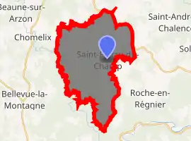
| |
 Saint-Pierre-du-Champ  Saint-Pierre-du-Champ | |
| Coordinates: 45°14′56″N 3°54′00″E | |
| Country | France |
| Region | Auvergne-Rhône-Alpes |
| Department | Haute-Loire |
| Arrondissement | Le Puy-en-Velay |
| Canton | Plateau du Haut-Velay granitique |
| Government | |
| • Mayor (2020–2026) | Didier Dantony |
| Area 1 | 31.09 km2 (12.00 sq mi) |
| Population (2017-01-01)[1] | 530 |
| • Density | 17/km2 (44/sq mi) |
| Time zone | UTC+01:00 (CET) |
| • Summer (DST) | UTC+02:00 (CEST) |
| INSEE/Postal code | 43217 /43130 |
| Elevation | 631–963 m (2,070–3,159 ft) (avg. 950 m or 3,120 ft) |
| 1 French Land Register data, which excludes lakes, ponds, glaciers > 1 km2 (0.386 sq mi or 247 acres) and river estuaries. | |
Population
| Year | Pop. | ±% |
|---|---|---|
| 1793 | 1,538 | — |
| 1806 | 1,621 | +5.4% |
| 1821 | 1,606 | −0.9% |
| 1831 | 1,600 | −0.4% |
| 1841 | 1,700 | +6.2% |
| 1851 | 1,607 | −5.5% |
| 1861 | 1,508 | −6.2% |
| 1872 | 1,491 | −1.1% |
| 1881 | 1,590 | +6.6% |
| 1891 | 1,622 | +2.0% |
| 1901 | 2,373 | +46.3% |
| 1911 | 1,449 | −38.9% |
| 1921 | 1,243 | −14.2% |
| 1931 | 1,123 | −9.7% |
| 1946 | 1,917 | +70.7% |
| 1954 | 851 | −55.6% |
| 1962 | 803 | −5.6% |
| 1968 | 715 | −11.0% |
| 1975 | 618 | −13.6% |
| 1982 | 541 | −12.5% |
| 1990 | 520 | −3.9% |
| 1999 | 520 | +0.0% |
| 2008 | 499 | −4.0% |
| 2017 | 530 | +6.2% |
References
- "Populations légales 2017". INSEE. Retrieved 6 January 2020.
| Wikimedia Commons has media related to Saint-Pierre-du-Champ. |
| Authority control |
|---|
This article is issued from Wikipedia. The text is licensed under Creative Commons - Attribution - Sharealike. Additional terms may apply for the media files.