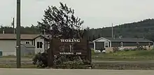
Woking, Alberta
Woking is a hamlet in northwestern Alberta, Canada within Saddle Hills County.[2] It is named for the town of Woking in Surrey, England. [3]
Woking | |
|---|---|
 Location of Woking in Alberta | |
| Coordinates: 55.5925°N 118.7719°W | |
| Country | |
| Province | |
| Census division | No. 19 |
| Municipal district | Saddle Hills County |
| Government | |
| • Type | Unincorporated |
| • Governing body | Saddle Hills County Council |
| Area | |
| • Total | 0.56 km2 (0.22 sq mi) |
| Elevation | 675 m (2,215 ft) |
| Population (2011)[1] | |
| • Total | 106 |
| • Density | 190/km2 (490/sq mi) |
| • Dwellings | 55 |
| Time zone | UTC-7 (MST) |
It is located in the Peace River Country north of the Town of Sexsmith and south of the Village of Rycroft and the Town of Spirit River.
The hamlet is located in census division No. 19 and in the federal riding of Peace River.
Demographics

As a designated place in the 2016 Census of Population conducted by Statistics Canada, Woking recorded a population of 102 living in 43 of its 55 total private dwellings, a change of -3.8% from its 2011 population of 106. With a land area of 0.55 km2 (0.21 sq mi), it had a population density of 185.5/km2 (480.3/sq mi) in 2016.[4]
As a designated place in the 2011 Census, Woking had a population of 106 living in 46 of its 55 total dwellings, a 7.1% change from its 2006 population of 99. With a land area of 0.56 km2 (0.22 sq mi), it had a population density of 189.3/km2 (490/sq mi) in 2011.[1]
See also
- List of communities in Alberta
- List of designated places in Alberta
- List of hamlets in Alberta
- Woking, Surrey, United Kingdom
References
- "Population and dwelling counts, for Canada, provinces and territories, and designated places, 2011 and 2006 censuses (Alberta)". Statistics Canada. 2012-02-08. Retrieved 2012-04-07.
- Alberta Municipal Affairs (2010-04-01). "Specialized and Rural Municipalities and Their Communities" (PDF). Retrieved 2010-07-04.
- Marden, Ernest G.; Marden, Austin (2010). Community Place Names of Alberta. Lulu.com. p. 357. ISBN 189747217X. Retrieved 2 September 2017.
- "Population and dwelling counts, for Canada, provinces and territories, and designated places, 2016 and 2011 censuses – 100% data (Alberta)". Statistics Canada. February 8, 2017. Retrieved February 13, 2017.