Lake Louise, Alberta
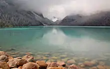
Lake Louise is a hamlet within Banff National Park in Alberta, Canada. Named after Princess Louise, Duchess of Argyll, it lies in Alberta's Rockies on the Bow River, 3 km (1.9 mi) northeast of the lake that shares its name. Initially settled in 1884 as an outpost for the Canadian Pacific Railway, Lake Louise sits at an elevation of 1,600 m (5,200 ft), making it Canada's highest community. The nearby lake, framed by mountains, is one of the most famous mountain vistas in the world; the famous Chateau Lake Louise also overlooks the lake.[3]
Lake Louise | |
|---|---|
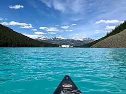 Lake Louise, with which the hamlet shares its name, pictured in June 2018 | |
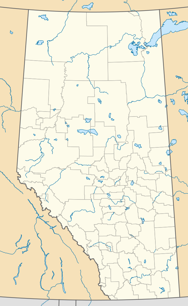 Lake Louise Location of Lake Louise in Alberta | |
| Coordinates: 51.4253°N 116.1806°W | |
| Country | Canada |
| Province | Alberta |
| Region | Alberta's Rockies |
| Census division | No. 15 |
| Improvement district | Improvement District No. 9 |
| Government | |
| • Type | Unincorporated |
| • Governing body | Improvement District No. 9 Council |
| • MP | Blake Richards (C) |
| Elevation | 1,600 m (5,200 ft) |
| Population (2011)[2] | |
| • Total | 691 |
| Time zone | UTC−7 (MST) |
| • Summer (DST) | UTC−6 (MDT) |
| Postal code span | T0L 1E0 |
| Area code(s) | 403, 587 |
| Highways | |
History
Since time immemorial the Indigenous peoples of Canada have lived in the foothills and forests of the Rocky Mountains including what is today Lake Louise, where they hunted bison and other big game animals. In the Stoney language of the Nakoda people the area is called Ho-run-num-nay, meaning "lake of the little fishes".
During the 1870s, the construction of the Canadian Pacific Railway (CPR) started. The railway was planned to run through Bow Valley. A Nakoda guide took CPR workman Tom Wilson to the site in 1882, and Wilson named it Emerald Lake. The hamlet was later called Holt City, and then Laggan, before being renamed Lake Louise.
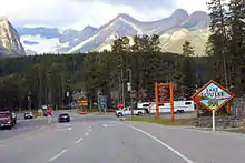
Lake Louise was added to Banff National Park in 1892, and has since become a tourist destination made accessible by its location off the Trans-Canada Highway. The hamlet's historic CPR station building has been preserved and today operates as a restaurant.
Geography
The hamlet is located in census division No. 15 and the federal riding of Banff—Airdrie. It is located beside the Trans-Canada Highway (Highway 1), 180 km (110 mi) west of Calgary.
The background of Lake Louise is filled with views of several snow-capped mountains including Mount Temple, Mount Whyte, and Mount Niblock.
Climate
Lake Louise experiences a subarctic climate (Köppen climate classification Dfc). Annual snowfall averages 3.3m and winter temperatures below −50 °C have been recorded. Summers consist of frosty mornings and crisp, cool days. Snow can occur in any month of the year. Since lower elevations on said latitude have humid continental climates instead, it may also be described as a subalpine climate. Because of its high diurnal temperature variation and high altitude, the frost-free period averages only 14 days.[4]
| Climate data for Lake Louise (1981–2010) | |||||||||||||
|---|---|---|---|---|---|---|---|---|---|---|---|---|---|
| Month | Jan | Feb | Mar | Apr | May | Jun | Jul | Aug | Sep | Oct | Nov | Dec | Year |
| Record high °C (°F) | 7.8 (46.0) |
13.9 (57.0) |
17.0 (62.6) |
26.5 (79.7) |
31.7 (89.1) |
31.1 (88.0) |
34.4 (93.9) |
32.2 (90.0) |
29.0 (84.2) |
26.1 (79.0) |
18.3 (64.9) |
12.2 (54.0) |
34.4 (93.9) |
| Average high °C (°F) | −5.4 (22.3) |
−1.7 (28.9) |
2.9 (37.2) |
7.5 (45.5) |
12.7 (54.9) |
16.7 (62.1) |
20.4 (68.7) |
20.1 (68.2) |
14.7 (58.5) |
7.3 (45.1) |
−1.7 (28.9) |
−6.9 (19.6) |
7.2 (45.0) |
| Daily mean °C (°F) | −12 (10) |
−9.7 (14.5) |
−4.7 (23.5) |
0.9 (33.6) |
5.8 (42.4) |
9.7 (49.5) |
12.6 (54.7) |
11.9 (53.4) |
7.1 (44.8) |
1.1 (34.0) |
−7.1 (19.2) |
−13.0 (8.6) |
0.2 (32.4) |
| Average low °C (°F) | −18.4 (−1.1) |
−17.6 (0.3) |
−12.3 (9.9) |
−5.8 (21.6) |
−1.2 (29.8) |
2.8 (37.0) |
4.7 (40.5) |
3.6 (38.5) |
−0.5 (31.1) |
−5.1 (22.8) |
−12.6 (9.3) |
−19.1 (−2.4) |
−6.8 (19.8) |
| Record low °C (°F) | −52.8 (−63.0) |
−50.6 (−59.1) |
−44.4 (−47.9) |
−33.9 (−29.0) |
−27.8 (−18.0) |
−10.0 (14.0) |
−7.0 (19.4) |
−7.5 (18.5) |
−25.0 (−13.0) |
−32.0 (−25.6) |
−44.0 (−47.2) |
−49.4 (−56.9) |
−52.8 (−63.0) |
| Average precipitation mm (inches) | 52.4 (2.06) |
47.9 (1.89) |
37.3 (1.47) |
32.3 (1.27) |
59.9 (2.36) |
54.3 (2.14) |
56.4 (2.22) |
53.9 (2.12) |
41.9 (1.65) |
37.7 (1.48) |
57.4 (2.26) |
48.7 (1.92) |
543.8 (21.41) |
| Average rainfall mm (inches) | 0.7 (0.03) |
0.0 (0.0) |
1.5 (0.06) |
9.0 (0.35) |
32.8 (1.29) |
54.1 (2.13) |
56.4 (2.22) |
53.6 (2.11) |
39.1 (1.54) |
19.0 (0.75) |
2.4 (0.09) |
0.0 (0.0) |
268.7 (10.58) |
| Average snowfall cm (inches) | 51.3 (20.2) |
33.4 (13.1) |
36.4 (14.3) |
23.5 (9.3) |
7.1 (2.8) |
0.2 (0.1) |
0.0 (0.0) |
0.0 (0.0) |
2.8 (1.1) |
18.7 (7.4) |
57.0 (22.4) |
48.8 (19.2) |
279.1 (109.9) |
| Source: Environment Canada[4] | |||||||||||||
Demographics
In 2011, Lake Louise had 691 year-round residents.[2] Residents often change year to year, with workers in the service and tourism industries moving to the area for work.[5]
Attractions
Lake Louise features a shopping centre named Samson Mall. Lake Louise Mountain Resort, a downhill ski area, is located across Highway 1. Chateau Lake Louise is southwest of the community on the shores of Lake Louise.
Government
Lake Louise is administered by Improvement District No. 9.[6]
Infrastructure
The Trans-Canada Highway (Highway 1) runs adjacent to the community while Highway 1A begins at the entrance to the community. The southern terminus of the Icefields Parkway (Highway 93) is just north of the community.
See also
- List of communities in Alberta
- List of hamlets in Alberta
- List of cities in Canada by elevation
Bibliography
References
| Wikimedia Commons has media related to Lake Louise, Alberta. |
- "Alberta Private Sewage Systems 2009 Standard of Practice Handbook: Appendix A.3 Alberta Design Data (A.3.A. Alberta Climate Design Data by Town)" (PDF) (PDF). Safety Codes Council. January 2012. pp. 212–215 (PDF pages 226–229). Retrieved October 8, 2013.
- "Evaluation of Parks Canada's Townsite Management Sub-Program" (PDF). Parks Canada. January 11, 2017. p. 47. Retrieved April 16, 2020.
- "Lake Louise | The Canadian Encyclopedia". www.thecanadianencyclopedia.ca. Retrieved 2020-09-21.
- "Canadian Climate Normals 1981-2010 Station Data - Climate - Environment and Climate Change Canada - Lake Louise". climate.weather.gc.ca. Environment Canada. September 25, 2013. Retrieved February 2, 2020.
- Calgary Heritage Park. "Laggan Station". Retrieved 2012-06-10.
- Improvement District No. 9 (Banff) Archived 2007-09-15 at the Wayback Machine - Alberta Municipal Affairs
- Alberta, Lake Louise. "Lake Louise - Banff National Park, Alberta Canada - Discover Lake Louise". Lake Louise - Banff National Park, Alberta Canada. Retrieved 2020-09-21.
- "Lake Louise | History & Facts". Encyclopedia Britannica. Retrieved 2020-09-21.
- "Chateau Lake Louise | The Canadian Encyclopedia". www.thecanadianencyclopedia.ca. Retrieved 2020-09-21.
- "History & Heritage". Banff & Lake Louise Tourism. 2016-06-09. Retrieved 2020-09-21.
- "Discover the Beauty of Lake Louise | Rocky Mountaineer". www.rockymountaineer.com. Retrieved 2020-09-21.
Places adjacent to Lake Louise, Alberta | |
|---|---|