National Register of Historic Places listings in Culpeper County, Virginia
This is a list of the National Register of Historic Places listings in Culpeper County, Virginia.

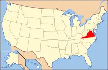
Location of Culpeper County in Virginia
This is intended to be a complete list of the properties and districts on the National Register of Historic Places in Culpeper County, Virginia, United States. The locations of National Register properties and districts for which the latitude and longitude coordinates are included below, may be seen in an online map.[1]
There are 29 properties and districts listed on the National Register in the county.
- This National Park Service list is complete through NPS recent listings posted January 29, 2021.[2]
Current listings
| [3] | Name on the Register[4] | Image | Date listed[5] | Location | City or town | Description |
|---|---|---|---|---|---|---|
| 1 | Auburn |  Auburn |
February 21, 2008 (#08000068) |
17736 Auburn Rd. 38°30′18″N 77°55′39″W |
Brandy Station | |
| 2 | Burgandine House |  Burgandine House |
March 7, 1997 (#97000153) |
807 S. Main St. 38°28′06″N 77°59′52″W |
Culpeper | |
| 3 | Clifton |  Clifton |
September 17, 2008 (#08000911) |
7091 Monumental Mills Rd. 38°36′29″N 78°00′21″W |
Rixeyville | |
| 4 | Croftburn Farm |  Croftburn Farm |
February 16, 2001 (#01000153) |
18175 Croftburn Farm Rd. 38°27′02″N 77°58′09″W |
Culpeper | |
| 5 | Culpeper Historic District | .jpg.webp) Culpeper Historic District |
October 22, 1987 (#87001809) |
Roughly bounded by Edmonson St., the Norfolk Southern railroad line, Stevens St., and West St. 38°28′22″N 77°59′44″W |
Culpeper | |
| 6 | Culpeper Municipal Electric Plant and Waterworks |  Culpeper Municipal Electric Plant and Waterworks |
April 2, 2019 (#100003604) |
410-414 Spring St. 38°28′09″N 78°00′14″W |
Culpeper | |
| 7 | Culpeper National Cemetery |  Culpeper National Cemetery |
February 26, 1996 (#96000029) |
305 U.S. Ave. 38°28′11″N 77°59′30″W |
Culpeper | |
| 8 | Eckington School |  Eckington School |
February 16, 2001 (#01000154) |
Junction of Blackjack and Mount Pony Rds. 38°24′14″N 77°55′26″W |
Culpeper | |
| 9 | Elmwood |  Elmwood |
January 16, 1986 (#86000075) |
U.S. Route 522, W.; also Elmwood Farm Dr., W. 38°32′44″N 78°07′01″W |
Boston | Elmwood Farm Dr. represents a boundary increase of December 24, 2013, the Elmwood Farm and Browning Store |
| 10 | Fairview Cemetery | 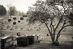 Fairview Cemetery |
January 11, 2006 (#05001521) |
U.S. Route 522, approximately 0.5 miles (0.80 km) west of Main St. 38°28′52″N 78°00′19″W |
Culpeper | |
| 11 | Farley |  Farley |
May 6, 1976 (#76002100) |
North of Brandy Station on Farley Rd., south of the Hazel River 38°32′27″N 77°53′31″W |
Brandy Station | |
| 12 | Graffiti House |  Graffiti House |
November 17, 2005 (#05001274) |
19484 Brandy Rd. 38°30′09″N 77°53′27″W |
Brandy Station | A field hospital during the Civil War. Many signatures and hand drawings by soldiers have been discovered on the inside walls. |
| 13 | Greenville |  Greenville |
March 17, 1980 (#80004184) |
Northeast of Raccoon's Ford 38°22′25″N 77°55′10″W |
Raccoon's Ford | |
| 14 | Greenwood |  Greenwood |
November 22, 1985 (#85002914) |
1931 Orange Rd. 38°27′15″N 78°00′02″W |
Culpeper | |
| 15 | Hill Mansion |  Hill Mansion |
March 17, 1980 (#80004182) |
501 East St. 38°28′13″N 77°59′42″W |
Culpeper | |
| 16 | A. P. Hill Boyhood Home |  A. P. Hill Boyhood Home |
October 2, 1973 (#73002006) |
102 N. Main St. 38°28′25″N 77°59′47″W |
Culpeper | |
| 17 | Little Fork Church | Little Fork Church |
November 12, 1969 (#69000234) |
Junction of Oak Shade and Little Fork Church Rds. 38°36′00″N 77°57′17″W |
Rixeyville | |
| 18 | Locust Grove |  Locust Grove |
October 10, 1985 (#85003131) |
Locust Grove Ln. 38°19′02″N 78°02′42″W |
Rapidan | |
| 19 | Lord Culpeper Hotel |  Lord Culpeper Hotel |
June 12, 2017 (#100001078) |
401 S. Main St. 38°28′16″N 77°59′48″W |
Culpeper | |
| 20 | Madden's Tavern |  Madden's Tavern |
August 16, 1984 (#84003526) |
Maddens Tavern Rd. 38°25′58″N 77°49′15″W |
Lignum | |
| 21 | Maple Springs |  Maple Springs |
December 12, 1997 (#97001510) |
20509 Clover Hill Rd. 38°34′53″N 77°53′26″W |
Jeffersonton | |
| 22 | Mitchells Presbyterian Church |  Mitchells Presbyterian Church |
May 7, 1980 (#80004183) |
Mitchell Rd. 38°22′47″N 78°01′27″W |
Mitchells | |
| 23 | Pitts Theatre |  Pitts Theatre |
May 15, 2008 (#08000420) |
303-307 S. Main St. 38°28′18″N 77°59′48″W |
Culpeper | |
| 24 | Rapidan Historic District |  Rapidan Historic District |
May 8, 1987 (#87000723) |
Junction of Rapidan, Old Rapidan, and Locust Dale Rds. 38°18′46″N 78°03′57″W |
Rapidan | Includes such structures as the Rapidan Passenger Depot. |
| 25 | Rose Hill |  Rose Hill |
August 7, 2020 (#100005428) |
19202 Batna Rd. 38°26′16″N 77°54′10″W |
Stevensburg | |
| 26 | Salubria |  Salubria |
February 16, 1970 (#70000789) |
East of the junction of State Route 3 and Batna Rd. 38°26′18″N 77°53′11″W |
Stevensburg | |
| 27 | Signal Hill |  Signal Hill |
January 21, 1999 (#98001650) |
16190 Germanna Highway 38°26′59″N 77°57′13″W |
Culpeper | |
| 28 | Slaughter-Hill House |  Slaughter-Hill House |
March 16, 1989 (#89000203) |
306 N. West St. 38°28′31″N 77°59′50″W |
Culpeper | |
| 29 | South East Street Historic District |  South East Street Historic District |
August 27, 2009 (#09000663) |
S. East, E. Asher, E. Chandler, and Page Sts., and the Culpeper National Cemetery 38°28′09″N 77°59′46″W |
Culpeper |
See also
| Wikimedia Commons has media related to National Register of Historic Places in Culpeper County, Virginia. |
References
- The latitude and longitude information provided in this table was derived originally from the National Register Information System, which has been found to be fairly accurate for about 99% of listings. Some locations in this table may have been corrected to current GPS standards.
- "National Register of Historic Places: Weekly List Actions". National Park Service, United States Department of the Interior. Retrieved on January 29, 2021.
- Numbers represent an alphabetical ordering by significant words. Various colorings, defined here, differentiate National Historic Landmarks and historic districts from other NRHP buildings, structures, sites or objects.
- "National Register Information System". National Register of Historic Places. National Park Service. April 24, 2008.
- The eight-digit number below each date is the number assigned to each location in the National Register Information System database, which can be viewed by clicking the number.
Municipalities and communities of Culpeper County, Virginia, United States | ||
|---|---|---|
| Town | Map of Virginia highlighting Culpeper County | |
| Unincorporated communities | ||
| ||
This article is issued from Wikipedia. The text is licensed under Creative Commons - Attribution - Sharealike. Additional terms may apply for the media files.