National Register of Historic Places listings in Madison County, Virginia
This is a list of the National Register of Historic Places listings in Madison County, Virginia.
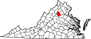
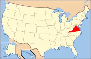
Location of Madison County in Virginia
This is intended to be a complete list of the properties and districts on the National Register of Historic Places in Madison County, Virginia, United States. The locations of National Register properties and districts for which the latitude and longitude coordinates are included below, may be seen in an online map.[1]
There are 21 properties and districts listed on the National Register in the county, including 2 National Historic Landmarks.
- This National Park Service list is complete through NPS recent listings posted February 5, 2021.[2]
Current listings
| [3] | Name on the Register[4] | Image | Date listed[5] | Location | City or town | Description |
|---|---|---|---|---|---|---|
| 1 | Belle Plaine |  Belle Plaine |
August 15, 2016 (#16000532) |
2488 S. U.S. Route 15 38°19′01″N 78°07′13″W |
Locust Dale | |
| 2 | Big Meadows Site | Big Meadows Site |
December 13, 1985 (#85003172) |
Head of Hogcamp Branch at Big Meadows[6]:117 38°31′00″N 78°25′52″W |
Luray | |
| 3 | Brampton |  Brampton |
December 12, 1985 (#85003350) |
Brampton Rd. 38°17′55″N 78°06′43″W |
Orange | |
| 4 | Camp Hoover |  Camp Hoover |
June 7, 1988 (#88001825) |
Shenandoah National Park 38°29′28″N 78°25′13″W |
Graves Mill | |
| 5 | Cliff Kill Site |  Cliff Kill Site |
December 15, 1985 (#85003153) |
Source of Hogcamp Branch at the edge of Big Meadows[7]:113 38°30′58″N 78°25′46″W |
Luray | |
| 6 | Coates Barn | _01.jpg.webp) Coates Barn |
August 12, 2020 (#100005442) |
934 Champe Plain Rd. 38°32′25″N 78°16′01″W |
Etlan | |
| 7 | George T. Corbin Cabin |  George T. Corbin Cabin |
January 13, 1989 (#88003067) |
1.5 miles off Skyline Dr. at the junction of Corbin Cabin and Nicholson Hollow Trails 38°36′07″N 78°20′41″W |
Nethers | |
| 8 | Gentle Site |  Gentle Site |
December 13, 1985 (#85003174) |
Confluence of Hogcamp Branch and the Rose River below Big Meadows[8] 38°31′36″N 78°24′28″W |
Luray | |
| 9 | Graves Mill |  Graves Mill |
August 30, 2006 (#06000754) |
29 Graves Rd. 38°25′27″N 78°22′09″W |
Wolftown | |
| 10 | Greenway |  Greenway |
November 16, 1988 (#88002385) |
U.S. Route 15 38°17′10″N 78°08′31″W |
Madison Mills | |
| 11 | Hebron Lutheran Church | 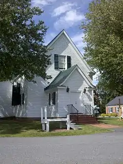 Hebron Lutheran Church |
July 2, 1971 (#71000986) |
1 mile northeast of Madison off U.S. Route 29 38°24′27″N 78°14′50″W |
Madison | |
| 12 | Hoffman Round Barn | 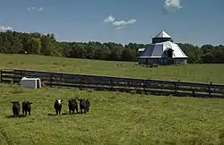 Hoffman Round Barn |
April 20, 2009 (#09000242) |
4864 Wolftown-Hood Rd. 38°20′46″N 78°19′56″W |
Wolftown | |
| 13 | The Homeplace |  The Homeplace |
August 5, 1999 (#99000959) |
U.S. Route 29 at its junction with Hebron Valley Rd. 38°24′14″N 78°13′17″W |
Madison | |
| 14 | James City Historic District | James City Historic District |
July 13, 2001 (#01000691) |
U.S. Route 29 38°26′14″N 78°08′16″W |
Madison | |
| 15 | Locust Hill |  Locust Hill |
May 30, 2002 (#02000590) |
Junction of U.S. Route 15 with Oak Park and Locust Dale Rds. 38°20′09″N 78°07′36″W |
Locust Dale | |
| 16 | Madison County Courthouse | %252C_Madison%252C_Virginia.jpg.webp) Madison County Courthouse |
November 12, 1969 (#69000258) |
Old U.S. Route 29 38°22′49″N 78°15′29″W |
Madison | |
| 17 | Madison County Courthouse Historic District | _Historic_District_-_Masonic_Hall.JPG.webp) Madison County Courthouse Historic District |
August 16, 1984 (#84003549) |
Main St. 38°22′39″N 78°15′36″W |
Madison | |
| 18 | The Residence |  The Residence |
June 19, 1979 (#79003052) |
Woodberry Forest School 38°17′33″N 78°07′08″W |
Woodberry Forest | |
| 19 | Robertson Mountain Site |  Robertson Mountain Site |
December 13, 1985 (#85003173) |
Address Restricted |
Luray | |
| 20 | Skyline Drive Historic District |  Skyline Drive Historic District |
April 28, 1997 (#97000375) |
Shenandoah National Park, from the northern entrance station at Front Royal to the southern entrance station at Rockfish Gap 38°32′36″N 78°23′36″W |
Luray | |
| 21 | Woodbourne |  Woodbourne |
June 28, 1999 (#99000727) |
Thrift Rd., 1.5 miles (2.4 km) west of its junction with U.S. Route 29 Alternate 38°22′50″N 78°16′41″W |
Madison |
See also
| Wikimedia Commons has media related to National Register of Historic Places in Madison County, Virginia. |
References
- The latitude and longitude information provided in this table was derived originally from the National Register Information System, which has been found to be fairly accurate for about 99% of listings. Some locations in this table may have been corrected to current GPS standards.
- "National Register of Historic Places: Weekly List Actions". National Park Service, United States Department of the Interior. Retrieved on February 5, 2021.
- Numbers represent an alphabetical ordering by significant words. Various colorings, defined here, differentiate National Historic Landmarks and historic districts from other NRHP buildings, structures, sites or objects.
- "National Register Information System". National Register of Historic Places. National Park Service. April 24, 2008.
- The eight-digit number below each date is the number assigned to each location in the National Register Information System database, which can be viewed by clicking the number.
- Foss, Robert Ward. Man and Mountain: An Archaeological Overview of the Shenandoah National Park. Thesis U of Virginia, 1977.
- Foss, Robert Ward. Man and Mountain: An Archaeological Overview of the Shenandoah National Park. Thesis U of Virginia, 1977.
- Foss, Robert Ward. Man and Mountain: An Archaeological Overview of the Shenandoah National Park. Thesis U of Virginia, 1977, 117.
Municipalities and communities of Madison County, Virginia, United States | ||
|---|---|---|
| Town | Map of Virginia highlighting Madison County | |
| CDPs | ||
| Unincorporated communities |
| |
| ||
This article is issued from Wikipedia. The text is licensed under Creative Commons - Attribution - Sharealike. Additional terms may apply for the media files.