National Register of Historic Places listings in Mathews County, Virginia
This is a list of the National Register of Historic Places listings in Mathews County, Virginia.
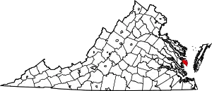
Location of Mathews County in Virginia
This is intended to be a complete list of the properties and districts on the National Register of Historic Places in Mathews County, Virginia, United States. The locations of National Register properties and districts for which the latitude and longitude coordinates are included below, may be seen in an online map.[1]
There are 15 properties and districts listed on the National Register in the county.
- This National Park Service list is complete through NPS recent listings posted January 29, 2021.[2]
Current listings
| [3] | Name on the Register[4] | Image | Date listed[5] | Location | City or town | Description |
|---|---|---|---|---|---|---|
| 1 | Billups House |  Billups House |
March 26, 1980 (#80004199) |
East of Moon 37°26′31″N 76°17′11″W |
Moon | |
| 2 | Fort Cricket Hill | 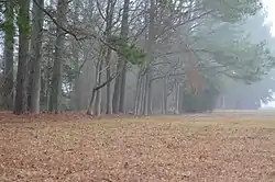 Fort Cricket Hill |
June 15, 1970 (#70000811) |
East of the Gwynn's Island bridge[6] 37°29′15″N 76°18′22″W |
Hudgins | Revolutionary War fortifications |
| 3 | Hesse |  Hesse |
February 12, 1974 (#74002137) |
East of Cobbs Creek off Proctor Ln. 37°30′49″N 76°21′37″W |
Blakes | |
| 4 | The Lane Hotel |  The Lane Hotel |
March 1, 2011 (#11000065) |
68 Church St. 37°26′03″N 76°19′19″W |
Mathews | |
| 5 | Mathews County Courthouse Square |  Mathews County Courthouse Square |
August 18, 1977 (#77001491) |
Church St. 37°26′00″N 76°19′20″W |
Mathews | |
| 6 | Mathews Downtown Historic District |  Mathews Downtown Historic District |
September 18, 2017 (#100001642) |
Mathews County Courthouse Square and vicinity 37°26′01″N 76°19′16″W |
Mathews | |
| 7 | Methodist Tabernacle |  Methodist Tabernacle |
May 21, 1975 (#75002024) |
Southeast of Mathews on Tabernacle Rd. at its junction with Salem Church Rd. 37°25′19″N 76°17′47″W |
Mathews | |
| 8 | New Point Comfort Lighthouse |  New Point Comfort Lighthouse |
March 1, 1973 (#73002037) |
Junction of Chesapeake Bay and Mobjack Bay 37°18′04″N 76°16′40″W |
New Point | |
| 9 | Old Thomas James Store |  Old Thomas James Store |
March 28, 2008 (#08000244) |
Main and Maple Sts. 37°26′01″N 76°19′14″W |
Mathews Court House | |
| 10 | Poplar Grove Mill and House | 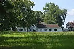 Poplar Grove Mill and House |
November 12, 1969 (#69000259) |
Southwest of the junction of State Route 14 and Poplar Grove Ln. 37°23′54″N 76°20′07″W |
Williams | |
| 11 | Riverlawn |  Riverlawn |
August 22, 2012 (#12000543) |
134 Williamsdale Lane 37°24′36″N 76°20′30″W |
Mathews | |
| 12 | Sibley's and James Store Historic District |  Sibley's and James Store Historic District |
March 24, 2010 (#10000093) |
239 Main St. (Main and Maple Sts.) 37°26′01″N 76°19′15″W |
Mathews | |
| 13 | Springdale |  Springdale |
May 23, 2013 (#13000339) |
1108 State Route 14 37°25′20″N 76°19′41″W |
Mathews | |
| 14 | B. Williams & Co. Store |  B. Williams & Co. Store |
June 3, 2009 (#09000394) |
1030 Williams Wharf Rd. 37°24′15″N 76°20′43″W |
Mathews | |
| 15 | Wolf Trap Light Station |  Wolf Trap Light Station |
December 2, 2002 (#02001434) |
Southeast of New Point Comfort 37°13′49″N 76°11′24″W |
Poquoson East |
Former listings
| [3] | Name on the Register | Image | Date listed | Date removed | Location | City or town | Summary |
|---|---|---|---|---|---|---|---|
| 1 | Donk's Theatre |  Donk's Theatre |
January 28, 2011 (#10001185) | February 7, 2017 | 259 Buckley Hall Rd. 37°28′18″N 76°19′35″W |
Hudgins |
See also
| Wikimedia Commons has media related to National Register of Historic Places in Mathews County, Virginia. |
References
- The latitude and longitude information provided in this table was derived originally from the National Register Information System, which has been found to be fairly accurate for about 99% of listings. Some locations in this table may have been corrected to current GPS standards.
- "National Register of Historic Places: Weekly List Actions". National Park Service, United States Department of the Interior. Retrieved on January 29, 2021.
- Numbers represent an alphabetical ordering by significant words. Various colorings, defined here, differentiate National Historic Landmarks and historic districts from other NRHP buildings, structures, sites or objects.
- "National Register Information System". National Register of Historic Places. National Park Service. April 24, 2008.
- The eight-digit number below each date is the number assigned to each location in the National Register Information System database, which can be viewed by clicking the number.
- Mathews County Comprehensive Plan, Mathews County, 2001-06-26, 2:15. Accessed 2016-12-13.
Municipalities and communities of Mathews County, Virginia, United States | ||
|---|---|---|
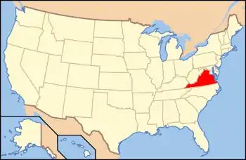
| CDPs | Map of Virginia highlighting Mathews County | |
| Unincorporated communities |
| |
| ||
This article is issued from Wikipedia. The text is licensed under Creative Commons - Attribution - Sharealike. Additional terms may apply for the media files.