National Register of Historic Places listings in Carroll County, Maryland
This is a list of the National Register of Historic Places listings in Carroll County, Maryland.
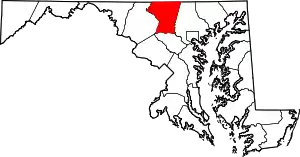
Location of Carroll County in Maryland
This is intended to be a complete list of the properties and districts on the National Register of Historic Places in Carroll County, Maryland, United States. Latitude and longitude coordinates are provided for many National Register properties and districts; these locations may be seen together in a map.[1]
There are 62 properties and districts listed on the National Register in the county, including 1 National Historic Landmark.
| Allegany - Anne Arundel - Baltimore (city) - Baltimore County - Calvert - Caroline - Carroll - Cecil - Charles - Dorchester - Frederick - Garrett - Harford - Howard - Kent - Montgomery - Prince George's - Queen Anne's - Somerset - St. Mary's - Talbot - Washington - Wicomico - Worcester |
- This National Park Service list is complete through NPS recent listings posted January 29, 2021.[2]
Current listings
| [3] | Name on the Register[4] | Image | Date listed[5] | Location | City or town | Description |
|---|---|---|---|---|---|---|
| 1 | Antrim | .jpg.webp) Antrim |
September 16, 1977 (#77000686) |
30 Trevanion Road, Taneytown, MD, 21787 39°39′15″N 77°10′29″W |
Taneytown | |
| 2 | Appler-Englar House | 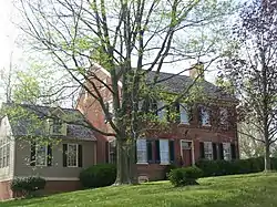 Appler-Englar House |
April 5, 2001 (#01000338) |
916 Winter's Church Rd. 39°33′13″N 77°07′42″W |
New Windsor | |
| 3 | Philip and Uriah Arter Farm |  Philip and Uriah Arter Farm |
December 12, 2006 (#06001124) |
10 Deep Run Rd., W. 39°40′10″N 77°00′50″W |
Union Mills | |
| 4 | Solomon Arter House | 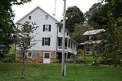 Solomon Arter House |
September 10, 1987 (#87001569) |
4029 Geeting Rd. 39°41′11″N 76°59′27″W |
Union Mills | |
| 5 | Avalon | 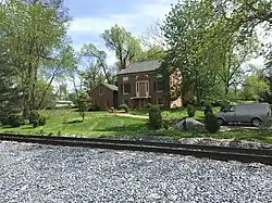 Avalon |
September 3, 1987 (#87001407) |
1111 Slingluff Road 39°32′30″N 77°05′38″W |
New Windsor | |
| 6 | Avondale | 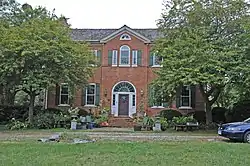 Avondale |
October 10, 1975 (#75000877) |
501 Stone Chapel Road 39°33′33″N 77°01′49″W |
Westminster | |
| 7 | Bennett-Kelly Farm | 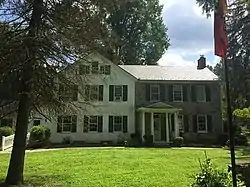 Bennett-Kelly Farm |
December 23, 2004 (#04001378) |
5842 Oakland Rd. 39°24′51″N 76°53′46″W |
Sykesville | |
| 8 | William and Catherine Biggs Farm | 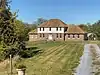 William and Catherine Biggs Farm |
November 2, 2001 (#01001197) |
8212 Sixes Bridge Rd. 39°37′40″N 77°17′12″W |
Detour | |
| 9 | Branton Manor | 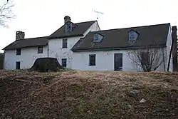 Branton Manor |
August 18, 1978 (#78001450) |
2819 Old Liberty Rd. 39°23′42″N 76°53′43″W |
Sykesville | |
| 10 | Moses Brown House | 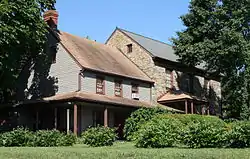 Moses Brown House |
December 11, 1980 (#80001800) |
Southeast of Eldersburg at 7604 Ridge Rd. 39°23′18″N 76°55′36″W |
Eldersburg | |
| 11 | Carroll County Almshouse and Farm |  Carroll County Almshouse and Farm |
December 4, 1975 (#75000878) |
500 S. Center St. 39°33′30″N 76°59′44″W |
Westminster | |
| 12 | Whittaker Chambers Farm |  Whittaker Chambers Farm |
May 17, 1988 (#88001824) |
E. Saw Mill Rd. 39°39′35″N 76°58′35″W |
Westminster | |
| 13 | Cold Saturday | 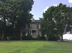 Cold Saturday |
December 11, 2008 (#08001174) |
3251 Gamber Rd. 39°29′07″N 76°54′09″W |
Finksburg | |
| 14 | Cover's Tannery | 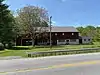 Cover's Tannery |
September 27, 2019 (#100004486) |
626 Francis Scott Key Hwy. 39°35′33″N 77°14′25″W |
Keymar | |
| 15 | Englar-Schweigart-Rinehart Farm | 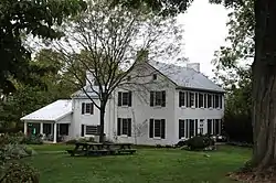 Englar-Schweigart-Rinehart Farm |
December 10, 2003 (#03001267) |
47 Rockland Rd. 39°34′50″N 77°02′20″W |
Westminster | |
| 16 | Christopher Erb House | 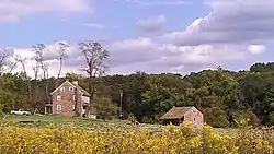 Christopher Erb House |
June 19, 1985 (#85001269) |
3333 Flickinger Rd. 39°39′52″N 77°05′06″W |
Silver Run | |
| 17 | Farm Content | 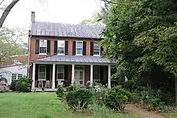 Farm Content |
June 20, 1975 (#75000879) |
1221 Old New Windsor Pike (MD 852) 39°33′31″N 77°02′30″W |
Westminster | |
| 18 | Friendship Valley Farm | 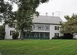 Friendship Valley Farm |
September 16, 1977 (#77000688) |
South of Westminster at 950 Gist Rd. 39°32′49″N 77°00′04″W |
Westminster | |
| 19 | Andrew P. Frizzell House and Farm Complex | 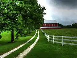 Andrew P. Frizzell House and Farm Complex |
September 11, 1986 (#86002391) |
3801 Salem Bottom Rd. 39°27′30″N 77°03′08″W |
Westminster | |
| 20 | Hampstead School | 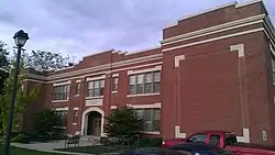 Hampstead School |
December 27, 2002 (#02001575) |
1211 N. Main St. 39°36′28″N 76°50′59″W |
Hampstead | |
| 21 | Hard Lodging | 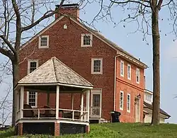 Hard Lodging |
June 9, 1978 (#78001451) |
4623 Ladiesburg Road 39°33′54″N 77°09′56″W |
Union Bridge | |
| 22 | Isaac Hoffman House | July 25, 1985 (#85001612) |
364 Shamer Lane 39°35′18″N 76°53′20″W |
Houcksville | ||
| 23 | Hopewell |  Hopewell |
December 8, 1980 (#80001803) |
Pearre and Clemsonville Rds. 39°31′48″N 77°10′13″W |
Union Bridge | |
| 24 | Keefer-Brubaker Farm | December 20, 2007 (#07001286) |
2719 Roop Rd. 39°39′22″N 77°12′13″W |
Taneytown | ||
| 25 | Jacob Koons Farm | 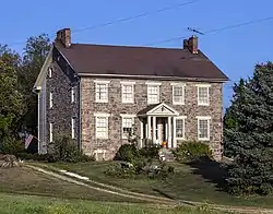 Jacob Koons Farm |
May 25, 2011 (#11000306) |
1151 Otterdale Mill Rd. 39°36′37″N 77°10′12″W |
Taneytown vicinity | |
| 26 | Lineboro Historic District | 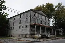 Lineboro Historic District |
November 15, 1996 (#96001350) |
Main St, Church to Mill Sts. 39°36′27″N 76°10′04″W |
Lineboro | |
| 27 | Linwood Historic District | .jpg.webp) Linwood Historic District |
September 27, 1980 (#80001801) |
McKinstry's Mill Rd. 39°33′39″N 77°08′30″W |
Linwood | |
| 28 | McKinstry's Mills Historic District |  McKinstry's Mills Historic District |
April 16, 1997 (#97000338) |
1494, 1498, and 10904 McKinstry's Mill Rd., 4500 and 4504 Sam's Creek Rd. 39°32′00″N 77°09′32″W |
Union Bridge | |
| 29 | McMurray-Frizzell-Aldridge Farm | 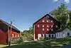 McMurray-Frizzell-Aldridge Farm |
April 13, 2001 (#01000339) |
3708 Baker Rd. 39°28′19″N 77°03′20″W |
Westminster | |
| 30 | Meadow Brook Farm | July 25, 1985 (#85001622) |
1006 Taneytown Pike 39°35′31″N 77°01′52″W |
Westminster | ||
| 31 | Mount Airy Historic District |  Mount Airy Historic District |
September 13, 1984 (#84001589) |
Roughly Main, Church, Maple, Park, Hill, and Warfield Sts. 39°22′31″N 77°09′21″W |
Mount Airy | |
| 32 | Mt. Pleasant | 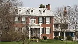 Mt. Pleasant |
November 4, 1998 (#98001260) |
200 W. Locust St. 39°34′28″N 77°10′57″W |
Union Bridge | |
| 33 | New Windsor Historic District | .jpg.webp) New Windsor Historic District |
August 21, 1997 (#97000925) |
Roughly bounded by Park, and Springdale Aves., New Windsor Rd., Lambert Ave., Coe Dr., and Maine St. 39°32′33″N 77°06′21″W |
New Windsor | |
| 34 | Old National Pike Milestones |  Old National Pike Milestones |
November 27, 1975 (#75002107) |
U.S. Route 40, U.S. Route 40 Alternate, and U.S. Route 40 Scenic, and Maryland Routes 144 and 165 39°25′13″N 77°16′01″W |
Mount Airy | |
| 35 | John Orendorff Farm | 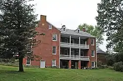 John Orendorff Farm |
March 7, 1997 (#97000102) |
412 Old Bachman's Valley Rd. 39°37′04″N 76°59′16″W |
Westminster | |
| 36 | Pipe Creek Friends Meetinghouse | 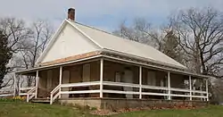 Pipe Creek Friends Meetinghouse |
November 7, 1976 (#76000983) |
Quaker Hill Rd. 39°33′48″N 77°10′13″W |
Union Bridge | |
| 37 | Rockland Farm | 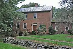 Rockland Farm |
August 21, 1986 (#86001730) |
201 Rockland Rd. 39°34′30″N 77°02′50″W |
Westminster | |
| 38 | Roop's Mill | 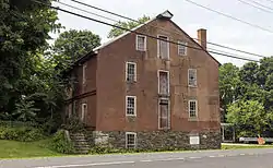 Roop's Mill |
October 31, 2008 (#08000796) |
1001 and 1019 Taneytown Pike 39°35′30″N 77°02′02″W |
Westminster | |
| 39 | Christian Royer House | 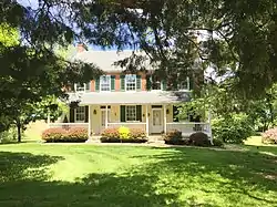 Christian Royer House |
November 7, 1979 (#79001119) |
North of Westminster on Fridinger Mill Rd. 39°37′32″N 76°57′57″W |
Westminster | |
| 40 | Ludwick Rudisel Tannery House | 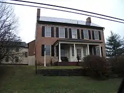 Ludwick Rudisel Tannery House |
November 10, 1980 (#80001802) |
65 Frederick St. 39°39′27″N 77°10′45″W |
Taneytown | |
| 41 | Robert and Phyllis Scott House | 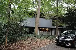 Robert and Phyllis Scott House |
December 23, 2004 (#04001377) |
1805 Uniontown Rd. 39°35′12″N 77°03′40″W |
Westminster | |
| 42 | Jacob F. Shaffer Farm | 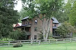 Jacob F. Shaffer Farm |
October 22, 1998 (#98001259) |
4758 Schalk Road One 39°42′00″N 76°49′48″W |
Millers | |
| 43 | Slagle-Byers House | 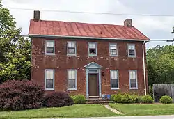 Slagle-Byers House |
June 21, 2007 (#07000566) |
1624 Littlestown Pike 39°37′17″N 76°59′51″W |
Westminster | |
| 44 | Springfield Presbyterian Church | 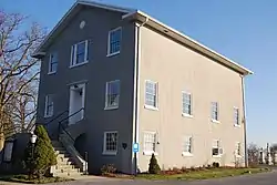 Springfield Presbyterian Church |
July 31, 1986 (#86002110) |
7300 Spout Hill Rd. 39°22′27″N 76°58′24″W |
Sykesville | |
| 45 | Stoner-Saum Farm | 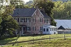 Stoner-Saum Farm |
December 6, 1996 (#96001415) |
1500 McKinstry's Mill Rd. 39°32′05″N 77°09′54″W |
Union Bridge | |
| 46 | Sykesville Historic District | 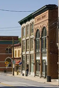 Sykesville Historic District |
September 25, 1985 (#85002498) |
Main St. and Springfield, Norwood, and Mellor Aves. 39°22′05″N 76°58′09″W |
Sykesville | |
| 47 | Taneytown Historic District | 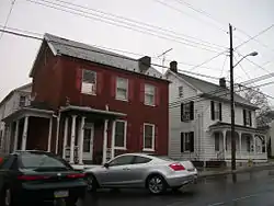 Taneytown Historic District |
October 9, 1986 (#86002850) |
Maryland Routes 140 and 194 39°39′30″N 77°10′26″W |
Taneytown | |
| 48 | Taylor-Manning-Leppo House | July 15, 2009 (#09000519) |
2600 Patapsco Rd. 39°32′27″N 76°54′00″W |
Finksburg | ||
| 49 | Terra Rubra | 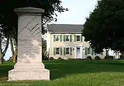 Terra Rubra |
July 24, 1978 (#78001449) |
1755 Keysville Bruceville Road 39°37′30″N 77°14′56″W |
Keysville | |
| 50 | Trevanion | 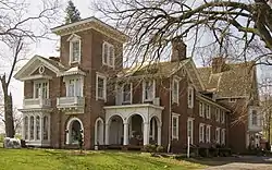 Trevanion |
September 15, 1977 (#77000687) |
1800 Trevanion Rd. 39°37′28″N 77°07′01″W |
Uniontown | |
| 51 | Union Bridge Historic District | 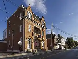 Union Bridge Historic District |
August 17, 1994 (#94000820) |
Roughly bounded by Bellevue, E. Locust, Buttersburg Alley, Church, Whyte, W. Locust, and the Western Maryland Railway tracks 39°34′03″N 77°10′40″W |
Union Bridge | |
| 52 | Union Bridge Station | 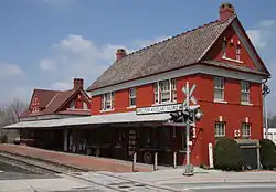 Union Bridge Station |
November 7, 1976 (#76000984) |
41 N. Main Street (MD 35) 39°34′14″N 77°10′39″W |
Union Bridge | Operated by the Western Maryland Railway |
| 53 | Union Mills Homestead Historic District |  Union Mills Homestead Historic District |
January 25, 1971 (#71000371) |
Junction of U.S. Route 140 and Deep Run Rd. 39°40′14″N 77°00′58″W |
Westminster | |
| 54 | Uniontown Academy | 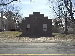 Uniontown Academy |
August 14, 1973 (#73000911) |
Uniontown Rd. 39°35′32″N 77°10′57″W |
Uniontown | |
| 55 | Uniontown Historic District | 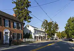 Uniontown Historic District |
January 3, 1986 (#86000059) |
Uniontown and Trevanion Rds. 39°35′40″N 77°06′55″W |
Uniontown | |
| 56 | Warfield Complex, Hubner, and T Buildings | 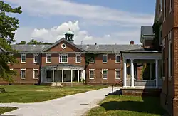 Warfield Complex, Hubner, and T Buildings |
November 2, 2000 (#00001271) |
Springfield Hospital Center 39°22′43″N 76°57′41″W |
Sykesville | |
| 57 | Weaver-Fox House | 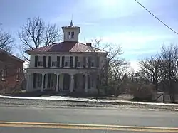 Weaver-Fox House |
November 20, 1975 (#75000876) |
3411 Main St. (Uniontown Rd.) 39°35′36″N 77°06′53″W |
Uniontown | |
| 58 | Wesley Chapel Methodist Episcopal Church | 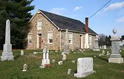 Wesley Chapel Methodist Episcopal Church |
March 22, 1984 (#84001593) |
Liberty and Johnsville Rds. 39°24′26″N 76°57′45″W |
Eldersburg | |
| 59 | Western Maryland College Historic District | 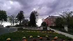 Western Maryland College Historic District |
March 26, 1976 (#76000985) |
W. Main and College Sts. 39°34′53″N 77°00′09″W |
Westminster | |
| 60 | Westminster Historic District | 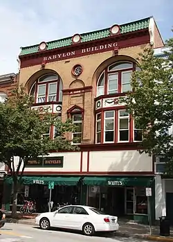 Westminster Historic District |
August 6, 1980 (#80001804) |
Maryland Routes 32 and 97 39°34′30″N 76°59′43″W |
Westminster | |
| 61 | Wilson's Inheritance | June 19, 1985 (#85001270) |
4400 Green Valley Rd. 39°34′16″N 77°09′35″W |
Union Bridge | ||
| 62 | Winemiller Family Farm | August 30, 2006 (#06000743) |
1909 Francis Scott Key Highway (Maryland Route 194) 39°37′46″N 77°13′12″W |
Taneytown |
See also
| Wikimedia Commons has media related to National Register of Historic Places in Carroll County, Maryland. |
References
- The latitude and longitude information provided in this table was derived originally from the National Register Information System, which has been found to be fairly accurate for about 99% of listings. Some locations in this table may have been corrected to current GPS standards.
- "National Register of Historic Places: Weekly List Actions". National Park Service, United States Department of the Interior. Retrieved on January 29, 2021.
- Numbers represent an alphabetical ordering by significant words. Various colorings, defined here, differentiate National Historic Landmarks and historic districts from other NRHP buildings, structures, sites or objects.
- "National Register Information System". National Register of Historic Places. National Park Service. April 24, 2008.
- The eight-digit number below each date is the number assigned to each location in the National Register Information System database, which can be viewed by clicking the number.
| Topics | 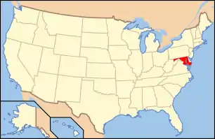 | |
|---|---|---|
| Lists by county | ||
| Lists by city | ||
| Other lists | ||
| ||
Municipalities and communities of Carroll County, Maryland, United States | ||
|---|---|---|
| Cities | | |
| Towns | ||
| CDP | ||
| Other communities |
| |
| Footnotes | ‡This populated place also has portions in an adjacent county | |
| ||
This article is issued from Wikipedia. The text is licensed under Creative Commons - Attribution - Sharealike. Additional terms may apply for the media files.