National Register of Historic Places listings in Wicomico County, Maryland
This is a list of the National Register of Historic Places listings in Wicomico County, Maryland.
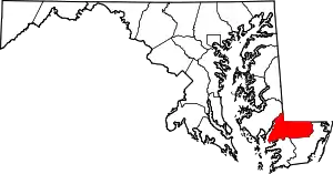
Location of Wicomico County in Maryland
This is intended to be a complete list of the properties and districts on the National Register of Historic Places in Wicomico County, Maryland, United States. Latitude and longitude coordinates are provided for many National Register properties and districts; these locations may be seen together in a map.[1]
There are 23 properties and districts listed on the National Register in the county.
| Allegany - Anne Arundel - Baltimore (city) - Baltimore County - Calvert - Caroline - Carroll - Cecil - Charles - Dorchester - Frederick - Garrett - Harford - Howard - Kent - Montgomery - Prince George's - Queen Anne's - Somerset - St. Mary's - Talbot - Washington - Wicomico - Worcester |
- This National Park Service list is complete through NPS recent listings posted January 29, 2021.[2]
Current listings
| [3] | Name on the Register[4] | Image | Date listed[5] | Location | City or town | Description |
|---|---|---|---|---|---|---|
| 1 | Asbury Methodist Episcopal Church | 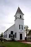 Asbury Methodist Episcopal Church |
August 27, 1999 (#99001041) |
26679 Collins Wharf Rd. 38°17′25″N 75°41′26″W |
Allen | |
| 2 | Beaudley | 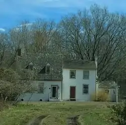 Beaudley |
December 7, 2001 (#01001334) |
3955 Jesterville Rd. 38°18′13″N 75°52′10″W |
Tyaskin | |
| 3 | Bennett's Adventure | Bennett's Adventure |
November 20, 1975 (#75000928) |
3 miles west of Allen on Clifford Cooper Rd. 38°17′02″N 75°44′05″W |
Allen | |
| 4 | Bounds Lott | 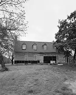 Bounds Lott |
November 14, 1978 (#78001488) |
4146 Rivermere Lane 38°18′32″N 75°44′56″W |
Allen | |
| 5 | Gillis-Grier House | 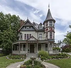 Gillis-Grier House |
October 31, 1972 (#72000589) |
401 N. Division St. 38°22′14″N 75°35′54″W |
Salisbury | |
| 6 | Honeysuckle Lodge | August 8, 1996 (#96000880) |
1601 Camden Ave. 38°20′06″N 75°36′53″W |
Salisbury | ||
| 7 | Sen. William P. Jackson House |  Sen. William P. Jackson House |
September 28, 1976 (#76001022) |
514 Camden Ave. 38°21′37″N 75°36′19″W |
Salisbury | Demolished in 1976[6] |
| 8 | Long Hill | .jpg.webp) Long Hill |
December 31, 1974 (#74000978) |
Wetipquin Ferry Rd 38°19′32″N 75°50′07″W |
Wetipquin | |
| 9 | Maple Leaf Farm Potato House | June 1, 1998 (#98000544) |
26632 Porter Mill Rd. 38°26′14″N 75°41′24″W |
Hebron | ||
| 10 | Pemberton Hall | _from_SSW_1.JPG.webp) Pemberton Hall |
February 18, 1971 (#71000379) |
Pemberton Rd. 38°20′52″N 75°38′40″W |
Salisbury | |
| 11 | Perry-Cooper House | 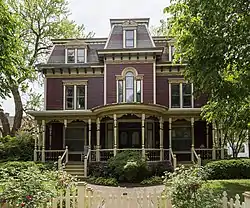 Perry-Cooper House |
November 17, 1977 (#77000706) |
200 E. William St. 38°22′10″N 75°35′51″W |
Salisbury | |
| 12 | Poplar Hill Mansion |  Poplar Hill Mansion |
October 7, 1971 (#71000380) |
117 Elizabeth St. 38°22′17″N 75°35′43″W |
Salisbury | |
| 13 | San Domingo School | .jpg.webp) San Domingo School |
February 16, 2007 (#07000044) |
11526 Old School Rd. 38°30′39″N 75°43′22″W |
Sharptown | |
| 14 | Spring Hill Church | 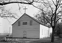 Spring Hill Church |
October 22, 1976 (#76001021) |
1 mile northeast of Hebron at the junction of U.S. Route 50 and Maryland Route 347 38°25′46″N 75°40′25″W |
Hebron | Destroyed by fire on July 22, 2014.[7] |
| 15 | St. Bartholomew's Episcopal Church | 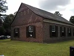 St. Bartholomew's Episcopal Church |
June 5, 1975 (#75000929) |
Green Hill Church Rd. 38°17′30″N 75°47′30″W |
Quantico | |
| 16 | St. Giles | 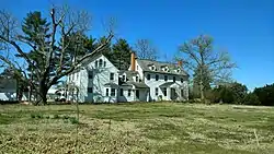 St. Giles |
December 20, 1982 (#82001602) |
Southwest of Hebron on Maryland Route 347 38°24′50″N 75°41′57″W |
Hebron | |
| 17 | Union Station | 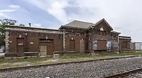 Union Station |
May 2, 2007 (#07000389) |
611 Railroad Ave. 38°22′16″N 75°35′35″W |
Salisbury | |
| 18 | United States Post Office | .jpg.webp) United States Post Office |
April 26, 2016 (#16000199) |
129 East Main St. 38°21′55″N 75°35′59″W |
Salisbury | Now the Maude R. Toulson Federal Building |
| 19 | F. Leonard Wailes Law Office | _4.JPG.webp) F. Leonard Wailes Law Office |
April 14, 1997 (#97000314) |
116-118 E. Main St. 38°21′55″N 75°35′59″W |
Salisbury | |
| 20 | Western Fields | June 12, 1987 (#87000641) |
Porter Mill Rd. 38°26′05″N 75°41′23″W |
Hebron | ||
| 21 | Whitehaven Historic District | 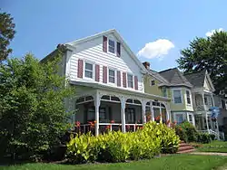 Whitehaven Historic District |
January 9, 1980 (#80001843) |
Whitehaven Rd., Church and River Sts., and Cinder and Locust Lanes 38°16′07″N 75°47′28″W |
Whitehaven | |
| 22 | Whitehaven Hotel | 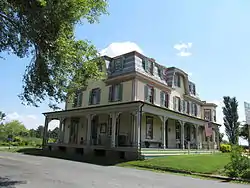 Whitehaven Hotel |
May 10, 1996 (#96000535) |
Whitehaven Rd. at its junction with River St. 38°16′07″N 75°47′20″W |
Whitehaven | |
| 23 | Yellow Brick House | 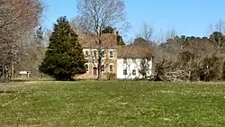 Yellow Brick House |
May 22, 1978 (#78001489) |
22342 Capitola Road (MD 352) 38°18′07″N 75°50′25″W |
Bivalve |
See also
| Wikimedia Commons has media related to National Register of Historic Places in Wicomico County, Maryland. |
References
- The latitude and longitude information provided in this table was derived originally from the National Register Information System, which has been found to be fairly accurate for about 99% of listings. Some locations in this table may have been corrected to current GPS standards.
- "National Register of Historic Places: Weekly List Actions". National Park Service, United States Department of the Interior. Retrieved on January 29, 2021.
- Numbers represent an alphabetical ordering by significant words. Various colorings, defined here, differentiate National Historic Landmarks and historic districts from other NRHP buildings, structures, sites or objects.
- "National Register Information System". National Register of Historic Places. National Park Service. April 24, 2008.
- The eight-digit number below each date is the number assigned to each location in the National Register Information System database, which can be viewed by clicking the number.
- "Senator William P. Jackson House, site". Maryland Historical Trust. Retrieved 2014-12-17.
- Statter, Dave (23 July 2014). "Pre-arrival video: Three alarms as historic church burns in Hebron, MD". Retrieved 15 June 2016.
| Topics | 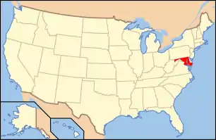 | |
|---|---|---|
| Lists by county | ||
| Lists by city | ||
| Other lists | ||
| ||
Municipalities and communities of Wicomico County, Maryland, United States | ||
|---|---|---|
| Cities | | |
| Towns | ||
| CDPs | ||
| Unincorporated communities | ||
| Footnotes | ‡This populated place also has portions in an adjacent county or counties | |
| ||
This article is issued from Wikipedia. The text is licensed under Creative Commons - Attribution - Sharealike. Additional terms may apply for the media files.