National Register of Historic Places listings in Charles County, Maryland
This is a list of the National Register of Historic Places listings in Charles County, Maryland.
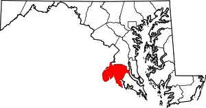
Location of Charles County in Maryland
This is intended to be a complete list of the properties and districts on the National Register of Historic Places in Charles County, Maryland, United States. Latitude and longitude coordinates are provided for many National Register properties and districts; these locations may be seen together in a map.[1]
There are 39 properties and districts listed on the National Register in the county, including 1 National Historic Landmark. Two other sites in the county were once listed on the Register but have been removed.
| Allegany - Anne Arundel - Baltimore (city) - Baltimore County - Calvert - Caroline - Carroll - Cecil - Charles - Dorchester - Frederick - Garrett - Harford - Howard - Kent - Montgomery - Prince George's - Queen Anne's - Somerset - St. Mary's - Talbot - Washington - Wicomico - Worcester |
- This National Park Service list is complete through NPS recent listings posted January 29, 2021.[2]
Current listings
| [3] | Name on the Register[4] | Image | Date listed[5] | Location | City or town | Description |
|---|---|---|---|---|---|---|
| 1 | Acquinsicke | February 20, 1992 (#92000070) |
Billingsley Rd. west of its junction with Maryland Route 228 38°36′30″N 77°02′14″W |
Pomfret | ||
| 2 | Araby | .jpg.webp) Araby |
July 25, 1974 (#74000947) |
Southeast of Mason on Maryland Route 425 38°34′43″N 77°06′54″W |
Mason's Springs | |
| 3 | Bryantown Historic District | 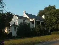 Bryantown Historic District |
March 14, 1985 (#85000590) |
Maryland Route 5 and County Route 232 38°33′11″N 76°50′39″W |
Bryantown | |
| 4 | Cedar Grove | March 2, 1979 (#79001124) |
South of La Plata off Maryland Route 6 west of Blossom Point Rd. 38°28′50″N 77°04′22″W |
La Plata | ||
| 5 | Ellerslie | 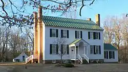 Ellerslie |
September 24, 1979 (#79003264) |
West of Port Tobacco on Maryland Route 6 38°30′20″N 77°02′29″W |
Port Tobacco | |
| 6 | The Exchange | June 7, 1984 (#84001763) |
7310 Greenland Place 38°30′54″N 76°58′23″W |
La Plata | ||
| 7 | Green's Inheritance | December 16, 1977 (#77000692) |
Northeast of Pomfret on Maryland Route 227 38°35′19″N 77°01′13″W |
Pomfret | ||
| 8 | Habre-de-Venture; Thomas Stone National Historic Site | 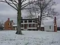 Habre-de-Venture; Thomas Stone National Historic Site |
October 31, 1972 (#72001595) |
6655 Rose Hill Rd., near its junction with Maryland Routes 6 and 225 38°31′55″N 77°01′53″W |
Port Tobacco | |
| 9 | The Hermitage | 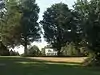 The Hermitage |
July 23, 1998 (#98000886) |
Washington Ave. 38°32′02″N 76°58′52″W |
La Plata | |
| 10 | Johnsontown Tobacco Barn No. 2 | 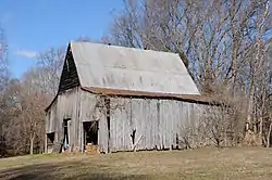 Johnsontown Tobacco Barn No. 2 |
December 27, 2011 (#11000947) |
9830 Johnsontown Rd. 38°29′12″N 76°58′17″W |
La Plata vicinity | part of the Tobacco Barns of Southern Maryland MPS |
| 11 | La Grange | 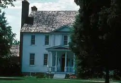 La Grange |
October 22, 1976 (#76000990) |
Maryland Route 6, west of U.S. Route 301 38°31′27″N 76°59′28″W |
La Plata | |
| 12 | Linden |  Linden |
November 23, 1977 (#77000693) |
North of Port Tobacco on Mitchell Rd. 38°33′16″N 77°00′46″W |
Port Tobacco | |
| 13 | The Lindens | 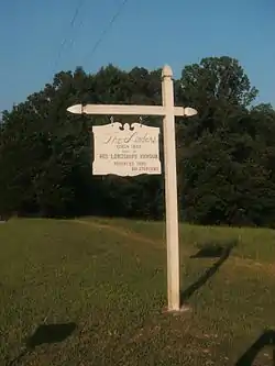 The Lindens |
April 23, 1990 (#90000607) |
Maryland Route 488 38°33′07″N 76°52′32″W |
Bryantown | |
| 14 | Locust Grove |  Locust Grove |
July 21, 1978 (#78001454) |
West of La Plata on Maryland Route 225 38°32′32″N 77°01′22″W |
La Plata | |
| 15 | Mallows Bay-Widewater Historic and Archeological District |  Mallows Bay-Widewater Historic and Archeological District |
April 24, 2015 (#15000173) |
Off Charles County shoreline at Sandy Pt. 38°28′21″N 77°16′07″W |
Nanjemoy vicinity | |
| 16 | Marshall Hall | 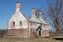 Marshall Hall |
May 12, 1976 (#76000152) |
5 miles north of Maryland Routes 210 and 227 38°41′06″N 77°05′55″W |
Bryans Road | |
| 17 | Maxwell Hall | July 30, 1974 (#74000949) |
East of Patuxent on Teagues Point Rd. 38°32′04″N 76°42′01″W |
Patuxent | ||
| 18 | McPherson's Purchase | January 3, 1985 (#85000019) |
Maryland Route 227 38°35′56″N 77°02′51″W |
Pomfret | ||
| 19 | Mount Air | December 22, 1978 (#78001453) |
West of Faulkner off U.S. Route 301 38°26′12″N 76°59′50″W |
Faulkner | ||
| 20 | Mount Aventine | 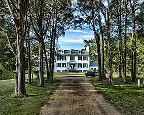 Mount Aventine |
April 18, 1996 (#94001328) |
1.8 miles southwest of Bryans Road on the northwestern side of Chapman's Landing Rd. 38°37′04″N 77°07′03″W |
Bryans Road | |
| 21 | Mt. Carmel Monastery |  Mt. Carmel Monastery |
December 4, 1973 (#73000913) |
North of Port Tobacco on Mt. Carmel Rd. 38°33′21″N 77°00′01″W |
Port Tobacco | |
| 22 | Oak Grove |  Oak Grove |
November 23, 1983 (#83003777) |
Turkey Hill Rd. 38°35′10″N 76°59′10″W |
La Plata | |
| 23 | Oakland | August 4, 1983 (#83002946) |
Maryland Route 5 38°33′30″N 76°48′40″W |
Bryantown | ||
| 24 | Pleasant Hill | December 8, 1997 (#97001449) |
9205 Marshall's Corner Rd. 38°35′18″N 76°59′37″W |
Pomfret | ||
| 25 | Port Tobacco Historic District | 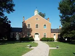 Port Tobacco Historic District |
August 4, 1989 (#79003911) |
Off Maryland Route 6 38°30′45″N 77°01′07″W |
Port Tobacco | |
| 26 | Retreat |  Retreat |
June 28, 1988 (#88000222) |
Maryland Route 484/Poor House Rd. and Maryland Route 6 38°30′38″N 77°02′48″W |
Port Tobacco | |
| 27 | Rich Hill | 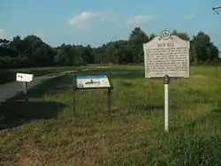 Rich Hill |
November 12, 1975 (#75000885) |
Northeast of Bel Alton on Bel Alton-Newtown Rd. 38°28′54″N 76°57′03″W |
Bel Alton | |
| 28 | Rose Hill | 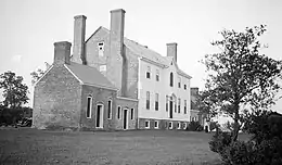 Rose Hill |
March 30, 1973 (#73000914) |
Rose Hill Rd. 38°31′19″N 77°01′42″W |
Port Tobacco | |
| 29 | Rosemary Lawn | April 16, 1992 (#92000380) |
Fire Tower Rd. 38°29′29″N 77°06′17″W |
Welcome | ||
| 30 | Sarum | 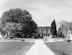 Sarum |
August 13, 1974 (#74000948) |
Southeast of Newport off Maryland Route 234 38°24′19″N 76°53′42″W |
Newport | |
| 31 | St. Catharine | .jpg.webp) St. Catharine |
October 1, 1974 (#74000950) |
East of Waldorf near the junction of Maryland Routes 232 and 382 38°36′34″N 76°49′36″W |
Waldorf | |
| 32 | St. Mary's Roman Catholic Church, Newport | 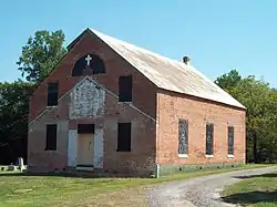 St. Mary's Roman Catholic Church, Newport |
May 30, 1991 (#91000603) |
St. Mary's Church Rd. 38°25′53″N 76°54′23″W |
Newport | |
| 33 | St. Thomas Manor | 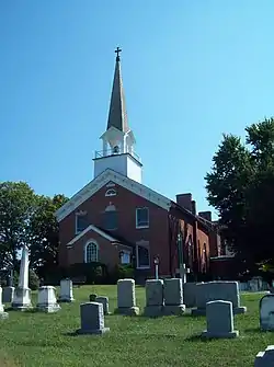 St. Thomas Manor |
November 10, 1988 (#88002050) |
Maryland Route 427/Chapel Point Rd. 38°27′55″N 77°01′27″W |
Port Tobacco | |
| 34 | Spye Park | October 4, 1990 (#90001523) |
Padgett Road 38°35′34″N 76°57′17″W |
White Plains | ||
| 35 | Stagg Hall | 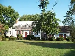 Stagg Hall |
December 29, 1988 (#88003061) |
County Route 469/Chapel Point Rd. 38°30′42″N 77°01′11″W |
Port Tobacco | |
| 36 | Thainston | 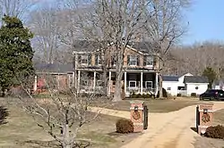 Thainston |
March 28, 1990 (#90000436) |
Mitchell Rd., north of Maryland Route 225 38°34′06″N 77°00′35″W |
La Plata | |
| 37 | Timber Neck Farm | 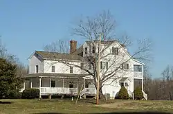 Timber Neck Farm |
September 6, 1979 (#79001123) |
Southeast of Faulkner Rd. 38°25′52″N 76°57′08″W |
Faulkner | |
| 38 | Truman's Place | January 20, 1988 (#87002264) |
Gallant Green Rd. 38°33′58″N 76°46′41″W |
Hughesville | ||
| 39 | Waverley | 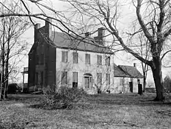 Waverley |
August 11, 1975 (#75000886) |
13535 Waverly Point Road 38°20′19″N 76°57′36″W |
Morgantown |
Formerly listed in the county
| [3] | Name on the Register | Image | Date listed | Date removed | Location | City or town | Summary |
|---|---|---|---|---|---|---|---|
| 1 | Johnsontown | May 31, 1991 (#91000610) | May 11, 2006 | Fairgrounds Rd. E of Penn Central RR tracks |
Waldorf | ||
| 2 | Widow's Pleasure | April 18, 1991 (#89000664) | August 8, 2007 | Piney Church Rd. 38°34′50″N 76°47′38″W |
Waldorf |
See also
| Wikimedia Commons has media related to National Register of Historic Places in Charles County, Maryland. |
References
- The latitude and longitude information provided in this table was derived originally from the National Register Information System, which has been found to be fairly accurate for about 99% of listings. Some locations in this table may have been corrected to current GPS standards.
- "National Register of Historic Places: Weekly List Actions". National Park Service, United States Department of the Interior. Retrieved on January 29, 2021.
- Numbers represent an alphabetical ordering by significant words. Various colorings, defined here, differentiate National Historic Landmarks and historic districts from other NRHP buildings, structures, sites or objects.
- "National Register Information System". National Register of Historic Places. National Park Service. April 24, 2008.
- The eight-digit number below each date is the number assigned to each location in the National Register Information System database, which can be viewed by clicking the number.
| Topics | 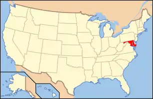 | |
|---|---|---|
| Lists by county | ||
| Lists by city | ||
| Other lists | ||
| ||
Municipalities and communities of Charles County, Maryland, United States | ||
|---|---|---|
| Towns | | |
| CDPs | ||
| Other communities | ||
| ||
This article is issued from Wikipedia. The text is licensed under Creative Commons - Attribution - Sharealike. Additional terms may apply for the media files.