National Register of Historic Places listings in Cecil County, Maryland
This is a list of the National Register of Historic Places listings in Cecil County, Maryland.
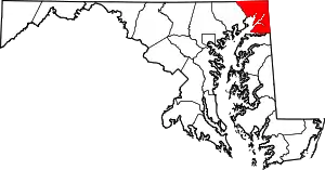
Location of Cecil County in Maryland
This is intended to be a complete list of the properties and districts on the National Register of Historic Places in Cecil County, Maryland, United States. Latitude and longitude coordinates are provided for many National Register properties and districts; these locations may be seen together in a map.[1]
There are 51 properties and districts listed on the National Register in the county.
| Allegany - Anne Arundel - Baltimore (city) - Baltimore County - Calvert - Caroline - Carroll - Cecil - Charles - Dorchester - Frederick - Garrett - Harford - Howard - Kent - Montgomery - Prince George's - Queen Anne's - Somerset - St. Mary's - Talbot - Washington - Wicomico - Worcester |
- This National Park Service list is complete through NPS recent listings posted January 29, 2021.[2]
Current listings
| [3] | Name on the Register[4] | Image | Date listed[5] | Location | City or town | Description |
|---|---|---|---|---|---|---|
| 1 | Bohemia Farm | 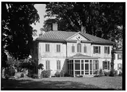 Bohemia Farm |
April 11, 1973 (#73000912) |
4920 Augustine Herman Highway; 1 mile south of the Bohemia River off Maryland Route 213 39°27′01″N 75°51′44″W |
Earleville | |
| 2 | Jeremiah Brown House and Mill Site | 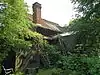 Jeremiah Brown House and Mill Site |
November 2, 1987 (#87001391) |
1416 Telegraph Rd. 39°42′13″N 76°00′15″W |
Rising Sun | |
| 3 | Mercer Brown House | 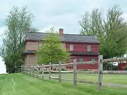 Mercer Brown House |
May 29, 1987 (#87000815) |
1270 England Creamery Rd. 39°41′28″N 75°59′52″W |
Rising Sun | |
| 4 | Bumpstead Archeological Site |  Bumpstead Archeological Site |
December 16, 1983 (#83003745) |
Address Restricted |
Elkton | |
| 5 | Charlestown Historic District | 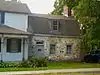 Charlestown Historic District |
April 14, 1975 (#75000880) |
Bounded by Tasker and Ogle Sts., Louisa Lane, and the North East River 39°34′26″N 75°58′32″W |
Charlestown | |
| 6 | John Churchman House |  John Churchman House |
September 11, 1986 (#86002337) |
115 Churchman Ln. 39°42′46″N 75°58′36″W |
Calvert | |
| 7 | Colora Meetinghouse | 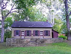 Colora Meetinghouse |
August 22, 1977 (#77000689) |
Corncake Row; North of Colora on Lipencott Rd. 39°40′32″N 76°05′56″W |
Colora | |
| 8 | East Nottingham Friends Meetinghouse | 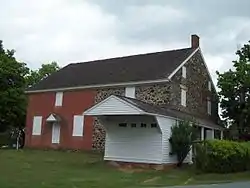 East Nottingham Friends Meetinghouse |
August 19, 1977 (#77000691) |
East of Rising Sun at the junction of Maryland Routes 272 and 273 39°42′04″N 75°59′00″W |
Rising Sun | |
| 9 | THE ELF (yacht) | 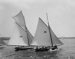 THE ELF (yacht) |
March 26, 1980 (#80001807) |
Sassafras River 39°21′43″N 75°53′13″W |
Fredericktown | |
| 10 | Elk Landing | 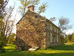 Elk Landing |
September 7, 1984 (#84001596) |
Landing Lane 39°35′45″N 75°50′28″W |
Elkton | |
| 11 | Elkton Armory | 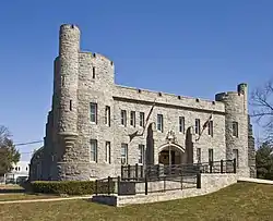 Elkton Armory |
September 25, 1985 (#85002670) |
Railroad Ave. and Bow St. 39°36′41″N 75°49′52″W |
Elkton | |
| 12 | Isaac England House |  Isaac England House |
March 20, 1980 (#80001808) |
1000 Crothers Road; 1 mile west of Zion on England Creamery Rd. 39°40′29″N 75°59′08″W |
Zion | |
| 13 | Gilpin's Falls Covered Bridge | 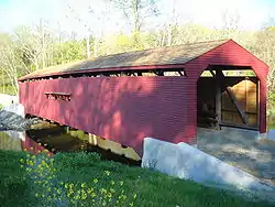 Gilpin's Falls Covered Bridge |
December 3, 2008 (#08001125) |
Maryland Route 272 39°38′56″N 75°57′20″W |
North East | |
| 14 | Grear Prehistoric Village Site | Grear Prehistoric Village Site |
July 30, 1975 (#75000882) |
Address Restricted |
White Crystal Beach | |
| 15 | Great House | 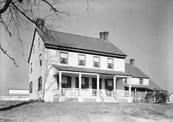 Great House |
June 7, 1984 (#84001598) |
284 Great House Farm Rd. 39°27′56″N 75°49′37″W |
St. Augustine | |
| 16 | Greenfields | 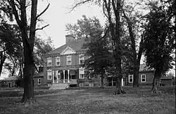 Greenfields |
February 11, 1972 (#72000574) |
South of Cecilton at 6840 Augustine Herman Highway on Maryland Route 213 39°23′21″N 75°51′54″W |
Cecilton | |
| 17 | Nathan and Susannah Harris House |  Nathan and Susannah Harris House |
March 22, 1984 (#84001602) |
541 Rising Sun Rd. 39°41′45″N 76°04′53″W |
Harrisville | |
| 18 | Edward W. Haviland House | 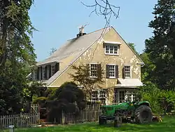 Edward W. Haviland House |
December 7, 2000 (#00001480) |
2464 Frenchtown Rd. 39°36′22″N 76°06′06″W |
Port Deposit | |
| 19 | Heath Farm Camp Archeological Site | Heath Farm Camp Archeological Site |
December 16, 1983 (#83003747) |
Address Restricted |
Elkton | |
| 20 | Heath Farm Jasper Quarry Archeological Site | Heath Farm Jasper Quarry Archeological Site |
December 16, 1983 (#83003753) |
Address Restricted |
Elkton | |
| 21 | Holly Hall | 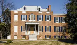 Holly Hall |
October 8, 1976 (#76000986) |
259 S. Bridge St. 39°36′08″N 75°49′41″W |
Elkton | |
| 22 | Hopewell |  Hopewell |
May 9, 1979 (#79001120) |
Northwest of Providence at 594 Little Elk Creek Road 39°42′49″N 75°54′08″W |
Providence | |
| 23 | Indian Queen Tavern and Black's Store | 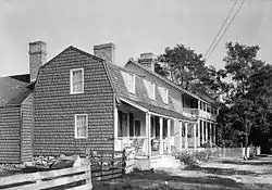 Indian Queen Tavern and Black's Store |
February 20, 1975 (#75000881) |
Market St. between Bladen and Cecil Sts. 39°34′27″N 75°58′39″W |
Charlestown | |
| 24 | Iron Hill Cut Jasper Quarry Archeological Site | Iron Hill Cut Jasper Quarry Archeological Site |
December 16, 1983 (#83003754) |
Address Restricted |
Elkton | |
| 25 | Elisha Kirk House | 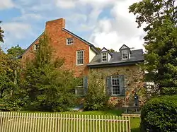 Elisha Kirk House |
July 21, 1982 (#82002809) |
18 Cross Keys Road 39°41′55″N 75°59′04″W |
Calvert | |
| 26 | Little Elk Farm |  Little Elk Farm |
May 9, 1979 (#79001121) |
Northwest of Providence at 392 Little Elk Creek Road 39°42′29″N 75°54′07″W |
Providence | |
| 27 | Joshua Lowe House | 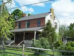 Joshua Lowe House |
April 5, 2001 (#01000337) |
35 New Bridge Rd. 39°42′54″N 76°09′29″W |
Rising Sun | |
| 28 | McCandless Archeological Site | McCandless Archeological Site |
December 16, 1983 (#83003775) |
Address Restricted |
Elkton | |
| 29 | Mitchell House | 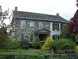 Mitchell House |
April 11, 1980 (#80001806) |
3370 Singerly Road (213) 39°42′08″N 75°52′06″W |
Fair Hill | |
| 30 | Mitchell House | 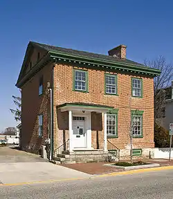 Mitchell House |
May 13, 1976 (#76000987) |
131 E. Main St. 39°36′31″N 75°49′41″W |
Elkton | |
| 31 | Mount Harmon | 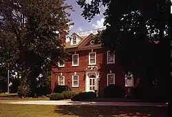 Mount Harmon |
June 5, 1974 (#74000945) |
Southwest of Earleville at 600 Grove Neck Rd. 39°23′02″N 75°56′29″W |
Earleville | |
| 32 | New Castle and Frenchtown Railroad Right-of-Way | 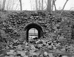 New Castle and Frenchtown Railroad Right-of-Way |
September 1, 1976 (#76002290) |
Off U.S. Route 40 between Porter, Delaware and Frenchtown 39°35′37″N 75°45′54″W |
Frenchtown | |
| 33 | Octorara Farm | 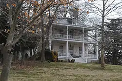 Octorara Farm |
May 7, 1980 (#80001805) |
South of Conowing on Rowlandsville Road 39°40′19″N 76°09′04″W |
Conowingo | |
| 34 | Old Lock Pump House, Chesapeake and Delaware Canal | 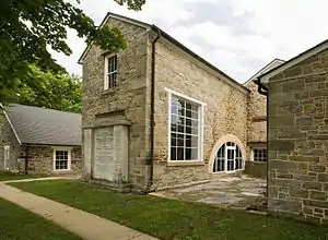 Old Lock Pump House, Chesapeake and Delaware Canal |
October 15, 1966 (#66000390) |
Maryland Route 213 39°31′32″N 75°48′39″W |
Chesapeake City | |
| 35 | Paw Paw Building | 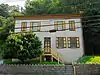 Paw Paw Building |
November 28, 1977 (#77000690) |
98 N. Main St. 39°36′28″N 76°07′07″W |
Port Deposit | |
| 36 | Perry Point Mansion House and Mill | 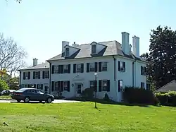 Perry Point Mansion House and Mill |
July 2, 1975 (#75000883) |
Veterans Administration Hospital grounds 39°32′58″N 76°04′15″W |
Perryville | |
| 37 | Port Deposit | 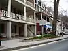 Port Deposit |
May 23, 1978 (#78001452) |
Eastern bank of the Susquehanna River, 10 miles (16 km) south of the Mason–Dixon line 39°36′32″N 76°07′09″W |
Port Deposit | |
| 38 | Principio Furnace |  Principio Furnace |
February 11, 1972 (#72000575) |
Address Restricted 39°34′38″N 76°02′11″W |
Perryville | |
| 39 | Thomas Richards House | 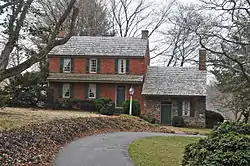 Thomas Richards House |
December 19, 1979 (#79001122) |
3 miles west of Rising Sun on U.S. Route 1 39°41′34″N 76°06′41″W |
Rising Sun | |
| 40 | Rock United Presbyterian Church | 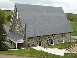 Rock United Presbyterian Church |
December 1, 1983 (#83003776) |
Maryland Route 273 at Rock Church Rd. 39°42′07″N 75°53′09″W |
Elkton | |
| 41 | Rodgers Tavern |  Rodgers Tavern |
April 26, 1972 (#72000576) |
W. Main St. 39°33′26″N 76°04′42″W |
Perryville | |
| 42 | Rose Hill | 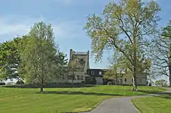 Rose Hill |
November 5, 1974 (#74000946) |
1100 Grove Neck Rd. 39°23′23″N 75°57′18″W |
Earleville | |
| 43 | Snow Hill Site | Snow Hill Site |
April 27, 1984 (#84001758) |
Address Restricted |
Port Deposit | |
| 44 | South Chesapeake City Historic District | 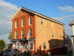 South Chesapeake City Historic District |
July 15, 1974 (#74000944) |
East of Maryland Route 213, south of the Chesapeake and Delaware Canal 39°31′37″N 75°48′51″W |
Chesapeake City | |
| 45 | St. Francis Xavier Church |  St. Francis Xavier Church |
October 10, 1975 (#75000884) |
1445 Bohemia Church Road 39°26′16″N 75°48′12″W |
Warwick | |
| 46 | St. Stephen's Episcopal Church | 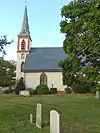 St. Stephen's Episcopal Church |
April 29, 1982 (#82002810) |
North of Earleville on Maryland Route 282 39°25′31″N 75°55′06″W |
Earleville | |
| 47 | Tome School for Boys Historic District |  Tome School for Boys Historic District |
May 16, 1984 (#84001760) |
Bainbridge Naval Training Grounds 39°36′10″N 76°06′26″W |
Port Deposit | |
| 48 | Turkey Point Light Station | 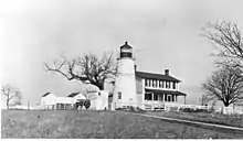 Turkey Point Light Station |
December 2, 2002 (#02001421) |
South Elk Neck State Park 39°26′59″N 76°00′32″W |
North East | |
| 49 | West Nottingham Academy Historic District | 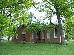 West Nottingham Academy Historic District |
July 26, 1990 (#90001125) |
Junction of Harrisville and Firetower Rds. 39°40′01″N 76°04′49″W |
Colora | |
| 50 | West Nottingham Meetinghouse | 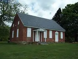 West Nottingham Meetinghouse |
November 7, 1976 (#76000988) |
Southwest of Rising Sun at the junction of Cox and Cowen Rds. 39°41′12″N 76°04′46″W |
Rising Sun | |
| 51 | Woodlands |  Woodlands |
September 24, 1979 (#79003274) |
93 Millcreek Lane 39°34′12″N 76°03′27″W |
Perryville |
See also
| Wikimedia Commons has media related to National Register of Historic Places in Cecil County, Maryland. |
References
- The latitude and longitude information provided in this table was derived originally from the National Register Information System, which has been found to be fairly accurate for about 99% of listings. Some locations in this table may have been corrected to current GPS standards.
- "National Register of Historic Places: Weekly List Actions". National Park Service, United States Department of the Interior. Retrieved on January 29, 2021.
- Numbers represent an alphabetical ordering by significant words. Various colorings, defined here, differentiate National Historic Landmarks and historic districts from other NRHP buildings, structures, sites or objects.
- "National Register Information System". National Register of Historic Places. National Park Service. April 24, 2008.
- The eight-digit number below each date is the number assigned to each location in the National Register Information System database, which can be viewed by clicking the number.
| Topics | 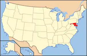 | |
|---|---|---|
| Lists by county | ||
| Lists by city | ||
| Other lists | ||
| ||
Municipalities and communities of Cecil County, Maryland, United States | ||
|---|---|---|
| Towns | | |
| Unincorporated communities |
| |
| Ghost town | ||
| ||
This article is issued from Wikipedia. The text is licensed under Creative Commons - Attribution - Sharealike. Additional terms may apply for the media files.