National Register of Historic Places listings in Talbot County, Maryland
This is a list of the National Register of Historic Places listings in Talbot County, Maryland.
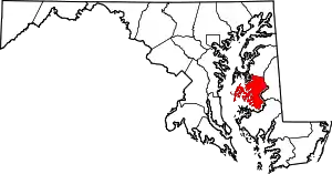
Location of Talbot County in Maryland
This is intended to be a complete list of the properties and districts on the National Register of Historic Places in Talbot County, Maryland, United States. Latitude and longitude coordinates are provided for many National Register properties and districts; these locations may be seen together in a map.[1]
There are 62 properties and districts listed on the National Register in the county, including 5 National Historic Landmarks.
| Allegany - Anne Arundel - Baltimore (city) - Baltimore County - Calvert - Caroline - Carroll - Cecil - Charles - Dorchester - Frederick - Garrett - Harford - Howard - Kent - Montgomery - Prince George's - Queen Anne's - Somerset - St. Mary's - Talbot - Washington - Wicomico - Worcester |
- This National Park Service list is complete through NPS recent listings posted January 29, 2021.[2]
Current listings
| [3] | Name on the Register[4] | Image | Date listed[5] | Location | City or town | Description |
|---|---|---|---|---|---|---|
| 1 | All Saints' Church |  All Saints' Church |
May 27, 1983 (#83002962) |
Maryland Route 662 38°50′46″N 76°04′53″W |
Easton | |
| 2 | The Anchorage |  The Anchorage |
July 30, 1974 (#74000968) |
Northwest of Easton off Maryland Route 370 38°47′41″N 76°07′49″W |
Easton | |
| 3 | Barnaby House | 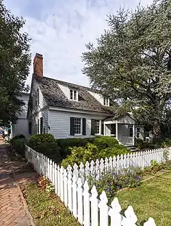 Barnaby House |
November 24, 1992 (#92001228) |
212 N. Morris St. 38°41′26″N 76°10′25″W |
Oxford | |
| 4 | Billie P. Hall (log canoe) | September 18, 1985 (#85002251) |
Evergreen Rd. 38°40′27″N 76°08′25″W |
Oxford | ||
| 5 | Cannonball House | 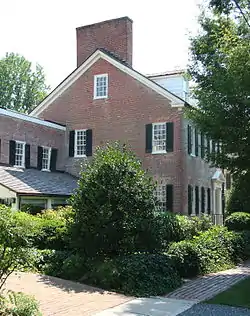 Cannonball House |
December 3, 1980 (#80001839) |
200 Mulberry St. 38°47′03″N 76°13′22″W |
St. Michaels | |
| 6 | Claude W. Somers | May 16, 1985 (#85001085) |
Old Ferry Terminal, Washington St. 38°50′11″N 76°16′51″W |
Claiborne | ||
| 7 | Clay's Hope | October 31, 1979 (#79001142) |
Bellevue Rd. 38°42′25″N 76°11′17″W |
Bellevue | ||
| 8 | Compton | July 25, 1974 (#74000970) |
West of Trappe on Howell Point Rd. 38°38′27″N 76°06′25″W |
Trappe | ||
| 9 | Crooked Intention | July 24, 1974 (#74000969) |
West of Maryland Route 33 38°46′44″N 76°13′53″W |
St. Michaels | ||
| 10 | Doncaster Town Site | September 5, 1975 (#75000920) |
Buffs Island Rd., on the shores of Shaw Bay[6] 38°51′30″N 76°11′27″W |
Easton | ||
| 11 | E. C. Collier | .jpg.webp) E. C. Collier |
May 16, 1985 (#85001087) |
Gibsontown Rd. 38°42′46″N 76°19′53″W |
Tilghman | |
| 12 | Easton Historic District | 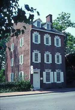 Easton Historic District |
September 17, 1980 (#80001835) |
Maryland Routes 328, 331, and 565 38°46′19″N 76°04′26″W |
Easton | |
| 13 | Edmee S. (log canoe) | 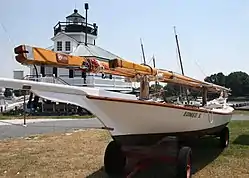 Edmee S. (log canoe) |
September 18, 1985 (#85002258) |
Mill St. 38°47′15″N 76°13′09″W |
St. Michaels | |
| 14 | Edna E. Lockwood (Chesapeake Bay bugeye) | 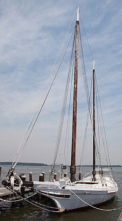 Edna E. Lockwood (Chesapeake Bay bugeye) |
February 13, 1986 (#86000258) |
Navy Point at the foot of Mill St. 38°47′15″N 76°13′10″W |
St. Michaels | |
| 15 | Flying Cloud (log canoe) | September 18, 1985 (#85002263) |
Magee Rd. 38°46′48″N 76°17′23″W |
Wittman | ||
| 16 | Hilda M. Willing |  Hilda M. Willing |
May 16, 1985 (#85001089) |
Gibsontown Rd. 38°42′46″N 76°19′53″W |
Tilghman | |
| 17 | Hope House |  Hope House |
November 1, 1979 (#79001143) |
Northwest of Easton, northeast of Voit Rd., and 0.8 miles northwest of the bridge at Tunis Mill 38°50′01″N 76°11′10″W |
Easton | |
| 18 | Island Bird (log canoe) | September 18, 1985 (#85002254) |
Miles River Yacht Club 38°48′00″N 76°13′10″W |
St. Michaels | ||
| 19 | Island Blossom (log canoe) | September 18, 1985 (#85002255) |
Miles River Yacht Club 38°48′00″N 76°13′10″W |
St. Michaels | ||
| 20 | Island Lark (log canoe) | September 18, 1985 (#85002259) |
Carpenter St. 38°47′10″N 76°13′19″W |
St. Michaels | ||
| 21 | Jay Dee (log canoe) | September 18, 1985 (#85002256) |
Miles River Yacht Club 38°48′00″N 76°13′10″W |
St. Michaels | ||
| 22 | Jena | 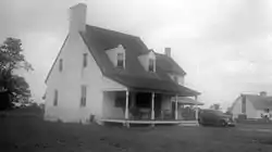 Jena |
August 6, 1980 (#80001838) |
East of Oxford off Maryland Route 333 38°41′17″N 76°08′18″W |
Oxford | |
| 23 | Kathryn | .jpg.webp) Kathryn |
May 16, 1985 (#85001090) |
Dogwood Harbor 38°42′46″N 76°19′53″W |
Tilghman Island | |
| 24 | Llandaff House | December 27, 2002 (#02001587) |
28472 Old Country Club Rd. 38°43′58″N 76°05′22″W |
Easton | ||
| 25 | Maggie Lee | _(2).jpg.webp) Maggie Lee |
May 16, 1985 (#85001091) |
Gibsontown Rd. 38°42′46″N 76°19′53″W |
Tilghman | |
| 26 | Magic (log canoe) | September 18, 1985 (#85002260) |
St. Michaels Marina 38°47′06″N 76°13′13″W |
St. Michaels | ||
| 27 | Miller's House | 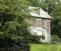 Miller's House |
December 17, 2010 (#10001038) |
Old Wye Mills Rd. 38°54′57″N 76°04′33″W |
Wye Mills | |
| 28 | Minnie V | -LRWalls.jpg.webp) Minnie V |
May 16, 1985 (#85001092) |
Gibsontown Rd. 38°42′46″N 76°19′53″W |
Tilghman | |
| 29 | Myrtle Grove | August 13, 1974 (#74000967) |
Goldsborough Neck Rd. 38°48′15″N 76°07′06″W |
Easton | ||
| 30 | Nellie L. Byrd | May 16, 1985 (#85001093) |
Gibsontown Rd. 38°42′46″N 76°19′53″W |
Tilghman | ||
| 31 | Noddy (log canoe) | September 18, 1985 (#85002257) |
Deepwater Point Rd. 38°48′05″N 76°13′17″W |
St. Michaels | ||
| 32 | Old Bloomfield | 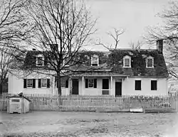 Old Bloomfield |
December 3, 1980 (#80001836) |
West of Easton on Bloomfield Rd. 38°45′59″N 76°07′06″W |
Easton | |
| 33 | The Old Inn | 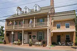 The Old Inn |
March 25, 1980 (#80001840) |
Talbot and Mulberry Sts. 38°47′01″N 76°13′25″W |
St. Michaels | |
| 34 | Old Wye Church | 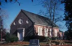 Old Wye Church |
August 9, 1984 (#84001888) |
Queenstown-Easton Rd. 38°56′11″N 76°04′48″W |
Wye Mills | |
| 35 | Orem's Delight | April 4, 1978 (#78001477) |
South of Bellevue off Ferry Neck Rd., on Benoni Point Rd. 38°41′10″N 76°12′11″W |
Bellevue | ||
| 36 | Otwell | 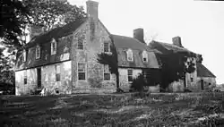 Otwell |
March 15, 1982 (#82002819) |
Otwell Rd. 38°41′55″N 76°08′16″W |
Oxford | |
| 37 | Oxford Historic District | 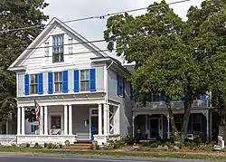 Oxford Historic District |
December 28, 2005 (#05001481) |
Roughly bounded by Tred Avon Rd., Town Creek, and Caroline Ave. 38°41′33″N 76°10′18″W |
Oxford | |
| 38 | Paw Paw Cove Site |  Paw Paw Cove Site |
December 23, 2009 (#09001150) |
Address Restricted |
Tilghman | |
| 39 | Persistence (log canoe) | September 18, 1985 (#85002261) |
St. Michaels Marina 38°47′06″N 76°13′13″W |
St. Michaels | ||
| 40 | Ralph T. Webster | May 16, 1985 (#85001094) |
Gibsontown Rd. 38°42′46″N 76°19′53″W |
Tilghman | ||
| 41 | Rebecca T. Ruark | 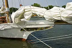 Rebecca T. Ruark |
May 16, 1985 (#85001095) |
Gibsontown Rd. 38°42′46″N 76°19′53″W |
Tilghman | |
| 42 | Reliance (Chesapeake Bay skipjack) | July 30, 1976 (#76001013) |
Knapps Narrows off Maryland Route 33 38°42′46″N 76°20′07″W |
Tilghman | ||
| 43 | Rock Clift | July 30, 1980 (#80001837) |
Southeast of Matthews off Maryland Route 328 38°48′12″N 75°56′37″W |
Matthews | ||
| 44 | Rover (log canoe) | September 18, 1985 (#85002262) |
St. Michaels Marina 38°47′06″N 76°13′13″W |
St. Michaels | ||
| 45 | Ruby G. Ford | May 16, 1985 (#85001096) |
Gibsontown Rd. 38°42′46″N 76°19′53″W |
Tilghman | Destroyed by fire | |
| 46 | S. C. Dobson (log canoe) | September 18, 1985 (#85002252) |
Peach Blossom Rd. 38°41′34″N 76°09′33″W |
Oxford | ||
| 47 | Saint Michaels Mill | 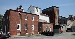 Saint Michaels Mill |
July 15, 1982 (#82002820) |
100 Chew Ave. 38°46′56″N 76°13′13″W |
St. Michaels | |
| 48 | Sandy (log canoe) | September 18, 1985 (#85002253) |
Sherwood Rd. 38°45′40″N 76°19′09″W |
Sherwood | ||
| 49 | Sharps Island Light | 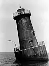 Sharps Island Light |
July 22, 1982 (#82002821) |
Southwest of Tilghman Island 38°38′19″N 76°22′05″W |
Tilghman Island | |
| 50 | Sherwood Manor | April 5, 1977 (#77000701) |
4 miles north of St. Michaels on Maryland Route 451 38°50′00″N 76°15′42″W |
St. Michaels | ||
| 51 | Sigsbee | 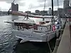 Sigsbee |
May 16, 1985 (#85001097) |
Knapps Narrows 38°43′09″N 76°20′02″W |
Tilghman | located in Baltimore, Maryland |
| 52 | St. John's Chapel of St. Michael's Parish | 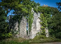 St. John's Chapel of St. Michael's Parish |
March 30, 1973 (#73000938) |
3 miles west of Easton on Maryland Route 370 38°47′46″N 76°07′43″W |
Easton | |
| 53 | St. Michaels Historic District |  St. Michaels Historic District |
September 11, 1986 (#86002427) |
Roughly bounded by North Ave., Mill St., the Miles River, Seymour, Baltimore and Eastern Railroad tracks, and Glory Ave. 38°47′04″N 76°13′24″W |
St. Michaels | |
| 54 | Stanley Norman | .jpg.webp) Stanley Norman |
May 16, 1985 (#85001086) |
Edgar Cove 38°45′58″N 76°15′37″W |
St. Michaels | |
| 55 | Tidewater Inn | 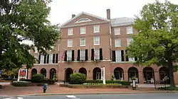 Tidewater Inn |
November 2, 2007 (#07001118) |
101 E. Dover St. 38°46′28″N 76°04′29″W |
Easton | |
| 56 | Troth's Fortune | 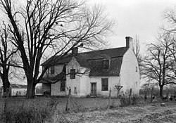 Troth's Fortune |
April 24, 1975 (#75000921) |
30776 Triple Farm Way 38°45′49″N 75°59′41″W |
Easton | |
| 57 | Victorian Corn Cribs | January 11, 1976 (#76002289) |
6.8 miles east of St. Michaels off Maryland Route 33 38°47′10″N 76°08′11″W |
St. Michaels | ||
| 58 | Virginia W | May 16, 1985 (#85001098) |
Knapps Narrows 38°43′09″N 76°20′02″W |
Tilghman | ||
| 59 | The Wilderness | July 25, 1974 (#74000971) |
Southwest of Trappe on Island Neck Rd. 38°38′22″N 76°08′12″W |
Trappe | ||
| 60 | Wye House | 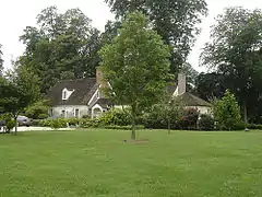 Wye House |
April 15, 1970 (#70000264) |
7 miles northwest of Easton on the Miles Neck River 38°51′02″N 76°10′14″W |
Easton | |
| 61 | Wye Mill | 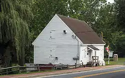 Wye Mill |
April 9, 1985 (#85000717) |
14296 Old Wye Mills Road (Maryland Route 662) 38°56′29″N 76°04′53″W |
Wye Mills | |
| 62 | Wye Town Farm House | December 16, 1982 (#82001600) |
Northwest of Easton on Bruff's Island Rd. 38°50′31″N 76°11′18″W |
Easton |
Former listings
| [3] | Name on the Register | Image | Date listed | Date removed | Location | City or town | Summary |
|---|---|---|---|---|---|---|---|
| 1 | Esther F | May 7, 1985 (#85003738) |
See also
| Wikimedia Commons has media related to National Register of Historic Places in Talbot County, Maryland. |
References
- The latitude and longitude information provided in this table was derived originally from the National Register Information System, which has been found to be fairly accurate for about 99% of listings. Some locations in this table may have been corrected to current GPS standards.
- "National Register of Historic Places: Weekly List Actions". National Park Service, United States Department of the Interior. Retrieved on January 29, 2021.
- Numbers represent an alphabetical ordering by significant words. Various colorings, defined here, differentiate National Historic Landmarks and historic districts from other NRHP buildings, structures, sites or objects.
- "National Register Information System". National Register of Historic Places. National Park Service. April 24, 2008.
- The eight-digit number below each date is the number assigned to each location in the National Register Information System database, which can be viewed by clicking the number.
- Location derived from its GNIS feature record; the NRIS lists the site as "Address Restricted".
| Topics |  | |
|---|---|---|
| Lists by county | ||
| Lists by city | ||
| Other lists | ||
| ||
Municipalities and communities of Talbot County, Maryland, United States | ||
|---|---|---|
| Towns | | |
| CDPs | ||
| Other communities | ||
| Footnotes | ‡This populated place also has portions in an adjacent county or counties | |
| ||
This article is issued from Wikipedia. The text is licensed under Creative Commons - Attribution - Sharealike. Additional terms may apply for the media files.