Buire-le-Sec
Buire-le-Sec is a commune in the Pas-de-Calais department in the Hauts-de-France region in northern France.
Buire-le-Sec | |
|---|---|
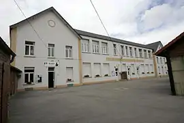
 The town hall and school of Buire-le-Sec | |
 Coat of arms | |
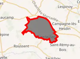
Location of Buire-le-Sec 
| |
 Buire-le-Sec  Buire-le-Sec | |
| Coordinates: 50°23′03″N 1°49′58″E | |
| Country | France |
| Region | Hauts-de-France |
| Department | Pas-de-Calais |
| Arrondissement | Montreuil |
| Canton | Auxi-le-Château |
| Intercommunality | CC Sept Vallées |
| Government | |
| • Mayor (2020–2026) | Isabelle Quenehen |
| Area 1 | 13.36 km2 (5.16 sq mi) |
| Population (2017-01-01)[1] | 777 |
| • Density | 58/km2 (150/sq mi) |
| Time zone | UTC+01:00 (CET) |
| • Summer (DST) | UTC+02:00 (CEST) |
| INSEE/Postal code | 62183 /62870 |
| Elevation | 38–93 m (125–305 ft) (avg. 80 m or 260 ft) |
| 1 French Land Register data, which excludes lakes, ponds, glaciers > 1 km2 (0.386 sq mi or 247 acres) and river estuaries. | |
Geography
Buire-le-Sec is a village situated some 5 miles (8 km) southeast of Montreuil-sur-Mer on the D139 road.
Population
| Year | Pop. | ±% |
|---|---|---|
| 1962 | 565 | — |
| 1968 | 604 | +6.9% |
| 1975 | 543 | −10.1% |
| 1982 | 551 | +1.5% |
| 1990 | 663 | +20.3% |
| 1999 | 788 | +18.9% |
| 2009 | 793 | +0.6% |
Sights
The church is one of the most beautiful and oldest in the arrondissement of Montreuil. It was built in the 12th century, though all that remains of that church are the foundations. Some 13th century features remain, but mostly it is of 16th century construction (the nave and transept). It is in the form of a Latin cross and built from chalk. The dimensions are: 32 meters long, including 19m for the nave and 7m for the choir. The width of the choir and the nave is 6m, the transept 15.50m in total. The porch has ribbed vaulting.
This article is issued from Wikipedia. The text is licensed under Creative Commons - Attribution - Sharealike. Additional terms may apply for the media files.