Lebiez
Lebiez (West Flemish: Sint-Vaast) is a commune in the Pas-de-Calais department in the Hauts-de-France region of France.
Lebiez
Sint-Vaast | |
|---|---|
 The town hall and school of Lebiez | |
 Coat of arms | |
Location of Lebiez 
| |
 Lebiez 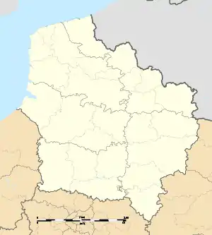 Lebiez | |
| Coordinates: 50°28′10″N 1°58′55″E | |
| Country | France |
| Region | Hauts-de-France |
| Department | Pas-de-Calais |
| Arrondissement | Montreuil |
| Canton | Fruges |
| Intercommunality | CC Haut Pays du Montreuillois |
| Government | |
| • Mayor (2020–2026) | Pascal Legrand |
| Area 1 | 9.57 km2 (3.69 sq mi) |
| Population (2017-01-01)[1] | 250 |
| • Density | 26/km2 (68/sq mi) |
| Time zone | UTC+01:00 (CET) |
| • Summer (DST) | UTC+02:00 (CEST) |
| INSEE/Postal code | 62492 /62990 |
| Elevation | 35–132 m (115–433 ft) (avg. 57 m or 187 ft) |
| 1 French Land Register data, which excludes lakes, ponds, glaciers > 1 km2 (0.386 sq mi or 247 acres) and river estuaries. | |
Geography
A small village situated 10 miles (16 km) east of Montreuil-sur-Mer at the D130 and D108 crossroads and by the banks of the Crequoise river.
Population
| Year | 1962 | 1968 | 1975 | 1982 | 1990 | 1999 | 2006 |
|---|---|---|---|---|---|---|---|
| Population | 231 | 267 | 240 | 245 | 243 | 208 | 244 |
| From the year 1962 on: No double counting—residents of multiple communes (e.g. students and military personnel) are counted only once. | |||||||
Places of interest
- The sixteenth century church of St.Vaast
- A chapel dating from the seventeenth century.
External links
| Wikimedia Commons has media related to Lebiez. |
- Lebiez on the Quid website (in French)
| Authority control |
|---|
This article is issued from Wikipedia. The text is licensed under Creative Commons - Attribution - Sharealike. Additional terms may apply for the media files.