Quernes
Quernes is a commune in the Pas-de-Calais department in the Hauts-de-France region of France.
Quernes | |
|---|---|
_mairie.JPG.webp) The town hall of Quernes | |
 Coat of arms | |
Location of Quernes 
| |
 Quernes 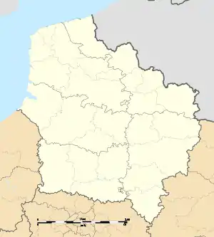 Quernes | |
| Coordinates: 50°36′21″N 2°22′02″E | |
| Country | France |
| Region | Hauts-de-France |
| Department | Pas-de-Calais |
| Arrondissement | Béthune |
| Canton | Aire-sur-la-Lys |
| Intercommunality | CA Béthune-Bruay, Artois-Lys Romane |
| Government | |
| • Mayor (2008–2014) | Hervé Delabre |
| Area 1 | 2.75 km2 (1.06 sq mi) |
| Population (2017-01-01)[1] | 458 |
| • Density | 170/km2 (430/sq mi) |
| Time zone | UTC+01:00 (CET) |
| • Summer (DST) | UTC+02:00 (CEST) |
| INSEE/Postal code | 62676 /62120 |
| Elevation | 25–71 m (82–233 ft) (avg. 28 m or 92 ft) |
| 1 French Land Register data, which excludes lakes, ponds, glaciers > 1 km2 (0.386 sq mi or 247 acres) and river estuaries. | |
Geography
Quernes is situated some 12 miles (19.3 km) northwest of Béthune and 32 miles (51.5 km) west of Lille, at the junction of the D186e1 and D186 roads.
Population
| Year | Pop. | ±% p.a. |
|---|---|---|
| 1968 | 324 | — |
| 1975 | 332 | +0.35% |
| 1982 | 360 | +1.16% |
| 1990 | 466 | +3.28% |
| 1999 | 469 | +0.07% |
| 2007 | 453 | −0.43% |
| 2012 | 479 | +1.12% |
| 2017 | 458 | −0.89% |
| Source: INSEE[2] | ||
Places of interest
- The church of St.Omer, dating from the eighteenth century.
- Remains of an ancient watermill.
References
- "Populations légales 2017". INSEE. Retrieved 6 January 2020.
- Population en historique depuis 1968, INSEE
| Wikimedia Commons has media related to Quernes. |
| Authority control |
|---|
This article is issued from Wikipedia. The text is licensed under Creative Commons - Attribution - Sharealike. Additional terms may apply for the media files.