Camblain-l'Abbé
Camblain-l’Abbé is a commune in the Pas-de-Calais department in the Hauts-de-France region of France.
Camblain-l’Abbé | |
|---|---|
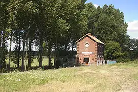 Old railroad station | |
 Coat of arms | |
Location of Camblain-l’Abbé 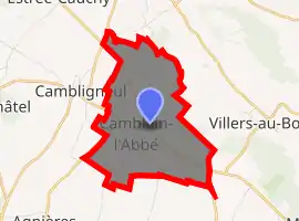
| |
 Camblain-l’Abbé 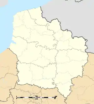 Camblain-l’Abbé | |
| Coordinates: 50°22′26″N 2°38′16″E | |
| Country | France |
| Region | Hauts-de-France |
| Department | Pas-de-Calais |
| Arrondissement | Arras |
| Canton | Avesnes-le-Comte |
| Intercommunality | CC Campagnes de l'Artois |
| Government | |
| • Mayor (2008–2014) | Pierre-Albert Mayeur |
| Area 1 | 5.61 km2 (2.17 sq mi) |
| Population (2017-01-01)[1] | 650 |
| • Density | 120/km2 (300/sq mi) |
| Time zone | UTC+01:00 (CET) |
| • Summer (DST) | UTC+02:00 (CEST) |
| INSEE/Postal code | 62199 /62690 |
| Elevation | 103–161 m (338–528 ft) (avg. 112 m or 367 ft) |
| 1 French Land Register data, which excludes lakes, ponds, glaciers > 1 km2 (0.386 sq mi or 247 acres) and river estuaries. | |
Geography
A farming village located 9 miles (15 km) northwest of Arras at the junction of the D341 with the D73E.
Population
| Year | 1962 | 1968 | 1975 | 1982 | 1990 | 1999 |
|---|---|---|---|---|---|---|
| Population | 366 | 390 | 448 | 561 | 615 | 653 |
| From the year 1962 on: No double counting—residents of multiple communes (e.g. students and military personnel) are counted only once. | ||||||
Places of interest
- The church of St.Pierre, dating from the sixteenth century.
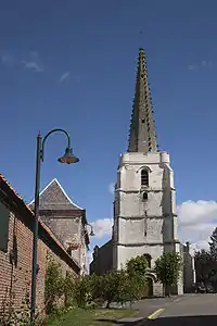
The church
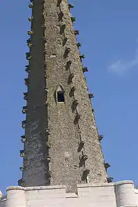
Details of the church spire
References
- "Populations légales 2017". INSEE. Retrieved 6 January 2020.
| Wikimedia Commons has media related to Camblain-l'Abbé. |
| Authority control |
|---|
This article is issued from Wikipedia. The text is licensed under Creative Commons - Attribution - Sharealike. Additional terms may apply for the media files.