National Register of Historic Places listings in Andover, Massachusetts
This is a list of the National Register of Historic Places listings in Andover, Massachusetts.
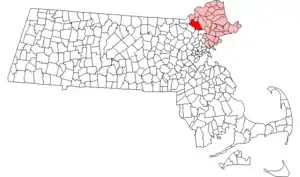
Location of Andover in Massachusetts
This is intended to be a complete list of the properties and districts on the National Register of Historic Places in Andover, Massachusetts, United States. The locations of National Register properties and districts for which the latitude and longitude coordinates are included below, may be seen in a Google map.[1]
Essex County, of which Andover is a part, is the location of 461 properties and districts listed on the National Register. Andover itself is the location of 51 of these properties and districts listed on the National Register.[2]
- This National Park Service list is complete through NPS recent listings posted January 29, 2021.[3]
Current listings
| [4] | Name on the Register[2] | Image | Date listed[5] | Location | City or town | Description |
|---|---|---|---|---|---|---|
| 1 | Abbot Tavern | 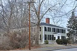 Abbot Tavern |
June 10, 1982 (#82004810) |
70 Elm St. 42°39′38″N 71°08′13″W |
Andover | |
| 2 | Asa and Sylvester Abbot House | 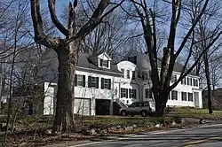 Asa and Sylvester Abbot House |
June 10, 1982 (#82004833) |
15-17 Porter Rd. 42°38′21″N 71°08′08″W |
Andover | Incorrectly listed on the register at 15-17 Andover Street. |
| 3 | Benjamin Abbot House |  Benjamin Abbot House |
February 24, 1975 (#75000242) |
9 Andover St. 42°38′47″N 71°09′11″W |
Andover | |
| 4 | J. T. Abbot House | 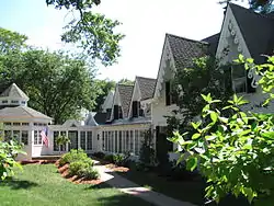 J. T. Abbot House |
June 10, 1982 (#82004814) |
34 Essex St. 42°39′23″N 71°08′37″W |
Andover | |
| 5 | Abbot-Baker House | 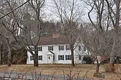 Abbot-Baker House |
June 10, 1982 (#82004811) |
5 Argilla Rd. 42°38′49″N 71°09′12″W |
Andover | |
| 6 | Abbot-Battles House | 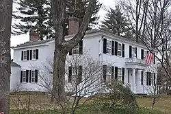 Abbot-Battles House |
June 10, 1982 (#82001905) |
31 Lowell St. 42°40′17″N 71°09′15″W |
Andover | |
| 7 | Abbot-Stinson House | 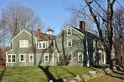 Abbot-Stinson House |
March 9, 1990 (#90000190) |
6 Stinson Rd. 42°38′15″N 71°07′20″W |
Andover | |
| 8 | Academy Hill Historic District | 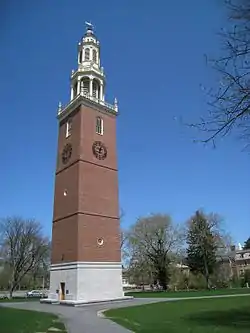 Academy Hill Historic District |
October 7, 1982 (#82000475) |
MA 28 42°38′48″N 71°08′07″W |
Andover | Encompasses Phillips Academy, Abbot Academy, Andover Theological Seminary. |
| 9 | Andover National Bank | 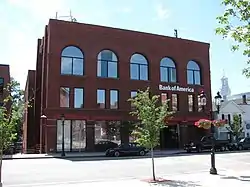 Andover National Bank |
June 10, 1982 (#82001907) |
23 Main St. 42°39′20″N 71°08′26″W |
Andover | |
| 10 | Andover Town Hall |  Andover Town Hall |
June 10, 1982 (#82004961) |
20 Main St. 42°39′21″N 71°08′25″W |
Andover | |
| 11 | Andover Village Industrial District | 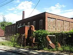 Andover Village Industrial District |
October 7, 1982 (#82000476) |
MA 28 42°39′20″N 71°08′54″W |
Andover | |
| 12 | Arden | 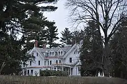 Arden |
June 10, 1982 (#82004812) |
276 N. Main St. 42°40′05″N 71°08′57″W |
Andover | |
| 13 | Timothy P. Bailey House | 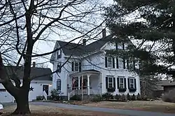 Timothy P. Bailey House |
June 10, 1982 (#82004828) |
210 Chandler Rd. 42°40′45″N 71°12′23″W |
Andover | |
| 14 | Ballardvale District | 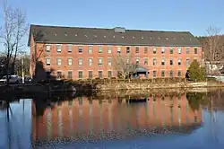 Ballardvale District |
October 7, 1982 (#82000477) |
Off Interstate 93 42°37′33″N 71°09′34″W |
Andover | |
| 15 | Barnard Block | 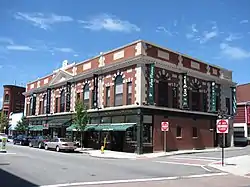 Barnard Block |
June 10, 1982 (#82004803) |
10-16 Main St. 42°39′22″N 71°08′26″W |
Andover | |
| 16 | Blanchard-Upton House | 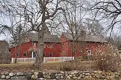 Blanchard-Upton House |
March 9, 1990 (#90000192) |
7 Hearthstone Pl. 42°37′53″N 71°11′16″W |
Andover | Listed at 62 Osgood St. |
| 17 | Bradlee School |  Bradlee School |
June 10, 1982 (#82004829) |
147 Andover St. 42°37′50″N 71°09′45″W |
Andover | |
| 18 | Central Street District | 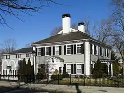 Central Street District |
October 7, 1982 (#82000478) |
Irregular Pattern along Central St. 42°39′06″N 71°08′41″W |
Andover | |
| 19 | Chandler-Bigsby-Abbot House | 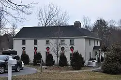 Chandler-Bigsby-Abbot House |
June 10, 1982 (#82004830) |
88 Lowell St. 42°39′59″N 71°09′25″W |
Andover | |
| 20 | Chandler-Hidden House | 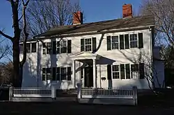 Chandler-Hidden House |
June 10, 1982 (#82004832) |
17 Hidden Rd. 42°38′28″N 71°08′01″W |
Andover | |
| 21 | Chickering House | 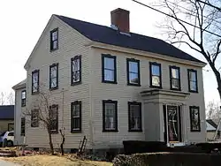 Chickering House |
June 10, 1982 (#82004831) |
28 Essex St. 42°39′22″N 71°08′34″W |
Andover | |
| 22 | Jehiel Cochran House | 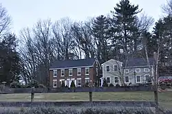 Jehiel Cochran House |
June 10, 1982 (#82004827) |
65 Burnham Rd. 42°40′10″N 71°08′32″W |
Andover | Incorrectly listed on the register at 63 Burnham Rd. |
| 23 | Dascomb House | 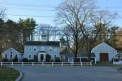 Dascomb House |
June 10, 1982 (#82004826) |
125 Dascomb Rd. 42°37′39″N 71°10′34″W |
Andover | |
| 24 | Flint Farm | 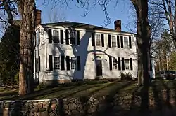 Flint Farm |
June 10, 1982 (#82004825) |
85 Osgood St. 42°38′02″N 71°11′19″W |
Andover | |
| 25 | Follansbee House | 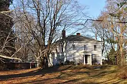 Follansbee House |
June 10, 1982 (#82004485) |
459 Lowell St. 42°38′36″N 71°12′34″W |
Andover | |
| 26 | William Foster House |  William Foster House |
March 9, 1990 (#90000191) |
96 Central St. 42°38′50″N 71°08′48″W |
Andover | |
| 27 | Nathan Frye House | 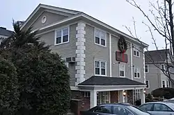 Nathan Frye House |
June 10, 1982 (#82004824) |
166 N. Main St. 42°39′42″N 71°08′42″W |
Andover | |
| 28 | David Gray House | 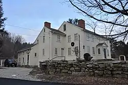 David Gray House |
June 10, 1982 (#82004823) |
232 Salem St. 42°37′59″N 71°06′39″W |
Andover | |
| 29 | Sarah H. Harding House | 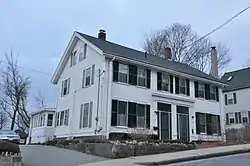 Sarah H. Harding House |
June 10, 1982 (#82004822) |
6-8 Harding St. 42°39′47″N 71°08′39″W |
Andover | |
| 30 | Harnden Farm | 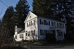 Harnden Farm |
June 10, 1982 (#82004821) |
261 Salem St. 42°37′52″N 71°06′32″W |
Andover | |
| 31 | Holt Farm | 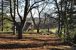 Holt Farm |
June 10, 1982 (#82004819) |
89 Prospect Rd. 42°38′17″N 71°06′34″W |
Andover | |
| 32 | Holt-Cummings-Davis House | 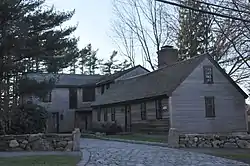 Holt-Cummings-Davis House |
June 10, 1982 (#82004820) |
67 Salem St. 42°38′38″N 71°07′31″W |
Andover | |
| 33 | Benjamin Jenkins House | 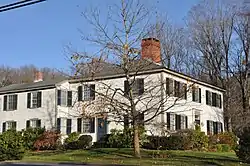 Benjamin Jenkins House |
June 10, 1982 (#82004818) |
362 Salem St. 42°37′24″N 71°05′39″W |
Andover | |
| 34 | The Lincolnshire | 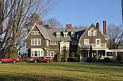 The Lincolnshire |
June 10, 1982 (#82004804) |
22 Hidden Rd. and 28 Hidden Way 42°38′25″N 71°07′58″W |
Andover | |
| 35 | Main Street-Locke Street Historic District | 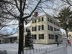 Main Street-Locke Street Historic District |
October 7, 1982 (#82000479) |
Main Street and Locke Street 42°39′09″N 71°08′19″W |
Andover | Listed as "Main Street-Locke". |
| 36 | Manning House | 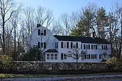 Manning House |
June 10, 1982 (#82004817) |
37 Porter Rd. 42°38′20″N 71°08′20″W |
Andover | |
| 37 | Memorial Hall Library | 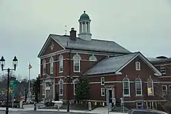 Memorial Hall Library |
June 10, 1982 (#82004805) |
2 N. Main St. 42°39′24″N 71°08′29″W |
Andover | |
| 38 | Musgrove Block |  Musgrove Block |
June 10, 1982 (#82004816) |
2 Main St. 42°39′25″N 71°08′27″W |
Andover | |
| 39 | Orlando |  Orlando |
June 10, 1982 (#82004815) |
260 N. Main St. 42°40′02″N 71°08′59″W |
Andover | Location of the private Lanam Club. |
| 40 | Osgood Farm | 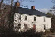 Osgood Farm |
June 10, 1982 (#82004806) |
116 Osgood St. 42°38′12″N 71°11′33″W |
Andover | |
| 41 | Abiel Pearson House | 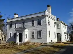 Abiel Pearson House |
June 10, 1982 (#82004807) |
33 High St. 42°39′36″N 71°08′29″W |
Andover | |
| 42 | William Perrin House | 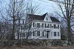 William Perrin House |
June 10, 1982 (#82004799) |
464 River Rd. 42°39′17″N 71°14′48″W |
Andover | |
| 43 | Pillsbury-French House | 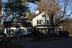 Pillsbury-French House |
June 10, 1982 (#82004800) |
103 Dascomb Rd. 42°37′48″N 71°10′27″W |
Andover | |
| 44 | Benjamin Punchard House | 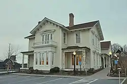 Benjamin Punchard House |
June 10, 1982 (#82004801) |
8 High St. 42°39′26″N 71°08′29″W |
Andover | |
| 45 | Rogers-Downing House | 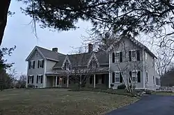 Rogers-Downing House |
June 10, 1982 (#82004802) |
269 Highland Rd. 42°39′35″N 71°07′10″W |
Andover | |
| 46 | Russell House | 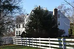 Russell House |
June 10, 1982 (#82004808) |
28 Rocky Hill Rd. 42°37′05″N 71°07′14″W |
Andover | |
| 47 | Shawsheen Village Historic District |  Shawsheen Village Historic District |
February 9, 1979 (#79000328) |
MA 133 42°40′22″N 71°08′51″W |
Andover | |
| 48 | Third Railroad Station |  Third Railroad Station |
June 10, 1982 (#82004809) |
100 School St. 42°39′23″N 71°08′43″W |
Andover | |
| 49 | Richard Ward House | 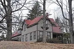 Richard Ward House |
June 10, 1982 (#82004962) |
71 Lowell St. 42°40′04″N 71°09′25″W |
Andover | |
| 50 | West Parish Center District | 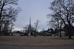 West Parish Center District |
October 7, 1982 (#82000480) |
MA 133 42°39′26″N 71°09′56″W |
Andover | |
| 51 | Woodbridge House | 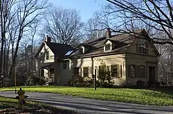 Woodbridge House |
June 10, 1982 (#82004813) |
293 Salem St. 42°37′40″N 71°06′20″W |
Andover | Misspelled "Woodridge" in the National Register. |
See also
| Wikimedia Commons has media related to National Register of Historic Places in Andover, Massachusetts. |
References
- The latitude and longitude information provided in this table was derived originally from the National Register Information System, which has been found to be fairly accurate for about 99% of listings. Some locations in this table may have been corrected to current GPS standards.
- "National Register Information System". National Register of Historic Places. National Park Service. April 24, 2008.
- "National Register of Historic Places: Weekly List Actions". National Park Service, United States Department of the Interior. Retrieved on January 29, 2021.
- Numbers represent an alphabetical ordering by significant words. Various colorings, defined here, differentiate National Historic Landmarks and historic districts from other NRHP buildings, structures, sites or objects.
- The eight-digit number below each date is the number assigned to each location in the National Register Information System database, which can be viewed by clicking the number.
External links
- Andover Historic Society database of historic properties
- Andover Historic Society list of historic districts
| Topics | 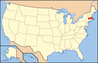 | ||||||||||||||||
|---|---|---|---|---|---|---|---|---|---|---|---|---|---|---|---|---|---|
| Lists by county | |||||||||||||||||
| Lists by city |
| ||||||||||||||||
| Other lists | |||||||||||||||||
| |||||||||||||||||
This article is issued from Wikipedia. The text is licensed under Creative Commons - Attribution - Sharealike. Additional terms may apply for the media files.