National Register of Historic Places listings in Essex County, Massachusetts
This list is of that portion of the National Register of Historic Places (NRHP) designated in Essex County, Massachusetts. The locations of these properties and districts for which the latitude and longitude coordinates are included below, may be seen in a map.[1]
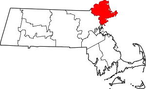
There are more than 450 designated properties in the county, including 25 that are further designated as National Historic Landmarks. The municipalities of Andover, Gloucester, Ipswich, Lawrence, Lynn, Methuen, and Salem are to be found on a separate list(s) of the more than 200 identified here, except two properties are split between Methuen and Lawrence, and one between Lynn and Nahant; these entries appear on more than one list.
- This National Park Service list is complete through NPS recent listings posted January 29, 2021.[2]
Cities and towns listed separately
Due to the number of listings in the county, some cities and towns have their sites listed separately.
| Community | Image | First Date listed | Last Date listed | Count |
|---|---|---|---|---|
| Andover |  |
February 24, 1975 | March 9, 1990 | 51 |
| Gloucester |  |
July 1, 1970 | December 20, 2016 | 34 |
| Ipswich | .jpg.webp) |
October 15, 1966 | August 22, 1996 | 31 |
| Lawrence |  |
November 9, 1972 | March 12, 2012 | 24 |
| Lynn |  |
November 28, 1978 | June 27, 2014 | 28 |
| Methuen | 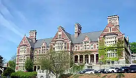 |
December 1, 1978 | January 3, 1985 | 45 |
| Salem |  |
October 15, 1966 | July 27, 2015 | 46 |
Current listings in other cities and towns
| [3] | Name on the Register[4] | Image | Date listed[5] | Location | City or town | Description |
|---|---|---|---|---|---|---|
| 1 | Abbot Hall |  Abbot Hall |
September 6, 1974 (#74000374) |
Washington Sq. 42°30′09″N 70°51′10″W |
Marblehead | |
| 2 | Abraham Adams House | _101)_99)_hdr.jpg.webp) Abraham Adams House |
March 9, 1990 (#90000245) |
8 Pearson Dr. 42°45′17″N 70°55′43″W |
Newbury | |
| 3 | Adams-Clarke House |  Adams-Clarke House |
March 9, 1990 (#90000211) |
93 W. Main St. 42°43′42″N 70°59′43″W |
Georgetown | |
| 4 | Agawam Diner |  Agawam Diner |
September 22, 1999 (#99001124) |
166 Newburyport Turnpike 42°42′17″N 70°54′37″W |
Rowley | |
| 5 | Amesbury and Salisbury Mills Village Historic District |  Amesbury and Salisbury Mills Village Historic District |
May 16, 1985 (#85001121) |
Market Sq. roughly bounded by Boardman, Water, Main and Pond Sts. 42°51′28″N 70°55′52″W |
Amesbury | |
| 6 | Amesbury Friends Meeting House |  Amesbury Friends Meeting House |
April 18, 2002 (#02000376) |
120 Friend St. 42°51′18″N 70°56′19″W |
Amesbury | |
| 7 | Ann's Diner | 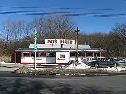 Ann's Diner |
December 10, 2003 (#03001264) |
11 Bridge Rd. (U.S. Route 1) 42°50′24″N 70°51′40″W |
Salisbury | |
| 8 | Asbury Grove Historic District | 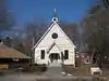 Asbury Grove Historic District |
November 18, 2009 (#09000935) |
Around Asbury St. 42°37′35″N 70°53′09″W |
Hamilton | |
| 9 | John Balch House | 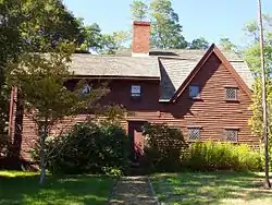 John Balch House |
February 23, 1973 (#73000275) |
448 Cabot St. 42°33′44″N 70°53′05″W |
Beverly | |
| 10 | Parson Barnard House | 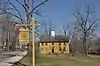 Parson Barnard House |
September 6, 1974 (#74000918) |
179 Osgood St. 42°41′23″N 71°07′02″W |
North Andover | Once thought to belong to Simon and Anne Bradstreet |
| 11 | Beverly Center Business District | 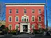 Beverly Center Business District |
July 5, 1984 (#84002313) |
Roughly bounded by Chapman, Central, Brown, Dane, and Essex Sts. 42°32′54″N 70°52′41″W |
Beverly | |
| 12 | Beverly Depot | .jpg.webp) Beverly Depot |
October 14, 1979 (#09000087) |
Park Street 42°32′51″N 70°53′07″W |
Beverly | |
| 13 | Beverly Depot-Odell Park Historic District |  Beverly Depot-Odell Park Historic District |
January 8, 2014 (#13001056) |
Roughly bounded by River, Rantoul & Pleasant Sts., Broadway 42°32′50″N 70°53′05″W |
Beverly | |
| 14 | Beverly Grammar School |  Beverly Grammar School |
March 9, 1990 (#90000198) |
50 Essex St. 42°33′06″N 70°52′34″W |
Beverly | |
| 15 | Beverly Powder House | Beverly Powder House |
August 15, 2019 (#100004267) |
Rear Madison Ave. 42°33′12″N 70°52′31″W |
Beverly | |
| 16 | Boardman House |  Boardman House |
October 15, 1966 (#66000131) |
Howard St. 42°28′20″N 71°02′17″W |
Saugus | |
| 17 | John Boardman House |  John Boardman House |
March 9, 1990 (#90000361) |
28 Lawrence Rd. 42°39′56″N 71°01′28″W |
Boxford | |
| 18 | Boxford Village Historic District |  Boxford Village Historic District |
April 11, 1973 (#73000279) |
Middleton and Topsfield Rds. and Main and Elm Sts. 42°39′43″N 70°59′58″W |
Boxford | |
| 19 | Bradford Burial Ground |  Bradford Burial Ground |
June 15, 2015 (#15000351) |
326 Salem St. 42°45′34″N 71°03′49″W |
Haverhill | |
| 20 | Bradford Common Historic District |  Bradford Common Historic District |
September 14, 1977 (#77000179) |
S. Main St. 42°45′59″N 71°04′45″W |
Haverhill | |
| 21 | Breakheart Reservation Parkways-Metropolitan Park System of Greater Boston |  Breakheart Reservation Parkways-Metropolitan Park System of Greater Boston |
August 11, 2003 (#03000748) |
Forest St., Pine Tops, Elm and Hemlock Rds. 42°29′15″N 71°02′05″W |
Saugus | Extends into Wakefield in Middlesex County. |
| 22 | Briggs Carriage Company |  Briggs Carriage Company |
April 3, 2017 (#100000822) |
14 & 20 Cedar St. 42°51′41″N 70°55′40″W |
Amesbury | |
| 23 | Brown House |  Brown House |
March 9, 1990 (#90000223) |
76 Bridge St. 42°36′58″N 70°51′06″W |
Hamilton | |
| 24 | Brown Square House |  Brown Square House |
March 7, 1975 (#75000284) |
11 Brown Sq. 42°48′40″N 70°52′27″W |
Newburyport | |
| 25 | Austin Brown House |  Austin Brown House |
March 9, 1990 (#90000222) |
1028 Bay Rd. 42°38′26″N 70°50′55″W |
Hamilton | |
| 26 | David Burnham House |  David Burnham House |
July 30, 1983 (#83000574) |
Pond St. 42°36′57″N 70°48′07″W |
Essex | |
| 27 | Capt. John Cabot House |  Capt. John Cabot House |
April 16, 1975 (#75000246) |
117 Cabot St. 42°32′45″N 70°52′49″W |
Beverly | |
| 28 | Parson Capen House |  Parson Capen House |
October 15, 1966 (#66000139) |
Howlett St. 42°38′36″N 70°57′00″W |
Topsfield | |
| 29 | Carlton-Frie-Tucker House |  Carlton-Frie-Tucker House |
March 9, 1990 (#90000251) |
140 Mill Rd. 42°39′28″N 71°06′00″W |
North Andover | |
| 30 | Chaplin-Clarke House |  Chaplin-Clarke House |
May 10, 1979 (#79000343) |
109 Haverhill St. 42°42′33″N 70°53′32″W |
Rowley | |
| 31 | Samuel Chase House |  Samuel Chase House |
March 9, 1990 (#90000273) |
154 Main St. 42°47′17″N 71°00′06″W |
West Newbury | |
| 32 | Claflin-Richards House |  Claflin-Richards House |
April 3, 1973 (#73000853) |
132 Main St. 42°36′14″N 70°53′16″W |
Wenham | |
| 33 | Cogswell's Grant |  Cogswell's Grant |
April 19, 1990 (#90000666) |
60 Spring St. 42°38′18″N 70°46′22″W |
Essex | |
| 34 | Benjamin Coker House |  Benjamin Coker House |
March 9, 1990 (#90000247) |
172 State St. 42°48′05″N 70°52′31″W |
Newburyport | |
| 35 | Community House | 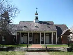 Community House |
May 11, 2011 (#11000265) |
284 Bay Rd. 42°36′47″N 70°52′21″W |
Hamilton | |
| 36 | Exercise Conant House | 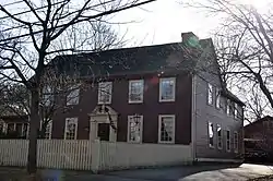 Exercise Conant House |
March 9, 1990 (#90000199) |
634 Cabot St. 42°34′33″N 70°53′47″W |
Beverly | |
| 37 | Samuel Corning House | 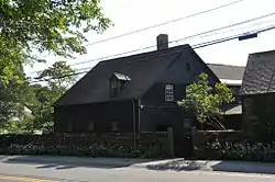 Samuel Corning House |
March 9, 1990 (#90000196) |
87 Hull St. 42°34′49″N 70°50′23″W |
Beverly | |
| 38 | Caleb Cushing House | 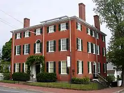 Caleb Cushing House |
November 7, 1973 (#73000327) |
98 High St. 42°48′24″N 70°52′16″W |
Newburyport | |
| 39 | Dalton House |  Dalton House |
March 29, 1978 (#78000464) |
95 State St. 42°48′29″N 70°52′18″W |
Newburyport | |
| 40 | Ephraim Davis House |  Ephraim Davis House |
March 9, 1990 (#90000228) |
Merrimack Rd., north of its junction with Amesbury Line Rd. 42°48′45″N 71°00′33″W |
Haverhill | |
| 41 | Derby Summerhouse |  Derby Summerhouse |
November 24, 1968 (#68000020) |
Magna Estate, Ingersoll St. 42°34′22″N 70°58′00″W |
Danvers | |
| 42 | Dickinson-Pillsbury-Witham House |  Dickinson-Pillsbury-Witham House |
March 9, 1990 (#90000210) |
170 Jewett St. 42°43′44″N 70°56′42″W |
Georgetown | |
| 43 | Dodge Building |  Dodge Building |
August 26, 1982 (#82001878) |
19-23 Pleasant St. 42°48′36″N 70°52′50″W |
Newburyport | |
| 44 | Dustin House |  Dustin House |
March 9, 1990 (#90000227) |
665 Hilldale Ave. 42°47′47″N 71°06′41″W |
Haverhill | |
| 45 | East Parish Meeting House |  East Parish Meeting House |
March 29, 2011 (#11000149) |
150 Middle Rd. 42°48′01″N 71°02′01″W |
Haverhill | |
| 46 | Emerson House |  Emerson House |
March 9, 1990 (#90000229) |
5-9 Pentucket St. 42°46′44″N 71°04′47″W |
Haverhill | |
| 47 | Essex Town Hall and TOHP Burnham Library |  Essex Town Hall and TOHP Burnham Library |
September 12, 2007 (#07000946) |
30 Martin St. 42°37′54″N 70°47′00″W |
Essex | |
| 48 | Estey Tavern |  Estey Tavern |
October 12, 1989 (#89001587) |
Central and Maple Sts. at MA 114 42°35′43″N 71°00′57″W |
Middleton | |
| 49 | Nathaniel Felton Houses |  Nathaniel Felton Houses |
April 1, 1982 (#82001882) |
43 Felton St. (Jr.) and 47 Felton St. (Sr.) 42°32′44″N 70°57′40″W |
Peabody | |
| 50 | First Religious Society Church and Parish Hall |  First Religious Society Church and Parish Hall |
April 2, 1976 (#76000278) |
26 Pleasant St. 42°48′39″N 70°52′18″W |
Newburyport | |
| 51 | First Unitarian Church |  First Unitarian Church |
September 18, 1989 (#88001091) |
7 Park St. 42°31′28″N 70°55′38″W |
Peabody | |
| 52 | Fish Flake Hill Historic District |  Fish Flake Hill Historic District |
October 26, 1971 (#71000082) |
Northern and southern sides of Front St. from Cabot to Bartlett Sts. 42°32′29″N 70°53′02″W |
Beverly | |
| 53 | Flint Public Library | 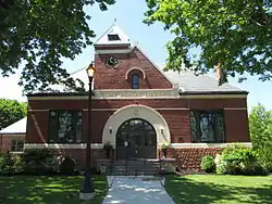 Flint Public Library |
June 14, 2002 (#02000631) |
2 N. Main St. 42°35′41″N 71°01′01″W |
Middleton | |
| 54 | Fort Sewall |  Fort Sewall |
April 14, 1975 (#75001908) |
Fort Sewall Promontory 42°30′32″N 70°50′30″W |
Marblehead | |
| 55 | Gen. Gideon Foster House |  Gen. Gideon Foster House |
June 23, 1976 (#76000287) |
35 Washington St. 42°31′22″N 70°55′30″W |
Peabody | |
| 56 | Phineas Foster House |  Phineas Foster House |
March 9, 1990 (#90000193) |
11 Old Topsfield Rd. 42°38′56″N 70°58′50″W |
Boxford | Listed on the Register at 15 Old Topsfield Rd. |
| 57 | Stephen Foster House |  Stephen Foster House |
March 9, 1990 (#90000262) |
109 North St. 42°39′35″N 70°56′02″W |
Topsfield | |
| 58 | Fowler House | 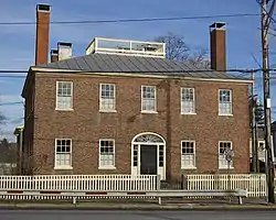 Fowler House |
September 17, 1974 (#74000367) |
166 High St. 42°33′22″N 70°55′29″W |
Danvers | |
| 59 | Rea Putnam Fowler House | .jpg.webp) Rea Putnam Fowler House |
March 9, 1990 (#90000202) |
4 Elerton Pl. 42°34′37″N 70°56′09″W |
Danvers | |
| 60 | Fox Hill School |  Fox Hill School |
February 10, 1988 (#87002554) |
81 Water St. 42°33′01″N 70°55′24″W |
Danvers | |
| 61 | French-Andrews House | 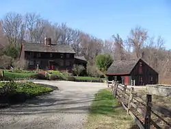 French-Andrews House |
March 9, 1990 (#90000263) |
86 Howlett Rd. 42°38′33″N 70°56′18″W |
Topsfield | |
| 62 | James Friend House |  James Friend House |
March 9, 1990 (#90000268) |
114 Cedar St. 42°35′46″N 70°54′23″W |
Wenham | |
| 63 | Samuel Frye House |  Samuel Frye House |
March 9, 1990 (#90000252) |
920 Turnpike St. 42°39′25″N 71°06′14″W |
North Andover | |
| 64 | Joseph Fuller House |  Joseph Fuller House |
March 9, 1990 (#90000244) |
161 Essex St. 42°37′03″N 71°02′11″W |
Middleton | |
| 65 | Lieut. Thomas Fuller House |  Lieut. Thomas Fuller House |
March 9, 1990 (#90000242) |
Old S. Main St. between Mt. Vernon and Boston Sts. 42°35′32″N 71°00′49″W |
Middleton | |
| 66 | Georgetown Central School |  Georgetown Central School |
August 30, 2001 (#01000915) |
1 Library St. 42°43′21″N 70°59′38″W |
Georgetown | Currently serves as Georgetown's Town Hall. |
| 67 | Elbridge Gerry House | 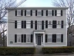 Elbridge Gerry House |
July 2, 1973 (#73000304) |
44 Washington St. 42°30′24″N 70°50′52″W |
Marblehead | |
| 68 | George Giddings House and Barn |  George Giddings House and Barn |
March 9, 1990 (#90000206) |
66 Choate St. 42°38′47″N 70°48′24″W |
Essex | |
| 69 | Gen. John Glover House | 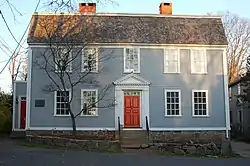 Gen. John Glover House |
November 28, 1972 (#72001101) |
11 Glover St. 42°30′19″N 70°50′51″W |
Marblehead | |
| 70 | Gott House |  Gott House |
March 9, 1990 (#90000255) |
Gott Ave. at Gott Ln. 42°41′14″N 70°37′53″W |
Rockport | |
| 71 | Capt. Joseph Gould House |  Capt. Joseph Gould House |
March 9, 1990 (#90000259) |
129 Washington St. 42°38′30″N 70°58′02″W |
Topsfield | |
| 72 | Zaccheus Gould House |  Zaccheus Gould House |
March 9, 1990 (#90000261) |
85 River Road 42°38′00″N 70°57′38″W |
Topsfield | Listed on the register at 73 Prospect Street; property has been subdivided |
| 73 | Granite Keystone Bridge |  Granite Keystone Bridge |
August 27, 1981 (#81000117) |
Granite St. 42°40′01″N 70°37′33″W |
Rockport | |
| 74 | Greenlawn Cemetery |  Greenlawn Cemetery |
May 11, 2000 (#00000481) |
195 Nahant Rd. 42°25′37″N 70°55′41″W |
Nahant | |
| 75 | Reverend John Hale House |  Reverend John Hale House |
October 9, 1974 (#74000364) |
39 Hale St. 42°32′56″N 70°52′30″W |
Beverly | |
| 76 | Hale-Boynton House |  Hale-Boynton House |
April 14, 1983 (#83000578) |
Middle St. 42°45′05″N 70°54′03″W |
Newbury | |
| 77 | Hamilton Historic District |  Hamilton Historic District |
April 13, 1973 (#73000300) |
540-700 and 563-641 Bay Rd. 42°37′21″N 70°51′14″W |
Hamilton | |
| 78 | Joseph Hardy House |  Joseph Hardy House |
March 9, 1990 (#90000219) |
69 King St.[6] 42°45′30″N 71°01′23″W |
Groveland | Listed at 93 King Street. |
| 79 | Harris Farm |  Harris Farm |
March 9, 1990 (#90000241) |
3 Manataug Trail 42°30′27″N 70°52′09″W |
Marblehead | |
| 80 | Hart House |  Hart House |
March 9, 1990 (#90000239) |
172 Chestnut St. 42°32′26″N 71°03′46″W |
Lynnfield | |
| 81 | Hastings-Morse House |  Hastings-Morse House |
March 14, 1991 (#90000225) |
595 E. Broadway 42°47′51″N 71°01′04″W |
Haverhill | |
| 82 | Haverhill Board of Trade Building |  Haverhill Board of Trade Building |
September 28, 2007 (#07001008) |
16-18 and 38-42 Walnut St. 42°46′32″N 71°05′22″W |
Haverhill | |
| 83 | Haverhill Historical Society Historic District |  Haverhill Historical Society Historic District |
June 8, 2005 (#05000560) |
240 Water St. 42°46′21″N 71°04′03″W |
Haverhill | |
| 84 | Charles H. Hayes Building |  Charles H. Hayes Building |
December 13, 2010 (#10001006) |
14-44 Granite St. 42°46′27″N 71°05′07″W |
Haverhill | |
| 85 | Hazen-Kimball-Aldrich House |  Hazen-Kimball-Aldrich House |
March 9, 1990 (#90000209) |
225 E. Main St. 42°42′59″N 70°58′32″W |
Georgetown | |
| 86 | Hazen-Spiller House |  Hazen-Spiller House |
March 9, 1990 (#90000226) |
8 Groveland St. 42°46′13″N 71°03′49″W |
Haverhill | |
| 87 | Henfield House |  Henfield House |
March 4, 1991 (#90000240) |
300 Main St. 42°32′06″N 71°03′34″W |
Lynnfield | |
| 88 | Hickey-Osborne Block |  Hickey-Osborne Block |
September 19, 1985 (#85002416) |
38-60 Main St. 42°31′32″N 70°55′33″W |
Peabody | |
| 89 | High Street Cemetery |  High Street Cemetery |
May 9, 2003 (#03000382) |
45 High St. 42°33′50″N 70°56′04″W |
Danvers | |
| 90 | Oliver Wendell Holmes House | .jpg.webp) Oliver Wendell Holmes House |
November 28, 1972 (#72001301) |
868 Hale St. 42°33′52″N 70°48′23″W |
Beverly | |
| 91 | Holyoke-French House |  Holyoke-French House |
April 26, 1972 (#72000123) |
Elm St. and Topsfield Rd. 42°39′41″N 70°59′50″W |
Boxford | |
| 92 | Robert "King" Hooper Mansion |  Robert "King" Hooper Mansion |
May 12, 1976 (#76000264) |
8 Hooper St. 42°28′34″N 70°51′01″W |
Marblehead | |
| 93 | George Hopkinson House |  George Hopkinson House |
March 9, 1990 (#90000220) |
362 Main St. 42°45′39″N 71°02′06″W |
Groveland | |
| 94 | Hose House No. 2 |  Hose House No. 2 |
July 3, 1986 (#86001461) |
30 Rantoul St. 42°32′35″N 70°53′09″W |
Beverly | |
| 95 | Hospital Point Light Station | 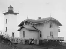 Hospital Point Light Station |
September 28, 1987 (#87002031) |
Bayview Ave. 42°32′40″N 70°51′30″W |
Beverly | |
| 96 | House at 922 Dale Street | 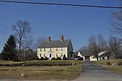 House at 922 Dale Street |
March 9, 1990 (#90000248) |
922 Dale St. 42°41′40″N 71°04′07″W |
North Andover | |
| 97 | Howe Village Historic District | 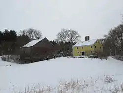 Howe Village Historic District |
April 3, 1973 (#73000282) |
Northeast of Boxford on MA 97 42°40′32″N 70°58′08″W |
Boxford | |
| 98 | Sir John Humphreys House | 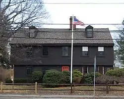 Sir John Humphreys House |
March 9, 1990 (#90000258) |
99 Paradise Rd. 42°28′21″N 70°55′06″W |
Swampscott | |
| 99 | Intervale Factory | 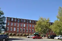 Intervale Factory |
June 30, 1988 (#88000958) |
402 River St. 42°45′56″N 71°05′52″W |
Haverhill | |
| 100 | Capt. Timothy Johnson House | 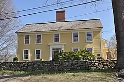 Capt. Timothy Johnson House |
March 9, 1990 (#90000249) |
18-20 Stevens St. 42°41′55″N 71°06′41″W |
North Andover | |
| 101 | Solomon Kimball House | 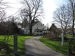 Solomon Kimball House |
March 9, 1990 (#90000264) |
26 Maple St. 42°36′03″N 70°55′13″W |
Wenham | |
| 102 | Kittredge Mansion | 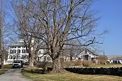 Kittredge Mansion |
December 12, 1976 (#76000282) |
56 Academy Rd. 42°41′26″N 71°06′51″W |
North Andover | |
| 103 | George Kunhardt Estate | 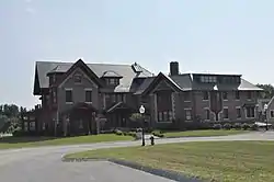 George Kunhardt Estate |
April 22, 1976 (#76000284) |
29-49 Cochichewick Drive 42°42′39″N 71°05′44″W |
North Andover | Listed on the register at 1518 Great Pond Road; since subdivided and converted to condominiums. |
| 104 | Stanley Lake House | 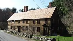 Stanley Lake House |
March 9, 1990 (#90000260) |
95 River Rd. 42°38′02″N 70°57′47″W |
Topsfield | |
| 105 | Thomas Lambert House | 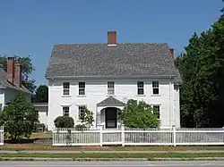 Thomas Lambert House |
March 9, 1990 (#90000256) |
142 Main St. 42°42′54″N 70°52′51″W |
Rowley | |
| 106 | Larch Farm | 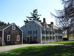 Larch Farm |
March 9, 1990 (#90000266) |
38 Larch Rd. 42°36′08″N 70°52′45″W |
Wenham | |
| 107 | Jeremiah Lee House | 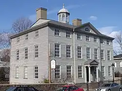 Jeremiah Lee House |
October 15, 1966 (#66000766) |
Washington St. 42°30′12″N 70°51′06″W |
Marblehead | |
| 108 | L.H. Hamel Leather Company Historic District | 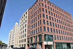 L.H. Hamel Leather Company Historic District |
February 18, 2009 (#09000032) |
Bounded by Essex, Locke, Duncan, and Winter Sts., and the former Boston and Maine railroad tracks 42°46′34″N 71°05′09″W |
Haverhill | |
| 109 | William Livermore House | 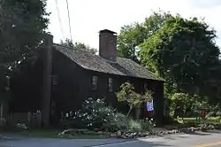 William Livermore House |
March 9, 1990 (#90000197) |
271 Essex St. 42°34′00″N 70°51′41″W |
Beverly | |
| 110 | Henry Cabot Lodge House | 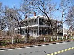 Henry Cabot Lodge House |
December 8, 1976 (#76001971) |
5 Cliff St. 42°25′18″N 70°54′39″W |
Nahant | |
| 111 | Lowell's Boat Shop | .jpg.webp) Lowell's Boat Shop |
June 9, 1988 (#88000706) |
459 Main St. 42°50′32″N 70°54′52″W |
Amesbury | |
| 112 | Machine Shop Village District | 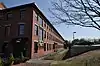 Machine Shop Village District |
October 14, 1982 (#82000482) |
Roughly bounded by Main, Pleasant, Clarendon, Water, 2nd Sts., and B&M railroad line 42°41′59″N 71°07′37″W |
North Andover | |
| 113 | Macy-Colby House | _-_Amesbury%252C_Massachusetts.JPG.webp) Macy-Colby House |
June 16, 2008 (#08000531) |
257 Main St. 42°50′45″N 70°55′46″W |
Amesbury | |
| 114 | Main Street Historic District | 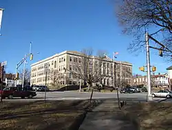 Main Street Historic District |
May 9, 2003 (#03000383) |
Main, Summer Sts. 42°46′42″N 71°04′42″W |
Haverhill | |
| 115 | Manchester Village Historic District |  Manchester Village Historic District |
January 8, 1990 (#89002156) |
Roughly Friend, School, North, Washington, Sea, Union, Central, Bennett, Bridge Sts., and Ashland Ave. 42°34′28″N 70°46′21″W |
Manchester | |
| 116 | Marblehead Historic District | 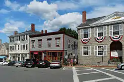 Marblehead Historic District |
January 10, 1984 (#84002402) |
Roughly bounded by Marblehead Harbor, Waldron Court, Essex, Elm, Pond, and Norman Sts. 42°30′15″N 70°50′58″W |
Marblehead | |
| 117 | Marblehead Light | 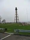 Marblehead Light |
June 15, 1987 (#87001479) |
Marblehead Neck 42°30′03″N 70°49′54″W |
Marblehead | |
| 118 | Samuel March House |  Samuel March House |
March 9, 1990 (#90000272) |
444 Main St. 42°48′11″N 70°59′07″W |
West Newbury | |
| 119 | Market Square Historic District | 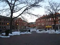 Market Square Historic District |
February 25, 1971 (#71000088) |
Market Sq. and properties fronting on State, Merrimac, Liberty, and Water Sts. 42°48′40″N 70°52′13″W |
Newburyport | |
| 120 | Meetinghouse Common District |  Meetinghouse Common District |
November 21, 1976 (#76000260) |
Summer, S. Common, and Main Sts. 42°32′21″N 71°03′01″W |
Lynnfield | |
| 121 | Merrimack Associates Building | 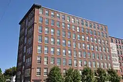 Merrimack Associates Building |
June 17, 2009 (#09000436) |
25 Locust St. 42°46′33″N 71°05′03″W |
Haverhill | |
| 122 | Moore-Hill House |  Moore-Hill House |
June 9, 1988 (#88000704) |
82 Franklin St. 42°31′41″N 70°56′07″W |
Peabody | |
| 123 | Timothy Morse House |  Timothy Morse House |
March 9, 1990 (#90000271) |
628 Main St. 42°48′25″N 70°58′06″W |
West Newbury | |
| 124 | Nahant Beach Boulevard-Metropolitan Park System of Greater Boston | Nahant Beach Boulevard-Metropolitan Park System of Greater Boston |
August 11, 2003 (#03000747) |
Nahant Beach Boulevard 42°26′12″N 70°56′17″W |
Nahant | Extends briefly into Lynn. |
| 125 | Nahant Civic Historic District | 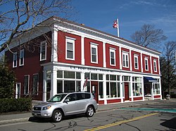 Nahant Civic Historic District |
September 3, 1991 (#91001174) |
332 and 334 Nahant Rd. and 15 Pleasant St. 42°25′27″N 70°54′51″W |
Nahant | |
| 126 | Nahant Life-Saving Station |  Nahant Life-Saving Station |
March 20, 2012 (#12000133) |
96 Nahant Rd. 42°25′51″N 70°56′01″W |
Nahant | |
| 127 | The New Hampshire | 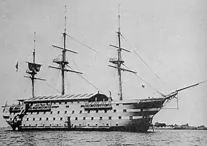 The New Hampshire |
October 29, 1976 (#76000261) |
Southeast of Manchester off Graves Island 42°34′14″N 70°44′44″W |
Manchester | Wreck of the USS New Hampshire |
| 128 | Newbury Historic District |  Newbury Historic District |
May 24, 1976 (#76000275) |
Irregular pattern along High Rd., Green and Hanover Sts. 42°47′51″N 70°51′44″W |
Newbury | |
| 129 | Newburyport Harbor Front Range Light |  Newburyport Harbor Front Range Light |
June 15, 1987 (#87001486) |
Merrimack River Coast Guard Station 42°47′54″N 70°48′35″W |
Newburyport | |
| 130 | Newburyport Harbor Light | 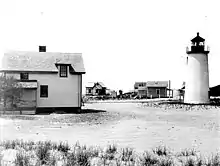 Newburyport Harbor Light |
June 15, 1987 (#87001485) |
Northern Boulevard 42°48′55″N 70°49′08″W |
Newburyport | |
| 131 | Newburyport Harbor Rear Range Light | 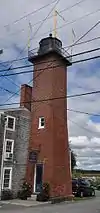 Newburyport Harbor Rear Range Light |
June 15, 1987 (#87000887) |
61½ Water St. 42°47′38″N 70°48′26″W |
Newburyport | |
| 132 | Newburyport Historic District | 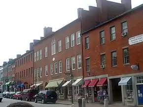 Newburyport Historic District |
August 2, 1984 (#84002411) |
Roughly bounded by the Merrimack River, Plummer Ave., Marlboro, Plummer, State, and High Sts. 42°48′41″N 70°52′40″W |
Newburyport | |
| 133 | Newell Farm | 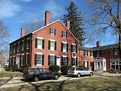 Newell Farm |
July 21, 1978 (#78001406) |
243 Main St. 42°47′33″N 70°59′50″W |
West Newbury | |
| 134 | Newman-Fiske-Dodge House |  Newman-Fiske-Dodge House |
March 9, 1990 (#90000267) |
162 Cherry St. 42°36′13″N 70°54′54″W |
Wenham | |
| 135 | North Andover Center Historic District |  North Andover Center Historic District |
March 5, 1979 (#79000336) |
Roughly bounded by Osgood, Pleasant, Stevens, Johnson, and Andover Sts. and Wood Lane 42°41′15″N 71°06′55″W |
North Andover | |
| 136 | James Noyes House |  James Noyes House |
March 9, 1990 (#90000246) |
7 Parker St. 42°47′51″N 70°51′46″W |
Newbury | |
| 137 | Odd Fellows' Hall |  Odd Fellows' Hall |
November 20, 1978 (#78001408) |
188-194 Cabot St. 42°32′52″N 70°52′48″W |
Beverly | |
| 138 | Old Castle |  Old Castle |
September 1, 1978 (#78000466) |
North of Rockport on MA 127 42°40′35″N 70°37′31″W |
Rockport | |
| 139 | Old Farm |  Old Farm |
March 9, 1990 (#90000265) |
9 Maple St. 42°35′55″N 70°55′03″W |
Wenham | |
| 140 | Old Garrison House |  Old Garrison House |
March 4, 1991 (#90000254) |
188 Granite St. 42°40′51″N 70°37′41″W |
Rockport | |
| 141 | Old Town House |  Old Town House |
August 13, 1976 (#76000265) |
Town House Sq. 42°30′19″N 70°51′01″W |
Marblehead | |
| 142 | Olmsted Subdivision Historic District |  Olmsted Subdivision Historic District |
July 1, 2002 (#02000696) |
Roughly bounded by New Ocean Paradise Rd., Swampscott Ave., Redington Rd. and Burrill St. 42°28′18″N 70°54′56″W |
Swampscott | |
| 143 | Prince Osborne House |  Prince Osborne House |
March 9, 1990 (#90000203) |
273 Maple St. 42°34′25″N 70°57′15″W |
Danvers | |
| 144 | Osgood Hill |  Osgood Hill |
February 5, 1999 (#99000135) |
709 and 723 Osgood St. 42°42′35″N 71°06′45″W |
North Andover | Locally known as the Stevens Estate |
| 145 | Col. John Osgood House |  Col. John Osgood House |
March 9, 1990 (#90000250) |
547 Osgood St. 42°42′03″N 71°06′42″W |
North Andover | |
| 146 | Samuel Osgood House |  Samuel Osgood House |
December 30, 1974 (#74000380) |
440 Osgood St. 42°41′50″N 71°06′53″W |
North Andover | |
| 147 | O'Shea Building |  O'Shea Building |
January 11, 1980 (#09000710) |
1-15 Main St. 42°31′32″N 70°55′36″W |
Peabody | |
| 148 | Palmer School |  Palmer School |
February 20, 1998 (#98000122) |
33 Main St. 42°39′32″N 71°00′10″W |
Boxford | |
| 149 | Emeline Patch House |  Emeline Patch House |
March 9, 1990 (#90000221) |
918 Bay Rd. 42°38′42″N 70°50′42″W |
Hamilton | |
| 150 | Peabody Central Fire Station |  Peabody Central Fire Station |
April 11, 1979 (#79000344) |
41 Lowell St. 42°31′38″N 70°55′52″W |
Peabody | |
| 151 | Peabody City Hall |  Peabody City Hall |
July 27, 1972 (#72000142) |
24 Lowell St. 42°31′35″N 70°55′44″W |
Peabody | |
| 152 | Peabody Civic Center Historic District |  Peabody Civic Center Historic District |
November 25, 1980 (#80000477) |
Chestnut, Church, Foster, Franklin, and Lowell Sts. 42°31′32″N 70°55′48″W |
Peabody | |
| 153 | Peabody Institute |  Peabody Institute |
December 22, 1997 (#97001559) |
15 Sylvan St. 42°33′41″N 70°56′30″W |
Danvers | |
| 154 | Peabody Institute Library | 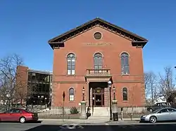 Peabody Institute Library |
June 4, 1973 (#73000311) |
Main St. 42°31′29″N 70°55′28″W |
Peabody | |
| 155 | Peabody School |  Peabody School |
October 23, 1986 (#86002900) |
170 Salem St. 42°45′48″N 71°04′15″W |
Haverhill | |
| 156 | George Peabody House | George Peabody House |
July 6, 1988 (#88000911) |
205 Washington St. 42°31′16″N 70°56′10″W |
Peabody | |
| 157 | John Perkins House |  John Perkins House |
March 9, 1990 (#90000269) |
75 Arbor St. 42°36′49″N 70°53′19″W |
Wenham | Probably demolished. |
| 158 | Platts-Bradstreet House |  Platts-Bradstreet House |
September 27, 1980 (#80000645) |
Main St. 42°43′07″N 70°52′31″W |
Rowley | |
| 159 | Primrose Street Schoolhouse | 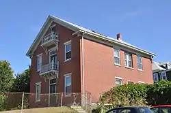 Primrose Street Schoolhouse |
June 23, 1983 (#83000582) |
71 Primrose St. 42°46′45″N 71°05′06″W |
Haverhill | |
| 160 | John Proctor House | 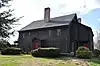 John Proctor House |
March 9, 1990 (#90000253) |
348 Lowell St. 42°32′01″N 70°57′16″W |
Peabody | |
| 161 | Deacon Edward Putnam Jr. House |  Deacon Edward Putnam Jr. House |
March 9, 1990 (#90000243) |
9 Gregory St. 42°35′40″N 70°59′34″W |
Middleton | Incorrectly listed on the register at 4 Gregory St. |
| 162 | Gen. Israel Putnam House | 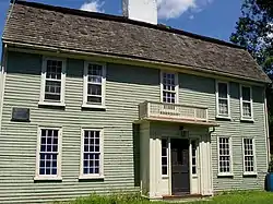 Gen. Israel Putnam House |
April 30, 1976 (#76000235) |
431 Maple St. 42°34′57″N 70°58′02″W |
Danvers | |
| 163 | James Putnam Jr. House |  James Putnam Jr. House |
March 9, 1990 (#90000205) |
42 Summer St. 42°34′33″N 70°56′58″W |
Danvers | |
| 164 | Rea-Proctor Homestead |  Rea-Proctor Homestead |
June 2, 1982 (#82001915) |
180 Conant Road 42°34′13″N 70°54′53″W |
Danvers | |
| 165 | Ridgewood Cemetery |  Ridgewood Cemetery |
February 8, 2016 (#15001049) |
177 Salem St. 42°40′49″N 71°06′09″W |
North Andover | |
| 166 | River Road-Cross Street Historic District |  River Road-Cross Street Historic District |
May 26, 2005 (#05000465) |
Cross, Prospect Sts., River, Salem Rds. 42°37′59″N 70°57′35″W |
Topsfield | |
| 167 | Rockport Downtown Main Street Historic District |  Rockport Downtown Main Street Historic District |
May 28, 1976 (#76000288) |
Portions of Main, Cleaves, Jewett, and School Sts. 42°39′29″N 70°37′11″W |
Rockport | |
| 168 | Rockport High School |  Rockport High School |
May 30, 1997 (#97000498) |
4 Broadway 42°39′28″N 70°37′03″W |
Rockport | |
| 169 | Old Rockport High School |  Old Rockport High School |
May 12, 2004 (#04000424) |
58 Broadway 42°39′19″N 70°37′22″W |
Rockport | |
| 170 | Rocks Village Historic District |  Rocks Village Historic District |
December 12, 1976 (#76001967) |
Northeast of Haverhill at the Merrimack River 42°48′33″N 71°00′08″W |
Haverhill | |
| 171 | Rocky Hill Meetinghouse and Parsonage |  Rocky Hill Meetinghouse and Parsonage |
April 11, 1972 (#72000115) |
4 Old Portsmouth Rd. 42°51′02″N 70°54′39″W |
Amesbury | |
| 172 | Rowley Village Forge Site | 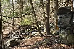 Rowley Village Forge Site |
March 2, 2001 (#01000201) |
Between Middleton and Topsfield Rds.[7] 42°38′52″N 70°59′25″W |
Boxford | |
| 173 | St. Michael's Church | 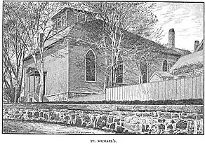 St. Michael's Church |
June 18, 1973 (#73000305) |
26 Pleasant St. 42°30′15″N 70°51′05″W |
Marblehead | |
| 174 | Salem Village Historic District | 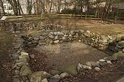 Salem Village Historic District |
January 31, 1975 (#75000252) |
Irregular pattern along Centre, Hobart, Ingersoll, and Collins Sts., as far north as Brentwood Circle, and south to Mello Parkway 42°34′00″N 70°57′38″W |
Danvers | |
| 175 | Samuel Brown School | 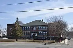 Samuel Brown School |
August 12, 2009 (#09000611) |
200 Lynn St. 42°30′13″N 70°57′08″W |
Peabody | |
| 176 | Saugus Iron Works National Historic Site | 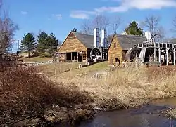 Saugus Iron Works National Historic Site |
October 15, 1966 (#66000047) |
Off U.S. Route 1 42°28′04″N 71°00′32″W |
Saugus | |
| 177 | Saugus Town Hall |  Saugus Town Hall |
June 20, 1985 (#85001332) |
Central St. 42°27′54″N 71°00′35″W |
Saugus | |
| 178 | Sawyer House | 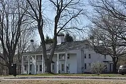 Sawyer House |
March 9, 1990 (#90000194) |
21 Endicott Rd. 42°37′41″N 70°58′39″W |
Boxford | |
| 179 | School Street School | 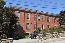 School Street School |
October 23, 1986 (#86002922) |
40 School St. 42°46′30″N 71°04′18″W |
Haverhill | |
| 180 | Seaside Park |  Seaside Park |
June 8, 2011 (#11000333) |
Atlantic Ave. 42°29′46″N 70°51′30″W |
Marblehead | |
| 181 | Second O'Shea Building | 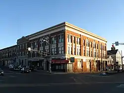 Second O'Shea Building |
March 27, 1980 (#80004237) |
9-13 Peabody Sq. 42°31′32″N 70°55′40″W |
Peabody | |
| 182 | Sewall-Scripture House |  Sewall-Scripture House |
September 30, 1982 (#82001902) |
40 King St. 42°39′27″N 70°37′37″W |
Rockport | |
| 183 | Hazadiah Smith House |  Hazadiah Smith House |
March 9, 1990 (#90000200) |
337 Cabot St. 42°33′16″N 70°52′43″W |
Beverly | |
| 184 | Soldiers and Sailors Memorial Building | 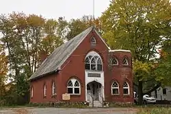 Soldiers and Sailors Memorial Building |
August 22, 2016 (#16000544) |
363 Main St. 42°47′59″N 70°59′28″W |
West Newbury | |
| 185 | Southwick House |  Southwick House |
November 29, 1983 (#83003974) |
151 Lowell St. 42°31′50″N 70°56′12″W |
Peabody | |
| 186 | Spencer-Pierce-Little House | _-_Newbury%252C_Massachusetts.JPG.webp) Spencer-Pierce-Little House |
November 24, 1968 (#68000043) |
Little's Lane 42°47′39″N 70°51′15″W |
Newbury | |
| 187 | Spofford-Barnes House |  Spofford-Barnes House |
September 6, 1974 (#74000366) |
Kelsey Rd. 42°41′01″N 70°59′06″W |
Boxford | |
| 188 | Sprague House |  Sprague House |
July 2, 1987 (#87001108) |
59 Endicott St. 42°33′00″N 70°55′38″W |
Danvers | |
| 189 | State Lunatic Hospital at Danvers | 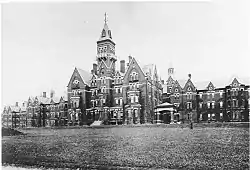 State Lunatic Hospital at Danvers |
January 26, 1984 (#84002436) |
450 Maple St. 42°34′58″N 70°58′30″W |
Danvers | |
| 190 | Abiel Stevens House |  Abiel Stevens House |
June 23, 1983 (#83000585) |
280 Salem St. 42°40′50″N 71°06′00″W |
North Andover | |
| 191 | Story Grammar School | 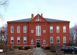 Story Grammar School |
March 13, 1986 (#86000378) |
140 Elm St. 42°30′16″N 70°51′19″W |
Marblehead | |
| 192 | Straightsmouth Island Light | 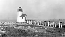 Straightsmouth Island Light |
June 15, 1987 (#87001487) |
Straightsmouth Island 42°39′31″N 70°35′10″W |
Rockport | |
| 193 | Superior Courthouse and Bartlett Mall | 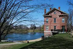 Superior Courthouse and Bartlett Mall |
April 30, 1976 (#76000280) |
Bounded by High, Pond, Auburn, and Greenleaf Sts. 42°48′07″N 70°52′30″W |
Newburyport | |
| 194 | Sutton Block | 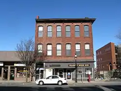 Sutton Block |
September 5, 1985 (#85002012) |
76-78 Main St. 42°31′30″N 70°55′32″W |
Peabody | |
| 195 | Swampscott Cemetery | Swampscott Cemetery |
March 6, 2013 (#13000051) |
400 Essex St. 42°29′00″N 70°54′47″W |
Swampscott | |
| 196 | Swampscott Fish House | 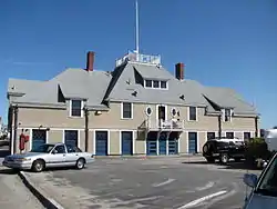 Swampscott Fish House |
May 16, 1985 (#85001120) |
Humphrey St. 42°28′03″N 70°54′37″W |
Swampscott | |
| 197 | Swampscott Railroad Depot | 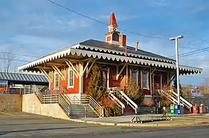 Swampscott Railroad Depot |
August 28, 1998 (#98001106) |
10 Railroad Ave. 42°28′25″N 70°55′22″W |
Swampscott | |
| 198 | Tavern Acres Historic District | 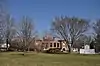 Tavern Acres Historic District |
September 29, 1995 (#95001134) |
Bounded by Bradstreet Rd., Green and Main Sts., and Park Way 42°41′42″N 71°07′34″W |
North Andover | |
| 199 | Elihu Thomson House |  Elihu Thomson House |
January 7, 1976 (#76002002) |
33 Elmwood Ave. 42°28′11″N 70°55′08″W |
Swampscott | |
| 200 | Capt. John Thorndike House | 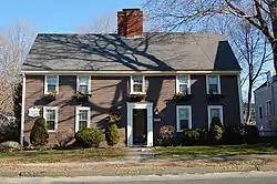 Capt. John Thorndike House |
March 9, 1990 (#90000195) |
184 Hale St. 42°34′49″N 70°50′23″W |
Beverly | |
| 201 | Benaiah Titcomb House | 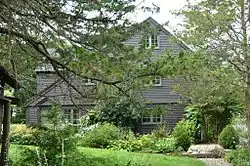 Benaiah Titcomb House |
March 9, 1990 (#90000208) |
189 John Wise Ave. 42°39′05″N 70°47′49″W |
Essex | |
| 202 | Topsfield Town Common District |  Topsfield Town Common District |
June 7, 1976 (#03001488) |
N. Common, E. Common, S. Common, W. Common, High St. Ext., Washington, Main, High, and Howlett Sts. 42°38′32″N 70°57′04″W |
Topsfield | |
| 203 | Towne Farm |  Towne Farm |
August 1, 2012 (#12000455) |
55 Towne Rd. 42°39′28″N 71°01′35″W |
Boxford | |
| 204 | Rev. John Tufts House |  Rev. John Tufts House |
March 9, 1990 (#90000270) |
750 Main St. 42°48′29″N 70°57′24″W |
West Newbury | |
| 205 | Twin Lights Historic District-Cape Ann Light Station | .jpg.webp) Twin Lights Historic District-Cape Ann Light Station |
October 7, 1971 (#71000355) |
1 mi (1.6 km) east of Rockport on Thacher Island 42°38′15″N 70°34′36″W |
Rockport | |
| 206 | Union Congregational Church |  Union Congregational Church |
November 5, 2014 (#14000894) |
350-354 Main St. 42°50′30″N 70°55′26″W |
Amesbury | |
| 207 | United Shoe Machinery Corporation Clubhouse |  United Shoe Machinery Corporation Clubhouse |
November 26, 1982 (#82000484) |
134 McKay St. 42°33′52″N 70°53′43″W |
Beverly | |
| 208 | US Customhouse | 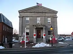 US Customhouse |
February 25, 1971 (#71000089) |
25 Water St. 42°48′44″N 70°52′09″W |
Newburyport | |
| 209 | US Post Office-Beverly Main | 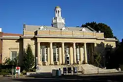 US Post Office-Beverly Main |
June 4, 1986 (#86001210) |
161 Rantoul St. 42°32′50″N 70°53′04″W |
Beverly | |
| 210 | US Post Office-Newburyport Main | 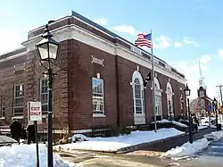 US Post Office-Newburyport Main |
June 18, 1986 (#86001341) |
61 Pleasant St. 42°48′38″N 70°52′22″W |
Newburyport | |
| 211 | Walker Body Company Factory | 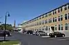 Walker Body Company Factory |
September 28, 2007 (#07000512) |
Oak St. at River Court 42°51′10″N 70°55′27″W |
Amesbury | |
| 212 | Washington Street Historic District | 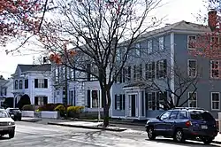 Washington Street Historic District |
September 12, 1985 (#85002380) |
Washington, Main, Holton and Sewall Sts. 42°31′23″N 70°55′28″W |
Peabody | |
| 213 | Washington Street Shoe District |  Washington Street Shoe District |
October 14, 1976 (#76000257) |
Washington, Wingate, Emerson Sts. Railroad and Washington Sqs. 42°46′25″N 71°05′05″W |
Haverhill | |
| 214 | Wenham Historic District | 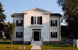 Wenham Historic District |
April 13, 1973 (#73000852) |
Both sides of Main St. between Beverly and Hamilton city lines 42°35′53″N 70°53′20″W |
Wenham | |
| 215 | White-Preston House | 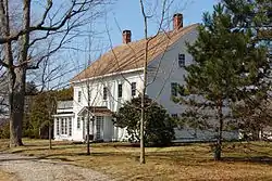 White-Preston House |
March 9, 1990 (#90000204) |
592 Maple St. 42°35′28″N 70°58′50″W |
Danvers | |
| 216 | John Greenleaf Whittier House |  John Greenleaf Whittier House |
October 15, 1966 (#66000792) |
86 Friend St. 42°51′20″N 70°56′08″W |
Amesbury | |
| 217 | Winter Street School | 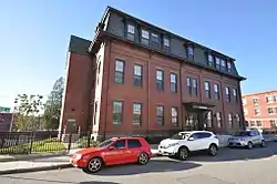 Winter Street School |
April 10, 2017 (#100000849) |
165 Winter St. 42°46′40″N 71°05′02″W |
Haverhill | |
| 218 | Woodberry-Quarrels House | 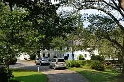 Woodberry-Quarrels House |
March 9, 1990 (#90000224) |
180 Bridge St. 42°36′55″N 70°50′42″W |
Hamilton | |
| 219 | Peter Woodbury House |  Peter Woodbury House |
March 9, 1990 (#90000201) |
82 Dodge St. 42°34′42″N 70°53′22″W |
Beverly |
See also
| Wikimedia Commons has media related to National Register of Historic Places in Essex County, Massachusetts. |
References
- The latitude and longitude information provided in this table was derived originally from the National Register Information System, which has been found to be fairly accurate for about 99% of listings. Some locations in this table may have been corrected to current GPS standards.
- "National Register of Historic Places: Weekly List Actions". National Park Service, United States Department of the Interior. Retrieved on January 29, 2021.
- Numbers represent an alphabetical ordering by significant words. Various colorings, defined here, differentiate National Historic Landmarks and historic districts from other NRHP buildings, structures, sites or objects.
- "National Register Information System". National Register of Historic Places. National Park Service. April 24, 2008.
- The eight-digit number below each date is the number assigned to each location in the National Register Information System database, which can be viewed by clicking the number.
- MACRIS record for Joseph Hardy House
- Location derived from NRIS-provided coordinates; the NRIS lists the site as "Address Restricted" but provides the coordinates
| Topics | 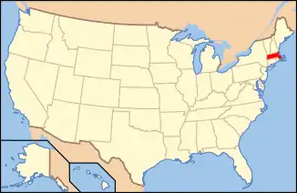 | ||||||||||||||||
|---|---|---|---|---|---|---|---|---|---|---|---|---|---|---|---|---|---|
| Lists by county | |||||||||||||||||
| Lists by city |
| ||||||||||||||||
| Other lists | |||||||||||||||||
| |||||||||||||||||
Municipalities and communities of Essex County, Massachusetts, United States | ||
|---|---|---|
| Cities | | |
| Towns | ||
| CDPs | ||
| Other villages | ||
| ||