National Register of Historic Places listings in Wakefield, Massachusetts
This is a list of properties and historic districts in Wakefield, Massachusetts, that are listed on the National Register of Historic Places.
The locations of National Register properties and districts (at least for all showing latitude and longitude coordinates below) may be seen in an online map by clicking on "Map of all coordinates".[1]
- This National Park Service list is complete through NPS recent listings posted January 29, 2021.[2]
Current listings
| [3] | Name on the Register | Image | Date listed[4] | Location | City or town | Description |
|---|---|---|---|---|---|---|
| 1 | Beacon Street Tomb | Beacon Street Tomb |
July 6, 1989 (#89000714) |
Beacon St. 42°30′35″N 71°04′50″W |
||
| 2 | Beebe Homestead | 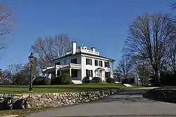 Beebe Homestead |
July 6, 1989 (#89000667) |
142 Main St. 42°31′01″N 71°04′28″W |
||
| 3 | E. Boardman House | 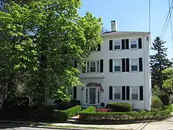 E. Boardman House |
July 6, 1989 (#89000686) |
34 Salem St. 42°30′31″N 71°04′07″W |
||
| 4 | Elizabeth Boit House | 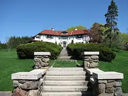 Elizabeth Boit House |
July 6, 1989 (#89000720) |
127 Chestnut St. 42°30′11″N 71°05′11″W |
||
| 5 | Breakheart Reservation Parkways-Metropolitan Park System of Greater Boston |  Breakheart Reservation Parkways-Metropolitan Park System of Greater Boston |
August 11, 2003 (#03000748) |
Forest St., Pine Tops, Elm and Hemlock Rds. 42°29′15″N 71°02′05″W |
Extends into Saugus in Essex County. | |
| 6 | Buildings at 35–37 Richardson Avenue | 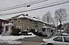 Buildings at 35–37 Richardson Avenue |
July 6, 1989 (#89000710) |
35–37 Richardson Ave. 42°30′08″N 71°04′24″W |
||
| 7 | Building at 38–48 Richardson Avenue | 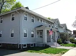 Building at 38–48 Richardson Avenue |
July 6, 1989 (#89000709) |
38–48 Richardson Ave. 42°30′05″N 71°04′30″W |
||
| 8 | Center Depot | 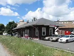 Center Depot |
July 6, 1989 (#89000693) |
57 Water St. 42°30′09″N 71°04′05″W |
||
| 9 | Church-Lafayette Streets Historic District | 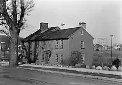 Church-Lafayette Streets Historic District |
July 6, 1989 (#89000757) |
Roughly Church St. from Lafayette St. to North Ave. 42°30′20″N 71°04′38″W |
||
| 10 | Common District |  Common District |
March 2, 1990 (#89000754) |
Roughly bounded by Lake Quannapowitt, Main St., Common St., Church St., and Lake Ave. 42°30′23″N 71°04′23″W |
||
| 11 | Jonas Cowdry House | 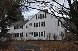 Jonas Cowdry House |
July 6, 1989 (#89000739) |
61 Prospect St. 42°30′18″N 71°05′08″W |
||
| 12 | Nathaniel Cowdry House | 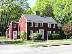 Nathaniel Cowdry House |
July 6, 1989 (#89000738) |
71 Prospect St. 42°30′17″N 71°05′10″W |
||
| 13 | Emerson-Franklin Poole House |  Emerson-Franklin Poole House |
July 6, 1989 (#89000685) |
23 Salem St. 42°30′31″N 71°04′10″W |
||
| 14 | Flanley's Block |  Flanley's Block |
July 6, 1989 (#89000729) |
349–353 Main St. 42°30′16″N 71°04′19″W |
||
| 15 | Captain Goodwin-James Eustis House |  Captain Goodwin-James Eustis House |
March 2, 1990 (#89000744) |
1 Elm St. 42°30′21″N 71°04′52″W |
Misspelled "Custis" in the National Register listing. | |
| 16 | Samuel Gould House |  Samuel Gould House |
July 6, 1989 (#89000704) |
48 Meriam St. 42°29′10″N 71°04′12″W |
||
| 17 | Green House |  Green House |
March 9, 1990 (#90000185) |
391 Vernon St. 42°31′23″N 71°03′53″W |
Duplicate listing for Capt. William Green House. | |
| 18 | Capt. William Green House | Capt. William Green House |
July 6, 1989 (#89000672) |
391 Vernon St. |
Duplicate listing for Green House. | |
| 19 | Deacon Daniel Green House |  Deacon Daniel Green House |
July 6, 1989 (#89000706) |
747 Main St. 42°29′29″N 71°04′10″W |
||
| 20 | Greenwood Union Church |  Greenwood Union Church |
July 6, 1989 (#89000697) |
Main and Oak 42°28′57″N 71°04′00″W |
||
| 21 | House at 18A and 20 Aborn Street |  House at 18A and 20 Aborn Street |
July 6, 1989 (#89000676) |
18A and 20 Aborn St. 42°30′45″N 71°04′20″W |
||
| 22 | House at 6 Adams Street |  House at 6 Adams Street |
July 6, 1989 (#89000721) |
6 Adams St. 42°30′07″N 71°05′13″W |
||
| 23 | House at 380 Albion Street |  House at 380 Albion Street |
July 6, 1989 (#89000711) |
380 Albion St. 42°29′32″N 71°05′08″W |
||
| 24 | House at 23 Avon Street |  House at 23 Avon Street |
July 6, 1989 (#89000730) |
23 Avon St. 42°30′15″N 71°04′26″W |
||
| 25 | House at 25 Avon Street |  House at 25 Avon Street |
July 6, 1989 (#89000731) |
25 Avon St. 42°30′15″N 71°04′29″W |
||
| 26 | House at 5 Bennett Street |  House at 5 Bennett Street |
July 6, 1989 (#89000698) |
5 Bennett St. 42°29′59″N 71°04′10″W |
||
| 27 | House at 15 Chestnut Street |  House at 15 Chestnut Street |
July 6, 1989 (#89000726) |
15 Chestnut St. 42°30′13″N 71°04′26″W |
||
| 28 | House at 21 Chestnut Street |  House at 21 Chestnut Street |
July 6, 1989 (#89000727) |
21 Chestnut St. 42°30′12″N 71°04′29″W |
||
| 29 | House at 95 Chestnut Street | 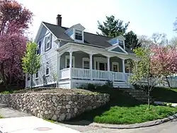 House at 95 Chestnut Street |
July 6, 1989 (#89000725) |
95 Chestnut St. 42°30′06″N 71°05′00″W |
||
| 30 | House at 39 Converse Street | 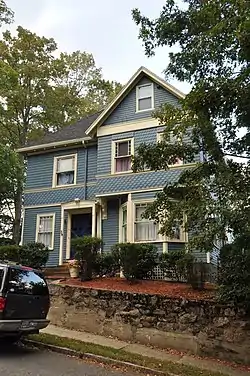 House at 39 Converse Street |
July 6, 1989 (#89000718) |
39 Converse St. 42°29′59″N 71°05′09″W |
||
| 31 | House at 28 Cordis Street | 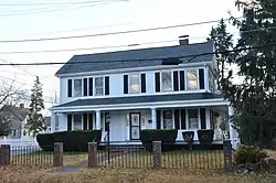 House at 28 Cordis Street |
July 6, 1989 (#89000675) |
28 Cordis St. 42°30′55″N 71°04′19″W |
||
| 32 | House at 40 Crescent Street | 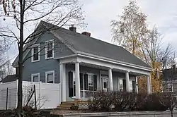 House at 40 Crescent Street |
July 6, 1989 (#89000691) |
40 Crescent St. 42°30′13″N 71°04′08″W |
||
| 33 | House at 26 Francis Avenue | 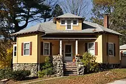 House at 26 Francis Avenue |
July 6, 1989 (#89000701) |
26 Francis Ave. 42°29′00″N 71°03′46″W |
||
| 34 | House at 118 Greenwood Street |  House at 118 Greenwood Street |
July 6, 1989 (#89000702) |
118 Greenwood St. 42°28′28″N 71°04′12″W |
||
| 35 | House at 20 Hancock Road |  House at 20 Hancock Road |
July 6, 1989 (#89000671) |
20 Hancock Rd. 42°31′05″N 71°04′25″W |
||
| 36 | House at 42 Hopkins Street |  House at 42 Hopkins Street |
July 6, 1989 (#89000732) |
42 Hopkins St. 42°30′13″N 71°05′48″W |
||
| 37 | House at 15 Lawrence Avenue |  House at 15 Lawrence Avenue |
July 6, 1989 (#89000682) |
15 Lawrence Ave. 42°30′37″N 71°04′14″W |
||
| 38 | House at 20 Lawrence Street |  House at 20 Lawrence Street |
July 6, 1989 (#89000680) |
20 Lawrence St. 42°30′36″N 71°04′11″W |
||
| 39 | House at 23 Lawrence Street |  House at 23 Lawrence Street |
July 6, 1989 (#89000681) |
23 Lawrence St. 42°30′40″N 71°04′10″W |
||
| 40 | House at 556 Lowell Street |  House at 556 Lowell Street |
July 6, 1989 (#89000670) |
556 Lowell St. 42°30′55″N 71°03′05″W |
||
| 41 | House at 190 Main Street |  House at 190 Main Street |
July 6, 1989 (#89000666) |
190 Main St. 42°30′49″N 71°04′27″W |
||
| 42 | House at 196 Main Street |  House at 196 Main Street |
July 6, 1989 (#89000668) |
196 Main St. 42°30′47″N 71°04′27″W |
||
| 43 | House at 1 Morrison Avenue |  House at 1 Morrison Avenue |
July 6, 1989 (#89000722) |
1 Morrison Ave. 42°30′03″N 71°05′18″W |
||
| 44 | House at 20 Morrison Road |  House at 20 Morrison Road |
July 6, 1989 (#89000724) |
20 Morrison Rd. 42°30′05″N 71°05′25″W |
||
| 45 | House at 32 Morrison Road |  House at 32 Morrison Road |
July 6, 1989 (#89000723) |
32 Morrison Rd. 42°30′01″N 71°05′20″W |
||
| 46 | House at 2 Nichols Street |  House at 2 Nichols Street |
July 6, 1989 (#89000740) |
2 Nichols St. 42°30′21″N 71°05′02″W |
||
| 47 | House at 509 North Avenue |  House at 509 North Avenue |
July 6, 1989 (#89000746) |
509 North Ave. 42°30′35″N 71°04′54″W |
||
| 48 | House at 52 Oak Street |  House at 52 Oak Street |
July 6, 1989 (#89000700) |
52 Oak St. 42°29′09″N 71°03′46″W |
||
| 49 | House at 8 Park Street |  House at 8 Park Street |
July 6, 1989 (#89000689) |
8 Park St. 42°30′23″N 71°04′15″W |
||
| 50 | House at 18 Park Street |  House at 18 Park Street |
July 6, 1989 (#89000690) |
18 Park St. 42°30′23″N 71°04′13″W |
||
| 51 | House at 22 Parker Road |  House at 22 Parker Road |
July 6, 1989 (#89000735) |
22 Parker Rd. 42°30′17″N 71°05′16″W |
||
| 52 | House at 88 Prospect Street |  House at 88 Prospect Street |
July 6, 1989 (#89000737) |
88 Prospect St. 42°30′14″N 71°05′10″W |
||
| 53 | House at 90 Prospect Street |  House at 90 Prospect Street |
July 6, 1989 (#89000736) |
90 Prospect St. 42°30′13″N 71°05′11″W |
||
| 54 | House at 7 Salem Street | 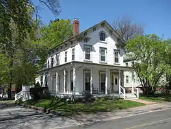 House at 7 Salem Street |
July 6, 1989 (#89000683) |
7 Salem St. 42°30′30″N 71°04′14″W |
||
| 55 | House at 19–21 Salem Street | 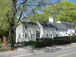 House at 19–21 Salem Street |
July 6, 1989 (#89000684) |
19–21 Salem St. 42°30′31″N 71°04′11″W |
||
| 56 | House at 38 Salem Street | 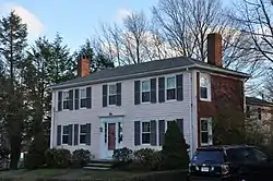 House at 38 Salem Street |
July 6, 1989 (#89000687) |
38 Salem St. 42°30′32″N 71°04′06″W |
||
| 57 | House at 113 Salem Street | 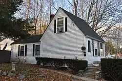 House at 113 Salem Street |
July 6, 1989 (#89000688) |
113 Salem St. 42°30′32″N 71°04′04″W |
||
| 58 | House at 13 Sheffield Road |  House at 13 Sheffield Road |
July 6, 1989 (#89000734) |
13 Sheffield Rd. 42°30′12″N 71°05′22″W |
||
| 59 | House at 30 Sheffield Road |  House at 30 Sheffield Road |
July 6, 1989 (#89000733) |
30 Sheffield Rd. 42°30′13″N 71°05′24″W |
||
| 60 | House at 54 Spring Street |  House at 54 Spring Street |
July 6, 1989 (#89000703) |
54 Spring St. 42°28′31″N 71°04′19″W |
||
| 61 | House at 193 Vernon Street |  House at 193 Vernon Street |
July 6, 1989 (#89000674) |
193 Vernon St. 42°30′41″N 71°04′01″W |
||
| 62 | House at 12 West Water Street | 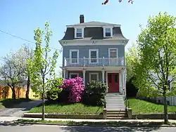 House at 12 West Water Street |
July 6, 1989 (#89000708) |
12 W. Water St. 42°30′07″N 71°04′17″W |
||
| 63 | House at 11 Wave Avenue |  House at 11 Wave Avenue |
July 6, 1989 (#89000678) |
11 Wave Ave. 42°30′40″N 71°04′15″W |
||
| 64 | House at 15 Wave Avenue | 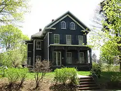 House at 15 Wave Avenue |
July 6, 1989 (#89000679) |
15 Wave Ave. 42°30′40″N 71°04′14″W |
||
| 65 | House at 9 White Avenue | 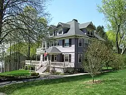 House at 9 White Avenue |
July 6, 1989 (#89000677) |
9 White Ave. 42°30′42″N 71°04′17″W |
||
| 66 | House at 28 Wiley Street | 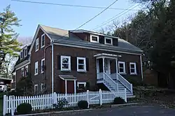 House at 28 Wiley Street |
July 6, 1989 (#89000695) |
28 Wiley St. 42°29′50″N 71°02′50″W |
||
| 67 | House at 1 Woodcrest Drive |  House at 1 Woodcrest Drive |
July 6, 1989 (#89000673) |
1 Woodcrest Dr. 42°31′11″N 71°03′51″W |
||
| 68 | Item Building |  Item Building |
July 6, 1989 (#89000712) |
26 Albion St. 42°30′11″N 71°04′19″W |
||
| 69 | Dr. Charles Jordan House |  Dr. Charles Jordan House |
July 6, 1989 (#89000716) |
9 Jordan Ave. 42°29′55″N 71°05′08″W |
||
| 70 | Deacon Thomas Kendall House |  Deacon Thomas Kendall House |
July 6, 1989 (#89000742) |
One Prospect St. 42°30′20″N 71°04′48″W |
||
| 71 | Lakeside Cemetery Chapel | 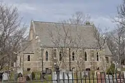 Lakeside Cemetery Chapel |
July 6, 1989 (#89000745) |
North Ave. 42°30′36″N 71°04′51″W |
||
| 72 | Lynnwood | 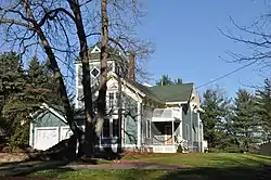 Lynnwood |
July 6, 1989 (#89000705) |
5 Linden Ave. 42°29′25″N 71°04′20″W |
||
| 73 | Massachusetts State Armory |  Massachusetts State Armory |
July 6, 1989 (#89000707) |
Main St. 42°30′05″N 71°04′13″W |
||
| 74 | Oliver House | 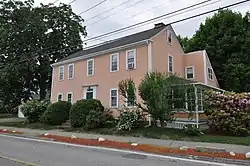 Oliver House |
April 15, 2014 (#14000157) |
58 Oak Street 42°29′10″N 71°03′44″W |
||
| 75 | Dr. S.O. Richardson House | 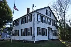 Dr. S.O. Richardson House |
July 6, 1989 (#89000696) |
694 Main St. 42°29′43″N 71°04′09″W |
||
| 76 | Dr. Thomas Simpson House |  Dr. Thomas Simpson House |
July 6, 1989 (#89000665) |
114 Main St. 42°31′06″N 71°04′35″W |
||
| 77 | South Reading Academy |  South Reading Academy |
July 6, 1989 (#89000713) |
7 Foster St. 42°30′11″N 71°04′19″W |
||
| 78 | St. Joseph's School |  St. Joseph's School |
July 6, 1989 (#89000749) |
15 Gould St. 42°30′02″N 71°04′45″W |
||
| 79 | William Stimpson House |  William Stimpson House |
July 6, 1989 (#89000741) |
22 Prospect St. 42°30′20″N 71°04′52″W |
||
| 80 | Daniel Sweetser House |  Daniel Sweetser House |
July 6, 1989 (#89000669) |
458 Lowell St. 42°31′00″N 71°03′32″W |
||
| 81 | Michael Sweetser House | 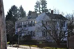 Michael Sweetser House |
July 6, 1989 (#89000699) |
15 Nahant St. 42°29′52″N 71°04′08″W |
||
| 82 | Temple Israel Cemetery | 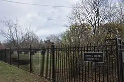 Temple Israel Cemetery |
July 6, 1989 (#89000753) |
North Ave. 42°30′33″N 71°04′49″W |
||
| 83 | D. Horace Tilton House |  D. Horace Tilton House |
July 6, 1989 (#89000715) |
379 Albion St. 42°29′34″N 71°05′09″W |
||
| 84 | US Post Office-Wakefield Main | 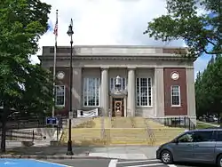 US Post Office-Wakefield Main |
October 19, 1987 (#86003439) |
321 Main St. 42°30′18″N 71°04′19″W |
||
| 85 | Wakefield Park | 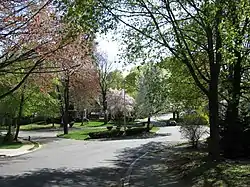 Wakefield Park |
March 2, 1990 (#89000755) |
Roughly Park Ave. between Summit Ave. and Chestnut St. 42°30′03″N 71°05′05″W |
A late 19th century "garden suburb" residential subdivision. | |
| 86 | Wakefield Rattan Co. | 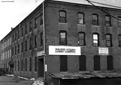 Wakefield Rattan Co. |
July 6, 1989 (#89000692) |
134 Water St. 42°30′11″N 71°03′59″W |
Buildings demolished in 2005. | |
| 87 | Wakefield Trust Company | 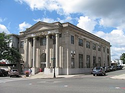 Wakefield Trust Company |
July 6, 1989 (#89000728) |
371 Main St. 42°30′14″N 71°04′17″W |
||
| 88 | Wakefield Upper Depot |  Wakefield Upper Depot |
July 6, 1989 (#89000719) |
27–29 Tuttle St. 42°30′07″N 71°04′35″W |
||
| 89 | H.M. Warren School | 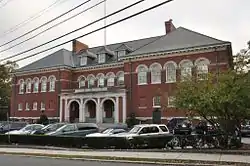 H.M. Warren School |
July 6, 1989 (#89000750) |
30 Converse St. 42°29′57″N 71°05′05″W |
||
| 90 | West Ward School | 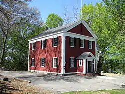 West Ward School |
July 6, 1989 (#89000748) |
39 Prospect St. 42°30′21″N 71°04′59″W |
||
| 91 | Suell Winn House | 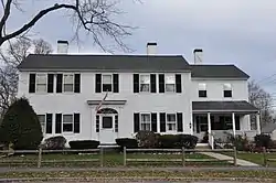 Suell Winn House |
July 6, 1989 (#89000743) |
72–74 Elm St. 42°30′33″N 71°05′04″W |
||
| 92 | Charles Winship House | 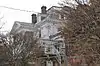 Charles Winship House |
July 6, 1989 (#89000717) |
13 Mansion Rd. 42°29′51″N 71°05′10″W |
||
| 93 | Woodville School | 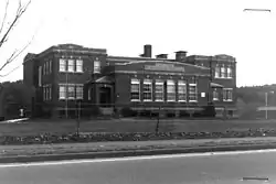 Woodville School |
July 6, 1989 (#89000694) |
Farm St. 42°29′52″N 71°03′04″W |
Listed building has been torn down. | |
| 94 | Woodward Homestead |  Woodward Homestead |
July 6, 1989 (#89000747) |
17 Main St. 42°31′27″N 71°04′46″W |
||
| 95 | Yale Avenue Historic District |  Yale Avenue Historic District |
July 6, 1989 (#89000756) |
16–25 Yale Ave. 42°30′18″N 71°04′25″W |
References
| Wikimedia Commons has media related to National Register of Historic Places in Wakefield, Massachusetts. |
- The latitude and longitude information provided in this table was derived originally from the National Register Information System, which has been found to be fairly accurate for about 99% of listings. Some locations in this table may have been corrected to current GPS standards.
- "National Register of Historic Places: Weekly List Actions". National Park Service, United States Department of the Interior. Retrieved on January 29, 2021.
- Numbers represent an alphabetical ordering by significant words. Various colorings, defined here, differentiate National Historic Landmarks and historic districts from other NRHP buildings, structures, sites or objects.
- The eight-digit number below each date is the number assigned to each location in the National Register Information System database, which can be viewed by clicking the number.
| Topics |  | ||||||||||||||||
|---|---|---|---|---|---|---|---|---|---|---|---|---|---|---|---|---|---|
| Lists by county | |||||||||||||||||
| Lists by city |
| ||||||||||||||||
| Other lists | |||||||||||||||||
| |||||||||||||||||
This article is issued from Wikipedia. The text is licensed under Creative Commons - Attribution - Sharealike. Additional terms may apply for the media files.