National Register of Historic Places listings in Somerville, Massachusetts
This is a list of properties and historic districts in Somerville, Massachusetts, that have been listed on the National Register of Historic Places.
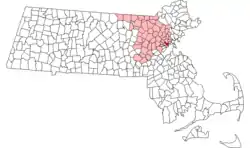
Location of Somerville in Massachusetts
The locations of National Register properties and districts (at least for all showing latitude and longitude coordinates below) may be seen in an online map by clicking on "Map of all coordinates".[1]
- This National Park Service list is complete through NPS recent listings posted February 5, 2021.[2]
Current listings
| [3] | Name on the Register | Image | Date listed[4] | Location | City or town | Description |
|---|---|---|---|---|---|---|
| 1 | Adams-Magoun House |  Adams-Magoun House |
September 18, 1989 (#89001239) |
438 Broadway 42°23′46″N 71°06′03″W |
Winter Hill | |
| 2 | Charles Adams-Woodbury Locke House |  Charles Adams-Woodbury Locke House |
September 18, 1989 (#89001240) |
178 Central St. 42°23′39″N 71°05′59″W |
Winter Hill | |
| 3 | Alewife Brook Parkway |  Alewife Brook Parkway |
March 13, 2004 (#04000249) |
Alewife Brook Parkway 42°24′34″N 71°07′50″W |
West Somerville | Extends into Cambridge |
| 4 | Almshouse | 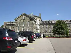 Almshouse |
April 13, 1982 (#82001908) |
45 Matignon Road, Cambridge[5] 42°24′08″N 71°07′57″W |
Property is mostly in Cambridge; building extends into Somerville. | |
| 5 | Clifton Bacon House | 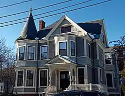 Clifton Bacon House |
September 18, 1989 (#89001244) |
27 Chester St. 42°23′39″N 71°07′26″W |
Davis Square | |
| 6 | Walter S. and Melissa E. Barnes House | 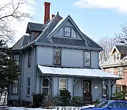 Walter S. and Melissa E. Barnes House |
March 8, 1990 (#89001266) |
140 Highland Ave. 42°23′17″N 71°06′12″W |
Central Hill | |
| 7 | Bow Street Historic District | 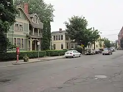 Bow Street Historic District |
March 26, 1976 (#76000274) |
Bow St. 42°22′53″N 71°05′54″W |
Union Square | |
| 8 | S. E. Brackett House | 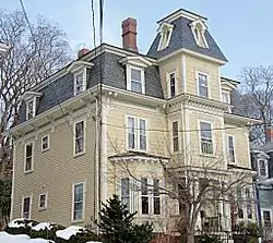 S. E. Brackett House |
September 18, 1989 (#89001252) |
63 Columbus Ave. 42°22′54″N 71°05′43″W |
Prospect Hill | |
| 9 | Broadway Winter Hill Congregational Church | 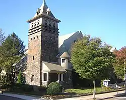 Broadway Winter Hill Congregational Church |
September 18, 1989 (#89001238) |
404 Broadway 42°23′42″N 71°05′58″W |
Winter Hill | |
| 10 | James H. Brooks House | 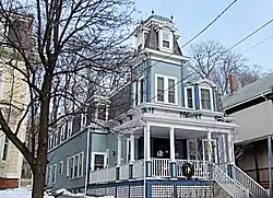 James H. Brooks House |
September 18, 1989 (#89001251) |
61 Columbus Ave. 42°22′54″N 71°05′42″W |
Prospect Hill | |
| 11 | Martin W. Carr School | 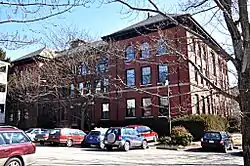 Martin W. Carr School |
July 5, 1984 (#84002530) |
25 Atherton St. 42°23′05″N 71°06′28″W |
Spring Hill | |
| 12 | Central Library |  Central Library |
September 18, 1989 (#89001274) |
79 Highland Ave. 42°23′09″N 71°05′40″W |
Central Hill | |
| 13 | Z. E. Cliff House |  Z. E. Cliff House |
September 18, 1989 (#89001280) |
29 Powder House Terr. 42°23′59″N 71°07′00″W |
Powder House | |
| 14 | Thomas Cook House |  Thomas Cook House |
September 18, 1989 (#89001250) |
21 College Hill Rd. 42°24′32″N 71°07′44″W |
West Somerville | |
| 15 | Cooper-Davenport Tavern Wing |  Cooper-Davenport Tavern Wing |
September 18, 1989 (#89001257) |
81 Eustis St. 42°23′01″N 71°06′51″W |
Ward 2 | |
| 16 | C. C. Crowell House |  C. C. Crowell House |
September 18, 1989 (#89001236) |
85 Benton Rd. 42°23′23″N 71°06′19″W |
Spring Hill | |
| 17 | Downer Rowhouses (Adams Street) | _Somerville%252C_MA.jpg.webp) Downer Rowhouses (Adams Street) |
September 18, 1989 (#89001225) |
55 Adams St. 42°23′40″N 71°06′01″W |
Winter Hill | |
| 18 | Downer Rowhouses (Central Street) | _Somerville%252C_MA.jpg.webp) Downer Rowhouses (Central Street) |
September 18, 1989 (#89001241) |
192–200 Central St. 42°23′41″N 71°05′59″W |
Winter Hill | |
| 19 | First Unitarian Church | 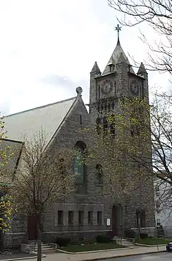 First Unitarian Church |
September 18, 1989 (#89001264) |
130 Highland Ave. 42°23′15″N 71°06′07″W |
Central Hill | |
| 20 | First Universalist Church |  First Universalist Church |
September 18, 1989 (#89001262) |
125 Highland Ave. 42°23′15″N 71°06′05″W |
Central Hill | |
| 21 | Alexander Foster House | 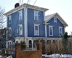 Alexander Foster House |
September 18, 1989 (#89001270) |
45 Laurel St. 42°23′04″N 71°06′15″W |
Spring Hill | |
| 22 | Samuel Gaut House |  Samuel Gaut House |
September 18, 1989 (#89001265) |
137 Highland Ave. 42°23′17″N 71°06′09″W |
Central Hill | |
| 23 | The Grandview |  The Grandview |
September 18, 1989 (#89001275) |
82 Munroe St. 42°22′56″N 71°05′42″W |
Prospect Hill | |
| 24 | The Highland |  The Highland |
September 18, 1989 (#89001260) |
66 Highland St. 42°23′13″N 71°05′55″W |
Central Hill | |
| 25 | Hollander Blocks |  Hollander Blocks |
September 18, 1989 (#89001296) |
Walnut St. and Pleasant Ave. 42°23′02″N 71°05′44″W |
Prospect Hill | |
| 26 | Elisha Hopkins House |  Elisha Hopkins House |
September 18, 1989 (#89001284) |
237 School St. 42°23′31″N 71°05′43″W |
Winter Hill | |
| 27 | House at 10 Arlington Street |  House at 10 Arlington Street |
September 18, 1989 (#89001230) |
10 Arlington St. 42°23′09″N 71°04′57″W |
East Somerville | |
| 28 | Houses at 28–36 Beacon Street | Houses at 28–36 Beacon Street |
September 18, 1989 (#89001232) |
28–36 Beacon St. 42°22′31″N 71°06′12″W |
Inman Square | |
| 29 | House at 14 Chestnut Street |  House at 14 Chestnut Street |
September 18, 1989 (#89001245) |
14 Chestnut St. 42°22′29″N 71°05′11″W |
Brickbottom | Building demolished |
| 30 | House at 25 Clyde Street |  House at 25 Clyde Street |
September 18, 1989 (#89001247) |
25 Clyde St. 42°23′41″N 71°06′33″W |
Magoun Square | |
| 31 | House at 72R Dane Street |  House at 72R Dane Street |
September 18, 1989 (#89001254) |
72R Dane St. 42°22′34″N 71°06′16″W |
Perry Park | |
| 32 | House at 21 Dartmouth Street |  House at 21 Dartmouth Street |
September 18, 1989 (#89001255) |
21 Dartmouth St. 42°23′27″N 71°05′50″W |
Winter Hill | |
| 33 | House at 343 Highland Avenue |  House at 343 Highland Avenue |
September 18, 1989 (#89001267) |
343 Highland Ave. 42°23′39″N 71°06′59″W |
Powder House | |
| 34 | House at 6 Kent Court |  House at 6 Kent Court |
September 18, 1989 (#89001269) |
6 Kent Ct. 42°22′57″N 71°06′41″W |
Ward 2 | |
| 35 | House at 197 Morrison Avenue |  House at 197 Morrison Avenue |
September 18, 1989 (#89001273) |
197 Morrison Ave. 42°23′51″N 71°07′10″W |
Davis Square | |
| 36 | House at 29 Mt. Vernon Street |  House at 29 Mt. Vernon Street |
September 18, 1989 (#89001302) |
29 Mt. Vernon St. 42°23′08″N 71°04′48″W |
East Somerville | |
| 37 | House at 81 Pearl Street |  House at 81 Pearl Street |
September 18, 1989 (#89001277) |
81 Pearl St. 42°23′05″N 71°05′06″W |
East Somerville | |
| 38 | House at 16–18 Preston Road |  House at 16–18 Preston Road |
September 18, 1989 (#89001279) |
16–18 Preston Rd. 42°23′01″N 71°06′08″W |
Spring Hill | |
| 39 | House at 5 Prospect Hill |  House at 5 Prospect Hill |
September 18, 1989 (#89001281) |
5 Prospect Hill Avenue 42°22′55″N 71°05′29″W |
Prospect Hill | |
| 40 | House at 35 Temple Street |  House at 35 Temple Street |
September 18, 1989 (#89001288) |
35 Temple St. 42°23′37″N 71°05′34″W |
Ten Hills | |
| 41 | House at 42 Vinal Avenue |  House at 42 Vinal Avenue |
September 18, 1989 (#89001290) |
42 Vinal Ave. 42°23′04″N 71°05′51″W |
Prospect Hill | |
| 42 | House at 49 Vinal Avenue |  House at 49 Vinal Avenue |
September 18, 1989 (#89001292) |
49 Vinal Ave. 42°23′05″N 71°05′49″W |
Prospect Hill | |
| 43 | Samuel Ireland House | 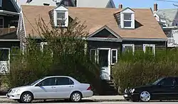 Samuel Ireland House |
September 18, 1989 (#89001299) |
117 Washington 42°22′52″N 71°05′15″W |
East Somerville | |
| 44 | Joseph K. James House | 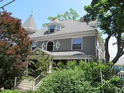 Joseph K. James House |
February 11, 1998 (#98000095) |
83 Belmont St. 42°23′18″N 71°06′30″W |
Spring Hill | |
| 45 | Amos Keyes House | 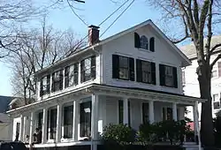 Amos Keyes House |
September 18, 1989 (#89001224) |
12 Adams St. 42°23′37″N 71°06′06″W |
Magoun Square | |
| 46 | R. A. Knight-Eugene Lacount House | 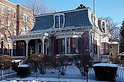 R. A. Knight-Eugene Lacount House |
September 18, 1989 (#89001256) |
34 Day St. 42°23′43″N 71°07′26″W |
Davis Square | |
| 47 | Langmaid Building | 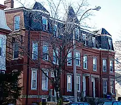 Langmaid Building |
September 18, 1989 (#89001259) |
48–52 Highland Ave. 42°23′07″N 71°05′45″W |
Central Hill | |
| 48 | Langmaid Terrace |  Langmaid Terrace |
September 18, 1989 (#89001237) |
359–365 Broadway 42°23′39″N 71°05′47″W |
Ten Hills | |
| 49 | Charles H. Lockhardt House | 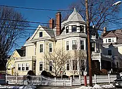 Charles H. Lockhardt House |
September 18, 1989 (#89001249) |
88 College Ave. 42°23′57″N 71°07′11″W |
Davis Square | |
| 50 | George Loring House | 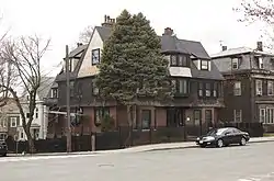 George Loring House |
September 18, 1989 (#89001263) |
76 Highland Ave. 42°23′10″N 71°05′51″W |
Central Hill | |
| 51 | A. L. Lovejoy House | 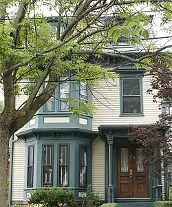 A. L. Lovejoy House |
September 18, 1989 (#89001297) |
30 Warren Ave. 42°22′53″N 71°05′45″W |
Prospect Hill | |
| 52 | Middlesex Canal Historic and Archaeological District | 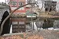 Middlesex Canal Historic and Archaeological District |
November 19, 2009 (#09000936) |
Numerous locations along the historic route of the Middlesex Canal 42°25′02″N 71°07′49″W |
West Somerville Ten Hills East Somerville |
Extends into other Middlesex County communities and Boston in Suffolk County. |
| 53 | Mount Vernon Street Historic District | 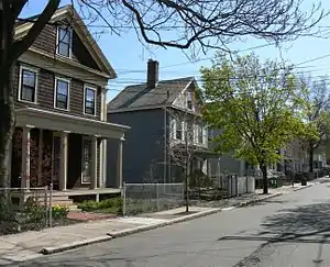 Mount Vernon Street Historic District |
September 18, 1989 (#89001223) |
8–24 Mt. Vernon St. 42°23′08″N 71°04′47″W |
East Somerville | |
| 54 | Robert Munroe House | 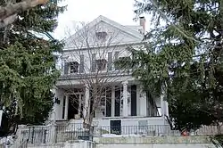 Robert Munroe House |
September 18, 1989 (#89001294) |
37 Walnut St. 42°22′57″N 71°05′46″W |
Prospect Hill | |
| 55 | Mystic Pumping Station | Mystic Pumping Station |
January 18, 1990 (#89002255) |
Alewife Brook Parkway 42°24′54″N 71°07′52″W |
West Somerville | Listing duplicates Mystic Water Works, below. |
| 56 | Mystic Valley Parkway, Metropolitan Park System of Greater Boston MPS | 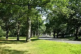 Mystic Valley Parkway, Metropolitan Park System of Greater Boston MPS |
January 18, 2006 (#05001529) |
Mystic Valley Parkway 42°25′47″N 71°07′49″W |
West Somerville | Also in Arlington Medford and Winchester |
| 57 | Mystic Water Works | Mystic Water Works |
September 18, 1989 (#89001227) |
Alewife Brook Parkway and Capen St. 42°24′54″N 71°07′52″W |
West Somerville | Listing duplicates Mystic Pumping Station, above. |
| 58 | John F. Nichols House | 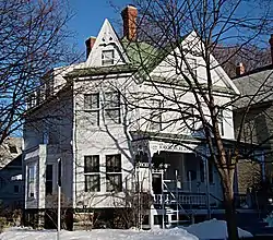 John F. Nichols House |
September 18, 1989 (#89001285) |
17 Summit St. 42°24′00″N 71°07′11″W |
Davis Square | |
| 59 | Louville V. Niles House | 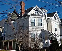 Louville V. Niles House |
September 18, 1989 (#89001276) |
97 Munroe St. 42°22′59″N 71°05′44″W |
Prospect Hill | |
| 60 | Louville Niles House | 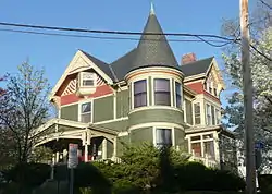 Louville Niles House |
September 18, 1989 (#89001295) |
45 Walnut St. 42°22′59″N 71°05′45″W |
Prospect Hill | |
| 61 | Old Cemetery | 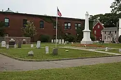 Old Cemetery |
September 18, 1989 (#89001301) |
Somerville Ave. and School St. 42°22′53″N 71°06′25″W |
Union Square | |
| 62 | Otis-Wyman House | 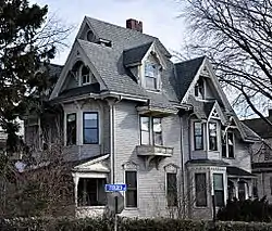 Otis-Wyman House |
September 18, 1989 (#89001289) |
67 Thurston St. 42°23′31″N 71°05′51″W |
Winter Hill | |
| 63 | Parker-Burnett House | 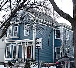 Parker-Burnett House |
September 18, 1989 (#89001291) |
48 Vinal Ave. 42°23′05″N 71°05′51″W |
Prospect Hill | |
| 64 | Powder House Park |  Powder House Park |
April 21, 1975 (#75000287) |
Powder House Circle 42°24′01″N 71°07′02″W |
Powder House | |
| 65 | Gustavus G. Prescott House | 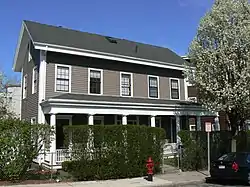 Gustavus G. Prescott House |
September 18, 1989 (#89001278) |
65–67 Perkins St. 42°23′03″N 71°04′45″W |
East Somerville | |
| 66 | The Rosebud |  The Rosebud |
September 22, 1999 (#99001125) |
381 Summer St. 42°23′40″N 71°07′17″W |
Davis Square | |
| 67 | Philemon Russell House | 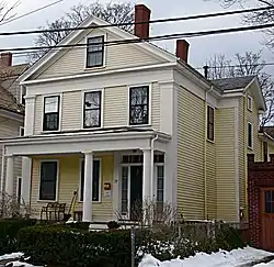 Philemon Russell House |
September 18, 1989 (#89001282) |
25 Russell St. 42°23′34″N 71°07′22″W |
Davis Square | |
| 68 | Susan Russell House | 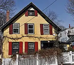 Susan Russell House |
September 18, 1989 (#89001286) |
58 Sycamore St. 42°23′24″N 71°06′04″W |
Winter Hill | |
| 69 | Charles Schuebeler House | 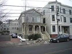 Charles Schuebeler House |
September 18, 1989 (#89001298) |
384 Washington St. 42°22′31″N 71°06′15″W |
Perry Park | |
| 70 | Lemuel Snow Jr. House | 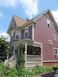 Lemuel Snow Jr. House |
September 18, 1989 (#89001234) |
81 Benton Rd. 42°23′22″N 71°06′20″W |
Spring Hill | |
| 71 | Somerville High School | 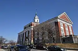 Somerville High School |
September 18, 1989 (#89001261) |
93 Highland St. 42°23′13″N 71°05′55″W |
Central Hill | Building is now the Somerville City Hall |
| 72 | Somerville Journal Building | 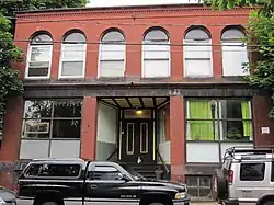 Somerville Journal Building |
September 18, 1989 (#89001300) |
8–10 Walnut St. 42°22′53″N 71°05′51″W |
Union Square | |
| 73 | Somerville Theatre |  Somerville Theatre |
January 26, 1990 (#89002330) |
55 Davis Sq. 42°23′48″N 71°07′22″W |
Davis Square | |
| 74 | Spring Hill Historic District |  Spring Hill Historic District |
September 18, 1989 (#89001222) |
Roughly bounded by Summer, Central, Atherton, and Spring 42°23′07″N 71°06′29″W |
Spring Hill | |
| 75 | Peter and Oliver Tufts House |  Peter and Oliver Tufts House |
September 18, 1989 (#89001287) |
78 Sycamore St. 42°23′27″N 71°06′02″W |
Winter Hill | |
| 76 | US Post Office-Somerville Main | 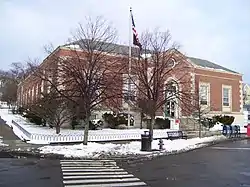 US Post Office-Somerville Main |
May 30, 1986 (#86001247) |
237 Washington St. 42°22′47″N 71°05′39″W |
Union Square | |
| 77 | H. Warren House | 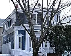 H. Warren House |
September 18, 1989 (#89001283) |
205 School St. 42°23′25″N 71°05′47″W |
Winter Hill | |
| 78 | West Somerville Branch Library | 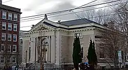 West Somerville Branch Library |
September 18, 1989 (#89001248) |
40 College Ave. 42°23′53″N 71°07′18″W |
Davis Square | |
| 79 | Charles Williams House | 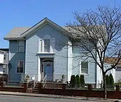 Charles Williams House |
September 18, 1989 (#89001253) |
108 Cross St. 42°23′03″N 71°05′22″W |
East Somerville | |
| 80 | Charles Williams Jr. House | 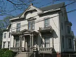 Charles Williams Jr. House |
September 18, 1989 (#89001228) |
1 Arlington St. 42°23′09″N 71°04′55″W |
East Somerville | |
| 81 | F. G. Williams House | 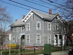 F. G. Williams House |
September 18, 1989 (#89001226) |
37 Albion St. 42°23′26″N 71°06′18″W |
Central Hill | |
| 82 | Daniel Worthen House | 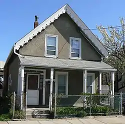 Daniel Worthen House |
September 18, 1989 (#89001272) |
8 Mt. Pleasant St. 42°23′07″N 71°04′43″W |
East Somerville | |
| 83 | Wright House | 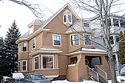 Wright House |
September 18, 1989 (#89001293) |
54 Vinal Ave. 42°23′06″N 71°05′51″W |
Prospect Hill | |
| 84 | George Wyatt House | 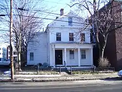 George Wyatt House |
September 18, 1989 (#89001233) |
33 Beacon St. 42°22′31″N 71°06′09″W |
Inman Square |
See also
| Wikimedia Commons has media related to National Register of Historic Places in Somerville, Massachusetts. |
References
- The latitude and longitude information provided in this table was derived originally from the National Register Information System, which has been found to be fairly accurate for about 99% of listings. Some locations in this table may have been corrected to current GPS standards.
- "National Register of Historic Places: Weekly List Actions". National Park Service, United States Department of the Interior. Retrieved on February 5, 2021.
- Numbers represent an alphabetical ordering by significant words. Various colorings, defined here, differentiate National Historic Landmarks and historic districts from other NRHP buildings, structures, sites or objects.
- The eight-digit number below each date is the number assigned to each location in the National Register Information System database, which can be viewed by clicking the number.
- MACRIS entry for Almshouse
| Topics |  | ||||||||||||||||
|---|---|---|---|---|---|---|---|---|---|---|---|---|---|---|---|---|---|
| Lists by county | |||||||||||||||||
| Lists by city |
| ||||||||||||||||
| Other lists | |||||||||||||||||
| |||||||||||||||||
This article is issued from Wikipedia. The text is licensed under Creative Commons - Attribution - Sharealike. Additional terms may apply for the media files.