National Register of Historic Places listings in Brookline, Massachusetts
This is a list of properties on the National Register of Historic Places in Brookline, Massachusetts.
- This National Park Service list is complete through NPS recent listings posted January 29, 2021.[1]
Brookline
| [2] | Name on the Register | Image | Date listed[3] | Location | Neighborhood | Description |
|---|---|---|---|---|---|---|
| 1 | 1767 Milestones | 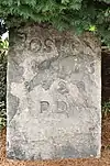 1767 Milestones |
April 7, 1971 (#71000084) |
Between Boston and Springfield along Old Post Rd. 42°19′48″N 71°05′29″W |
Coolidge Corner | Includes markers in Suffolk, Middlesex, Worcester, and Hampden counties. Only one marker, listed separately below, is located in Brookline. |
| 2 | Larz Anderson Park Historic District |  Larz Anderson Park Historic District |
October 17, 1985 (#85003245) |
Bounded by Goddard and Avon Sts. 42°18′43″N 71°08′10″W |
Larz Anderson Park | Extends into Boston in Suffolk County |
| 3 | Arcade Building | 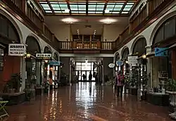 Arcade Building |
October 17, 1985 (#85003247) |
314–320A Harvard St. 42°20′35″N 71°07′26″W |
Coolidge Corner | |
| 4 | Beacon Street Historic District | Beacon Street Historic District |
October 17, 1985 (#85003322) |
Roughly on Beacon St. from Saint Mary's to Ayr Rd. 42°20′23″N 71°07′56″W |
Coolidge Corner, Washington Square, Cleveland Circle | |
| 5 | Beaconsfield Terraces Historic District | Beaconsfield Terraces Historic District |
October 17, 1985 (#85003248) |
11–25, 33–43, and 44–55 Garrison Rd. and 316–326, 332–344, and 350–366 Tappan St. 42°20′15″N 71°08′18″W |
Beaconsfield | |
| 6 | William Ingersoll Bowditch House |  William Ingersoll Bowditch House |
October 17, 1985 (#85003249) |
9 Toxteth St. 42°20′08″N 71°07′01″W |
Brookline Village | |
| 7 | Brandegee Estate |  Brandegee Estate |
October 17, 1985 (#85003244) |
280 Newton St. 42°18′28″N 71°08′46″W |
South Brookline | Extends into Boston in Suffolk County |
| 8 | Brookline Town Green Historic District | 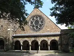 Brookline Town Green Historic District |
June 22, 1980 (#80000650) |
Chestnut Pl., Fairmont, Dudley, Boylston, Walnut and Warren Sts., Hedge, Codman, and Kennard Rds. 42°19′36″N 71°07′53″W |
Chestnut Hill | |
| 9 | Brookline Village Commercial District | 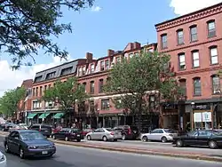 Brookline Village Commercial District |
May 22, 1979 (#79000364) |
Irregular Pattern along Washington St. 42°20′00″N 71°07′16″W |
Brookline Village | |
| 10 | Building at 30–34 Station Street | 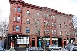 Building at 30–34 Station Street |
October 17, 1985 (#85003250) |
30–34 Station St. 42°19′59″N 71°07′01″W |
Brookline Village | |
| 11 | Lewis Cabot Estate | 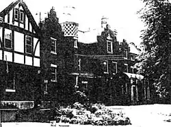 Lewis Cabot Estate |
October 17, 1985 (#85003251) |
514 Warren St. 42°19′21″N 71°08′35″W |
Brookline | Demolished. |
| 12 | Candler Cottage | 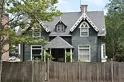 Candler Cottage |
October 17, 1985 (#85003252) |
447 Washington St. 42°20′08″N 71°07′31″W |
Coolidge Corner | |
| 13 | Chestnut Hill Historic District | 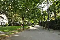 Chestnut Hill Historic District |
October 17, 1985 (#85003253) |
Roughly bounded by Middlesex Rd., Reservoir Ln., Denny Rd., Boylston St. and Dunster Rd. 42°19′36″N 71°09′32″W |
Chestnut Hill | Overlaps slightly into Newton |
| 14 | Isaac Child House |  Isaac Child House |
October 17, 1985 (#85003254) |
209 Newton St. 42°18′38″N 71°08′38″W |
South Brookline | |
| 15 | Timothy Corey House No. 1 |  Timothy Corey House No. 1 |
October 17, 1985 (#85003255) |
808 Washington St. 42°20′29″N 71°08′22″W |
Corey Farm | |
| 16 | Timothy Corey House No. 2 |  Timothy Corey House No. 2 |
October 17, 1985 (#85003256) |
786–788 Washington St. 42°20′29″N 71°08′21″W |
Corey Farm | |
| 17 | Cottage Farm Historic District |  Cottage Farm Historic District |
March 29, 1978 (#78000455) |
Roughly bounded by Amory, Dummer, Lenox, Brookline and Beacon Sts. 42°20′51″N 71°06′44″W |
Cottage Farm | |
| 18 | Cypress-Emerson Historic District | 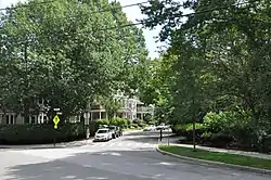 Cypress-Emerson Historic District |
October 17, 1985 (#85003257) |
Roughly bounded by Waverly, Emerson, and Cypress Sts. 42°19′58″N 71°07′21″W |
Emerson Garden | |
| 19 | Robert S. Davis House | 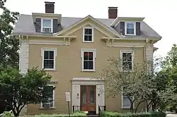 Robert S. Davis House |
October 17, 1985 (#85003259) |
50 Stanton Rd. 42°20′03″N 71°07′37″W |
Brookline Hills | |
| 20 | Thomas Aspinwall Davis House | 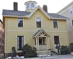 Thomas Aspinwall Davis House |
October 17, 1985 (#85003260) |
29 Linden Pl. 42°20′06″N 71°07′02″W |
Brookline Village | |
| 21 | Edward Devotion House |  Edward Devotion House |
February 14, 1978 (#78002835) |
347 Harvard St. 42°20′39″N 71°07′29″W |
Coolidge Corner | |
| 22 | Alfred Douglass House | 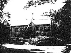 Alfred Douglass House |
October 17, 1985 (#85003261) |
76 Fernwood Rd. 42°18′41″N 71°08′33″W |
Buttonwood Village | Demolished. Listing address is 157 Clyde St. |
| 23 | The Dutch House |  The Dutch House |
January 24, 1986 (#86000093) |
20 Netherlands Rd. 42°20′09″N 71°06′45″W |
Brookline Village | |
| 24 | Gen. Simon Elliot House |  Gen. Simon Elliot House |
October 17, 1985 (#85003262) |
61 Heath St. 42°19′29″N 71°08′42″W |
Woodland-Heath | |
| 25 | Emmett Cottage |  Emmett Cottage |
October 17, 1985 (#85003263) |
217 Freeman St. 42°20′52″N 71°07′13″W |
Brookline | |
| 26 | Fernwood |  Fernwood |
October 17, 1985 (#85003264) |
155 Clyde St. 42°19′14″N 71°08′50″W |
Buttonwood Village | |
| 27 | Fire Station No. 7 | 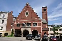 Fire Station No. 7 |
October 17, 1985 (#85003265) |
665 Washington St. 42°20′19″N 71°08′02″W |
Washington Square | |
| 28 | Fisher Hill Historic District | 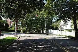 Fisher Hill Historic District |
October 17, 1985 (#85003266) |
Roughly bounded by Clinton and Sumner Rds., Boylston St. and Chestnut Hill Ave. 42°19′52″N 71°08′29″W |
Fisher Hill | |
| 29 | Fisher Hill Reservoir and Gatehouse |  Fisher Hill Reservoir and Gatehouse |
January 18, 1990 (#89002254) |
Fisher Rd. between Hyslop and Channing Rds. 42°19′45″N 71°08′37″W |
Fisher Hill | |
| 30 | Dr. Tappan Eustis Francis House | 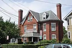 Dr. Tappan Eustis Francis House |
October 17, 1985 (#85003267) |
35 Davis Ave. 42°19′57″N 71°07′14″W |
Emerson Garden | |
| 31 | Peter Fuller Building | 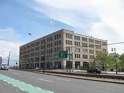 Peter Fuller Building |
October 17, 1985 (#85003269) |
808 Commonwealth Ave. 42°21′01″N 71°06′19″W |
North Brookline | |
| 32 | John Goddard House |  John Goddard House |
October 17, 1985 (#85003270) |
235 Goddard Ave. 42°18′54″N 71°08′11″W |
Larz Anderson Park | |
| 33 | Graffam Development Historic District |  Graffam Development Historic District |
October 17, 1985 (#85003271) |
Roughly bounded by Abbottsford Rd., Babcock St., Manchester, and Naples Rds. 42°20′56″N 71°07′04″W |
Graffam-McKay | |
| 34 | Green Hill Historic District |  Green Hill Historic District |
October 17, 1985 (#85003272) |
Roughly Warren St., Sargent Rd., and Cottage St. 42°19′18″N 71°07′59″W |
Brookline | |
| 35 | Hammond Pond Parkway |  Hammond Pond Parkway |
March 18, 2004 (#04000250) |
Hammond Pond Parkway 42°19′16″N 71°10′20″W |
Chestnut Hill | |
| 36 | John Harris House and Farm |  John Harris House and Farm |
October 17, 1985 (#85003246) |
284 Newton St. 42°18′19″N 71°08′36″W |
South Brookline | Extends into Boston in Suffolk County |
| 37 | Charles Heath House |  Charles Heath House |
October 17, 1985 (#85003273) |
12 Heath Hill 42°19′33″N 71°08′34″W |
Woodland-Heath | |
| 38 | Ebenezer Heath House |  Ebenezer Heath House |
October 17, 1985 (#85003274) |
30 Heath St. 42°19′31″N 71°08′36″W |
Woodland-Heath | |
| 39 | Holyhood Cemetery |  Holyhood Cemetery |
October 17, 1985 (#85003275) |
Heath St. 42°19′12″N 71°10′03″W |
Chestnut Hill | |
| 40 | Hotel Adelaide |  Hotel Adelaide |
October 17, 1985 (#85003276) |
13–21 High St. 42°19′51″N 71°07′06″W |
Pill Hill | |
| 41 | Hotel Kempsford |  Hotel Kempsford |
October 17, 1985 (#85003277) |
72 Walnut St. 42°19′50″N 71°07′08″W |
Pill Hill | |
| 42 | House at 105 Marion Street |  House at 105 Marion Street |
October 17, 1985 (#85003278) |
105 Marion St. 42°19′51″N 71°07′29″W |
Coolidge Corner | |
| 43 | House at 12 Linden Street |  House at 12 Linden Street |
October 17, 1985 (#85003279) |
12 Linden St. 42°20′04″N 71°07′07″W |
Brookline Village | |
| 44 | House at 12 Vernon Street |  House at 12 Vernon Street |
October 17, 1985 (#85003280) |
12 Vernon St. 42°20′18″N 71°07′22″W |
Coolidge Corner | |
| 45 | House at 12–16 Corey Road |  House at 12–16 Corey Road |
October 17, 1985 (#85003281) |
12–16 Corey Rd. 42°20′17″N 71°08′35″W |
Corey Farm | |
| 46 | House at 155 Reservoir |  House at 155 Reservoir |
October 17, 1985 (#85003282) |
155 Reservoir Rd. 42°19′40″N 71°08′59″W |
Pill Hill | |
| 47 | House at 156 Mason Terrace |  House at 156 Mason Terrace |
October 17, 1985 (#85003283) |
156 Mason Terr. 42°20′33″N 71°07′47″W |
Corey Hill | |
| 48 | House at 19 Linden Street |  House at 19 Linden Street |
October 17, 1985 (#85003284) |
19 Linden St. 42°20′03″N 71°07′04″W |
Brookline Village | |
| 49 | House at 25 Stanton Road |  House at 25 Stanton Road |
October 17, 1985 (#85003285) |
25 Stanton Rd. 42°20′03″N 71°07′31″W |
Brookline | |
| 50 | House at 38–40 Webster Place |  House at 38–40 Webster Place |
October 17, 1985 (#85003286) |
38–40 Webster Pl. 42°19′59″N 71°06′57″W |
Brookline Village | |
| 51 | House at 4 Perry Street |  House at 4 Perry Street |
October 17, 1985 (#85003287) |
4 Perry St. 42°20′07″N 71°07′04″W |
Brookline Village | |
| 52 | House at 44 Linden Street |  House at 44 Linden Street |
October 17, 1985 (#85003288) |
44 Linden St. 42°20′05″N 71°07′02″W |
Brookline Village | |
| 53 | House at 44 Stanton Road |  House at 44 Stanton Road |
October 17, 1985 (#85003289) |
44 Stanton Rd. 42°20′02″N 71°07′37″W |
Brookline Hills | |
| 54 | House at 5 Lincoln Road |  House at 5 Lincoln Road |
October 17, 1985 (#85003290) |
5 Lincoln Rd. 42°20′02″N 71°07′33″W |
Brookline Hills | |
| 55 | House at 53 Linden Street |  House at 53 Linden Street |
October 17, 1985 (#85003291) |
53 Linden St. 42°20′04″N 71°06′59″W |
Brookline Village | |
| 56 | House at 83 Penniman Place |  House at 83 Penniman Place |
October 17, 1985 (#85003292) |
83 Penniman Pl. 42°19′54″N 71°08′54″W |
Fisher Hill | Damaged by fire and demolished in 2009. |
| 57 | House at 89 Rawson Road and 86 Colburne Crescent |  House at 89 Rawson Road and 86 Colburne Crescent |
October 17, 1985 (#85003302) |
89 Rawson Rd. and 86 Colburne Crescent 42°20′05″N 71°08′02″W |
Aspinwall Hill | |
| 58 | House at 9 Linden Street |  House at 9 Linden Street |
October 17, 1985 (#85003293) |
9 Linden St. 42°20′04″N 71°07′08″W |
Brookline Village | |
| 59 | Houses at 76–96 Harvard Avenue |  Houses at 76–96 Harvard Avenue |
October 17, 1985 (#85003294) |
76–96 Harvard Ave. 42°20′13″N 71°07′32″W |
Harvard Avenue | |
| 60 | Thaddeus Jackson House |  Thaddeus Jackson House |
October 17, 1985 (#85003295) |
15 Alberta Rd. 42°18′21″N 71°09′16″W |
South Brookline | |
| 61 | John Fitzgerald Kennedy National Historic Site |  John Fitzgerald Kennedy National Historic Site |
May 26, 1967 (#67000001) |
83 Beals St. 42°20′53″N 71°07′34″W |
Coolidge Corner | |
| 62 | Kilsyth Terrace |  Kilsyth Terrace |
October 17, 1985 (#85003296) |
15–27 Kilsyth Rd. 42°19′45″N 71°08′39″W |
Corey Farm | |
| 63 | Linden Park |  Linden Park |
October 17, 1985 (#85003297) |
Linden Pl. and Linden St. 42°20′37″N 71°07′09″W |
Brookline Village | |
| 64 | Linden Square |  Linden Square |
October 17, 1985 (#85003298) |
Linden Pl. 42°20′06″N 71°07′02″W |
Brookline Village | |
| 65 | Longwood Historic District |  Longwood Historic District |
September 13, 1978 (#78000460) |
Roughly bounded by Chapel, St. Marys, Monmouth, and Kent Sts. 42°20′32″N 71°06′40″W |
Longwood | |
| 66 | Lynch-O'Gorman House |  Lynch-O'Gorman House |
October 17, 1985 (#85003299) |
41 Mason Terr. 42°20′26″N 71°07′56″W |
Corey Hill | |
| 67 | Milestone | Milestone |
October 17, 1985 (#85003300) |
Harvard St. near Marion 42°20′24″N 71°07′17″W |
Coolidge Corner | This marker is also contained in the 1767 Milestones, listed above. |
| 68 | George R. Minot House |  George R. Minot House |
January 7, 1976 (#76001976) |
71 Sears Rd. 42°19′03″N 71°08′21″W |
Brookline | |
| 69 | William Murphy House |  William Murphy House |
October 17, 1985 (#85003303) |
97 Sewall Ave. 42°20′30″N 71°07′02″W |
Longwood | |
| 70 | Olmsted Park System | 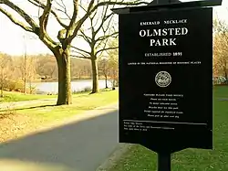 Olmsted Park System |
December 8, 1971 (#71000086) |
Encompassing the Back Bay Fens, Muddy River, Olmsted (Leverett Park), Jamaica Park, Arborway, and Franklin Park 42°20′43″N 71°05′45″W |
Brookline | Extends into Boston, Suffolk County |
| 71 | Frederick Law Olmsted House National Historic Site | 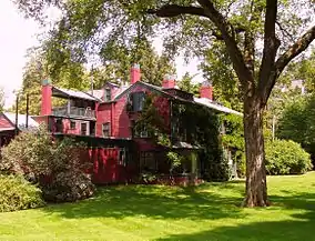 Frederick Law Olmsted House National Historic Site |
October 15, 1966 (#66000780) |
99 Warren St. 42°19′31″N 71°07′58″W |
Brookline | |
| 72 | Rev. John Orrock House | 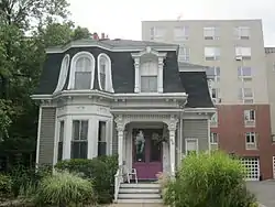 Rev. John Orrock House |
October 17, 1985 (#85003304) |
64 Winchester St.[4] 42°20′33″N 71°07′51″W |
Corey Hill | |
| 73 | Paine Estate | 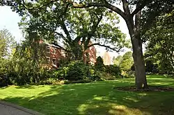 Paine Estate |
October 17, 1985 (#85003305) |
325 Heath St. 42°19′21″N 71°09′15″W |
Woodland-Heath | |
| 74 | Perkins Estate | 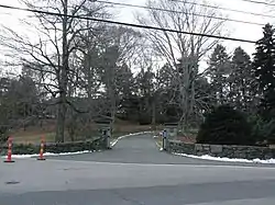 Perkins Estate |
October 17, 1985 (#85003306) |
450 Warren St. 42°19′14″N 71°08′39″W |
Brookline | |
| 75 | Pill Hill Historic District |  Pill Hill Historic District |
December 16, 1977 (#77000187) |
Roughly bounded by Boylston St., Pond Ave., Acron, Oakland and Highland Rds. 42°19′41″N 71°07′14″W |
Pill Hill | |
| 76 | Reservoir Park |  Reservoir Park |
October 17, 1985 (#85003307) |
Boylston St. 42°19′35″N 71°08′12″W |
Brookline | |
| 77 | Richmond Court | 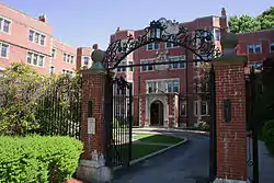 Richmond Court |
July 18, 1985 (#85001575) |
1209–1217 Beacon St. 42°20′35″N 71°06′59″W |
North Brookline | |
| 78 | Ritchie Building | 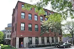 Ritchie Building |
October 17, 1985 (#85003308) |
112 Cypress St. 42°19′51″N 71°07′34″W |
Brookline Hills | |
| 79 | Roughwood |  Roughwood |
October 17, 1985 (#85003309) |
400 Heath St. 42°19′13″N 71°09′30″W |
Woodland-Heath | Now the campus of Pine Manor College. |
| 80 | Saint Aidan's Church and Rectory | 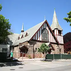 Saint Aidan's Church and Rectory |
October 17, 1985 (#85003310) |
207 Freeman and 158 Pleasant Sts. 42°20′51″N 71°07′11″W |
North Brookline | |
| 81 | St. Mark's Methodist Church | St. Mark's Methodist Church |
December 17, 1976 (#76000268) |
90 Park St. 42°20′21″N 71°07′31″W |
Coolidge Corner | |
| 82 | Saint Mary of the Assumption Church, Rectory, School and Convent | 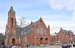 Saint Mary of the Assumption Church, Rectory, School and Convent |
October 17, 1985 (#85003311) |
67 Harvard St. and 3 and 5 Linden Pl. 42°20′06″N 71°07′11″W |
Brookline Village | |
| 83 | Saint Paul's Church, Chapel, and Parish House | 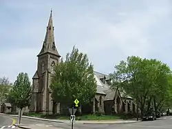 Saint Paul's Church, Chapel, and Parish House |
October 17, 1985 (#85003312) |
15 and 27 Saint Paul St. and 104 Aspinwall Ave. 42°20′14″N 71°07′06″W |
Brookline Village | |
| 84 | Saint Paul's Rectory | 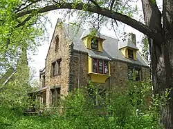 Saint Paul's Rectory |
October 17, 1985 (#85003313) |
130 Aspinwall Ave. 42°20′14″N 71°07′04″W |
Brookline Village | |
| 85 | Sargent's Pond |  Sargent's Pond |
October 17, 1985 (#85003314) |
Sargent Rd. 42°19′17″N 71°07′40″W |
Brookline | |
| 86 | Second Unitarian Church |  Second Unitarian Church |
October 17, 1985 (#85003315) |
11 Charles St. 42°21′06″N 71°07′46″W |
Coolidge Corner | |
| 87 | Eliphalet Spurr House | 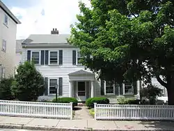 Eliphalet Spurr House |
October 17, 1985 (#85003316) |
103 Walnut St. 42°19′52″N 71°07′09″W |
Pill Hill | |
| 88 | James H. Standish House |  James H. Standish House |
October 17, 1985 (#85003317) |
54 Francis St. 42°20′19″N 71°06′57″W |
Brookline Village | |
| 89 | Strathmore Road Historic District |  Strathmore Road Historic District |
October 17, 1985 (#85003318) |
Strathmore Rd. and Clinton Path 42°20′10″N 71°08′48″W |
Cleveland Circle | |
| 90 | Winand Toussaint House |  Winand Toussaint House |
October 17, 1985 (#85003319) |
203 Aspinwall Ave. 42°20′09″N 71°06′56″W |
Brookline Village | |
| 91 | Town Stable |  Town Stable |
October 17, 1985 (#85003320) |
235 Cypress St.[4] 42°20′39″N 71°07′29″W |
Pill Hill | |
| 92 | William F. Tuckerman House |  William F. Tuckerman House |
October 17, 1985 (#85003321) |
63 Harvard Ave. 42°20′12″N 71°07′27″W |
Harvard Avenue | |
| 93 | Ginery Twichell House |  Ginery Twichell House |
October 17, 1985 (#85003240) |
17 Kent St. 42°19′59″N 71°07′05″W |
Brookline Village | |
| 94 | VFW Parkway, Metropolitan Park System of Greater Boston |  VFW Parkway, Metropolitan Park System of Greater Boston |
January 5, 2005 (#04001432) |
VFW Parkway, between Spring and Centre Sts. 42°17′10″N 71°09′31″W |
South Brookline | Most of its length is in Boston in Suffolk County. |
| 95 | Walnut Hills Cemetery |  Walnut Hills Cemetery |
October 17, 1985 (#85003241) |
Grove St. and Allandale Rd. 42°18′10″N 71°08′50″W |
South Brookline | |
| 96 | West Roxbury Parkway, Metropolitan Park System of Greater Boston |  West Roxbury Parkway, Metropolitan Park System of Greater Boston |
January 19, 2006 (#05001528) |
West Roxbury Parkway, Bellevue Hill, E. Border Rd., and W. Border Rd. 42°18′10″N 71°09′11″W |
South Brookline | Extends into Boston in Suffolk County |
| 97 | White Place Historic District |  White Place Historic District |
October 17, 1985 (#85003243) |
White Pl. between Washington St. and Davis Path 42°19′22″N 71°07′10″W |
Emerson Garden | |
| 98 | Benjamin White House |  Benjamin White House |
October 17, 1985 (#85003242) |
203 Heath St. 42°19′20″N 71°08′58″W |
Woodland-Heath |
See also
| Wikimedia Commons has media related to National Register of Historic Places in Brookline, Massachusetts. |
References
- "National Register of Historic Places: Weekly List Actions". National Park Service, United States Department of the Interior. Retrieved on January 29, 2021.
- Numbers represent an alphabetical ordering by significant words. Various colorings, defined here, differentiate National Historic Landmarks and historic districts from other NRHP buildings, structures, sites or objects.
- The eight-digit number below each date is the number assigned to each location in the National Register Information System database, which can be viewed by clicking the number.
- "Weekly list of actions taken on properties: 2/25/13 through 3/01/13". National Park Service. March 8, 2013. Retrieved March 14, 2013.
| Topics |  | ||||||||||||||||
|---|---|---|---|---|---|---|---|---|---|---|---|---|---|---|---|---|---|
| Lists by county | |||||||||||||||||
| Lists by city |
| ||||||||||||||||
| Other lists | |||||||||||||||||
| |||||||||||||||||
This article is issued from Wikipedia. The text is licensed under Creative Commons - Attribution - Sharealike. Additional terms may apply for the media files.