National Register of Historic Places listings in southern Boston
Boston, Massachusetts is home to many listings on the National Register of Historic Places. This list encompasses those locations that are located south of the Massachusetts Turnpike. See National Register of Historic Places listings in northern Boston for listings north of the Turnpike. Properties and districts located elsewhere in Suffolk County's other three municipalities are also listed separately.
There are 337 properties and districts listed on the National Register in Suffolk County, including 58 National Historic Landmarks. The southern part of the city of Boston is the location of 169 of these properties and districts, including 13 National Historic Landmarks. Two historic districts overlap into both northern and southern Boston: milestones that make up the 1767 Milestones are found in both areas, and the Olmsted Park System extends through much of the city.
- This National Park Service list is complete through NPS recent listings posted February 5, 2021.[1]
Current listings
| [2] | Name on the Register[3] | Image | Date listed[4] | Location | City or town | Description |
|---|---|---|---|---|---|---|
| 1 | 1767 Milestones | 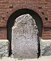 1767 Milestones |
April 7, 1971 (#71000084) |
Between Boston and Springfield along Old Post Rd. 42°19′48″N 71°05′29″W |
Roxbury, Mission Hill | Includes markers in Allston-Brighton, and markers in Hampden, Middlesex, and Worcester counties |
| 2 | Abbotsford |  Abbotsford |
September 16, 1987 (#87000885) |
300 Walnut Ave. 42°18′58″N 71°05′35″W |
Roxbury | |
| 3 | Adams-Nervine Asylum | 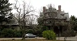 Adams-Nervine Asylum |
June 1, 1982 (#82004456) |
990–1020 Centre St. 42°18′13″N 71°07′31″W |
Jamaica Plain | |
| 4 | All Saints' Church | 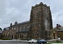 All Saints' Church |
June 16, 1980 (#80000678) |
211 Ashmont St. 42°17′09″N 71°03′48″W |
Dorchester | |
| 5 | Allston Congregational Church | 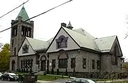 Allston Congregational Church |
November 7, 1997 (#97001377) |
31–41 Quint Ave. 42°21′06″N 71°08′05″W |
Allston | |
| 6 | Almont Apartments | 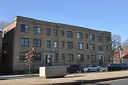 Almont Apartments |
September 22, 2014 (#14000698) |
1439–1443 & 1447–1451 Blue Hill Ave. 42°16′29″N 71°05′38″W |
Mattapan | |
| 7 | Larz Anderson Park Historic District |  Larz Anderson Park Historic District |
October 17, 1985 (#85003245) |
Bounded by Goddard and Avon Sts. 42°18′43″N 71°08′10″W |
Jamaica Plain | Extends into Brookline in Norfolk County |
| 8 | Arnold Arboretum | .JPG.webp) Arnold Arboretum |
October 15, 1966 (#66000127) |
22 Divinity Ave. 42°17′55″N 71°07′30″W |
Jamaica Plain and Roslindale | |
| 9 | Ascension-Caproni Historic District | 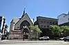 Ascension-Caproni Historic District |
December 23, 2019 (#100004335) |
Roughly bounded by Washington St., Newcomb St, Thorndike St. & Reed St. 42°20′02″N 71°04′44″W |
Roxbury | |
| 10 | Sarah J. Baker School | 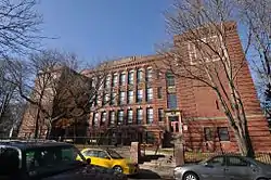 Sarah J. Baker School |
July 7, 1983 (#83004285) |
33 Perrin St. 42°19′20″N 71°04′48″W |
Roxbury | |
| 11 | Bellevue Standpipe | 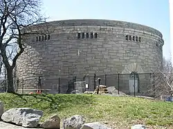 Bellevue Standpipe |
January 18, 1990 (#89002251) |
On Bellevue Hill at Washington St. and Roxbury Parkway 42°16′31″N 71°08′40″W |
West Roxbury | |
| 12 | Benedict Fenwick School | 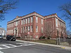 Benedict Fenwick School |
February 11, 2004 (#04000023) |
150 Magnolia St. 42°18′49″N 71°04′21″W |
Dorchester | |
| 13 | Berger Factory | 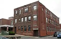 Berger Factory |
April 9, 1980 (#80000677) |
37 Williams St. 42°19′58″N 71°04′59″W |
Roxbury | |
| 14 | Bigelow School | 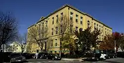 Bigelow School |
February 21, 1985 (#85000316) |
350 W. 4th St. 42°21′08″N 71°02′52″W |
South Boston | |
| 15 | James Blake House | 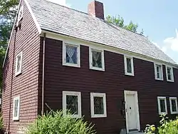 James Blake House |
May 1, 1974 (#74002350) |
735 Columbia Rd. 42°19′11″N 71°03′37″W |
Dorchester | |
| 16 | Blue Hills Parkway | 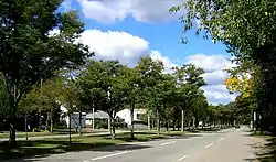 Blue Hills Parkway |
June 23, 2003 (#03000574) |
Blue Hills Parkway 42°15′21″N 71°05′38″W |
Mattapan | Extends into Milton in Norfolk County |
| 17 | Boston Consumptives Hospital | Boston Consumptives Hospital |
February 7, 2002 (#01001557) |
249 River St. 42°16′34″N 71°05′01″W |
Dorchester | |
| 18 | Boston Harbor Islands Archeological District | 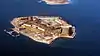 Boston Harbor Islands Archeological District |
December 21, 1985 (#85003323) |
Address Restricted |
Boston Harbor | Extends into Quincy in Norfolk County and Hingham in Plymouth County |
| 19 | Boston Light |  Boston Light |
October 15, 1966 (#66000133) |
Little Brewster Island, Boston Harbor 42°19′41″N 70°53′26″W |
Boston Harbor | |
| 20 | Boston Young Men's Christian Association | 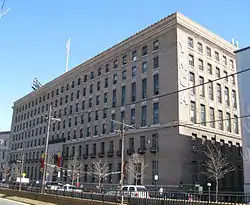 Boston Young Men's Christian Association |
August 20, 1998 (#98001082) |
312–320 Huntington Ave. 42°20′27″N 71°05′14″W |
Fenway–Kenmore | |
| 21 | Bowditch School | 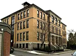 Bowditch School |
August 3, 1990 (#90001145) |
80–82 Green St. 42°18′42″N 71°06′36″W |
Jamaica Plain | |
| 22 | Brandegee Estate | 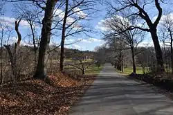 Brandegee Estate |
October 17, 1985 (#85003244) |
280 Newton St. 42°18′18″N 71°08′05″W |
Chestnut Hill | Extends into Brookline in Norfolk County |
| 23 | Brighton Center Historic District | 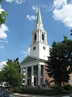 Brighton Center Historic District |
February 20, 2001 (#01000088) |
Academy Hill Rd., Chestnut Hill Ave., Dighton, Elko, Henshaw, Leicester, Market, Washington, and Winship Sts. 42°20′57″N 71°09′13″W |
Brighton | |
| 24 | Brighton Evangelical Congregational Church |  Brighton Evangelical Congregational Church |
August 21, 1997 (#97000920) |
404–410 Washington St. 42°20′55″N 71°09′22″W |
Brighton | |
| 25 | Brook Farm | 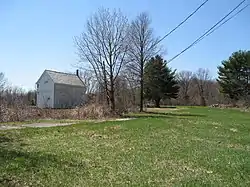 Brook Farm |
October 15, 1966 (#66000141) |
670 Baker St. 42°17′14″N 71°10′43″W |
West Roxbury | |
| 26 | Buildings at 825–829 Blue Hill Avenue |  Buildings at 825–829 Blue Hill Avenue |
September 10, 2014 (#14000561) |
825–829 Blue Hill Ave. 42°17′49″N 71°05′16″W |
Dorchester | |
| 27 | Calf Pasture Pumping Station Complex | Calf Pasture Pumping Station Complex |
August 2, 1990 (#90001095) |
435 Mount Vernon St. 42°18′48″N 71°02′01″W |
Dorchester | |
| 28 | Cartoof & Sherman Apartments |  Cartoof & Sherman Apartments |
November 12, 2020 (#100005763) |
31-35 Wales St. 42°17′48″N 71°05′06″W |
Dorchester | |
| 29 | Cathedral of St. George Historic District | 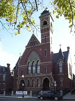 Cathedral of St. George Historic District |
November 25, 1998 (#98001361) |
517–523–525 E. Broadway 42°20′07″N 71°02′37″W |
South Boston | |
| 30 | Charles Street African Methodist Episcopal Church |  Charles Street African Methodist Episcopal Church |
September 1, 1983 (#83000601) |
551 Warren St. 42°18′45″N 71°05′03″W |
Roxbury | |
| 31 | Chestnut Hill Reservoir Historic District |  Chestnut Hill Reservoir Historic District |
January 18, 1990 (#89002271) |
Beacon St. and Commonwealth Ave. 42°19′58″N 71°09′27″W |
Brighton | Extends into Newton. |
| 32 | Christ Church |  Christ Church |
January 30, 1986 (#86000140) |
1220 River St. 42°15′38″N 71°07′48″W |
Hyde Park | |
| 33 | Clapp Houses |  Clapp Houses |
May 2, 1974 (#74000911) |
199 and 195 Boston St. 42°19′12″N 71°03′25″W |
Dorchester | Home of the Dorchester Historic Society |
| 34 | Codman Square District |  Codman Square District |
June 23, 1983 (#83000602) |
Norfolk, Talbot, Epping, Lithgow, Centre, and Moultrie Sts. 42°17′25″N 71°04′16″W |
Dorchester | |
| 35 | Collins Building |  Collins Building |
June 8, 2005 (#05000559) |
213–217 Washington St. 42°18′02″N 71°04′37″W |
Dorchester | |
| 36 | Columbia Road–Bellevue Street Historic District |  Columbia Road–Bellevue Street Historic District |
September 8, 2017 (#100001582) |
400-500 Block of Columbia Rd., and parts of Bellevue St. 42°18′46″N 71°04′06″W |
Dorchester | |
| 37 | Columbia Road–Devon Street Historic District |  Columbia Road–Devon Street Historic District |
July 17, 2017 (#100001315) |
193-231 (odd) & 200-204 (even) Columbia Rd. 42°18′25″N 71°04′35″W |
Roxbury | |
| 38 | Columbia Road-Strathcona Road Historic District |  Columbia Road-Strathcona Road Historic District |
August 3, 2018 (#100002734) |
90-94,102-108, 105-111, 129-135, 137, 143-147, 150-156 Columbia & 16 Strathcona Rds., 114-126 Washington St. 42°18′21″N 71°04′46″W |
Roxbury | |
| 39 | Congregation Adath Jeshurun |  Congregation Adath Jeshurun |
November 12, 1999 (#99001304) |
397 Blue Hill Ave. 42°18′43″N 71°04′53″W |
Dorchester | |
| 40 | Crawford Street Historic District |  Crawford Street Historic District |
November 18, 2020 (#100005798) |
5-38 Crawford St., 42 Elm Hill Ave., 621 Warren St. 42°18′40″N 71°05′06″W |
Roxbury | |
| 41 | Cyclorama Building | Cyclorama Building |
April 13, 1973 (#73000318) |
543–547 Tremont St. 42°20′40″N 71°04′19″W |
South End | |
| 42 | Sarah Davidson Apartment Block |  Sarah Davidson Apartment Block |
December 18, 2013 (#13000928) |
3 Gaylord St. 42°17′56″N 71°04′23″W |
Dorchester | |
| 43 | Dearborn School |  Dearborn School |
August 2, 2000 (#00000871) |
25 Ambrose St. 42°19′46″N 71°04′42″W |
Roxbury | |
| 44 | Dillaway School |  Dillaway School |
April 9, 1980 (#80001683) |
16–20 Kenilworth St. 42°19′43″N 71°05′14″W |
Roxbury | |
| 45 | Dimock Community Health Center Complex | 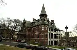 Dimock Community Health Center Complex |
February 21, 1985 (#85000317) |
41 and 55 Dimock St. 42°19′14″N 71°05′51″W |
Roxbury | |
| 46 | District 13 Police Station | 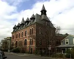 District 13 Police Station |
February 10, 1988 (#87002549) |
28 Seaverns Ave. 42°18′43″N 71°06′46″W |
Jamaica Plain | |
| 47 | Dorchester Heights Historic District | 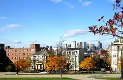 Dorchester Heights Historic District |
November 1, 2001 (#01001198) |
Roughly a one block area surrounding Telegraph Hill 42°19′58″N 71°02′48″W |
South Boston | |
| 48 | Dorchester Heights National Historic Site |  Dorchester Heights National Historic Site |
October 15, 1966 (#66000050) |
South Boston 42°19′58″N 71°02′47″W |
South Boston | |
| 49 | Dorchester North Burying Ground |  Dorchester North Burying Ground |
April 18, 1974 (#74000915) |
Stoughton St. and Columbia Rd. 42°19′00″N 71°03′52″W |
Dorchester | |
| 50 | Dorchester Park | 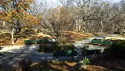 Dorchester Park |
February 20, 2008 (#08000089) |
Bounded by Dorchester Ave., Richmond, Adams, and Richview Sts. 42°16′34″N 71°04′01″W |
Dorchester | |
| 51 | Dorchester Pottery Works | 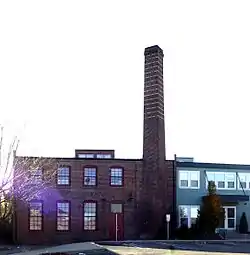 Dorchester Pottery Works |
February 21, 1985 (#85000318) |
101–105 Victory Rd. 42°17′49″N 71°03′05″W |
Dorchester | |
| 52 | Dorchester South Burying Ground | 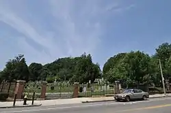 Dorchester South Burying Ground |
June 27, 2014 (#14000365) |
2095 Dorchester Ave. 42°16′43″N 71°04′01″W |
Dorchester | |
| 53 | Dorchester Temple Baptist Church |  Dorchester Temple Baptist Church |
January 16, 1998 (#97001239) |
670 Washington St. 42°17′17″N 71°04′17″W |
Dorchester | |
| 54 | Dorchester-Milton Lower Mills Industrial District | 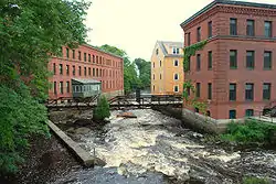 Dorchester-Milton Lower Mills Industrial District |
April 2, 1980 (#80000675) |
Both sides of the Neponset River; also Adams, River, and Medway Sts., Millers Lane, and Eliot and Adams Sts. 42°16′16″N 71°04′08″W |
Dorchester | Extends into Milton in Norfolk County; second set of addresses represents a boundary increase |
| 55 | Frederick Douglass Square Historic District | 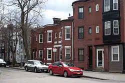 Frederick Douglass Square Historic District |
October 3, 1996 (#96001063) |
Roughly bounded by Hammond St., Cobat St., Windsor St., and Westminster St., Lower Roxbury 42°20′09″N 71°05′04″W |
Roxbury | |
| 56 | Dudley Station Historic District | 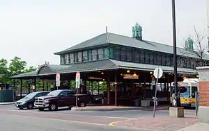 Dudley Station Historic District |
December 5, 1985 (#85003074) |
Washington, Warren, and Dudley Sts. 42°19′48″N 71°05′04″W |
Roxbury | |
| 57 | Samuel Edelman Apartments | 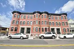 Samuel Edelman Apartments |
March 5, 2019 (#100003471) |
97-103 Norfolk St. 42°17′18″N 71°04′34″W |
Dorchester | |
| 58 | Edna G. shipwreck (eastern rig dragger) |  Edna G. shipwreck (eastern rig dragger) |
November 22, 2010 (#10000039) |
Stellwagen Bank National Marine Sanctuary |
Boston vicinity | Eastern Rig Dragger Fishing Vessel Shipwrecks in the Stellwagen Bank National Marine Sanctuary MPS |
| 59 | Egleston Substation | 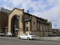 Egleston Substation |
December 27, 2010 (#10001066) |
3025 Washington St. 42°19′01″N 71°05′51″W |
Jamaica Plain | |
| 60 | Eliot Burying Ground | 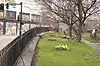 Eliot Burying Ground |
June 25, 1974 (#74000388) |
Eustis and Washington Sts. 42°19′55″N 71°04′55″W |
Roxbury | |
| 61 | Eliot Congregational Church | 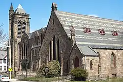 Eliot Congregational Church |
February 9, 1994 (#93001587) |
56 Dale St., corner 118-120 Walnut St. 42°19′10″N 71°04′55″W |
Roxbury | |
| 62 | Eliot Hall |  Eliot Hall |
July 15, 1988 (#88000959) |
7A Eliot St. 42°18′37″N 71°06′59″W |
Jamaica Plain | |
| 63 | Elm Hill Park Historic District | February 1, 2021 (#100006078) |
2-38 Elm Hill Park, 538-570 Warren St. 42°18′46″N 71°04′57″W |
Roxbury | ||
| 64 | Esmond Street Historic District | 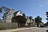 Esmond Street Historic District |
November 5, 2018 (#100003070) |
Bicknell, Bradshaw, Esmond, & Harvard Sts. 42°17′51″N 71°05′02″W |
Dorchester | |
| 65 | Evergreen Cemetery | Evergreen Cemetery |
August 14, 2009 (#09000612) |
2060 Commonwealth Ave. 42°20′20″N 71°09′43″W |
Brighton | |
| 66 | Fairview Cemetery |  Fairview Cemetery |
September 16, 2009 (#09000717) |
45 Fairview Ave. 42°14′45″N 71°08′19″W |
Hyde Park | |
| 67 | Fenway Park | Fenway Park |
March 7, 2012 (#12000069) |
24, & 2–4 Yawkey Wy., 64–76 Brookline Ave., & 70–80 Lansdowne St. 42°20′50″N 71°05′47″W |
Fenway–Kenmore | Longtime home of Boston Red Sox built in 1912; has been oldest ballpark in use by Major League Baseball since 1999. |
| 68 | Fenway Studios | 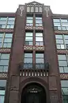 Fenway Studios |
September 13, 1978 (#78000473) |
30 Ipswich St. 42°20′50″N 71°05′28″W |
Fenway–Kenmore | |
| 69 | Fenway-Boylston Street District | 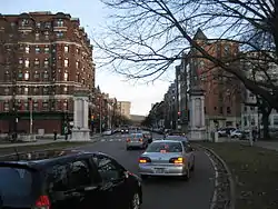 Fenway-Boylston Street District |
September 4, 1984 (#84002875) |
Fenway, Boylston, Westland, and Hemenway Sts. 42°20′43″N 71°05′26″W |
Fenway–Kenmore | |
| 70 | Fields Corner Municipal Building |  Fields Corner Municipal Building |
November 12, 1981 (#81000620) |
1 Arcadia St., 195 Adams St. 42°18′07″N 71°03′38″W |
Dorchester | |
| 71 | First Church of Jamaica Plain | 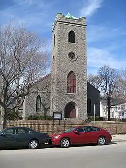 First Church of Jamaica Plain |
July 15, 1988 (#88000955) |
6 Eliot St. 42°18′35″N 71°07′00″W |
Jamaica Plain | |
| 72 | First Congregational Church of Hyde Park | 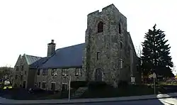 First Congregational Church of Hyde Park |
November 12, 1999 (#99001308) |
6 Webster St. 42°15′27″N 71°07′15″W |
Hyde Park | |
| 73 | Forest Hills Cemetery | 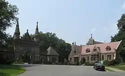 Forest Hills Cemetery |
November 17, 2004 (#04001219) |
95 Forest Hills Ave. 42°17′35″N 71°06′29″W |
Jamaica Plain | |
| 74 | Fort Independence | 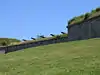 Fort Independence |
October 15, 1970 (#70000921) |
Castle Island 42°20′17″N 71°00′42″W |
South Boston | |
| 75 | Fort Warren |  Fort Warren |
August 29, 1970 (#70000540) |
Georges Island, Boston Harbor 42°19′11″N 70°55′43″W |
Boston Harbor | |
| 76 | Fowler-Clark-Epstein Farmstead | 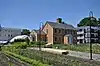 Fowler-Clark-Epstein Farmstead |
March 16, 2020 (#100005089) |
487 Norfolk St. 42°16′47″N 71°05′20″W |
Mattapan | |
| 77 | Frances and Isabella Apartments | 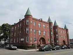 Frances and Isabella Apartments |
February 22, 2002 (#02000081) |
430–432 and 434–436 Dudley St. 42°19′27″N 71°04′29″W |
Roxbury | |
| 78 | Francis Street–Fenwood Road Historic District | 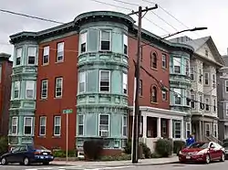 Francis Street–Fenwood Road Historic District |
June 23, 2016 (#16000409) |
Roughly bounded by Huntington Ave., Francis, Vining & Fenwood Sts., St. Albans Rd. 42°20′05″N 71°06′23″W |
Longwood | |
| 79 | Isabella Stewart Gardner Museum | 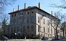 Isabella Stewart Gardner Museum |
January 27, 1983 (#83000603) |
280 The Fenway 42°20′17″N 71°05′59″W |
Fenway–Kenmore | |
| 80 | William Lloyd Garrison House | 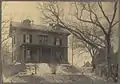 William Lloyd Garrison House |
October 15, 1966 (#66000653) |
125 Highland St. 42°19′34″N 71°05′38″W |
Roxbury | |
| 81 | William Lloyd Garrison School | 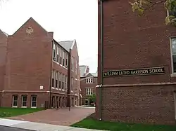 William Lloyd Garrison School |
April 16, 1980 (#80000674) |
20 Hutchings St. 42°18′34″N 71°05′22″W |
Roxbury | |
| 82 | Goldsmith Block | 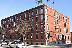 Goldsmith Block |
June 5, 2007 (#07000510) |
41 Ruggles St., 746–750 Shawmut Ave. 42°19′56″N 71°05′02″W |
Roxbury | |
| 83 | Governor Shirley Square Historic District | 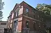 Governor Shirley Square Historic District |
July 18, 2016 (#16000454) |
Dudley, Hampden, Dunmore & Magazine Sts., Blue Hill & Mt. Pleasant Ave. 42°19′33″N 71°04′31″W |
Roxbury | |
| 84 | Graves Light Station | 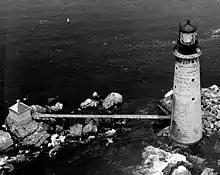 Graves Light Station |
September 28, 1987 (#87002041) |
Entrance to North Channel, Boston Harbor 42°21′54″N 70°52′11″W |
Boston Harbor | |
| 85 | Greek Orthodox Cathedral of New England | 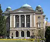 Greek Orthodox Cathedral of New England |
June 30, 1988 (#88000957) |
520 Parker St. 42°20′11″N 71°05′39″W |
Fenway–Kenmore | |
| 86 | Greenwood Memorial United Methodist Church | 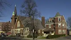 Greenwood Memorial United Methodist Church |
March 8, 2002 (#02000154) |
378A–380 Washington St. 42°17′49″N 71°04′19″W |
Dorchester | |
| 87 | Haffenreffer Brewery | 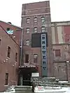 Haffenreffer Brewery |
May 2, 1982 (#82004453) |
Germania St. 42°18′52″N 71°06′15″W |
Jamaica Plain | |
| 88 | Edward Everett Hale House | 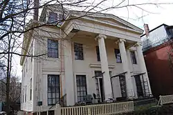 Edward Everett Hale House |
March 21, 1979 (#73000325) |
12 Morley St. 42°19′44″N 71°05′33″W |
Roxbury | |
| 89 | John Harris House and Farm | 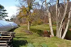 John Harris House and Farm |
October 17, 1985 (#85003246) |
284 Newton St. 42°18′19″N 71°08′35″W |
Chestnut Hill | Extends into Brookline in Norfolk County |
| 90 | Harrison Square Historic District |  Harrison Square Historic District |
October 22, 2002 (#02001190) |
Bounded by MBTA Braintree line embankment, Park, Everett, Freeport, Mill, Asland, Blanche Sts., Victory Rd. 42°18′07″N 71°03′13″W |
Dorchester | |
| 91 | Harriswood Crescent | Harriswood Crescent |
March 13, 1986 (#86000375) |
60-88 Harold St. 42°19′05″N 71°05′47″W |
Roxbury | |
| 92 | Harvard Avenue Fire Station |  Harvard Avenue Fire Station |
March 31, 1983 (#83000605) |
16 Harvard Ave. 42°21′19″N 71°07′58″W |
Allston | |
| 93 | Harvard Avenue Historic District | Harvard Avenue Historic District |
April 28, 2000 (#00000415) |
Roughly bounded by Linden St., Commonwealth Ave., Harvard Ave., and Park Vale Ave. 42°21′12″N 71°07′58″W |
Allston | |
| 94 | Edward H. Haskell Home for Nurses | 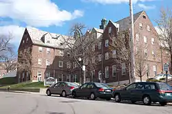 Edward H. Haskell Home for Nurses |
February 26, 2004 (#04000085) |
220 Fisther Ave., 63 Parker Hill Ave. 42°19′49″N 71°06′36″W |
Mission Hill | |
| 95 | Hibernian Hall | 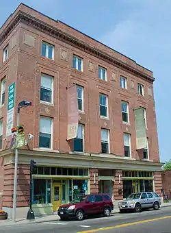 Hibernian Hall |
June 2, 2004 (#04000534) |
182–186 Dudley St. 42°19′43″N 71°04′57″W |
Roxbury | |
| 96 | Highland Spring Brewery Bottling and Storage Buildings | 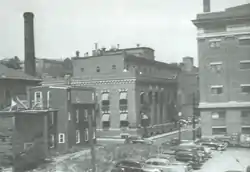 Highland Spring Brewery Bottling and Storage Buildings |
May 28, 2010 (#10000300) |
154–166 Terrace St. 42°19′37″N 71°05′55″W |
Mission Hill | |
| 97 | Home for Aged Couples | 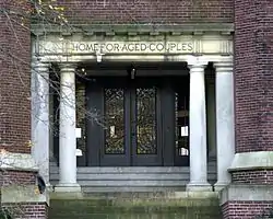 Home for Aged Couples |
August 11, 2005 (#05000879) |
409, 419 Walnut Ave. and 2055 Columbus Ave. 42°18′49″N 71°05′43″W |
Jamaica Plain | |
| 98 | Home for Destitute Jewish Children |  Home for Destitute Jewish Children |
October 8, 2014 (#14000840) |
150–156 American Legion Hwy. 42°17′41″N 71°05′34″W |
Dorchester | Now houses a community center and charter school. |
| 99 | House at 17 Cranston Street | 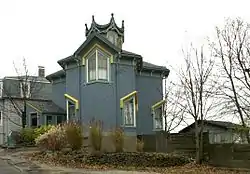 House at 17 Cranston Street |
November 20, 1987 (#87001398) |
17 Cranston St. 42°19′14″N 71°06′35″W |
Jamaica Plain | |
| 100 | Timothy Hoxie House | 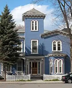 Timothy Hoxie House |
November 20, 1987 (#87001399) |
135 Hillside St. 42°19′52″N 71°06′19″W |
Mission Hill | |
| 101 | Intervale Street-Blue Hill Avenue Historic District | 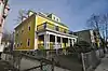 Intervale Street-Blue Hill Avenue Historic District |
November 13, 2020 (#100005783) |
Blue Hill Ave. and Intervale St. 42°18′42″N 71°04′48″W |
Dorchester | |
| 102 | Intervale Street-Columbia Road Historic District |  Intervale Street-Columbia Road Historic District |
February 28, 2019 (#100003470) |
117-121, 123-127, 129-135, 137-143, 145-159, 161, 162 Intervale St. & 282-284, 286-288 Columbia Rd. 42°18′35″N 71°04′32″W |
Dorchester | |
| 103 | John Eliot Square District |  John Eliot Square District |
April 23, 1973 (#73000854) |
John Eliot Sq. 42°19′47″N 71°05′27″W |
Roxbury | |
| 104 | Joshua Bates School | 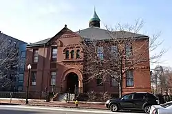 Joshua Bates School |
August 22, 2008 (#08000793) |
731 Harrison Ave. 42°20′15″N 71°04′19″W |
South End | |
| 105 | Alvah Kittredge House | 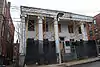 Alvah Kittredge House |
May 8, 1973 (#73000855) |
12 Linwood St. 42°19′47″N 71°05′38″W |
Roxbury | |
| 106 | Lawrence Model Lodging Houses | 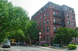 Lawrence Model Lodging Houses |
September 22, 1983 (#83000606) |
79, 89, 99 and 109 E. Canton St. 42°20′17″N 71°04′14″W |
South End | |
| 107 | Long Island Head Light |  Long Island Head Light |
June 15, 1987 (#87001481) |
Long Island 42°19′49″N 70°57′28″W |
Boston Harbor | |
| 108 | Harrison Loring House | 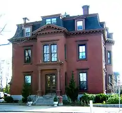 Harrison Loring House |
September 1, 1983 (#83000604) |
789 E. Broadway St. 42°20′07″N 71°02′01″W |
South Boston | |
| 109 | Loring–Greenough House | 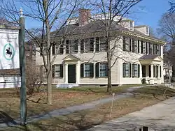 Loring–Greenough House |
April 26, 1972 (#72000544) |
12 South St. 42°18′35″N 71°06′56″W |
Jamaica Plain | |
| 110 | Lower Roxbury Historic District | 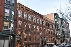 Lower Roxbury Historic District |
December 9, 1994 (#94001494) |
Roughly the area surrounding Coventry, Cunard, and Walpole Sts. 42°20′11″N 71°05′12″W |
Roxbury | |
| 111 | Massachusetts Historical Society Building |  Massachusetts Historical Society Building |
October 15, 1966 (#66000770) |
1154 Boylston St. 42°20′47″N 71°05′26″W |
Fenway–Kenmore | |
| 112 | Massachusetts Mental Health Center | Massachusetts Mental Health Center |
January 21, 1994 (#93001489) |
74 Fenwood Rd. 42°20′08″N 71°06′35″W |
Fenway–Kenmore | Campus demolished in 2010. |
| 113 | Massachusetts School of Art |  Massachusetts School of Art |
August 3, 1989 (#89000974) |
364 Brookline Ave. 42°20′20″N 71°06′24″W |
Fenway–Kenmore | |
| 114 | Mission Hill Triangle Historic District |  Mission Hill Triangle Historic District |
November 6, 1989 (#89001747) |
Roughly bounded by Smith St., Worthington St., Tremont St., and Huntington Ave. 42°20′02″N 71°06′09″W |
Mission Hill | |
| 115 | Monument Square Historic District | Monument Square Historic District |
October 11, 1990 (#90001536) |
Roughly bounded by Jamaicaway, Pond, Centre and Eliot Sts. 42°18′34″N 71°06′57″W |
Jamaica Plain | Not to be confused with Monument Square Historic District (Charlestown, Boston, Massachusetts), where the Bunker Hill Monument is located. |
| 116 | Moreland Street Historic District | 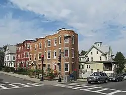 Moreland Street Historic District |
March 29, 1984 (#84002890) |
Roughly bounded by Kearsarge, Blue Hill Aves., Warren, Waverly, and Winthrop Sts. 42°19′25″N 71°04′48″W |
Roxbury | |
| 117 | Morton Street, Metropolitan Park System of Greater Boston |  Morton Street, Metropolitan Park System of Greater Boston |
January 24, 2005 (#04001572) |
Morton St. between Arborway and Gallivan Blvd. 42°17′11″N 71°05′27″W |
Jamaica Plain | |
| 118 | Mount Hope Cemetery |  Mount Hope Cemetery |
September 24, 2009 (#09000767) |
355 Walk Hill St. 42°17′12″N 71°06′19″W |
Roslindale | |
| 119 | Mount Pleasant Historic District | 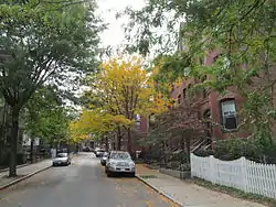 Mount Pleasant Historic District |
February 9, 1989 (#89000004) |
Roughly bounded by Forest St. and Mount Pleasant Ave. 42°19′33″N 71°04′43″W |
Roxbury | |
| 120 | Nazing Court Apartments | 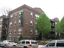 Nazing Court Apartments |
May 12, 2004 (#04000426) |
224–236 Seaver St. and 1–8 Nazing Court 42°18′13″N 71°05′36″W |
Roxbury | |
| 121 | Neponset Valley Parkway, Metropolitan Park System of Greater Boston |  Neponset Valley Parkway, Metropolitan Park System of Greater Boston |
January 24, 2005 (#04001573) |
Neponset Valley Parkway 42°14′14″N 71°07′36″W |
Hyde Park | Extends into Milton in Norfolk County |
| 122 | New England Conservatory of Music | 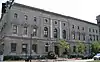 New England Conservatory of Music |
May 14, 1980 (#80000672) |
290 Huntington Ave. 42°20′26″N 71°05′13″W |
Fenway–Kenmore | |
| 123 | New Riding Club | 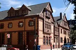 New Riding Club |
August 20, 1987 (#87001394) |
52 Hemenway St. 42°20′42″N 71°05′23″W |
Fenway–Kenmore | |
| 124 | Nix's Mate Daybeacon | 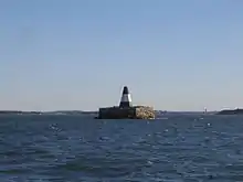 Nix's Mate Daybeacon |
March 18, 2004 (#04000189) |
Nubble Channel, The Narrows, Boston Harbor 42°19′56″N 70°56′42″W |
Boston Harbor | |
| 125 | Oak Square School | 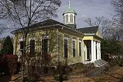 Oak Square School |
November 10, 1980 (#80000465) |
35 Nonantum St. 42°20′59″N 71°10′10″W |
Brighton | |
| 126 | Old Harbor Reservation Parkways, Metropolitan Park System of Greater Boston | 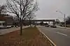 Old Harbor Reservation Parkways, Metropolitan Park System of Greater Boston |
July 24, 2008 (#08000693) |
William J. Day Boulevard, Columbia Rd. between Farragut Rd and Kosciuszko Cir., and Old Colony Ave. between Pacuska Ave. 42°19′46″N 71°02′45″W |
South Boston | |
| 127 | Olmsted Park System | 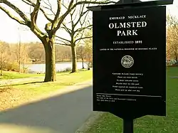 Olmsted Park System |
December 8, 1971 (#71000086) |
Encompassing the Back Bay Fens, Muddy River, Olmsted (Leverett Park), Jamaica Park, Arborway, and Franklin Park 42°20′43″N 71°05′45″W |
Jamaica Plain and Fenway–Kenmore | |
| 128 | Theodore Parker Unitarian Universalist Church |  Theodore Parker Unitarian Universalist Church |
June 29, 2020 (#100005274) |
1859 Centre St. 42°17′10″N 71°09′18″W |
West Roxbury | |
| 129 | Paul's Bridge | 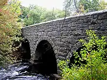 Paul's Bridge |
December 11, 1972 (#72000140) |
Neponset Valley Parkway over the Neponset River 42°14′04″N 71°07′24″W |
Hyde Park | Extends into Milton in Norfolk County |
| 130 | The Peabody | The Peabody |
August 8, 2001 (#01000872) |
195–197 Ashmont St. 42°17′07″N 71°03′53″W |
Dorchester | |
| 131 | Pierce House |  Pierce House |
April 26, 1974 (#74000917) |
24 Oakton Ave. 42°17′13″N 71°03′13″W |
Dorchester | |
| 132 | Pilgrim Congregational Church | 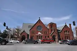 Pilgrim Congregational Church |
December 18, 2013 (#13000929) |
540–544 Columbia Road 42°18′58″N 71°04′01″W |
Dorchester | |
| 133 | Ellen H. Swallow Richards House |  Ellen H. Swallow Richards House |
March 31, 1992 (#92001874) |
32 Eliot St. 42°18′57″N 71°07′06″W |
Jamaica Plain | |
| 134 | The Riviera | 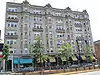 The Riviera |
December 7, 1995 (#95001450) |
270 Huntington Ave. 42°20′30″N 71°05′11″W |
Fenway–Kenmore | |
| 135 | Roslindale Baptist Church | 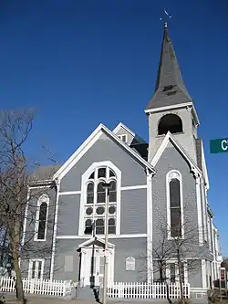 Roslindale Baptist Church |
November 5, 1998 (#98001330) |
52 Cummins Highway 42°17′07″N 71°07′41″W |
Roslindale | |
| 136 | Roslindale Congregational Church | 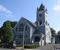 Roslindale Congregational Church |
July 26, 1991 (#91000925) |
25 Cummins Highway at its junction with Summer Ave. 42°17′42″N 71°07′43″W |
Roslindale | |
| 137 | Roslindale Substation | 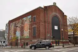 Roslindale Substation |
August 27, 2013 (#13000621) |
4228 Washington St., 42°17′11″N 71°07′41″W |
Roslindale | |
| 138 | Roxbury High Fort |  Roxbury High Fort |
April 23, 1973 (#73000856) |
Beech Glen St. at Fort Ave. 42°19′16″N 71°05′24″W |
Roxbury | |
| 139 | Roxbury Highlands Historic District | Roxbury Highlands Historic District |
February 22, 1989 (#89000147) |
Roughly bounded by Dudley St., Washington St., and Columbus Ave. 42°19′32″N 71°05′26″W |
Roxbury | |
| 140 | Roxbury Presbyterian Church |  Roxbury Presbyterian Church |
March 15, 1991 (#89002125) |
328 Warren St. 42°19′10″N 71°04′55″W |
Roxbury | |
| 141 | Saint Augustine Chapel and Cemetery | 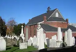 Saint Augustine Chapel and Cemetery |
September 18, 1987 (#87001495) |
Dorchester St. between W. 6th and Tudor Sts. 42°20′02″N 71°03′00″W |
South Boston | |
| 142 | St. Joseph's Roman Catholic Church Complex | 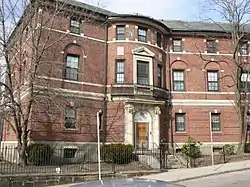 St. Joseph's Roman Catholic Church Complex |
December 28, 1989 (#89002169) |
Bounded by Circuit, Regent, Hulbert, and Fenwick Sts. 42°19′26″N 71°05′16″W |
Roxbury | |
| 143 | St. Luke's and St. Margaret's Church | 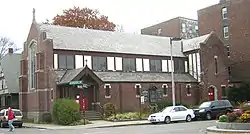 St. Luke's and St. Margaret's Church |
November 12, 1997 (#97001472) |
5-7 St. Luke's Rd. 42°21′07″N 71°07′40″W |
Allston | |
| 144 | Saint Mark's Episcopal Church | 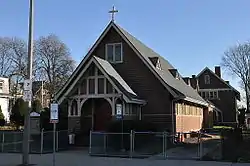 Saint Mark's Episcopal Church |
July 3, 2014 (#12000783) |
73 Columbia Rd. 42°18′16″N 71°04′56″W |
Dorchester | |
| 145 | St. Mary's Episcopal Church |  St. Mary's Episcopal Church |
October 30, 1998 (#98001292) |
14–16 Cushing Ave. 42°18′59″N 71°03′54″W |
Dorchester | |
| 146 | Savin Hill Historic District | 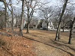 Savin Hill Historic District |
May 9, 2003 (#03000385) |
Roughly bounded by Savin Hill Ave., Morrissey Boulevard, Dorchester Bay, and Interstate 93 42°18′33″N 71°03′01″W |
Dorchester | |
| 147 | Sears Roebuck and Company Mail Order Store |  Sears Roebuck and Company Mail Order Store |
January 15, 1991 (#90001992) |
309 Park Dr. and 201 Brookline Ave. 42°20′41″N 71°06′12″W |
Fenway–Kenmore | A former Sears building now known as Landmark Center |
| 148 | Second Church in Boston | 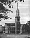 Second Church in Boston |
June 24, 2010 (#10000391) |
874, 876, 880 Beacon St. 42°20′49″N 71°06′17″W |
Fenway–Kenmore | |
| 149 | Sherman Apartments Historic District | 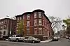 Sherman Apartments Historic District |
November 28, 2012 (#12000978) |
544–546 Washington, 4–6, 12–14, 18 Lyndhurst Sts. 42°17′32″N 71°04′17″W |
Dorchester | |
| 150 | Shirley-Eustis House | _-_exterior_before_restoration.jpg.webp) Shirley-Eustis House |
October 15, 1966 (#66000787) |
31–37 Shirley St. 42°19′24″N 71°04′21″W |
Roxbury | |
| 151 | Benjamin Silverman Apartments | 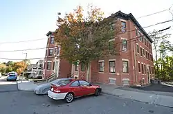 Benjamin Silverman Apartments |
August 24, 2018 (#100002790) |
50-52 Lorne & 4 Wilson Sts. 42°17′38″N 71°05′29″W |
Dorchester | |
| 152 | South Boston Boat Clubs Historic District | South Boston Boat Clubs Historic District |
September 1, 2005 (#05000936) |
1793–1849 William J. Day Boulevard 42°19′56″N 71°01′37″W |
South Boston | |
| 153 | South End District | 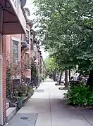 South End District |
May 8, 1973 (#73000324) |
South Bay area between Huntington and Harrison Aves.; also 200–224 Northampton St. 42°20′23″N 71°04′23″W |
South End | Second set of addresses represents a boundary increase December 29, 2014 |
| 154 | Stony Brook Reservation Parkways, Metropolitan Park System of Great Boston MPS | Stony Brook Reservation Parkways, Metropolitan Park System of Great Boston MPS |
January 3, 2006 (#05001509) |
Dedham, Enneking, Turtle Pond Parkways, Smith Field, Reservation, W. Border Rds. 42°15′28″N 71°08′32″W |
Hyde Park and West Roxbury | Extends into Dedham in Norfolk County |
| 155 | Students House | 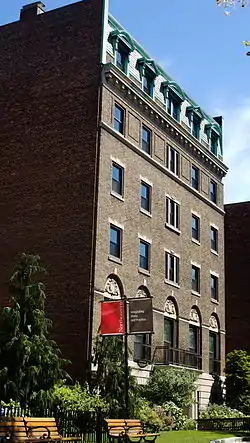 Students House |
September 11, 1997 (#97000970) |
96 The Fenway 42°20′31″N 71°05′33″W |
Fenway–Kenmore | |
| 156 | Sumner Hill Historic District |  Sumner Hill Historic District |
October 22, 1987 (#87001889) |
Roughly bounded by Seaverns Ave., Everett St., Carolina Ave., and Newbern St. 42°18′35″N 71°06′43″W |
Jamaica Plain | |
| 157 | Symphony and Horticultural Halls | 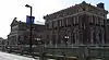 Symphony and Horticultural Halls |
May 30, 1975 (#75000301) |
Massachusetts and Huntington Aves. 42°20′33″N 71°05′09″W |
Fenway–Kenmore | |
| 158 | Symphony Hall | 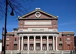 Symphony Hall |
January 20, 1999 (#99000633) |
301 Massachusetts Ave. 42°20′33″N 71°05′09″W |
South End | |
| 159 | Thane Street Historic District | 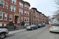 Thane Street Historic District |
November 13, 2020 (#100005782) |
70-78 Harvard St, 22-24, 26-28, 30-32 Thane St. 42°17′49″N 71°04′35″W |
Dorchester | |
| 160 | William Monroe Trotter House | .jpg.webp) William Monroe Trotter House |
May 11, 1976 (#76002003) |
97 Sawyer Ave. 42°18′47″N 71°03′46″W |
Dorchester | |
| 161 | Truman Parkway-Metropolitan Park System of Greater Boston |  Truman Parkway-Metropolitan Park System of Greater Boston |
January 5, 2005 (#04001430) |
Truman Parkway 42°14′53″N 71°06′59″W |
Hyde Park | Extends into Milton in Norfolk County |
| 162 | Upham's Corner Market | 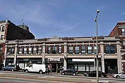 Upham's Corner Market |
October 11, 1990 (#90001537) |
600 Columbia Rd. 42°19′02″N 71°03′55″W |
Dorchester | |
| 163 | US Post Office Garage | 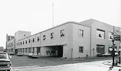 US Post Office Garage |
June 26, 1986 (#86001378) |
135 A St. 42°20′36″N 71°03′14″W |
South Boston | Destroyed |
| 164 | VFW Parkway, Metropolitan Park System of Greater Boston | 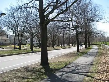 VFW Parkway, Metropolitan Park System of Greater Boston |
January 5, 2005 (#04001432) |
VFW Parkway, between Spring and Centre Sts. 42°17′10″N 71°09′31″W |
West Roxbury and Chestnut Hill | Briefly crosses into Brookline in Norfolk County. |
| 165 | Walton and Roslin Halls |  Walton and Roslin Halls |
December 18, 2013 (#13000930) |
702–708 & 710–726 Washington St., 3–5 Walton St. 42°17′13″N 71°04′16″W |
Dorchester | |
| 166 | Nathan Warnick Apartments | 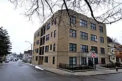 Nathan Warnick Apartments |
December 23, 2019 (#100003942) |
57 Bicknell St. 42°17′55″N 71°04′59″W |
Dorchester | |
| 167 | West Roxbury Parkway, Metropolitan Park System of Greater Boston | 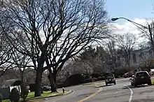 West Roxbury Parkway, Metropolitan Park System of Greater Boston |
January 19, 2006 (#05001528) |
West Roxbury Parkway, Bellevue Hill, East Border Rd., and West Border Rd. 42°18′10″N 71°09′11″W |
West Roxbury and Chestnut Hill | Extends into Brookline in Norfolk County |
| 168 | Westerly Burial Ground | 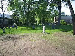 Westerly Burial Ground |
November 20, 1987 (#87001401) |
Centre St. 42°16′53″N 71°09′34″W |
West Roxbury | |
| 169 | Woodbourne Historic District | 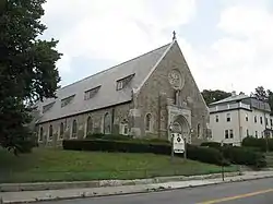 Woodbourne Historic District |
June 4, 1999 (#99000593) |
Roughly bounded by Walk Hill, Goodway, and Wachusett Sts. 42°17′30″N 71°06′58″W |
Jamaica Plain |
See also
| Wikimedia Commons has media related to National Register of Historic Places in Boston. |
References
- "National Register of Historic Places: Weekly List Actions". National Park Service, United States Department of the Interior. Retrieved on February 5, 2021.
- Numbers represent an alphabetical ordering by significant words. Various colorings, defined here, differentiate National Historic Landmarks and historic districts from other NRHP buildings, structures, sites or objects.
- "National Register Information System". National Register of Historic Places. National Park Service. March 13, 2009.
- The eight-digit number below each date is the number assigned to each location in the National Register Information System database, which can be viewed by clicking the number.
| Topics |  | ||||||||||||||||
|---|---|---|---|---|---|---|---|---|---|---|---|---|---|---|---|---|---|
| Lists by county | |||||||||||||||||
| Lists by city |
| ||||||||||||||||
| Other lists | |||||||||||||||||
| |||||||||||||||||
